St. Augustine dates to 1565, and 25% of its homes were built before 1940
Among the most historic 1% of U.S. towns · #1 of 638 in Florida. What drives it
42 places in town are on the National Register, among them 5 National Historic Landmarks and ten historic districts with 1,634 buildings between them. Below: 4 old photos and papers, maps from 1937 on, and the census since 1830.
Founding year: Wikidata; Wikipedia’s history section gives the same year. First post office: 1821.The full story ↓
History grade
What drives St. Augustine’s History grade
On its age, its old homes and the National Register, St. Augustine is among the most historic 1% of U.S. towns, #1 of 638 in Florida. All 3 inputs are above most U.S. towns; its National Register listings ranks highest and its share of homes from before 1940 lowest.
A+
HistoryA character grade: shown, never part of St. Augustine’s overall grade.
Few Florida towns list much on the Register (a typical Florida town has 0.0 per 10,000 residents, the U.S. 2.4), so St. Augustine’s 1,076 sits above most of its state (100% of Florida towns have fewer) while its 1,652 historic buildings outnumber those of 99% of U.S. towns.
How sure. Graded on any two of the three inputs instead, the letter would still be A+. The pre-1940 share (±2.4 points) is firm at this size. Two sources give 1565.
Founding year: Wikidata (other dates in Quick answers). Homes: Census ACS 2020–24. National Register: National Park Service, May 2026 list; each listing counted once (boundary changes and added documentation belong to their listing), and a historic district counts its contributing buildings. How TownRatings grades history →
What stands out about St. Augustine’s past
Read from the archive, the National Register and the record. The page puts what stands out first.
The country’s official list of buildings and places worth saving. 5 are National Historic Landmarks, the highest tier. Boundary changes and added documentation are counted with their listing.
Before the Spanish arrived in 1565, the area of St. Augustine was inhabited by the Timucua, who lived in villages along the St. Johns River. They farmed, fished, hunted, and maintained trade networks with neighboring groups. Their social structures included hereditary chiefs and organized ceremonies.
The first European known to have explored the coasts of Florida was the Spanish explorer and governor of Puerto Rico Juan Ponce de León, who likely ventured in 1513 as far north as the vicinity of the future St. Augustine. He named the peninsula, which he believed to be an island, La Florida and claimed it for the Spanish crown.
Passages that mention St. Augustine, cut from the printed page as they were published.
History and antiquities of St. Augustine, Florida1881 · page 67Read the page →
Read the text
the settlement of St. Augustine. The Spaniards regarded it as an infringement upon their rights ; and although a treaty, after this settlement, had been made between Spain and England, eonfirming to the latter all her settlements and islands, yet as no boundaries or limits were mentioned, their respective rights and boundaries remained a subject of dispute for seventy years.
Text read by machine from the scan; it may contain errors.
History and antiquities of St. Augustine, Florida1881Read the page →
Read the text
"The town of St. Augustine, that heretofore appeared like a rustic village, their white houses peeping from among the clustered boughs and golden fruit of their favorite tree, beneath whose shade the foreign invalid cooled his fevered limbs, and imbibed health from the fragrant air, — how was she fallen ! Dry, unsightly poles, with ragged bark, stick up around her dwellings ; and where the mocking-bird once delighted to budd her nest, and tune her lovely songs, owls hoot at night, and sterile
Text read by machine from the scan; it may contain errors.
Scans and text from the Internet Archive. Books published in 1930 or earlier, which are in the public domain.
By decade
St. Augustine, decade by decade
2 decades in the archive, from the 1890s to the 1980s. Scroll each row; tap a photo for its story.
Nothing in the archives for these yearsWeddings on Main Street, storms, parades, school pictures, the old store. If it’s in your family album, it belongs here.
Nothing in the archives for these yearsWeddings on Main Street, storms, parades, school pictures, the old store. If it’s in your family album, it belongs here.
Every edition of the U.S. Geological Survey’s map of St. Augustine. Tap a year, or press play to watch the town change.
1937St Augustine sheet · 1:24,000
U.S. Geological Survey historical topographic maps (public domain), via Esri’s collection of the scans. The red ring marks the center of St. Augustine.
Then & now
Stand where they stood
No then-and-now pairs yet. Take a photo from the same spot as an old one and they appear here side by side.
Retake this viewRUIDIAZ(1893) 1.043, 1893
Find the spot, match the angle, and add your photo. It becomes the first then-and-now pair on St. Augustine’s page.
In 1565, according to Wikidata and Wikipedia’s history of the town. St. Augustine’s post office opened in 1821, and the census of 1830 counted 1,708 people here.
How does St. Augustine rank for history?
St. Augustine is among the most historic 1% of U.S. towns, #1 of 638 in Florida. The History grade combines the town’s founding era, the share of homes built before 1940 and its National Register listings. It’s a character grade, so it isn’t part of the overall grade. How it works.
What is on the National Register in St. Augustine?
42 listings, 5 of them National Historic Landmarks: 22 buildings, among them the Cathedral of St. Augustine (a National Historic Landmark since 1970), 12 historic districts with 1,634 contributing buildings, 5 sites, 2 structures, and 1 object. 1,652 historic buildings in all.
How old are the homes in St. Augustine?
25% of St. Augustine’s homes were built before 1940 (Census estimate, ±2.4 points), against a typical 0.6% for a Florida town; the median home was built in 1980.
Founding dates: Wikidata, Wikipedia, the U.S. post office records of Blevins & Helbock (CC0) and the Census. Homes by year built: Census ACS 2020–24. National Register of Historic Places: National Park Service (list of May 22, 2026). Old photos, postcards and papers: Wikimedia Commons, the Library of Congress and other public archives, credited on each item’s page. Maps: U.S. Geological Survey historical topographic maps (via Esri) and Sanborn fire-insurance maps (Library of Congress). History text and census tables: Wikipedia (CC BY-SA 4.0). Places that used to be: USGS Geographic Names Information System (2021).
From Wikimedia Commons (8), the Library of Congress (2), Wikidata (5), the National Register of Historic Places (42), Wikipedia, U.S. Geological Survey historical maps, U.S. Census counts (via Wikipedia), the US Post Offices dataset (Blevins & Helbock), the USGS Geographic Names Information System and old county and town histories (Internet Archive). Archive images are copied here with their credits and licenses, shown on each photo’s page. Refreshed monthly.


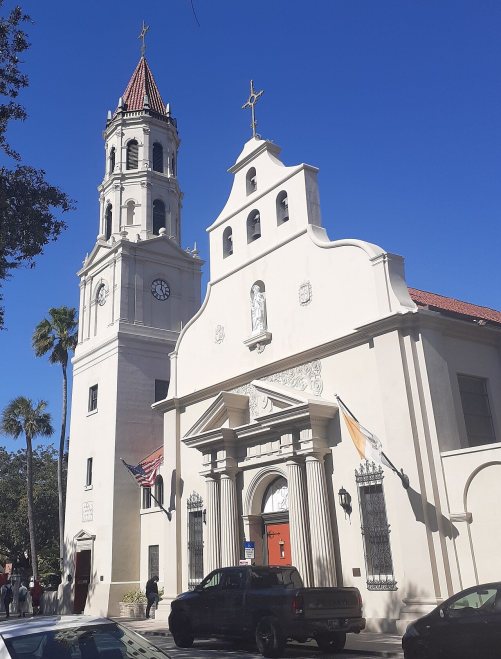 ★ Landmark
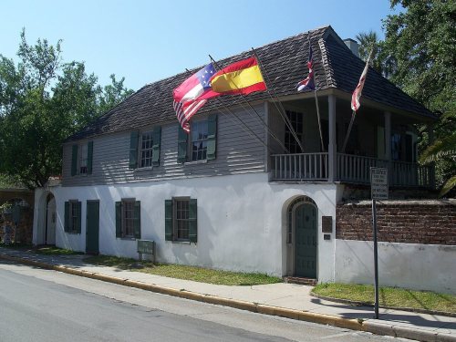 ★ Landmark
 ★ Landmark
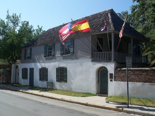 ★ Landmark
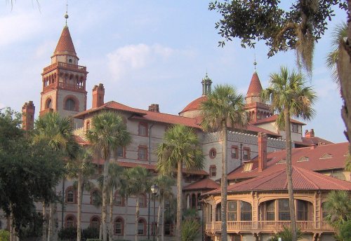 ★ Landmark




 1898
 1980
 2016
 2015
 2013
 2012
 2010
 2009


