Lakeland dates to 1875, and 19 of its places are on the National Register
More historic than 60% of U.S. towns · #42 of 638 in Florida. What drives it
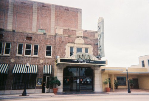
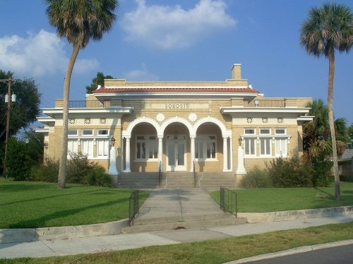
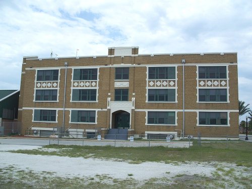
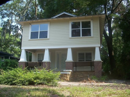
Most of Lakeland was built recently: 6% of its homes predate 1940 and the median home dates from 1983. 19 places in town are on the National Register, among them the Florida Southern College Architectural District, a National Historic Landmark, and eight historic districts with 1,824 buildings between them. Below: 6 old photos and papers, maps from 1889 on, and the census since 1890.
Founding year: Wikidata. First post office: 1884.The full story ↓
History grade
What drives Lakeland’s History grade
On its age, its old homes and the National Register, Lakeland is more historic than 60% of U.S. towns, #42 of 638 in Florida. Its National Register listings hold the grade up; its share of homes from before 1940 pulls it down.
B
HistoryA character grade: shown, never part of Lakeland’s overall grade.
Among the 400 U.S. cities of 100,000 or more, Lakeland ranks #210 on History.
Few Florida towns list much on the Register (a typical Florida town has 0.0 per 10,000 residents, the U.S. 2.4), so Lakeland’s 153 sits above most of its state (96% of Florida towns have fewer) while its 1,838 historic buildings outnumber those of 99% of U.S. towns.
How sure. Graded on any two of the three inputs instead, the letter would range from C to B+. The pre-1940 share (±0.6 points) is firm at this size. Two sources give 1875.
Founding year: Wikidata (other dates in Quick answers). Homes: Census ACS 2020–24. National Register: National Park Service, May 2026 list; each listing counted once (boundary changes and added documentation belong to their listing), and a historic district counts its contributing buildings. How TownRatings grades history →
What stands out about Lakeland’s past
Read from the archive, the National Register and the record. The page puts what stands out first.
National Park Service, National Register of Historic Places. Photos from Wikimedia Commons, credited on each place’s page.
Places that used to be
Lost post offices, old corners, places now gone and burying grounds
Lakeland’s post office has been open since 1884. Another post office, Christina, opened and closed inside today’s town.
Lakeland
1884–today
Christina
1908–1918
18801950today
Hamlets and corners on the map
Bartles Trailer CourtBeacon Hill Colony Mobile Home ParkBeacon Terrace Mobile Home ParkBethany Mobile Home ParkCitrus Center Colony Mobile Home ParkColonial Mobile Home VillageEl Camba Mobile Home ParkElim Mobile Home ParkFountain HeightsFountainview Estates Mobile Home ParkFoxwood Lake Mobile Home ParkGeorgetowne Mobile ManorGolden Wings Mobile Home ParkHeatherwood Village Mobile Home ParkHickory Hills Manor Mobile Home ParkHilltop Mobile Home ParkHoliday Mobile Home ParkHull Street Blues Mobile Home ParkImperial Manor Mobile Home TerraceKings and Queens Mobile Home ParkKings Manor Mobile Home ParkLake Bonny Mobile Home ParkLakeland Estates Mobile Home CommunityLakeland Harbor Mobile Home Park
Gone or out of use
Lakeland Army Air Fieldmilitary
7cemeteries and burying grounds inside Lakeland
GapwayGriffinLakeland Memorial GardensLakeviewRoselawnStephensonTiger Flowers
US Post Offices dataset (Blevins & Helbock, CC0). Places and cemeteries from the USGS Geographic Names Information System (2021).
In the 18th century Native Americans groups, collectively called "Seminoles", moved into the areas left vacant. In 1823, the United States and the various tribes in Florida signed the Treaty of Moultrie Creek, which created a reservation in central Florida that included what is now Polk County. Starting in 1832, the United States government tried to move the Seminoles in Florida west to the Indian Territory. Most of the Seminoles resisted, resulting in the Second Seminole War, which lasted from 1835 to 1842. By the end of that war, most of the Seminoles had been sent west, with a few remnants pushed well south of what is now Polk County.
Nothing in the archives for these yearsWeddings on Main Street, storms, parades, school pictures, the old store. If it’s in your family album, it belongs here.
Every edition of the U.S. Geological Survey’s map of Lakeland. Tap a year, or press play to watch the town change.
1944Lakeland sheet · 1:24,000
U.S. Geological Survey historical topographic maps (public domain), via Esri’s collection of the scans. The red ring marks the center of Lakeland.
Every building
Lakeland, building by building, 1889–1922
Fire insurance maps drew every building, what it was made of and what it was used for, so insurers could price the risk of fire. Pick a year, then a sheet.
1889Sheet 1 of 1
Edition
Sheets
BrickWoodStone
Sanborn Map Company, via the Library of Congress. Editions published in 1930 or earlier, which are in the public domain.
Then & now
Stand where they stood
No then-and-now pairs yet. Take a photo from the same spot as an old one and they appear here side by side.
Retake this view1940 Census Enumeration District Maps - Florida - Polk County - Lakeland - ED 53-18 - ED 53-33, 1880
Find the spot, match the angle, and add your photo. It becomes the first then-and-now pair on Lakeland’s page.
In 1875, according to Wikidata. Lakeland’s post office opened in 1884, and the census of 1890 counted 552 people here.
How does Lakeland rank for history?
Lakeland is more historic than 60% of U.S. towns, #42 of 638 in Florida. The History grade combines the town’s founding era, the share of homes built before 1940 and its National Register listings. It’s a character grade, so it isn’t part of the overall grade. How it works.
What is on the National Register in Lakeland?
19 listings: 10 buildings, 8 historic districts with 1,824 contributing buildings, and 1 structure. 1,838 historic buildings in all.
How old are the homes in Lakeland?
6% of Lakeland’s homes were built before 1940 (Census estimate), against a typical 0.6% for a Florida town; the median home was built in 1983.
Founding dates: Wikidata, Wikipedia, the U.S. post office records of Blevins & Helbock (CC0) and the Census. Homes by year built: Census ACS 2020–24. National Register of Historic Places: National Park Service (list of May 22, 2026). Old photos, postcards and papers: Wikimedia Commons, the Library of Congress and other public archives, credited on each item’s page. Maps: U.S. Geological Survey historical topographic maps (via Esri) and Sanborn fire-insurance maps (Library of Congress). History text and census tables: Wikipedia (CC BY-SA 4.0). Places that used to be: USGS Geographic Names Information System (2021).
From Wikimedia Commons (4), the Library of Congress (2), the National Register of Historic Places (19), Wikipedia, Wikidata and Wikipedia for famous people, U.S. Geological Survey historical maps, U.S. Census counts (via Wikipedia), the US Post Offices dataset (Blevins & Helbock), the USGS Geographic Names Information System and Sanborn fire insurance maps (Library of Congress). Archive images are copied here with their credits and licenses, shown on each photo’s page. Refreshed monthly.


 ★ Landmark




 1905
 1909


