Jacksonville has 106 places on the National Register
More historic than 79% of U.S. towns · #19 of 638 in Florida. What drives it
Dated to 1791 (Wikidata), with 5% of its homes built before 1940 and 12 historic districts holding 6,412 contributing buildings. Most of Jacksonville was built recently: 5% of its homes predate 1940 and the median home dates from 1987. Below: 20 old photos and papers, maps from 1884 on, the census since 1850, and every listing on the Register.
Founding year: Wikidata. First post office: 1824.The full story ↓
History grade
What drives Jacksonville’s History grade
On its age, its old homes and the National Register, Jacksonville is more historic than 79% of U.S. towns, #19 of 638 in Florida. Its National Register listings hold the grade up; its share of homes from before 1940 pulls it down.
A−
HistoryA character grade: shown, never part of Jacksonville’s overall grade.
Among the 400 U.S. cities of 100,000 or more, Jacksonville ranks #130 on History.
Few Florida towns list much on the Register (a typical Florida town has 0.0 per 10,000 residents, the U.S. 2.4), so Jacksonville’s 65.6 sits above most of its state (92% of Florida towns have fewer) while its 6,412 historic buildings outnumber those of 100% of U.S. towns.
NoteThe founding year comes from Wikidata alone; no second source gives 1791.
How sure. Graded on any two of the three inputs instead, the letter would range from B− to A+. The pre-1940 share (±0.3 points) is firm at this size. A citywide figure averages neighborhoods that differ a lot.
Founding year: Wikidata (other dates in Quick answers). Homes: Census ACS 2020–24. National Register: National Park Service, May 2026 list; each listing counted once (boundary changes and added documentation belong to their listing), and a historic district counts its contributing buildings. How TownRatings grades history →
What stands out about Jacksonville’s past
Read from the archive, the National Register and the record. The page puts what stands out first.
The country’s official list of buildings and places worth saving. One is a National Historic Landmark, the highest tier. Boundary changes and added documentation are counted with their listing.
National Park Service, National Register of Historic Places. Photos from Wikimedia Commons, credited on each place’s page.
Places that used to be
Lost post offices, old corners, places now gone and burying grounds
Jacksonville’s post office has been open since 1824. 47 other post offices opened and closed inside today’s town.
Jacksonville
1824–today
Fort George Island
1828–1829
Mandarin
1830–today
Batton Island
1849–1850
Mayport Mills
1850–1869
Bayard
1855–1977
Fort George
1869–1963
Mayport
1869–1968
Saint Nicholas
1871–1908
Maxville
1875–today
18201920today
Hamlets and corners on the map
Admiral's Walk Mobile Home EstatesAlcoy Road Mobile Home ParkAllens Mobile Home ParkAmericana Mobile Home ParkArgyle ForestArlingtonArrow Lane Mobile Home ParkAtlantic Village Mobile Home ParkAvondaleAzalea TerraceBaileys Mobile Home ParkBayardBeacon HillsBeauclercBeauclerc GardensBeechwoodBeeghly HeightsBeverly HillsBiltmoreBiscayne VillageBlack HammockBowdenBrentwoodBriarwood Mobile Home Park
Gone or out of use
Baine AirportairportBeauclerc Country ClublocaleFort DiegolocaleGoodbys Lake ChurchchurchJacksonville Heights Lookout TowertowerReddie Point Post LightbuildingSaint Joseph Academyschool
45family graveyards and cemeteries inside Jacksonville
AndersonArlington ParkBowlesChapel Hills Memory GardensChapel Hills Memory GardensCityCosmoDanielsDeeseDunn CreekDuval County PaupersEdgewoodEvergreenFerreiraGilmoreGreenlawnGreenwoodHillside Cemetery Potters FieldJacksonville NationalJulingtonLoftonMandarinManningMayportMemorialMount OliveOaklawnOaklawnOgilvieParrishParsonsPickettPinehurstPinkstonRainRestlawn Memorial ParkRiverside Memorial ParkSaint JosephSammisSellersTalbot IslandThe EvergreenTillotsonWestviewWhitker
See all 45
Anderson Cemetery · Arlington Park Cemetery · Bowles Cemetery · Chapel Hills Memory Gardens · Chapel Hills Memory Gardens · City Cemetery · Cosmo Cemetery · Daniels Cemetery · Deese Cemetery · Dunn Creek Cemetery · Duval County Paupers Cemetery · Edgewood Cemetery · Evergreen Cemetery · Ferreira Cemetery · Gilmore Cemetery · Greenlawn Cemetery · Greenwood Cemetery · Hillside Cemetery Potters Field · Jacksonville National Cemetery · Julington Cemetery · Lofton Cemetery · Mandarin Cemetery · Manning Cemetery · Mayport Cemetery · Memorial Cemetery · Mount Olive Cemetery · Oaklawn Cemetery · Oaklawn Cemetery · Ogilvie Cemetery · Parrish Cemetery · Parsons Cemetery · Pickett Cemetery · Pinehurst Cemetery · Pinkston Cemetery · Rain Cemetery · Restlawn Memorial Park · Riverside Memorial Park · Saint Joseph Cemetery · Sammis Cemetery · Sellers Cemetery · Talbot Island Cemetery · The Evergreen Cemetery · Tillotson Cemetery · Westview Cemetery · Whitker Cemetery
US Post Offices dataset (Blevins & Helbock, CC0). Places and cemeteries from the USGS Geographic Names Information System (2021).
The area of the modern city of Jacksonville has been inhabited for thousands of years. On Black Hammock Island in the national Timucuan Ecological and Historic Preserve, a University of North Florida team discovered some of the oldest remnants of pottery in the United States, dating to 2500 BCE.
Passages that mention Jacksonville, cut from the printed page as they were published.
History of Jacksonville, Florida and vicinity, 1513 to 19241925 · page 107Read the page →
Read the text
An Ordinance Regulating Patrols: Be it ordained by the intendant and councilmen of the town of Jacksonville, That the town marshal furnish the intendant, at such times as he may require, a full and complete list of the names of all white male inhabitants of the town of Jacksonville, between the ages of sixteen and fifty-five years; and it shall be the duty of the intendant to require and make said persons do and perform patrol duty within the limits of said corporation of Jacksonville, at any time and at all such times as he may deem necessary,
Text read by machine from the scan; it may contain errors.
History of Jacksonville, Florida and vicinity, 1513 to 19241925 · page 341Read the page →
Read the text
Eddy, all of Jacksonville. The Seminole Indian war and the panic of 1837 caused the abandonment of the enterprise.¢ In the 1840’s, a survey was made for a railroad from Jacksonville to Cedar Key, and another from Jacksonville to the Suwanee River. Then matters were allowed to rest and powerful opposition arose with the organization of a company, of which David Levy Yulee was the head, to build a railroad from Fernandina to Cedar Key. Yulee successfully
Text read by machine from the scan; it may contain errors.
History of early Jacksonville, Florida1911 · page 146Read the page →
Read the text
In the 40 's, a survey was made for a railroad from Jacksonville to Cedar Keys, and another from Jacksonville to the Snwanee River. With this matters were allowed to rest, and in the mean time powerful opposition developed with the organization of a company, of which David Levy Yulee was the acknowledged head, to build a railroad from Fernandina to Cedar Keys. Yulee success-
Text read by machine from the scan; it may contain errors.
History of early Jacksonville, Florida1911 · page 59Read the page →
Read the text
During tlie period between the incorporation of Jacksonville and the outbreak of the Seminole war in December, 1835, plans were laid for the establishment of some important enterprises, chief among which was the organization of a company to build a railroad from Jacksonville to Tallahassee, and later to extend it to some point on the Gulf coast. This was in 1834. The name of the
Text read by machine from the scan; it may contain errors.
Scans and text from the Internet Archive. Books published in 1930 or earlier, which are in the public domain.
Timeline
Jacksonville, 1791 to 1978
Woven from the archive, old maps, post office records, the National Register and the people born here.
Nothing in the archives for these yearsWeddings on Main Street, storms, parades, school pictures, the old store. If it’s in your family album, it belongs here.
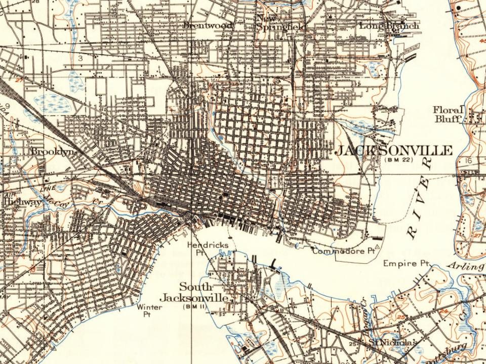
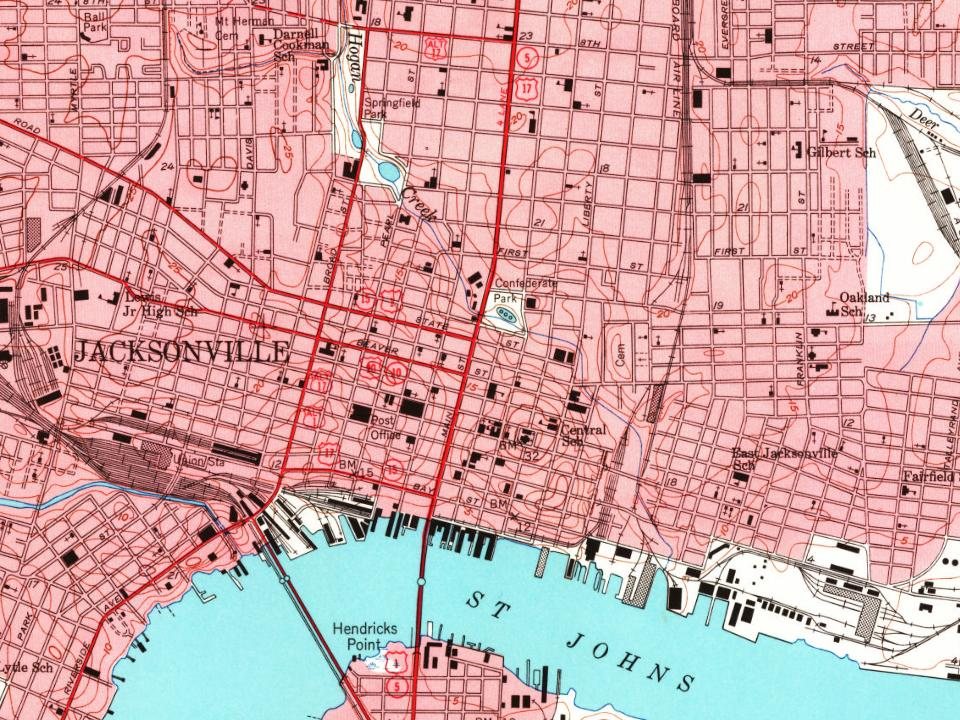
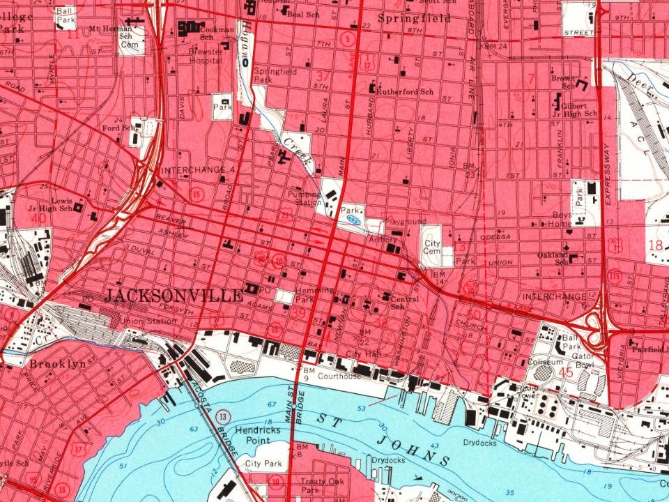
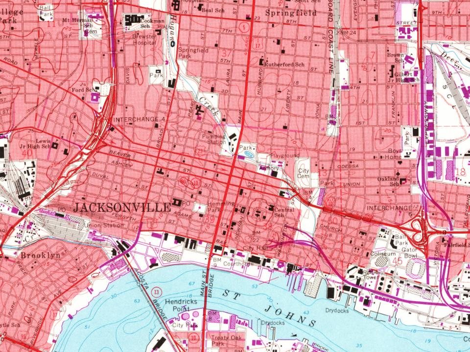
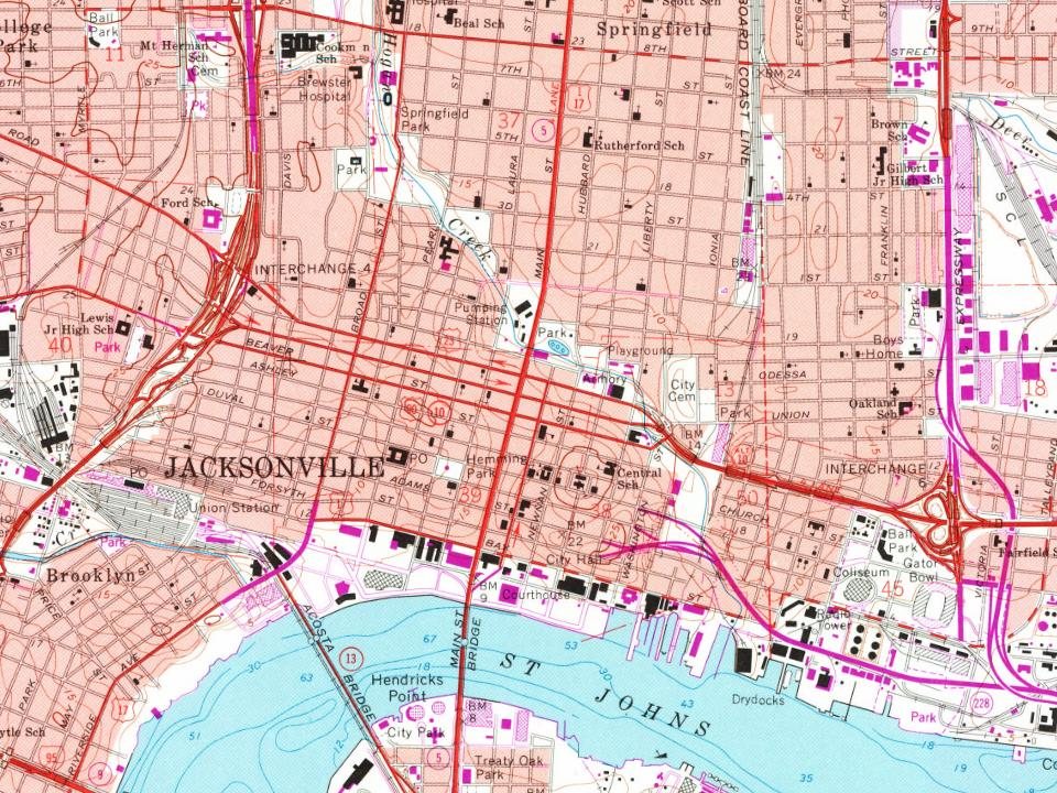
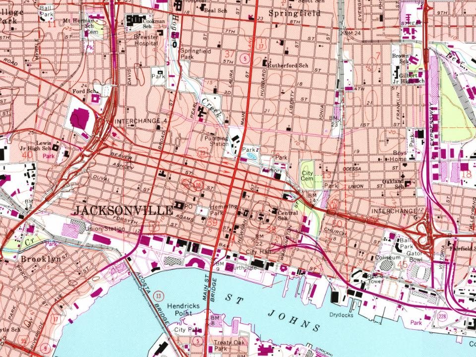
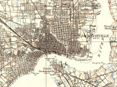
Every edition of the U.S. Geological Survey’s map of Jacksonville. Tap a year, or press play to watch the town change.
1918Jacksonville sheet · 1:62,500
U.S. Geological Survey historical topographic maps (public domain), via Esri’s collection of the scans. The red ring marks the center of Jacksonville.
Every building
Jacksonville, building by building, 1884–1913
Fire insurance maps drew every building, what it was made of and what it was used for, so insurers could price the risk of fire. Pick a year, then a sheet.
In 1791, according to Wikidata. Jacksonville’s post office opened in 1824, and the census of 1850 counted 1,045 people here.
How does Jacksonville rank for history?
Jacksonville is more historic than 79% of U.S. towns, #19 of 638 in Florida. The History grade combines the town’s founding era, the share of homes built before 1940 and its National Register listings. It’s a character grade, so it isn’t part of the overall grade. How it works.
What is on the National Register in Jacksonville?
106 listings: 84 buildings, 12 historic districts with 6,294 contributing buildings, 7 sites, and 3 structures. 6,412 historic buildings in all.
How old are the homes in Jacksonville?
5% of Jacksonville’s homes were built before 1940 (Census estimate), against a typical 0.6% for a Florida town; the median home was built in 1987.
Founding dates: Wikidata, Wikipedia, the U.S. post office records of Blevins & Helbock (CC0) and the Census. Homes by year built: Census ACS 2020–24. National Register of Historic Places: National Park Service (list of May 22, 2026). Old photos, postcards and papers: Wikimedia Commons, the Library of Congress and other public archives, credited on each item’s page. Maps: U.S. Geological Survey historical topographic maps (via Esri) and Sanborn fire-insurance maps (Library of Congress). History text and census tables: Wikipedia (CC BY-SA 4.0). Places that used to be: USGS Geographic Names Information System (2021).
From Wikimedia Commons (10), the Library of Congress (10), Wikidata (2), the National Register of Historic Places (106), Wikipedia, Wikidata and Wikipedia for famous people, U.S. Geological Survey historical maps, U.S. Census counts (via Wikipedia), the US Post Offices dataset (Blevins & Helbock), the USGS Geographic Names Information System, Sanborn fire insurance maps (Library of Congress) and old county and town histories (Internet Archive). Archive images are copied here with their credits and licenses, shown on each photo’s page. Refreshed monthly.








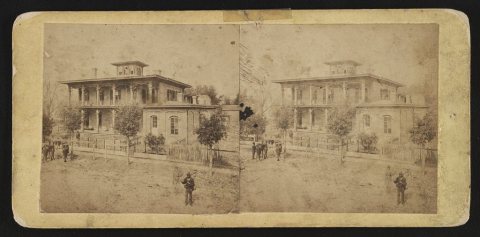 1862
 1864
 1864
 1898
 1898
 1898
 1898
 1898
 1898
 1898
 1898
 1900
 1900
 1900
 1900