Guest, Sign inJoin

Post to Gainesville

We’ll email a one-tap link to publish your post. No password, and nothing is public until you click it.
Already a member? Sign in
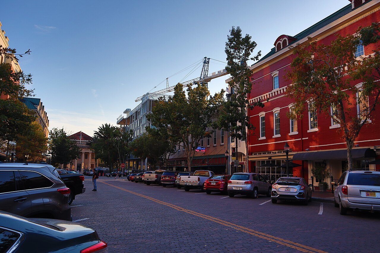
Gainesville, FL DowntownPhoto: Rbrko · CC BY-SA 4.0
AOutdoors
Outdoors in Gainesville

12% of Gainesville’s land is conserved: 4,809 acres

62 miles of mapped trail cross Gainesville, 1.0 per square mile of land. The biggest trail networks: Morningside Nature Center (5.1 mi), Sweetwater Wetlands Park (3.7 mi), Split Rock Conservation Area (3.1 mi). 90% of residents live within a half mile of a park.

Ahead of 89% of U.S. towns · #49 of 638 in Florida. What drives it

Conserved land
12%
4,809 acres · of 64.0 sq mi of land
Trails
62 mi
1.0 per sq mi of land
Park land
4,243 ac
29 acres per 1,000 residents
Near a park
90%
of residents within ½ mile
Bike routes
150 mi
113 mi lanes · 31 mi paths
Lakes & rivers
22
2 boat launches

What kind of outdoors town is Gainesville?

Read from the map. The page puts what stands out first.

Outdoors grade

How much outdoors does Gainesville have?

On conserved land, trails, park land and how close residents live to a park, Gainesville is ahead of 89% of U.S. towns, #49 of 638 in Florida. All four inputs are above most U.S. towns; conserved land ranks highest, park acres per resident lowest.

A
OutdoorsA character grade: shown, never part of Gainesville’s overall grade.
All U.S. towns we grade (21,298)Ahead of 89%
LessMore
Florida towns of 2,500+ (638)Ahead of 92%

Among the 400 U.S. cities of 100,000 or more, Gainesville ranks #89 on Outdoors.

How sure. Graded on any three of the four inputs instead, the letter would still be A. Trails and many small parks come from OpenStreetMap, mapped by volunteers, so coverage varies from town to town; the half mile is a straight line from each census block, so a river or highway in the way isn’t counted against it.

PAD-US, OpenStreetMap (© OpenStreetMap contributors), Census 2025 Gazetteer and 2020 blocks; details in Sources below. How TownRatings grades the outdoors →

The map

Conserved land, trails & bike routes

Tap a number to zoom to a park. Tap a layer to hide it.

12345678
Easements protect land from building but are usually private.© OpenStreetMap contributors · USGS PAD-US
Places to walk

Pick a walk

The longest trail network is Morningside Nature Center, with 5.1 miles. Directions go to the nearest trailhead or public parking.

Morningside Nature Center

Managed by City of Gainesville
406 acres5.1 mi of trail
Flatwoods Loop TrailWest Perimeter TrailGaliberry TrailBlueberry Trail+1
Dog rules not recorded
No trailhead mapped yetWebsite ↗

Sweetwater Wetlands Park

Park
257 acres3.7 mi of trail
Dog rules not recorded
Directionsto the trail sign

Split Rock Conservation Area

Nature preserve
239 acres3.1 mi of trail
Main Trail
Dog rules not recorded
No trailhead mapped yet

Four Creeks Preserve

Managed by Alachua County Parks
704 acres2.8 mi of trail
Blue TrailYellow TrailConnector trail
Dog rules not recorded
No trailhead mapped yet

Loblolly Woods North

Park
98 acres2.5 mi of trail
Hogtown Creek PathHogtown Creek Greenwayhogtown creek greenwayMason Manor Boardwalk
Dog rules not recorded
Directionsto the parking lot

San Felasco Park

Park
206 acres1.7 mi of trail
Flatwoods Trail SouthPond TrailSouth LoopHardwood Hammock Trail+1
Dog rules not recorded
No trailhead mapped yetWebsite ↗

Butler North

Park
48 acres1.7 mi of trail
Dog rules not recorded
Directionsto the parking lot

Clear Lake Nature Park

Nature preserve
266 acres1.4 mi of trail
The Snake
Dog rules not recorded
Directionsto the parking lot
All 61 parks & preserves
Morningside Nature Center406 acres · 5.1 mi of trail · City of Gainesville
Sweetwater Wetlands Park257 acres · 3.7 mi of trail
Directions
Split Rock Conservation Area239 acres · 3.1 mi of trail
Four Creeks Preserve704 acres · 2.8 mi of trail · Alachua County Parks
Loblolly Woods North98 acres · 2.5 mi of trail
Directions
San Felasco Park206 acres · 1.7 mi of trail
Butler North48 acres · 1.7 mi of trail
Directions
Clear Lake Nature Park266 acres · 1.4 mi of trail
Directions
Bivens Arm Nature Park89 acres · 1.4 mi of trail
Directions
Veterans Memorial Park70 acres · 1.4 mi of trail
Directions
Westside Recreation Center26 acres · 1.4 mi of trail · City of Gainesville
Directions
Gum Root Park426 acres · 1.2 mi of trail
Directions
Lake Alice Conservation Area139 acres · 1.1 mi of trail
Directions
Alfred A. Ring Park47 acres · 0.9 mi of trail
Directions
Hogtown Creek Headwaters74 acres · 0.8 mi of trail
Directions
Natural Area Teaching Laboratory69 acres · 0.8 mi of trail · University of Florida
Directions
Possum Creek Park48 acres · 0.7 mi of trail · City of Gainesville
Directions
Devil's Millhopper Geological State Park84 acres · 0.6 mi of trail · Florida State Parks
Directions
Fred Cone Park30 acres · 0.5 mi of trail
Newnans Lake Conservation Area261 acres · 0.4 mi of trail
Directions
Loblolly Woods South78 acres · 0.4 mi of trail
Directions
Northside Park37 acres · 0.4 mi of trail
Directions
Cofrin Nature Park35 acres · 0.4 mi of trail
Directions
Depot Park33 acres · 0.4 mi of trail
Directions
Springtree Park13 acres · 0.4 mi of trail
John Mahon Nature Park11 acres · 0.4 mi of trail
Directions
Tom Petty Park21 acres · 0.3 mi of trail
Reserve Park5 acres · 0.3 mi of trail
Directions
Bo Diddley Plaza2 acres · 0.3 mi of trail
Directions
Springhill Park4 acres · 0.2 mi of trail
Sweetwater Park3 acres · 0.2 mi of trail
Directions
Garden of Hope2 acres · 0.2 mi of trail
Directions
Smokey Bear Park6 acres · 0.1 mi of trail
Norman Park4 acres · 0.1 mi of trail · University of Florida
Directions
Broken Arrow Bluff Park3 acres · 0.1 mi of trail
Oakview Park2 acres · 0.1 mi of trail
Boulware Springs Park107 acres
Directions
Newnans Lake State Forest69 acres · Florida Department of Agriculture and Consumer Services
Duval Park28 acres
T B McPherson Recreation Complex15 acres
Greentree Park14 acres
Directions
Lake Kanapaha13 acres · Alachua County
Sweetwater Preserve9 acres
Directions
Cora P. Roberson Park8 acres
Directions
Flavet Field7 acres · UF Recsports
Directions
Kiwanis Park7 acres
Directions
Paynes Prairie Preserve State Park5 acres · Florida State Parks
Plaza of the Americas5 acres · University of Florida
Directions
Auditorium Park3 acres
Directions
Sunbay Duck Pond3 acres
Directions
University Park Arboretum3 acres
Graham Park2 acres
Directions
Roper Park2 acres
Directions
Haisley Lynch Dog Park1 acres
Directions
Sorority Park1 acres
Directions
Pleasant Park1 acres
Law School Park1 acres · University of Florida
38th Street Park1 acres · City of Gainesville
Hidden Gem Park1 acres
Directions
Tigert Park1 acres
Directions
Donald Lee & Virginia Joanne Rockwood Park1 acres · Alachua Conservation Trust
Who protects it

4,809 conserved acres

12% of Gainesville’s land. Who manages Gainesville’s conserved land, from the USGS Protected Areas Database. Approximate, because parcels can overlap.

Town or city2,725 ac
Regional Water Districts1,199 ac
USDA easements (NRCS)838 ac
Other state land560 ac
State parks294 ac
Land trusts & nonprofits35 ac
County6 ac
Local Other or Unknown · 1,256 acLocal Conservation Area · 978 acAgricultural Easement · 838 acUnknown Easement · 838 acLocal Park · 577 ac
Good to know

Conserved doesn’t always mean open to visitors. 838 acres are conservation easements, usually private land. The walks above are places people visit.

The biggest protected parcels
Parcel (PAD-US)Managed byAcresPublic access
Gum Root Park
Local Other or Unknown
Town or city369Open
Newnans Lake Conservation Area
Local Conservation Area
Regional Water Districts361Restricted
Morningside Nature Center
Local Recreation Area
Town or city267Open
Split Rock Conservation Area
Local Conservation Area
Town or city238Open
Paynes Prairie Preserve State Park
State Conservation Area
State parks228Open
Sugarfoot Prairie Conservation Area
Local Conservation Area
Town or city195Open
San Felasco Park
Local Other or Unknown
Town or city191Open
Flatwoods Conservation Area
Local Conservation Area
Town or city155Open
Loblolly Woods Nature Park
Local Other or Unknown
Town or city154Open
Lake Alice
State Other or Unknown
Other state land129Open

5 smaller protected places aren’t shown.

Things to do

89 places to go in Gainesville

Beaches, playgrounds, peaks, falls and more. Pick a kind.

Public pools in Gainesville
Alight Gainesville Apartment Pool
Directions
Florida Pool
Directions
Northeast PoolFee
Directions
Sunbay Pool
Directions
Tanglewood Pool
Directions
Weschester Pool
Directions

Plus 2 public pools without a name on the map. Tap “Show all on map” to see them.

Trails & water

25 named trails and 22 lakes & rivers

Named trails
Open to bikes · 10.0 miUnpaved · 34.2 mi
Blue Trail1.5 mi
Main Trail1.3 mi
Yellow Trail1.1 mi
Hogtown Creek Greenway1.0 mi
Hogtown Creek Path0.6 mi
Flatwoods Loop Trail0.5 mi
West Perimeter Trail0.5 mi
Galiberry Trail0.5 mi
Flatwoods Trail South0.5 mi
The Snake0.5 mi
15 more trails
Blueberry Trail
0.4 mi
Old Field Nature Trail
0.4 mi
hogtown creek greenway
0.4 mi
North Perimeter Trail
0.4 mi
Trail
0.4 mi
Hibiscus
0.3 mi
John Mahon Nature Trail
0.3 mi
Gardenia
0.3 mi
Holly
0.3 mi
Lily
0.3 mi
Ecotone Trail
0.3 mi
Pond Trail
0.2 mi
Connector trail
0.2 mi
Deer Tongue Trail
0.2 mi
Gopher Loop
0.2 mi
Lakes & rivers tap for directions
Biking & sports

150 miles of bike routes

Bike lanes are often missing from the map in smaller towns, so that number is likely low.

113 mi
painted or protected bike lanes
31 mi
off-road bike paths
5.9 mi
shoulders & shared lanes
Courts & fields
115Tennis
54Basketball
24Pickleball
24Baseball
22Beach volleyball
21Soccer
11Football
10Tracks

Includes school and college facilities, which aren’t always open to the public.

History along the way

44 places on the National Register

The country’s official list of places worth saving (National Park Service). The map also marks 47 historic points from OpenStreetMap: plaques, memorials and old buildings.

History →
Maj. James B. Bailey HouseBuilding · listed 1972
About it
Matheson HouseBuilding · listed 1973
About it
Hotel ThomasBuilding · listed 1973
About it
Epworth HallBuilding · listed 1973
About it
Buckman HallBuilding · listed 1974
About it
Thomas HallBuilding · listed 1974
About it
Anderson HallBuilding · listed 1979
About it
Bryan HallBuilding · listed 1979
About it
Flint HallBuilding · listed 1979
About it
Floyd HallBuilding · listed 1979
About it
Library EastBuilding · listed 1979
About it
Newell HallBuilding · listed 1979
About it

32 more on the History page.

When to get out

April is the best month for walking in Gainesville

NOAA’s 1991–2020 normals for the town and the daylight at its latitude. Outlined months have long days, highs of 59 to 86 °F and little rain for the place.

JanFebMarAprMayJunJulAugSepOctNovDec
Daylight (h)10.411.111.912.913.614.013.913.212.311.410.610.2
High (°F)687176828891929189837570
Rain (in)3.52.93.62.93.57.67.07.45.82.91.93.0

November is the driest month (1.9 in) and July the warmest (highs of 92 °F). 7.6 inches fall in June, the wettest month. Summer highs reach 92 °F, too hot for the outline. The climate in Gainesville →

Next door

Gainesville and its neighbors

Gainesville has the most mapped trails of the 2 towns around it. Tap a town to see its outdoors.

TownConserved
of land
Trail mi
per sq mi
Park acres
per 1,000
Near a park
½ mile
Outdoors
Gainesville12%1.02990%A
Alachua15%0.631566%A

The four inputs of the Outdoors grade, from the engine; shares are of land, not water.

Questions about parks and trails in Gainesville

Where can I hike in Gainesville?

The longest trail networks: Morningside Nature Center, 5.1 miles; Sweetwater Wetlands Park, 3.7 miles; Split Rock Conservation Area, 3.1 miles; Four Creeks Preserve, 2.8 miles. Each one is on the map above, with directions to the nearest trailhead or parking.

How much of Gainesville is conserved land?

12% of its land, against a typical 3% for a Florida town and 4% nationally (PAD-US). Conserved doesn’t always mean open to visitors: easements are usually private land.

Are dogs allowed on Gainesville’s trails?

Morningside Nature Center and Sweetwater Wetlands Park don’t have dog rules recorded on the map; check the signs at the trailhead.

Where can I bike in Gainesville?

150 miles of bike routes are on the map: 113 of painted or protected lanes, 31 of off-road paths and 5.9 of shoulders and shared lanes.

Is there public land near Gainesville?

50,809 acres of parks and open public land lie inside Gainesville or within 10 miles of it (PAD-US), 4,687 of them inside the city line.

How much outdoors does Gainesville have?

Ahead of 89% of U.S. towns on the Outdoors grade, #49 of 638 in Florida. The grade combines the share of land that is conserved, miles of mapped trail per square mile of land, park acres per 1,000 residents and the share of residents within a half mile of a park. It’s a character grade, so it isn’t part of the overall grade. How it works.

Trail talk

Conditions, parking and favorite walks from Gainesville neighbors.
Town Square →
Share a tip
Sources

Where this page comes from

Conserved and public land: USGS Protected Areas Database of the United States (PAD-US), service updated July 2026. Parks, trails, playgrounds, beaches and other places: OpenStreetMap (© OpenStreetMap contributors, ODbL), map data as of 2026-10-28. Land and water area: Census 2025 Gazetteer. Residents near a park: 2020 Census blocks. National Register: National Park Service. How TownRatings grades the outdoors →