
Cape Coral water ski show, c. 1975
Cape Coral’s story
69 years in pictures
Census counts: 10,193 in 1970, 194,016 in 2020. The archive holds 6 old photos and papers going back to 1975 and 3 maps from 1958 on.
- 1957Cape Coral is settled
Each edition grades its towns against each other only.

For a city of 236,264, Cape Coral does unevenly: it grades C−, 484th among Florida's 634 graded towns. Residents are healthier than 62% of U.S. towns on CDC estimates. The trade-offs: the typical home is worth about $335K, 4.4 years of the Cape Coral metro’s $76K median household income, and FEMA rates its natural-hazard risk higher than 84% of U.S. communities, with hurricanes at the top. Cape Coral’s January low is 53°F, near the Florida town median (51°F) and above the median of U.S. towns (22°F). On history, just 20 of Florida’s 779 towns do worse. The biggest place to walk is Four Mile Cove Ecological Preserve, 374 acres with 1.4 miles of trail.
154,305 counted in 2010 and 194,016 in 2020; an estimated 236,264 in 2025.
Growth hasn’t slowed: 21.8% since 2020, after 25.7% in the decade before.
U.S. Census 2010 & 2020 counts · Census Bureau estimate, July 1, 2025
Each subject compared with towns across the country (schools within Florida), ordered by how far Cape Coral is from typical.
How TownRatings grades towns →
Census counts: 10,193 in 1970, 194,016 in 2020. The archive holds 6 old photos and papers going back to 1975 and 3 maps from 1958 on.
Who provides power, water and the rest in Cape Coral, and how to reach them.
EPA SDWIS (Oct 9, 2026) · HIFLD + EIA-861 2025 · Census 2020 ZCTAs · NCES 2024–25 · registration: vote.gov, updated Nov 17, 2025.
Ordered by what stands out in Cape Coral.
Cape Coral has more 90° days than nearly all U.S. towns and has home values still below their peak, but it has a long record of flood insurance claims.
4,381 flood insurance claims have been filed here, and 26 properties have flooded more than once.
Since 1979, 4,381 flood insurance claims have been paid out in Cape Coral.
FEMA flood insurance claims · FEMA National Risk Index · OpenFEMA
Its public schools are run by the Lee school district. Three of its 35 schools are below, each with why it’s listed.
| School | Level | Students | Letter |
|---|---|---|---|
| Gulf Elementary SchoolLargest public elementary schoolGrades PK–5 | Grades PK–5 | 1,193 | A− |
| Ida S. Baker High SchoolLargest public high schoolGrades 9–12 | Grades 9–12 | 2,191 | B− |
| Oasis Charter Elementary School-SouthTop results in townGrades K–5 | Grades K–5 | 875 | A |
NCES · EDFacts · graded within FL on state tests and graduation
Jobs based here grew from 24,964 in 2013 to 42,015.
About one in 4 of Cape Coral’s working residents works in town. Since 2013, Cape Coral has added 17,051 jobs, to 42,015 in 2023. The average trip to work in Cape Coral is 30 minutes.
| Cape Coral | Florida towns | U.S. towns | |
|---|---|---|---|
| Working residents who work in town | 23% | 5% | 8% |
| Average trip to work | 30 minutes | 27 minutes | 25 minutes |
| Work from home | 15% | 14% | 11% |
Census LEHD 2023 · ACS
| Cape Coral | Florida towns | U.S. towns | |
|---|---|---|---|
| Conserved land | 1.9% | 3% | 4.3% |
| Miles of trail per square mile | 0.4 miles per square mile | 0.4 | 0.4 |
| Biggest places to walk | Trails | Acres |
|---|---|---|
| 1. Yellow Fever Creek Preserve | 2.6 mi | 219 |
| 2. Four Mile Cove Ecological Preserve | 1.4 mi | 374 |
| 3. Del Prado Linear Park | 0.6 mi | 50 |
Trails & parks © OpenStreetMap contributors · Conserved land: USGS PAD-US
The Punta Gorda 4 Ese weather station, 19 miles away, records that about 136 days a year reach 90°, more than in 98% of U.S. towns. January nights average 52.7°, milder than in 99% of U.S. towns; July afternoons average 92°.
Cape Coral has warm winters and hot summers, with plenty of rain. Cape Coral’s July high is 92°F. Snow is almost unheard of.
NOAA U.S. Climate Normals, 1991–2020
14% of Cape Coral adults 18 to 64 have no health insurance. Cape Coral beats the Florida average on 5 of 31 CDC measures and trails it on 1. 34% of Cape Coral adults sleep under 7 hours.
| Cape Coral | Florida towns | U.S. towns | |
|---|---|---|---|
| No health insurance, 18–64 (CDC PLACES) | 14% | 14% | 8.1% |
| Depression (CDC PLACES) | 18% | 18% | 23% |
| Obesity (CDC PLACES) | 31% | 32% | 35% |
| Sleep under 7 hours (CDC PLACES) | 34% | 37% | 36% |
| What stands out | Cape Coral | FL |
|---|---|---|
| Fewer adults facing a utility shut-off | 6.9% | 8.6% |
| Fewer adults facing food insecurity | 13.5% | 16.8% |
| More adults who have had cancer | 10.4% | 9.1% |
CDC PLACES 2025 · modeled estimates for adults · CMS · HRSA
The typical value, about $335K, is 22% below its August 2022 peak. At about $335K, home values are up 1% in five years, against a rise of 19% across Florida.
65% of renter households spend 30% or more of their income on rent in Cape Coral. The typical Cape Coral home is worth about $335,000, down 2.9% in a year, 11% below the Florida typical home.
| Cape Coral | Florida towns | U.S. towns | |
|---|---|---|---|
| Median rent | $1,858 a month | $1,647 a month | $1,185 a month |
| Renters paying 30%+ of income on rent | 65% | 59% | 48% |
| Households that own their home | 77% | 72% | 73% |
Census ACS, 2020–24 · Zillow Home Value Index · Redfin Data Center
Cape Coral has grown 22% since 2020, to 236,264 residents in the Census Bureau’s 2025 estimate. 27% of adults 25 and older have a bachelor’s degree or more, vs 34% across Florida.
| Cape Coral | Florida towns | U.S. towns | |
|---|---|---|---|
| Median age | 48.6 years | 42.4 years | 40.5 years |
| Aged 65 or older | 25% | 20% | 18% |
| Under 18 | 18% | 20% | 22% |
| Bachelor’s degree or more, 25+ | 27% | 31% | 29% |
50.0% women, 50.0% men
That’s an even split within the survey’s margin of ±0.7 points. Across Florida, 50.9% of residents are women. Median age: women 49.4, men 48.0.
| Cape Coral | FL | U.S. | |
|---|---|---|---|
| Under 10 | 9.9% | 10.3% | 11.6% |
| 10 to 17 | 7.7% | 9.2% | 10.3% |
| 18 to 24 | 6% | 8.1% | 9.1% |
| 25 to 34 | 11.1% | 12.7% | 13.7% |
| 35 to 44 | 11% | 12.7% | 13.2% |
| 45 to 54 | 13.4% | 12.3% | 12.2% |
| 55 to 64 | 15.9% | 13.4% | 12.7% |
| 65 to 74 | 14.4% | 11.7% | 10.2% |
| 75 and older | 10.5% | 9.6% | 7% |
| No diploma | 7.2% | 10.1% | 10.4% |
| High school | 34.8% | 27.2% | 26% |
| Some college | 21.5% | 18.5% | 19.1% |
| Associate’s | 9.6% | 10.1% | 8.8% |
| Bachelor’s | 17.5% | 21.3% | 21.6% |
| Graduate | 9.4% | 12.9% | 14.1% |
Census population estimates, 2025 · U.S. Census Bureau · ACS 2020-2024 5-year estimates
Museums, parks, gardens and other places to visit around Cape Coral. Close and well known come first.
 7 mi MuseumEdison and Ford Winter Estates
 20 mi Stadium & arenaHertz Arena
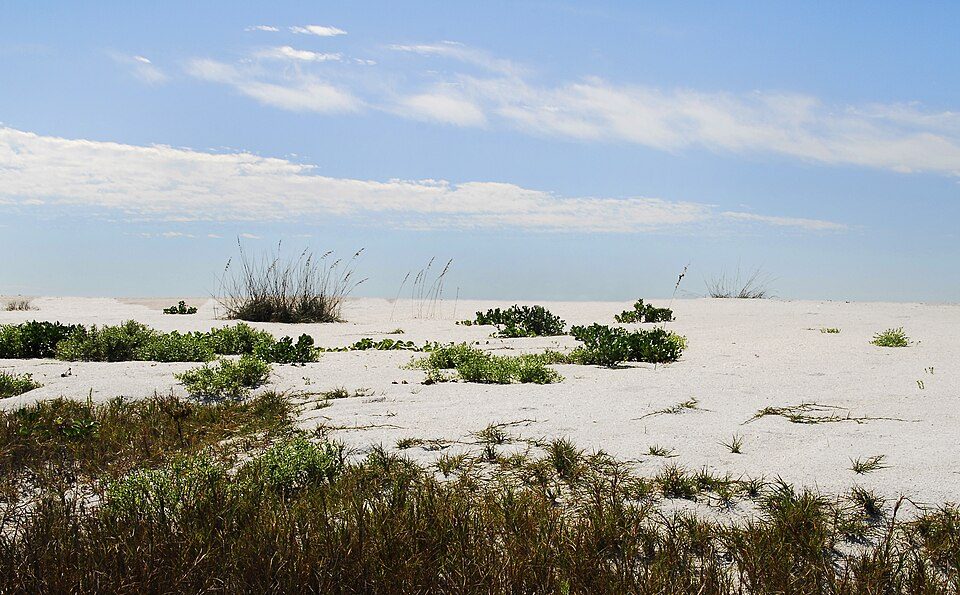 16 mi State parkCayo Costa State Park17 mi State parkMound Key Archeological State Park
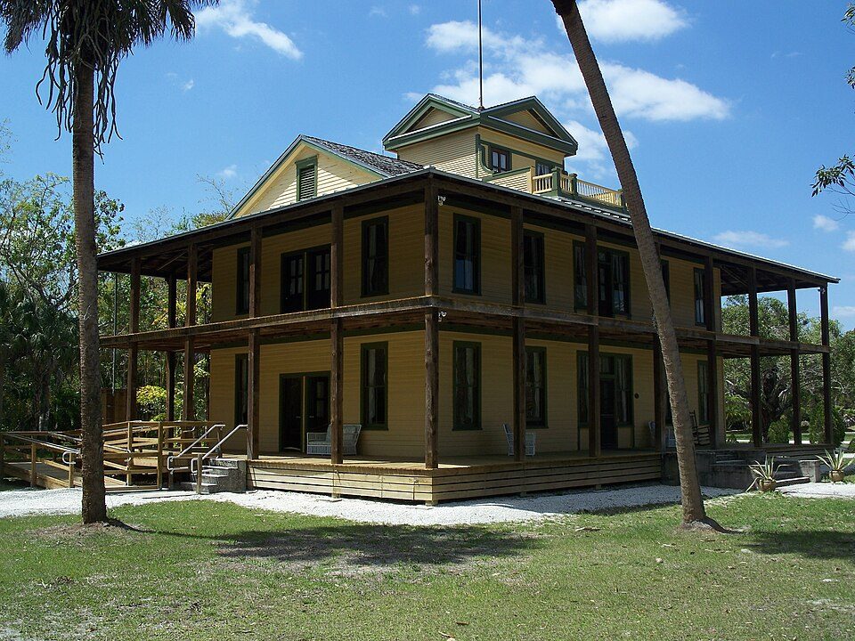 18 mi State parkKoreshan State Historic Site
 33 mi Ancient siteWarm Mineral Springs
Edison and Ford Winter Estates: Rolf Müller (User:Rolfmueller), CC BY-SA 3.0 · Hertz Arena: Tthaas, CC BY-SA 3.0 · Cayo Costa State Park: https://www.flickr.com/photos/andrea_pauline/, CC BY-SA 2.0 · Koreshan State Historic Site: Ebyabe, CC BY-SA 3.0 · Warm Mineral Springs: Blas0082, Public domain
1 within 15 miles of the center of Cape Coral
About 4 of every 100 Cape Coral residents are enrolled in college, against 6 across Florida.
11 notable people were born in Cape Coral.


City in the United States
Cape Coral is a city in Lee County, Florida, United States, on the Gulf of Mexico. Founded in 1957, the city's population had grown to 194,016 as of the 2020 census, a 26% increase from 154,309 at the 2010 census, making it the ninth-most populous city in Florida. With an area of 120 square miles (310 km2), Cape Coral is the largest city between Tampa and Miami in both population and area. It is the largest and principal city in the Cape Coral-Fort Myers, Florida Metropolitan Statistical Area. The city has over 400 mi (640 km) of navigable waterways, more than any other city on earth.
From Wikipedia, licensed CC BY-SA 4.0 · facts via Wikidata (CC0)
5 towns share a border with Cape Coral.
| Town | FL rank | Overall | Cost | Safety | Schools | Health |
|---|---|---|---|---|---|---|
| Cape Coral | #484 | C− | D | — | C+ | B |
| North Fort Myers | #320 | C | B | — | C+ | C+ |
| Matlacha Isles-Matlacha Shores | — | — | — | — | — | — |
| Fort Myers | #570 | D | D− | C− | C+ | C+ |
| Burnt Store Marina | — | — | D | — | C+ | A− |
| Lochmoor Waterway Estates | #358 | C | D | — | C+ | B+ |
Burnt Store Marina has fewer than 2,500 residents, so it gets subject grades but no overall grade. Cape Coral, North Fort Myers, Burnt Store Marina and Lochmoor Waterway Estates report no FBI crime data of their own. Matlacha Isles-Matlacha Shores isn’t graded (fewer than 1,000 residents, or not enough data). Compare Cape Coral with a neighbor →
Short answers, built from the data on this page.
Cape Coral grades C− overall, better than 17% of U.S. towns and #484 of 634 in Florida. It grades B for health and C+ for schools. Cost of living is its weak spot, with a D.
11 notable people were born here, including Mike Zunino and Niko Price.


