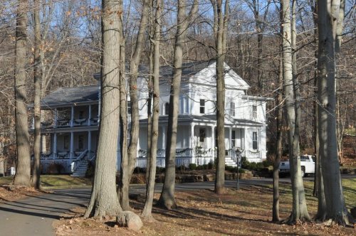
Wallingford dates to 1667, and 16% of its homes were built before 1940
More historic than 83% of U.S. towns · #80 of 155 in Connecticut. What drives it
10 places in town are on the National Register, among them a historic district with 66 buildings. Below: 14 old photos and papers, maps from 1892 on, and the census since 1820.
Founding year: Wikidata. First post office: 1794.The full story ↓
History grade
What drives Wallingford’s History grade
On its age, its old homes and the National Register, Wallingford is more historic than 83% of U.S. towns, #80 of 155 in Connecticut. All 3 inputs are above most U.S. towns; its age ranks highest and its National Register listings lowest.
A−
HistoryA character grade: shown, never part of Wallingford’s overall grade.
Connecticut towns list more on the Register than most of the country (a typical Connecticut town has 73.3 per 10,000 residents, the U.S. 2.4), so Wallingford’s 18.5 sits below most of its state (21% of Connecticut towns have fewer) while its 82 historic buildings outnumber those of 88% of U.S. towns.
NoteThe founding year comes from Wikidata alone; no second source gives 1667.
How sure. Graded on any two of the three inputs instead, the letter would range from B to A. The pre-1940 share (±1.9 points) is firm at this size.
Founding year: Wikidata (other dates in Quick answers). Homes: Census ACS 2020–24. National Register: National Park Service, May 2026 list; each listing counted once (boundary changes and added documentation belong to their listing), and a historic district counts its contributing buildings. How TownRatings grades history →
What stands out about Wallingford’s past
Read from the archive, the National Register and the record. The page puts what stands out first.
Established on October 10, 1667 by the Connecticut General Assembly, Wallingford was founded by a group of 38 planters and freemen. These early settlers chose a strategic location near the Quinnipiac River, which is now the area known as Main Street. By May 12, 1670, the settlement had grown to include 126 residents living in temporary housing, and by 1675, 40 permanent homes had been constructed.
One of Wallingford's early settlers was Thomas Yale, an influential figure in the New Haven Colony and an ancestor of Elihu Yale, the benefactor after whom Yale University is named. Thomas Yale was a signatory of the Wallingford plantation covenant in 1667, marking the formal establishment of the town.
Passages that mention Wallingford, cut from the printed page as they were published.
The descendants of John Brockett, one of the original founders of New Haven colony1905Read the page →
Read the text
Saxon Gaullhen, i.e., "old fortification," was the name of an old town in England which Leland thus quaintly describes: "The town of Wallingford hath beene a very notable thing and welle waulled. And by the patentes and donations of Edmunde, Erie of Cornewaul, and Lord of the House of Wallingford, ther wer 14 Parish Chirchis in Wallingford."
Text read by machine from the scan; it may contain errors.
History of the Wallingford disaster1878 · page 47Read the page →
Read the text
" The rush to Wallingford yesterday was something without precedent in the history of railroading in this State, and tlie throngs in the depot and on the platform at train time, the crowds at the ticket-office windows, the hurrying to the cars and the great length of trains, made the scene striking and memorable. Besides the regular trains, several large specials were run, three of them of fourteen cars and one of twenty-one cars, which either immediately preceded or directly followed the regular trains. All the regular trains were also very large. Yesterday
Text read by machine from the scan; it may contain errors.
History of the Wallingford disaster1878 · page 46Read the page →
Read the text
Bishop, president of the New York, New Haven & Hartford Railroad has an excellent substitute for a heart. When, without any solicitation or expectation on our part, he stated that on Wednesday, August 14th, tickets to Wallingford would be sold from every station on the road, and that the entire gross receipts would be given for the relief of the sufferers, we all commended his wise and generous plan. The railroad company had by means of jMinted bills advertised their plan,
Text read by machine from the scan; it may contain errors.
Scans and text from the Internet Archive. Books published in 1930 or earlier, which are in the public domain.
By decade
Wallingford, decade by decade
5 decades in the archive, from the 1860s to the 1910s. Scroll each row; tap a photo for its story.
Nothing in the archives for these yearsWeddings on Main Street, storms, parades, school pictures, the old store. If it’s in your family album, it belongs here.
In 1667, according to Wikidata. Wallingford’s post office opened in 1794, and the census of 1820 counted 2,237 people here.
How does Wallingford rank for history?
Wallingford is more historic than 83% of U.S. towns, #80 of 155 in Connecticut. The History grade combines the town’s founding era, the share of homes built before 1940 and its National Register listings. It’s a character grade, so it isn’t part of the overall grade. How it works.
What is on the National Register in Wallingford?
10 listings: 8 buildings, among them the John Barker House (listed 1974, the first), 1 historic district, the Wallingford Center Historic District, with 66 contributing buildings, and 1 site. 82 historic buildings in all.
How old are the homes in Wallingford?
16% of Wallingford’s homes were built before 1940 (Census estimate, ±1.9 points), against a typical 15% for a Connecticut town; the median home was built in 1972.
Founding dates: Wikidata, Wikipedia, the U.S. post office records of Blevins & Helbock (CC0) and the Census. Homes by year built: Census ACS 2020–24. National Register of Historic Places: National Park Service (list of May 22, 2026). Old photos, postcards and papers: Wikimedia Commons, the Library of Congress and other public archives, credited on each item’s page. Maps: U.S. Geological Survey historical topographic maps (via Esri) and Sanborn fire-insurance maps (Library of Congress). History text and census tables: Wikipedia (CC BY-SA 4.0). Places that used to be: USGS Geographic Names Information System (2021).
From Wikimedia Commons (12), the Library of Congress (2), Wikidata (4), the National Register of Historic Places (10), Wikipedia, Wikidata and Wikipedia for famous people, U.S. Geological Survey historical maps, U.S. Census counts (via Wikipedia), the US Post Offices dataset (Blevins & Helbock), the USGS Geographic Names Information System and old county and town histories (Internet Archive). Archive images are copied here with their credits and licenses, shown on each photo’s page. Refreshed monthly.


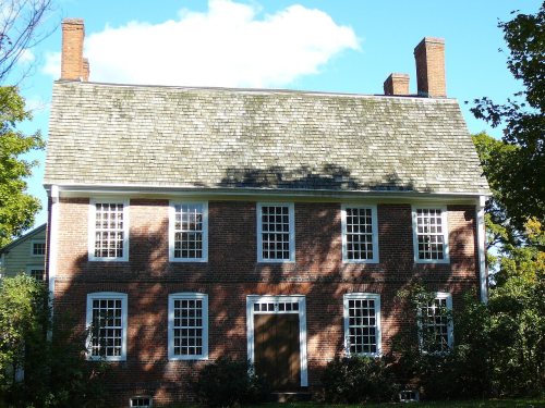


 1901–1907
 1905
 1905
 1907
 1907–1915
 c. 1908
 1908
 c. 1910
 1912