How Stonington began, and where its name came from
When was Stonington founded?
1649
Stonington dates its founding to 1649 (Wikidata). The census first counted it in 1820.
First census: 3,036 in 18202020 census: 976377 years
How did Stonington get its name?
Stonington was named "Souther Towne" or Southerton by Massachusetts in 1658, and officially became part of Connecticut in 1662 when Connecticut received its royal charter.
More on the name
Southerton was renamed "Mistick" in 1665, and finally named Stonington in 1666, meaning "stony town".
How historic is Stonington?
A+
Among the most historic 1% of U.S. towns, on its age, its old homes and the National Register.
On its age, its old homes and the National Register, Stonington is among the most historic 1% of U.S. towns. All 3 inputs put Stonington near the top nationally; its share of homes from before 1940 ranks highest.
A+
HistoryA character grade: shown, never part of Stonington’s overall grade.
Connecticut towns list more on the Register than most of the country (a typical Connecticut town has 73.3 per 10,000 residents, the U.S. 2.4), so Stonington’s 4,176 sits above most of its state (100% of Connecticut towns have fewer) while its 390 historic buildings outnumber those of 96% of U.S. towns.
NoteThe founding year comes from Wikidata alone; no second source gives 1649.
How sure. Graded on any two of the three inputs instead, the letter would still be A+. The pre-1940 share is a Census survey estimate (±5.4 points).
Founding year: Wikidata (other dates in Quick answers). Homes: Census ACS 2020–24. National Register: National Park Service, May 2026 list; each listing counted once (boundary changes and added documentation belong to their listing), and a historic district counts its contributing buildings. How TownRatings grades history →
What stands out about Stonington’s past
Read from the archive, the National Register and the record. The page puts what stands out first.
The first European colonists to arrive include William Chesebrough and Walter Palmer in Wequetequock, Thomas Minor in Quiambaug, and Thomas Stanton in Pawcatuck. Stanton established a trading house in the Pawcatuck section of town in 1649. The present territory of Stonington was part of lands that had belonged to the Pequot people, who referred to the areas making up Stonington as Paquatuck (Stony Brook to the Pawcatuck River) and Mistack (Mystic River to Stony Brook). It was named "Souther Towne" or Southerton by Massachusetts in 1658, and officially became part of Connecticut in 1662 when Connecticut received its royal charter. Southerton was renamed "Mistick" in 1665, and finally named Stonington in 1666, meaning "stony town". The town of North Stonington was set off as a parish from Stonington in 1724 and incorporated as a town in 1807.
Passages that mention Stonington, cut from the printed page as they were published.
History of the town of Stonington, county of New London, Connecticut, from its frist settlement in 1649 to 19001900 · page 119Read the page →
Read the text
1720, order the sum of ten pounds to be paid out of the public treasury of this Colony toward repairing the half of the bridge between the towns of Stonington and Westerly, and the remainder of the charge thereof to be paid by the town of Stonington, and that the Selectmen of said town should take eftectual care that said half part of said bridge should be always maintained and kept in good repair by said town of Stonington until this Assembly should order otherwise. And whereas the said selectmen of Stonington hare been very negligent in said affair, for want of some suitable provision in said
Text read by machine from the scan; it may contain errors.
History of the town of Stonington, county of New London, Connecticut, from its frist settlement in 1649 to 19001900 · page 91Read the page →
Read the text
No more churches were organized in Stonington before the division of the town in 1807. Pending the agitation and controversial feeling between the inhabitants of the northern and southern sections of the town of Stonington, relative to the old mail stage route, and the layout of the new highway from Stonington Borough to Old Mystic, and the construction of the bridge over Lambert's Cove, Pine Tree Point to Quana duct, in order to give the electors of the town an opportunity to decide the
Text read by machine from the scan; it may contain errors.
Scans and text from the Internet Archive. Books published in 1930 or earlier, which are in the public domain.
By decade
Stonington, decade by decade
3 decades in the archive, from the 1670s to the 1900s. Scroll each row; tap a photo for its story.
Nothing in the archives for these yearsWeddings on Main Street, storms, parades, school pictures, the old store. If it’s in your family album, it belongs here.
Fire insurance maps drew every building, what it was made of and what it was used for, so insurers could price the risk of fire. Pick a year, then a sheet.
In 1649, according to Wikidata. Stonington’s post office opened in 1792, and the census of 1820 counted 3,036 people here.
How does Stonington rank for history?
Stonington is among the most historic 1% of U.S. towns. The History grade combines the town’s founding era, the share of homes built before 1940 and its National Register listings. It’s a character grade, so it isn’t part of the overall grade. How it works.
How old are the homes in Stonington?
77% of Stonington’s homes were built before 1940 (Census estimate, ±5.4 points), against a typical 15% for a Connecticut town; the median home was built in 1938.
Founding dates: Wikidata, Wikipedia, the U.S. post office records of Blevins & Helbock (CC0) and the Census. Homes by year built: Census ACS 2020–24. National Register of Historic Places: National Park Service (list of May 22, 2026). Old photos, postcards and papers: Wikimedia Commons, the Library of Congress and other public archives, credited on each item’s page. Maps: U.S. Geological Survey historical topographic maps (via Esri) and Sanborn fire-insurance maps (Library of Congress). History text and census tables: Wikipedia (CC BY-SA 4.0). Places that used to be: USGS Geographic Names Information System (2021).
From Wikimedia Commons (9), Wikidata (3), Wikipedia, Wikidata and Wikipedia for famous people, U.S. Geological Survey historical maps, U.S. Census counts (via Wikipedia), Sanborn fire insurance maps (Library of Congress) and old county and town histories (Internet Archive). Archive images are copied here with their credits and licenses, shown on each photo’s page. Refreshed monthly.


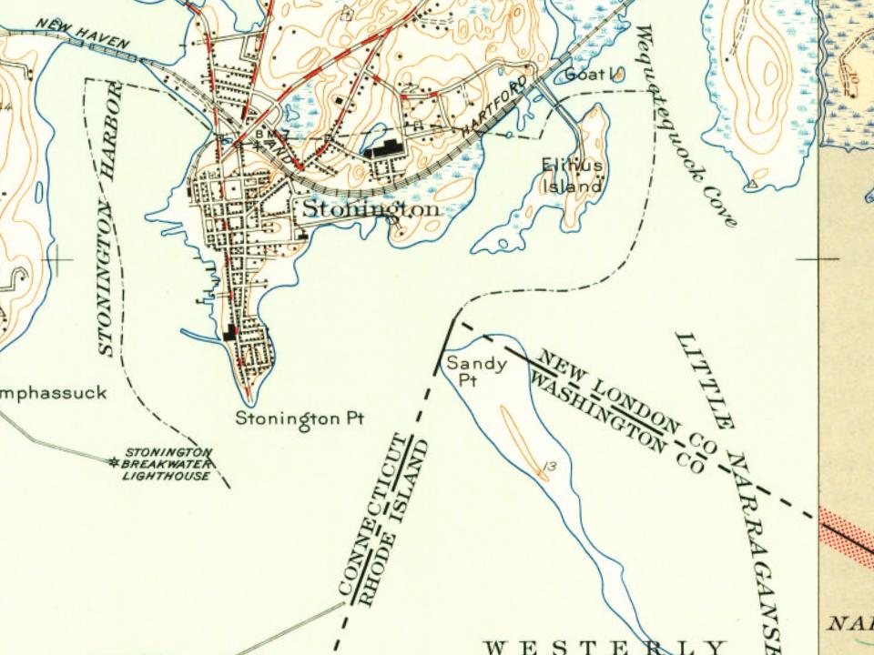


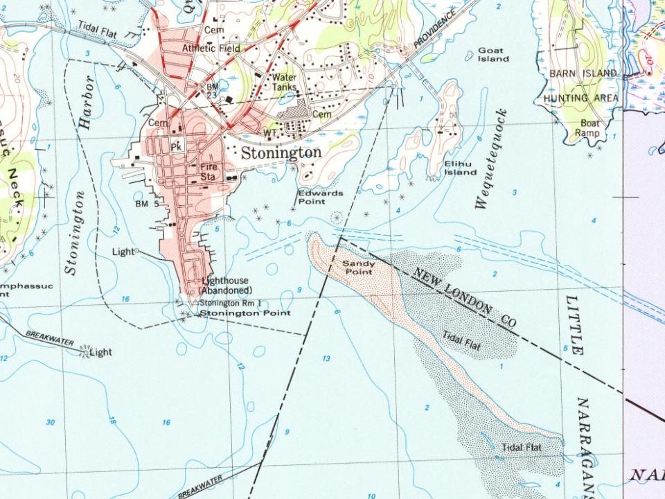


 1907–1915
 1907–1915
 1907–1915
 c. 1907
 1907–1915
 1907–1915


