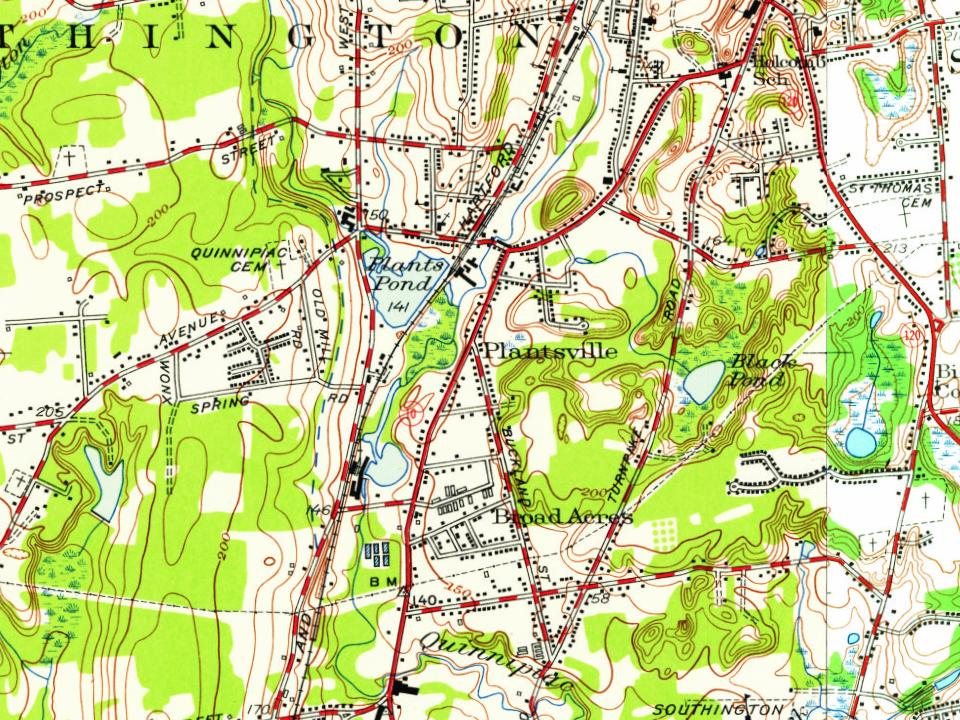
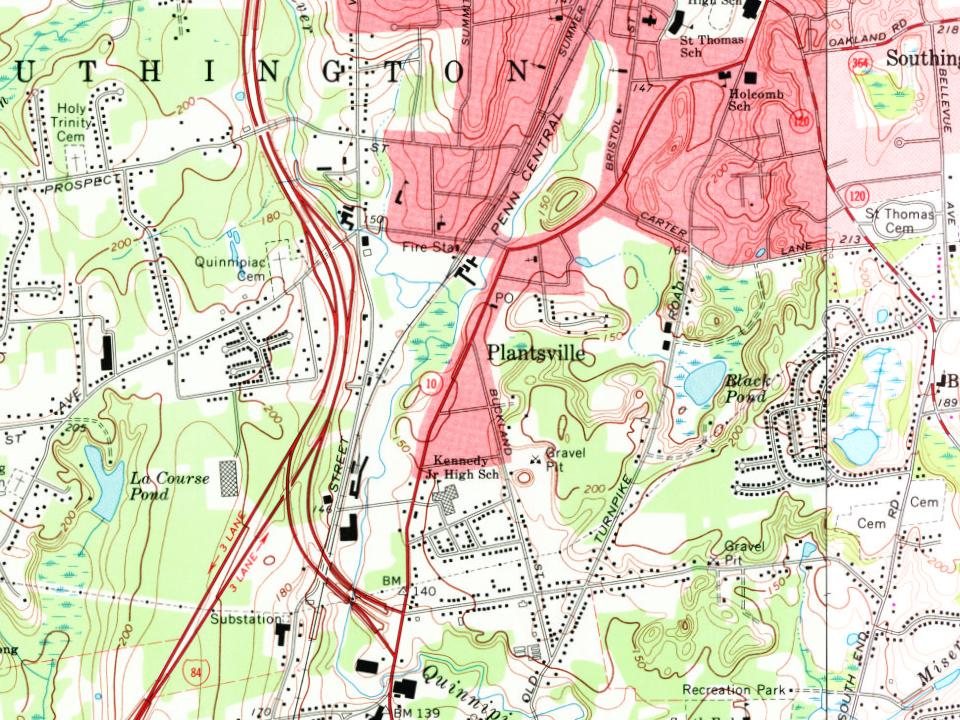
Every edition of the U.S. Geological Survey’s map of Plantsville. Tap a year, or press play to watch the town change.
1892Meriden sheet · 1:62,500
U.S. Geological Survey historical topographic maps (public domain), via Esri’s collection of the scans. The red ring marks the center of Plantsville.
On the National Register
8 listings protect 236 historic buildings
The country’s official list of buildings and places worth saving.
places listed
8
National Historic Landmarks
0
none yet
historic buildings protected
236
each building in a district counts
National Park Service, National Register of Historic Places. Photos from Wikimedia Commons, credited on each place’s page.
The story so far
Plantsville, in brief
Wikipedia doesn’t have a history of Plantsville yet. The photos, dates and memories neighbors add here are how it gets written.
Plantsville is a neighborhood in the town of Southington, Hartford County, Connecticut, United States. It is centered at the merger between South Main Street (road from the Milldale section) and West Main Street (road from the Marion section). As of the 2020 census, Plantsville had a population of 2,016. The Zip Code Tabulation Area for zip code 06479, which is assigned the postal city name Plantsville, includes the entire southwestern corner of the town of Southington, including Marion and Milldale. Beginning in 2015 Plantsville (not including Marion and Milldale) was listed as a census-designated place.
Its first post office opened in 1853.
Intro from Wikipedia. Population: U.S. Census Bureau.
From the old history books
What they wrote about Plantsville in 1886
Passages that mention Plantsville, cut from the printed page as they were published.
The memorial history of Hartford County, Connecticut, 1633-18841886 · page 363Read the page →
Read the text
between Farmington and Plainville, runs nearly through its centre from north to south. The Eight Mile River, rising in Bristol, flows in at the northwest corner of Southington, then taking a southeasterly course joins the Quinnipiac at the village of Plantsville. After this junction the river bears a little to the east of south across the Cheshire line, then turning to the east flows through a gorge in a ridge of sandstone into Wallino'ford. The principal tributaries of these streams are Roaring Brook from the west and Misery Brook from the east.
Text read by machine from the scan; it may contain errors.
The memorial history of Hartford County, Connecticut, 1633-18841886 · page 373Read the page →
Read the text
The Congregational Church in Plantsville was a colony from the Congregational Church in Southington. The society was organized in September, 1865. The church was organized Dec. 20, 1865, witli sixtythree members, mostly from the church in Southington. Their house of worship was finished in 1867. The first pastor was the Rev. William R. Eastman, 1866-1876 ; the present pastor, the Rev. L. F. Berry, was installed June 13, 1877. The present membership is three hundred and three.
Text read by machine from the scan; it may contain errors.
Scans and text from the Internet Archive. Books published in 1930 or earlier, which are in the public domain.
By decade
Plantsville, decade by decade
One decade in the archive so far: the 1900s. Scroll each row; tap a photo for its story.
Nothing in the archives for these yearsWeddings on Main Street, storms, parades, school pictures, the old store. If it’s in your family album, it belongs here.
Founding dates: Wikidata, Wikipedia, the U.S. post office records of Blevins & Helbock (CC0) and the Census. Homes by year built: Census ACS 2020–24. National Register of Historic Places: National Park Service (list of May 22, 2026). Old photos, postcards and papers: Wikimedia Commons, the Library of Congress and other public archives, credited on each item’s page. Maps: U.S. Geological Survey historical topographic maps (via Esri) and Sanborn fire-insurance maps (Library of Congress). History text and census tables: Wikipedia (CC BY-SA 4.0). Places that used to be: USGS Geographic Names Information System (2021). How TownRatings grades history →
From Wikimedia Commons (12), U.S. Geological Survey historical maps, Sanborn fire insurance maps (Library of Congress) and old county and town histories (Internet Archive). Archive images are copied here with their credits and licenses, shown on each photo’s page. Refreshed monthly.




 1901–1907
 c. 1908
 2017
 2017
 2017
 2017
 2017
 2010
 2010
 2010
 2010
 2010
