Guilford dates to 1639, and 12% of its homes were built before 1940
More historic than 92% of U.S. towns · #35 of 155 in Connecticut. What drives it
17 places in town are on the National Register, among them the Henry Whitfield House, a National Historic Landmark, and six historic districts with 523 buildings between them. Below: 15 old photos and papers, maps from 1893 on, and the census since 1820.
Founding year: Wikidata. First post office: 1793.The full story ↓
History grade
What drives Guilford’s History grade
On its age, its old homes and the National Register, Guilford is more historic than 92% of U.S. towns, #35 of 155 in Connecticut. All 3 inputs are above most U.S. towns; its age ranks highest and its share of homes from before 1940 lowest.
A
HistoryA character grade: shown, never part of Guilford’s overall grade.
Connecticut towns list more on the Register than most of the country (a typical Connecticut town has 73.3 per 10,000 residents, the U.S. 2.4), so Guilford’s 242 sits above most of its state (80% of Connecticut towns have fewer) while its 535 historic buildings outnumber those of 97% of U.S. towns.
NoteThe founding year comes from Wikidata alone; no second source gives 1639.
How sure. Graded on any two of the three inputs instead, the letter would range from A− to A+. The pre-1940 share is a Census survey estimate (±3.0 points).
Founding year: Wikidata (other dates in Quick answers). Homes: Census ACS 2020–24. National Register: National Park Service, May 2026 list; each listing counted once (boundary changes and added documentation belong to their listing), and a historic district counts its contributing buildings. How TownRatings grades history →
What stands out about Guilford’s past
Read from the archive, the National Register and the record. The page puts what stands out first.
Prior to European colonization, the area that became Guilford was the site of Menunkatuck, a Quinnipiac village. The Quinnipiac spoke Quiripi, one of the Eastern Algonquian branches of the Algonquian language family.
By 1614, the Dutch had surveyed, charted, and established New Netherland, a colonial province, with claimed territories from the Delmarva Peninsula to Cape Cod. This included claims over the Quinnipiac territory. However, a lack of any significant Dutch presence in the area gave English settlers an opportunity to settle in the Quinnipiac territory. Dutch claims over land that included Menunkatuck (and would later include Guilford) remained until the 1674 Treaty of Westminster that ended the Third Anglo-Dutch War.
Passages that mention Guilford, cut from the printed page as they were published.
A history of the plantation of Menunkatuck and of the original town of Guilford, Connecticut1897 · page 377Read the page →
Read the text
In March, 1807, the Rcz'. Daz'id DaUkcin, a native of Litchfield was chosen pastor at Guilford and in June, 1809, he was inducted into office as the rector of the Episcopal parishes of Guilford, North Guilford, and North Killingworth, in all of which he ofificiated until September, 1824, when he confined his labors to the two parishes of Guilford. In 1834 he resigned the rcctorate of the Guilford parish and his place was supplied by Rev. Lorenzo Thompson Bennett, of Xew Haven (Y. C. 1825), who continued until Easter, 1835, when he resigned,
Text read by machine from the scan; it may contain errors.
A history of the plantation of Menunkatuck and of the original town of Guilford, Connecticut1897 · page 344Read the page →
Read the text
after the former was settled, it was so much more convenient to attend service there that the Hammonassett people longed to do so and pay toward the support of that minister and meeting house instead of going to Guilford. So in May, 1672, the General Court recommended the town of Guilford and " their inhabitants on the east end. neare Homonoscitt, to consult with their neighbors of Kenil worth, uhat may be most advantageious to the publique good in rcfference to those people of the east end, their contribution to the ministry of Killing-
Text read by machine from the scan; it may contain errors.
The history of Guilford, Connecticut1877 · page 143Read the page →
Read the text
and a part of Chatham and a part of Berlin in forming the district of Middletown in 1752). Killingworth and Say brook were set off in 1780, into the district of Saybrook, and in 1834, Madison (formerly East Guilford) and Killingworth were each formed into separate districts, which left the probate district of Guilford to include Branford, Guilford and the First Society of North Branford, from which Branford was set off as a separate probate district in 1850.
Text read by machine from the scan; it may contain errors.
Scans and text from the Internet Archive. Books published in 1930 or earlier, which are in the public domain.
By decade
Guilford, decade by decade
7 decades in the archive, from the 1830s to the 1980s. Scroll each row; tap a photo for its story.
Nothing in the archives for these yearsWeddings on Main Street, storms, parades, school pictures, the old store. If it’s in your family album, it belongs here.
Nothing in the archives for these yearsWeddings on Main Street, storms, parades, school pictures, the old store. If it’s in your family album, it belongs here.
In 1639, according to Wikidata. Guilford’s post office opened in 1793, and the census of 1820 counted 4,131 people here.
How does Guilford rank for history?
Guilford is more historic than 92% of U.S. towns, #35 of 155 in Connecticut. The History grade combines the town’s founding era, the share of homes built before 1940 and its National Register listings. It’s a character grade, so it isn’t part of the overall grade. How it works.
What is on the National Register in Guilford?
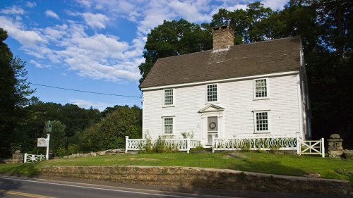
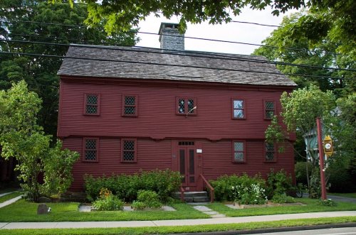
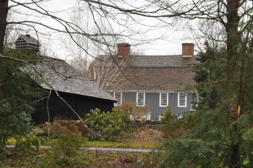
17 listings: 10 buildings, among them the Henry Whitfield House (a National Historic Landmark since 1997) and the Henry Whitfield House (listed 1972, the first), 6 historic districts with 523 contributing buildings, and 1 structure. 535 historic buildings in all.
How old are the homes in Guilford?
12% of Guilford’s homes were built before 1940 (Census estimate, ±3.0 points), against a typical 15% for a Connecticut town; the median home was built in 1974.
Founding dates: Wikidata, Wikipedia, the U.S. post office records of Blevins & Helbock (CC0) and the Census. Homes by year built: Census ACS 2020–24. National Register of Historic Places: National Park Service (list of May 22, 2026). Old photos, postcards and papers: Wikimedia Commons, the Library of Congress and other public archives, credited on each item’s page. Maps: U.S. Geological Survey historical topographic maps (via Esri) and Sanborn fire-insurance maps (Library of Congress). History text and census tables: Wikipedia (CC BY-SA 4.0). Places that used to be: USGS Geographic Names Information System (2021).
From Wikimedia Commons (9), the Library of Congress (10), Wikidata (5), the National Register of Historic Places (17), Wikipedia, Wikidata and Wikipedia for famous people, U.S. Geological Survey historical maps, U.S. Census counts (via Wikipedia), the US Post Offices dataset (Blevins & Helbock), the USGS Geographic Names Information System and old county and town histories (Internet Archive). Archive images are copied here with their credits and licenses, shown on each photo’s page. Refreshed monthly.


 ★ Landmark






 1905
 1905
 1905
 1905
 1905
 1905
 c. 1910
 1915
 c. 1930
 1930
 1980
 2008
 2007
 2006
 2004


