Redstone was established in the late 19th century by industrialist John Cleveland Osgood as part of a coal mining enterprise. Osgood's coal empire also spurred construction of the Crystal River Railroad and Redstone's historic dwellings.
As an experiment in "enlightened industrial paternalism," Osgood constructed 84 cottages and a 40-room inn, all with indoor plumbing and electricity, for his coal miners and cokers, as well as modern bathhouse facilities, a club house with a library and a theatre, and a school. Most of these Craftsman-era Swiss-style cottages are still used as homes.
Every edition of the U.S. Geological Survey’s map of Redstone. Tap a year, or press play to watch the town change.
1960Redstone sheet · 1:24,000
U.S. Geological Survey historical topographic maps (public domain), via Esri’s collection of the scans. The red ring marks the center of Redstone.
Places that used to be
Lost post offices
Redstone had its own post office from 1898 to 1962.
Redstone
1898–1962
18901960today
US Post Offices dataset (Blevins & Helbock, CC0). Places and cemeteries from the USGS Geographic Names Information System (2021).
Questions about Redstone’s history
What year was Redstone founded?
The Redstone post office opened in 1898, the earliest record of the town by name (U.S. post office records).
What is on the National Register in Redstone?
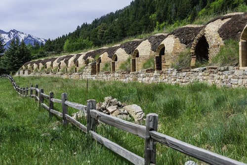
6 listings: 4 buildings, among them the Osgood Castle (listed 1971, the first), and 2 historic districts, the Redstone Historic District and the Redstone Coke Oven Historic District, with 31 contributing buildings. 35 historic buildings in all.
Founding dates: Wikidata, Wikipedia, the U.S. post office records of Blevins & Helbock (CC0) and the Census. Homes by year built: Census ACS 2020–24. National Register of Historic Places: National Park Service (list of May 22, 2026). Old photos, postcards and papers: Wikimedia Commons, the Library of Congress and other public archives, credited on each item’s page. Maps: U.S. Geological Survey historical topographic maps (via Esri) and Sanborn fire-insurance maps (Library of Congress). History text and census tables: Wikipedia (CC BY-SA 4.0). Places that used to be: USGS Geographic Names Information System (2021). How TownRatings grades history →
From Wikimedia Commons (3), the National Register of Historic Places (6), Wikipedia, U.S. Geological Survey historical maps, the US Post Offices dataset (Blevins & Helbock) and the USGS Geographic Names Information System. Archive images are copied here with their credits and licenses, shown on each photo’s page. Refreshed monthly.



 2015
 2011
 2007

