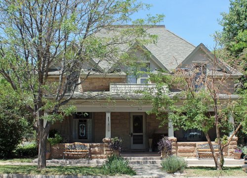
La Veta’s post office opened in 1876, and 33% of its homes were built before 1940
Its Register listings are the Francisco Plaza, the Lamme Hospital and the Smith, Edwin L. Building. Its Register listings are the Francisco Plaza, the Lamme Hospital and the Smith, Edwin L. Building. Below: 6 old photos and papers, maps from 1912 on, and the census since 1880.
Col. John M. Francisco, the sutler at Fort Garland, and his business partner, Henry Daigre, purchased 48,000 acres of land in Cuchara Valley in 1862. The land was part of the Vigil land grant. They established a settlement for farmers and ranchers, with Francisco Fort as the commercial center. The 100-foot-square building was constructed with 2-foot thick adobe walls, interior rooms, that opened up to a central plaza. It was built with a flat roof with gun ports along the parapets. In 1863, the fort was attacked by a band of Ute Indians. Men got on the roof to defend the fort, and a volunteer rode to Fort Lyon. The Utes departed before the troops arrived.
Nothing in the archives for these yearsWeddings on Main Street, storms, parades, school pictures, the old store. If it’s in your family album, it belongs here.
Nothing in the archives for these yearsWeddings on Main Street, storms, parades, school pictures, the old store. If it’s in your family album, it belongs here.
Founding dates: Wikidata, Wikipedia, the U.S. post office records of Blevins & Helbock (CC0) and the Census. Homes by year built: Census ACS 2020–24. National Register of Historic Places: National Park Service (list of May 22, 2026). Old photos, postcards and papers: Wikimedia Commons, the Library of Congress and other public archives, credited on each item’s page. Maps: U.S. Geological Survey historical topographic maps (via Esri) and Sanborn fire-insurance maps (Library of Congress). History text and census tables: Wikipedia (CC BY-SA 4.0). Places that used to be: USGS Geographic Names Information System (2021). How TownRatings grades history →
From Wikimedia Commons (17), Wikidata (1), the National Register of Historic Places (3), Wikipedia, Wikidata and Wikipedia for famous people, U.S. Geological Survey historical maps, U.S. Census counts (via Wikipedia), the US Post Offices dataset (Blevins & Helbock), the USGS Geographic Names Information System and Sanborn fire insurance maps (Library of Congress). Archive images are copied here with their credits and licenses, shown on each photo’s page. Refreshed monthly.


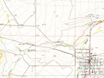
 c. 1902
 c. 1902
 1940
 2016
 2014
 2014
 2014
 2012
 2012
 2012
 2011
 2008
 2007
 2005