Greeley dates to 1869, and 16 of its places are on the National Register
More historic than 50% of U.S. towns · #41 of 159 in Colorado. What drives it
Most of Greeley was built recently: 7% of its homes predate 1940 and the median home dates from 1985. 16 places in town are on the National Register, among them three historic districts with 48 buildings between them. Below: 17 old photos and papers, maps from 1886 on, and the census since 1870.
Founding year: Wikidata. First post office: 1870.The full story ↓
History grade
What drives Greeley’s History grade
On its age, its old homes and the National Register, Greeley is more historic than 50% of U.S. towns, #41 of 159 in Colorado. Its National Register listings hold the grade up; its age pulls it down.
B−
HistoryA character grade: shown, never part of Greeley’s overall grade.
Among the 400 U.S. cities of 100,000 or more, Greeley ranks #240 on History.
Few Colorado towns list much on the Register (a typical Colorado town has 1.1 per 10,000 residents, the U.S. 2.4), so Greeley’s 5.6 sits near the middle of its state (64% of Colorado towns have fewer) while its 62 historic buildings outnumber those of 86% of U.S. towns.
How sure. Graded on any two of the three inputs instead, the letter would range from C to B. The pre-1940 share (±1.0 points) is firm at this size. Two sources give 1869.
Founding year: Wikidata (other dates in Quick answers). Homes: Census ACS 2020–24. National Register: National Park Service, May 2026 list; each listing counted once (boundary changes and added documentation belong to their listing), and a historic district counts its contributing buildings. How TownRatings grades history →
What stands out about Greeley’s past
Read from the archive, the National Register and the record. The page puts what stands out first.
National Park Service, National Register of Historic Places. Photos from Wikimedia Commons, credited on each place’s page.
Every building
Greeley, building by building, 1886–1918
Fire insurance maps drew every building, what it was made of and what it was used for, so insurers could price the risk of fire. Pick a year, then a sheet.
Nothing in the archives for these yearsWeddings on Main Street, storms, parades, school pictures, the old store. If it’s in your family album, it belongs here.
Greeley began as the Union Colony of Colorado, which was founded in 1869 by Nathan C. Meeker, an agricultural reporter for the New York Tribune, as an experimental utopian farming community "based on temperance, religion, agriculture, education and family values," with the backing of the Tribune's editor Horace Greeley, who had visited Colorado in the 1859 Pike's Peak Gold Rush and had popularized the phrase "Go West, young man". A committee which included Meeker and former Civil War general Robert Alexander Cameron traveled to Colorado to find a suitable site, and purchased 12,000 acres at the confluence of the Cache la Poudre and South Platte Rivers. The site, formerly known as the "Island Grove Ranch", included the area of Latham, an Overland Trail station, and was halfway between Cheyenne, Wyoming and Denver, Colorado along the tracks of the Denver Pacific Railroad.
The following article in The Greeley Tribune, November 14, 1888, from the pen of J. J. Stevens, who had not signed the petition, will show clearly the reasons of the opposition : " I have consulted all the doctors in Greeley but one, whom I have not been able to see, and asked this question : 'Are the fevers that have prevailed in Greeley to be attributed to the water that is used? ' and have received for answer from every one of them,' No,' and have been informed by some of them that fevers occur fully as frequently in the
Text read by machine from the scan; it may contain errors.
"Be if ordained by the City Council of the City of Greeley, ■: tate of Colorado: " Section 1. All persons are hereby prohibited from selling any intoxicating, malt, vinous, mixed or fermented liquors, within the corporate limits of the City of Greeley, or within one mile of the outer boundaries thereof, except as hereinafter provided; and all persons are hereby prohibited from giving away ary such intoxicating, malt, vinous, mixed or fermented liquors in any street, alley, public park, hotel, boarding house, eating house, saloon, restaurant, place of traffic, or place of public resort, or upon any vacant lot, within the City of Greeley, or within one mile "f the outer boun-
Text read by machine from the scan; it may contain errors.
Scans and text from the Internet Archive. Books published in 1930 or earlier, which are in the public domain.
Timeline
Greeley, 1869 to 1991
Woven from the archive, old maps, post office records, the National Register and the people born here.
In 1869, according to Wikidata. Greeley’s post office opened in 1870, and the census of 1870 counted 480 people here.
How does Greeley rank for history?
Greeley is more historic than 50% of U.S. towns, #41 of 159 in Colorado. The History grade combines the town’s founding era, the share of homes built before 1940 and its National Register listings. It’s a character grade, so it isn’t part of the overall grade. How it works.
What is on the National Register in Greeley?
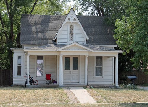
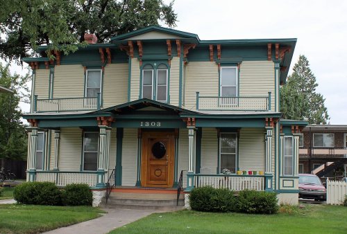
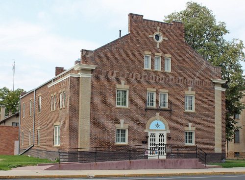
16 listings: 13 buildings, among them the Meeker Memorial Museum (listed 1970, the first), and 3 historic districts, the White-Plumb Farm, the Greeley Downtown and the Artesia Farm, with 48 contributing buildings. 62 historic buildings in all.
How old are the homes in Greeley?
7% of Greeley’s homes were built before 1940 (Census estimate, ±1.0 points), against a typical 2.5% for a Colorado town; the median home was built in 1985.
Founding dates: Wikidata, Wikipedia, the U.S. post office records of Blevins & Helbock (CC0) and the Census. Homes by year built: Census ACS 2020–24. National Register of Historic Places: National Park Service (list of May 22, 2026). Old photos, postcards and papers: Wikimedia Commons, the Library of Congress and other public archives, credited on each item’s page. Maps: U.S. Geological Survey historical topographic maps (via Esri) and Sanborn fire-insurance maps (Library of Congress). History text and census tables: Wikipedia (CC BY-SA 4.0). Places that used to be: USGS Geographic Names Information System (2021).
From Wikimedia Commons (8), the Library of Congress (9), Wikidata (1), the National Register of Historic Places (16), Wikipedia, Wikidata and Wikipedia for famous people, U.S. Geological Survey historical maps, U.S. Census counts (via Wikipedia), the US Post Offices dataset (Blevins & Helbock), the USGS Geographic Names Information System, Sanborn fire insurance maps (Library of Congress) and old county and town histories (Internet Archive). Archive images are copied here with their credits and licenses, shown on each photo’s page. Refreshed monthly.





 1901
 1908
 1908
 1911
 1915
 1915
 1915
 1939
 1939
 1939
 1940
 1940s
 1940s
 1940
 1941
 1941
 1941


