Durango’s post office opened in 1880, and 14% of its homes were built before 1940
More historic than 71% of U.S. towns · #15 of 159 in Colorado. What drives it
9 places in town are on the National Register, among them two historic districts with 184 buildings between them. Below: 12 old photos and papers, maps from 1883 on, and the census since 1890.
The Durango post office opened in 1880, the earliest record of the town by name. Wikidata gives 1881. Three smaller post offices, Animas City (1877), Fort Lewis (1880) and Animas (1886), opened inside today’s city and later closed.
First census: 2,726 in 18902020 census: 19,071146 years
How historic is Durango?
B+
More historic than 71% of U.S. towns, on its age, its old homes and the National Register.
Founding year: the first Durango post office (Blevins & Helbock, CC0). Wikidata: 1881.The full story ↓
History grade
What drives Durango’s History grade
On its age, its old homes and the National Register, Durango is more historic than 71% of U.S. towns, #15 of 159 in Colorado. Its National Register listings hold the grade up; its age pulls it down.
B+
HistoryA character grade: shown, never part of Durango’s overall grade.
Few Colorado towns list much on the Register (a typical Colorado town has 1.1 per 10,000 residents, the U.S. 2.4), so Durango’s 98.4 sits above most of its state (94% of Colorado towns have fewer) while its 191 historic buildings outnumber those of 93% of U.S. towns.
How sure. Graded on any two of the three inputs instead, the letter would range from C+ to A−. The pre-1940 share (±2.8 points) is firm at this size. The founding year is the first post office, not a stated founding date; Wikidata’s 1881 falls in the same era, so the grade doesn’t depend on which one is used.
Founding year: the first post office (other dates in Quick answers). Homes: Census ACS 2020–24. National Register: National Park Service, May 2026 list; each listing counted once (boundary changes and added documentation belong to their listing), and a historic district counts its contributing buildings. How TownRatings grades history →
What stands out about Durango’s past
Read from the archive, the National Register and the record. The page puts what stands out first.
National Park Service, National Register of Historic Places. Photos from Wikimedia Commons, credited on each place’s page.
Places that used to be
Lost post offices, old corners, places now gone and burying grounds
Durango’s post office has been open since 1880. Three other post offices opened and closed inside today’s town.
Animas City
1877–1885
Durango
1880–today
Fort Lewis
1880–1891
Animas
1886–1900
18701950today
Hamlets and corners on the map
Carbon Junction
Gone or out of use
Bell QuarrymineC and F Coal MinemineChampion Gold MinemineCity MinemineCoal Gulch MinemineColumbine PitmineGold Coin MinemineHazel Mine GroupmineLemon PitmineMcCartney Group MinemineMiller Mountain MinemineSaint Paul MinemineSiegrist PitmineThomas Property Minemine
3cemeteries and burying grounds inside Durango
Animas CityGreen MountainGreenmount
US Post Offices dataset (Blevins & Helbock, CC0). Places and cemeteries from the USGS Geographic Names Information System (2021).
Every building
Durango, building by building, 1883–1919
Fire insurance maps drew every building, what it was made of and what it was used for, so insurers could price the risk of fire. Pick a year, then a sheet.
1883Sheet 1 of 1
Edition
Sheets
BrickWoodStone
Sanborn Map Company, via the Library of Congress. Editions published in 1930 or earlier, which are in the public domain.
The town was organized from September 1880 to April 1881 by the Denver and Rio Grande Railroad (D&RG, later known as the Denver and Rio Grande Western railroad) as part of their efforts to reach Silverton, Colorado, and service the San Juan mining district, the goal of their "San Juan Extension" built from Alamosa, Colorado. The D&RG chose a site in the Animas Valley close to the Animas River near what is now the Downtown Durango Historic Business District for its railroad facilities following a brief and most likely perfunctory negotiation with the other establishment in the area known as Animas City, two miles (3.2 km) to the north. The city was named by ex-Colorado Governor Alexander C. Hunt, a friend of D&RG President William Jackson Palmer, after Durango, Mexico, based on his favorable impression of that city resulting from a scouting trip undertaken on behalf of Palmer.
Passages that mention Durango, cut from the printed page as they were published.
The great San Juan of Colorado and New Mexico1901 · page 15Read the page →
Read the text
ing for the future of this now remote section. At present the two outlets are by wagon road, sixty miles to the Den¬ ver & Rio Grande and the Rio Grande Southern railroads, at Durango, and a hundred and twenty miles to the Santa Fe, at Thoreau. The haul is over roads very poor in places, and when the railroad is finally reached rehandling is necessary to shipment; and, if a shipment is consigned via Durango, still another transfer from narrow to stand¬
Text read by machine from the scan; it may contain errors.
The great San Juan of Colorado and New Mexico1901 · page 17Read the page →
Read the text
coal industry, which determined the owners of the New York smelter to remove their plant to this point. From the preceding sentence it appears that the presence of ex¬ tensive coal deposits in the vicinity of Durango was known prior to the organization of the town. The old San Juan coal mine, now defunct, was operated years before Durango was laid out, and it was near this property that the smelter was erected. The trestlework and tipple of this mine have
Text read by machine from the scan; it may contain errors.
Scans and text from the Internet Archive. Books published in 1930 or earlier, which are in the public domain.
Timeline
Durango, 1874 to 2001
Woven from the archive, old maps, post office records, the National Register and the people born here.
Nothing in the archives for these yearsWeddings on Main Street, storms, parades, school pictures, the old store. If it’s in your family album, it belongs here.
The Durango post office opened in 1880, the earliest record of the town by name (U.S. post office records). Wikidata gives 1881.
How does Durango rank for history?
Durango is more historic than 71% of U.S. towns, #15 of 159 in Colorado. The History grade combines the town’s founding era, the share of homes built before 1940 and its National Register listings. It’s a character grade, so it isn’t part of the overall grade. How it works.
What is on the National Register in Durango?
9 listings: 6 buildings, among them the Newman Block (listed 1979, the first), 2 historic districts, the East Third Avenue Historic Residential District and the Main Avenue Historic District, with 184 contributing buildings, and 1 structure. 191 historic buildings in all.
How old are the homes in Durango?
14% of Durango’s homes were built before 1940 (Census estimate, ±2.8 points), against a typical 2.5% for a Colorado town; the median home was built in 1989.
Founding dates: Wikidata, Wikipedia, the U.S. post office records of Blevins & Helbock (CC0) and the Census. Homes by year built: Census ACS 2020–24. National Register of Historic Places: National Park Service (list of May 22, 2026). Old photos, postcards and papers: Wikimedia Commons, the Library of Congress and other public archives, credited on each item’s page. Maps: U.S. Geological Survey historical topographic maps (via Esri) and Sanborn fire-insurance maps (Library of Congress). History text and census tables: Wikipedia (CC BY-SA 4.0). Places that used to be: USGS Geographic Names Information System (2021).
From Wikimedia Commons (9), the Library of Congress (3), the National Register of Historic Places (9), Wikipedia, Wikidata and Wikipedia for famous people, U.S. Geological Survey historical maps, U.S. Census counts (via Wikipedia), the US Post Offices dataset (Blevins & Helbock), the USGS Geographic Names Information System, Sanborn fire insurance maps (Library of Congress) and old county and town histories (Internet Archive). Archive images are copied here with their credits and licenses, shown on each photo’s page. Refreshed monthly.


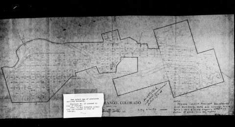


 1939
 1939
 1940
 1940
 1940
 1940
 1940


