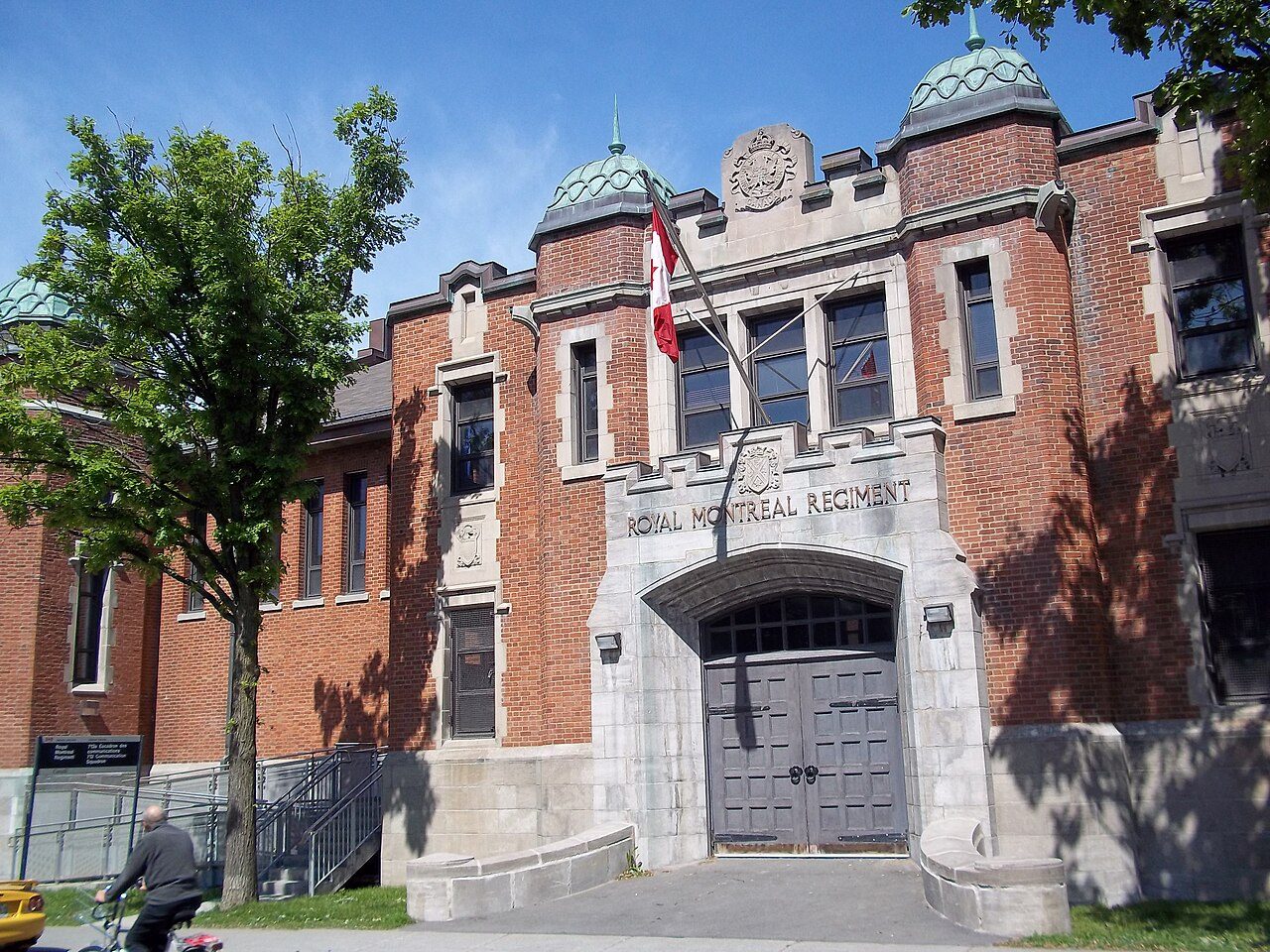
Armoury
In French: Manège militaire du Royal Montreal Regiment
Also known as St. Catherine Armoury
4625 St. Catherine Street West, Westmount
About Armoury
The federal government recognizes Armoury for its heritage, the only such building in Westmount. By its record, Armoury was built in 1925–1926. Within 400 m there is one more historic place.
The Armoury, located on St. Catherine Street in a residential neighbourhood of Westmount is set in landscaped grounds planted with mature trees. The two-storey, red brick structure imparts a solid, military appearance with a twin-towered frontispiece and projecting pavilion ends. Flat-roofed administrative wings flank the large, gable-roofed drill hall. The designation is confined to the footprint of the building.
From the Canadian Register of Historic Places, Armoury · Open Government Licence – Canada · quoted as the register has it
The federal government rates the heritage buildings it owns as Classified or Recognized.
Make it a walk: 2 historic places in about 10 minutes
Westmount · about 400 m on foot, as the crow flies


- 1ArmouryStart here
- 2Canadian Pacific Railway Station, Westmount, QuebecHeritage Railway Station · 400 m on
Questions about Armoury
When was Armoury built?
Work on Armoury is recorded as 1925–1926.
Can you visit Armoury?
Its exterior is visible from public ground; access inside is up to the owner.
Is Armoury protected?
While the federal government owns it, changes go through its heritage review.
What is Armoury?
Armoury is a Recognized Federal Heritage Building, designated in 1991.
Contains information licensed under the Open Government Licence – Canada (Parks Canada).
Sources: Parks Canada, Directory of Federal Heritage Designations · Canadian Register of Historic Places (federal extract) · Photos: Wikimedia Commons, each credited with its licence and copied to our own server · Wikidata (CC0) for map points, other names and articles.
Adapted from Statistics Canada (Census of Population 2021, population estimates 2025, 2021 census boundaries) under the Statistics Canada Open Licence; this does not constitute an endorsement by Statistics Canada. Neighbourhood names in some cities © OpenStreetMap contributors (ODbL).