 Photo: DomLemLali · CC BY-SA 4.0
Marieville’s surroundings: 17 historic places within 10 km
Saint-Mathias-sur-Richelieu, 8.6 km from Marieville, has the nearest place of the highest rank. The earliest of 9 people born in Marieville before 1914 is Joseph-Napoléon Poulin. The municipality’s date on Wikidata is May 20, 1858: a founding, an incorporation or an amalgamation, the record doesn’t say which.
Marieville in old pictures
One old photograph of the town, made before 1950. It opens full screen with a tap.
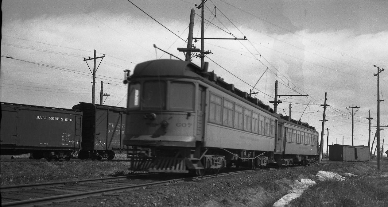 c. 1940
Public domain or CC0, made before 1950, from Wikimedia Commons; old views of places can be drawings, prints or maps of their time. Each credit opens the image’s page.
Near Marieville, within 10 km: 10 places of national rank
They belong to 3 towns, chiefly Chambly, Saint-Mathias-sur-Richelieu and Carignan. At 6.9 km, Manoir Rolland in Saint-Mathias-sur-Richelieu is the closest. By age, Fort Chambly leads, from 1665, at 9 km.
The 12 nearest, within 10 km
| Manoir RollandClassified heritage building (Québec) · 1830 · 6.9 km away, in Saint-Mathias-sur-Richelieu |
| Lockstation Cabin 8Recognized Federal Heritage Building · 1906–1910 · 7.2 km away, in Carignan |
| Maison Thomas-WhiteheadClassified heritage building (Québec) · 1815–1816 · 7.6 km away, in Chambly |
| Site patrimonial de la Maison-Thomas-WhiteheadClassified heritage site (Québec) · 7.6 km away, in Chambly |
| Lockstation Cabin 7Recognized Federal Heritage Building · 1906–1910 · 7.7 km away, in Chambly |
| Cabin at Bridge 2Recognized Federal Heritage Building · 1906–1908 · 7.7 km away, in Chambly |
| Maison John-YuleClassified heritage building (Québec) · 1816 · 8.2 km away, in Chambly |
| De Salaberry HouseNational Historic Site · 1814–1816 · 8.4 km away, in Chambly |
| St. Stephen's Anglican ChurchNational Historic Site · 1820–1823 · 8.7 km away, in Chambly |
| Fort ChamblyNational Historic Site · 1665–1871 · 9 km away, in Chambly |
| Woodworking ShopRecognized Federal Heritage Building · 1883–1884 · 9 km away, in Chambly |
| Maison FranchèreClassified heritage building (Québec) · 1821 · 9.2 km away, in Saint-Mathias-sur-Richelieu |
Near Marieville (10 km around), the dated heritage is mostly from the years before Confederation
The historic places within 10 km of Marieville, not in it, by the first construction date on each record.
Fort Chambly, in Chambly, goes back furthest, to 1665. Dated places within 10 km: 16. 9 predate Confederation.
The biggest share of Marieville’s homes dates from 2001 to 2015: 33%
Half of the homes standing in Marieville today were built before 2001. New building is strong in Marieville: 5.8% of homes date from 2016–21, where most towns have 4.1%. 19% of Marieville’s homes predate 1961, close to the typical town’s 18%.
2021 Census, private dwellings by period of construction (Statistics Canada); the typical town is the middle Canadian town of 2,500 or more.
Natives of Marieville from 1821 to 1910
At 90, Albiny Paquette outlived the rest, dying in 1978. By Wikipedia’s reach, Joseph Hormisdas Rainville leads, with 5 articles. Counting only births before 1914, there are 9. The decades after Confederation gave 5 of the 9.


Everyone born in Marieville → Born before 1914 (the page’s periods: Confederation to the First World War). Birthplaces from Wikidata, each checked against the person’s Wikipedia article.
Marieville and its neighbours
| Town | People | Places | Highest | Oldest |
|---|---|---|---|---|
| Marieville | 11,910 | 0 | 0 | — |
| Richelieu | 6,048 | 0 | 0 | — |
| Sainte-Angèle-de-Monnoir | 1,862 | 0 | 0 | — |
| Saint-Mathias-sur-Richelieu | 4,598 | 3 | 3 | 1784 |
| Rougemont | 2,832 | 0 | 0 | — |
| Saint-Jean-Baptiste | 3,332 | 2 | 1 | 1797 |
| Mont-Saint-Grégoire | 3,158 | 0 | 0 | — |
Marieville in brief
Older stock first: 19% of homes in Marieville were standing by 1961, against 18% in the typical town. Among the lives from its past: Joseph Hormisdas Rainville (1875), Paul LaRocque (1846) and Delia Tetreault (1865). Beyond that, as with most towns its size, no historic place is listed.
What this data can and can’t tell you
- Protection. In Québec, a classement or a municipal citation under the Loi sur le patrimoine culturel protects the building in law; a federal designation recognises significance and binds only federal owners.
- People and events. Parks Canada’s open file gives its national historic persons no place. A town’s page names one only when the person was born there (matched by name and both life years) or one of its own historic places carries the name and its record speaks of them; national historic events stay off.
- The tiers. Tiers follow the designation: national recognition and classement first, other federal designations next, provincial and local listings last.
- The grade. There is no history grade: the page sets out the record and compares it with other towns.
- Québec’s register. The Répertoire du patrimoine culturel du Québec is open data, so the province’s own designations and its municipalities’ citations are here in full.
- The federal register. Every federal designation is in Parks Canada’s directory, and the Canadian Register of Historic Places gives most of them a bilingual statement of significance.
Questions about Marieville’s history
How many historic places does Marieville have on the registers?
Not within Marieville. Its nearest is a top designation: Manoir Rolland, 6.9 km away in Saint-Mathias-sur-Richelieu.
When did Marieville become a municipality?
The date Wikidata holds for Marieville is May 20, 1858, whether founding, incorporation or merger.
How old are the homes in Marieville?
19% predate 1961, where the typical town has 18%.
Contains information licensed under the Open Government Licence – Canada (Parks Canada).
Sources: Parks Canada, Directory of Federal Heritage Designations · Canadian Register of Historic Places (federal extract) · Wikidata (CC0) for map points, other names and articles · Statistics Canada, 2021 Census (homes by period of construction). Under the Statistics Canada Open Licence.
Adapted from Statistics Canada (Census of Population 2021, population estimates 2025, 2021 census boundaries) under the Statistics Canada Open Licence; this does not constitute an endorsement by Statistics Canada. Neighbourhood names in some cities © OpenStreetMap contributors (ODbL).