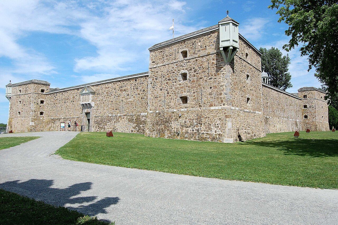
Fort Chambly
Also known as Old Fort Point Chartrain
2 Richelieu Street, Chambly
Fort Chambly, c. 1814 and today
Drag across to compare. The two views aren’t taken from exactly the same spot.

c. 1814: Photo: Bouchette, Joseph, 1774-1841 artiste , Bennett, W. J. (William James), 1787-1844 aquafortiste · Public domain. Today: Photo: Mickael Pollard · CC BY-SA 2.0.
About Fort Chambly
Fort Chambly is one of 4 National Historic Sites in Chambly. Fort Chambly went up in 1665–1871. One other place on the registers stands within 400 m.
Fort Chambly National Historic Site of Canada is a square-shaped stone fortress strategically placed on the Richelieu River at Chambly, Québec. The present structure is the fourth fort to have been constructed on the same site. Four prominent corner bastions and high curtain walls protect accommodation and storage facilities arranged around a central courtyard. Strongly built of stone the fort also features bartizans, embrasures and muskets loopholes. The fort stands within a large waterside park. Official recognition refers to the fort on its small plot of land on the banks of the Richelieu River.
From the Canadian Register of Historic Places, Fort Chambly National Historic Site of Canada · Open Government Licence – Canada · quoted as the register has it
National Historic Sites are places the Minister of Environment designates, on the advice of the Historic Sites and Monuments Board, for their national significance.
2 old views of Fort Chambly
Made before 1950, from 1814 to 1882: public domain or CC0. Tap one to see it full screen.
 c. 1882
From Wikimedia Commons, copied to our own server; some are drawings, prints or maps of their time. Each credit is in the viewer.
Make it a walk: 4 historic places in about 15 minutes
Chambly · about 800 m on foot, as the crow flies


- 1Fort ChamblyStart here
- 2St. Stephen's Anglican ChurchNational Historic Site · 300 m on
- 3De Salaberry HouseNational Historic Site · 400 m on
- 4Maison John-YuleClassified heritage building (Québec) · 200 m on
1 within 300 m
Every place on the record within this distance; each opens its own page.
Questions about Fort Chambly
When was Fort Chambly built?
Fort Chambly went up in 1665–1871, by its record.
What is Fort Chambly?
Fort Chambly is a National Historic Site of Canada, designated in 1920.
Is Fort Chambly protected?
National Historic Site status commemorates; legal protection, where there is any, comes from the province or municipality, or from federal ownership.
Can you visit Fort Chambly?
Yes from the outside; whether it opens its doors is for its owner to say.
Contains information licensed under the Open Government Licence – Canada (Parks Canada).
Sources: Parks Canada, Directory of Federal Heritage Designations · Canadian Register of Historic Places (federal extract) · Photos: Wikimedia Commons, each credited with its licence and copied to our own server · Wikidata (CC0) for map points, other names and articles.
Adapted from Statistics Canada (Census of Population 2021, population estimates 2025, 2021 census boundaries) under the Statistics Canada Open Licence; this does not constitute an endorsement by Statistics Canada. Neighbourhood names in some cities © OpenStreetMap contributors (ODbL).