 Top
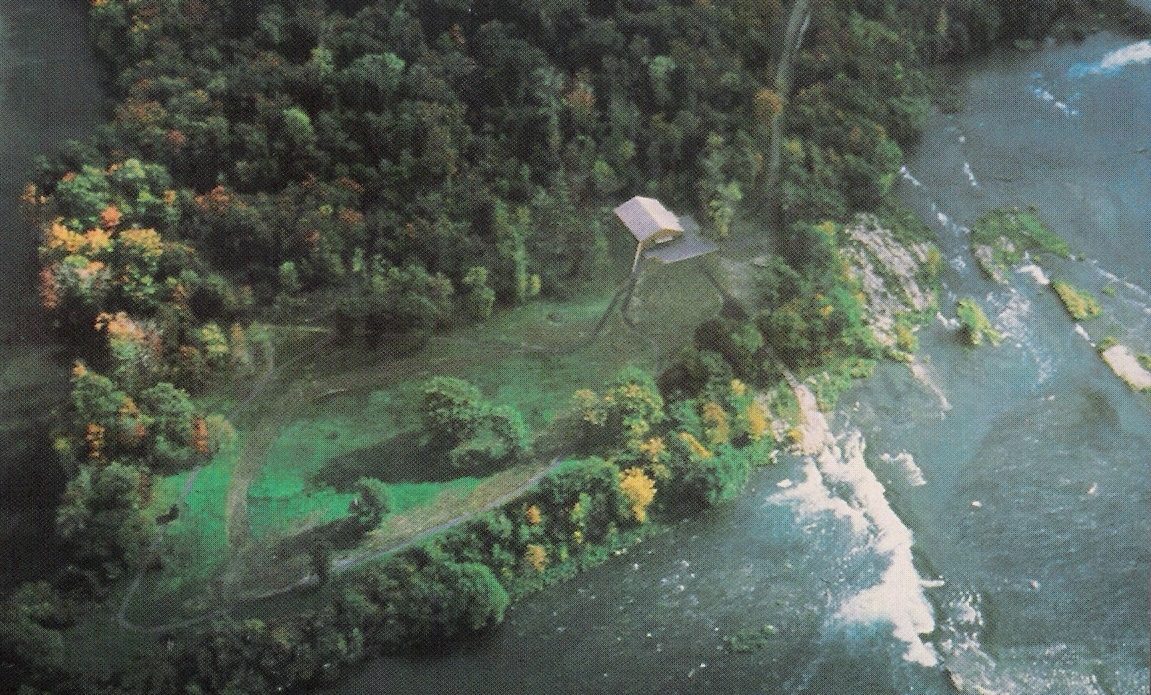
National Historic SitePointe-du-Buisson333 Émond StreetPhoto: Pointedubuisson · CC BY-SA 3.0 · Commons file
 Site patrimonial de l'Entrée-Inférieure-de-l'Ancien-Canal-de-Beauharnois · Photo: Cantons-de-l'Est · CC BY-SA 4.0
3historic places on the registers
History of Beauharnois · Canada’s heritage registers
Heritage in Beauharnois: 3 historic places, all of the highest rank
In Beauharnois the earliest construction date, 1842, belongs to Site patrimonial de l'Entrée-Inférieure-de-l'Ancien-Canal-de-Beauharnois. Wikidata’s date for the municipality is January 1, 2002; it may record a founding, an incorporation or an amalgamation. Relative to its size Beauharnois has 2 per 10,000 residents, more than 86% of Canadian towns.
Historic places
3
2 per 10,000 residents
Highest designations
3
National Historic Sites, classified federal buildings and Québec’s classements
Oldest building
1842
the first construction date on its record
Homes built before 1961
30%
typical town: 18%
In pictures
2 photos of Beauharnois’s historic places
Site patrimonial de l'Entrée-Inférieure-de-l'Ancien-Canal-de-Beauharnois and Pointe-du-Buisson lead the set. Of the places on Beauharnois’s registers, 2 have a photo here. The set includes 2 of Beauharnois’s highest-designated places.
Photos from Wikimedia Commons, each credited to its photographer with its licence; names open the place’s page. Tap a photo to step through them full screen.
The map
Where Beauharnois’s history is
Every place on the registers inside the town, by its designation.
Highest designations
Hover a dot for its name; tap one to open its page.
The 3, by tier
3 Highest designations
Two open registers meet here: Parks Canada’s Directory of Federal Heritage Designations and Québec’s heritage register, which records both provincial classements and municipal citations.
Points from Wikidata (Parks Canada’s files carry none) and from Québec’s register, as mapped there. One place, placed by its register’s municipality, has no point and isn’t on the map.
Highest designations
3 places in Beauharnois with the highest designation
The group holds 2 National Historic Sites and a place classified by Québec. National Historic Sites and Classified Federal Heritage Buildings, Canada’s highest federal recognition. They date from 1842 (Site patrimonial de l'Entrée-Inférieure-de-l'Ancien-Canal-de-Beauharnois) to 1929. Each one opens its own page.
 Top
Classified heritage site (Québec) · 1842–1845Site patrimonial de l'Entrée-Inférieure-de-l'Ancien-Canal-de-Beauharnoisrue BourcierPhoto: Cantons-de-l'Est · CC BY-SA 4.0 · Commons file
National Historic Site · 1929–1933Beauharnois Power Development80 de Melocheville Boulevard
Homes by age
A town of older homes: 30% of Beauharnois’s were built before 1961 (18% is typical)
Half of the homes standing in Beauharnois today were built before 1981. From 2016 to 2021 Beauharnois added 8% of its homes, more than the typical town’s 4.1%. In Beauharnois, 24% of homes date from 1961 to 1980, much as in most towns (27%).
30%
Before 1961
24%
1961–80
21%
1981–2000
17%
2001–15
8%
2016–21
BeauharnoisTypical town
2021 Census, private dwellings by period of construction (Statistics Canada); the typical town is the middle Canadian town of 2,500 or more.
Born here
9 lives that began in Beauharnois before 1914
The decades after Confederation gave 6 of the 9. By Wikipedia’s reach, Louis Dantin leads, with 4 articles. Charles Daoust comes first, born in 1825. At the other end is Randolph Hewton, from 1888.
Charles Daoust
George Caverhill
Louis Dantin
Walter Reed
William-Athanase Baker
Albert Laberge
Yvonne Beaudry
John Alexander Sullivan
Randolph Hewton
1800182518501875190019251950

Louis Dantin1865–1945 · Canadian writer

Albert Laberge1871–1960 · Canadian journalist and writer
JS
John Alexander Sullivan1879–1952 · Canadian politician
RH
Randolph Hewton1888–1960 · Canadian painter
WR
Walter Reed1869–1945 · Canadian politician
CD
Charles Daoust1825–1868 · Canadian lawyer, journalist and political figure
GC
George Caverhill1858–1937
WB
William-Athanase Baker1870–1949
Everyone born in Beauharnois → Born before 1914 (the page’s periods: Confederation to the First World War). Birthplaces from Wikidata, each checked against the person’s Wikipedia article.
Towns its size
Beauharnois has the most of 16 towns its size
Towns of 15,200 to 15,400 residents, by places on the registers.
Beauharnois3
Their median is 0. 11 of them have none.
Neighbours
Beauharnois and its neighbours
| Town | People | Places | Highest | Oldest |
|---|---|---|---|---|
| Beauharnois | 15,285 | 3 | 3 | 1842 |
| Saint-Étienne-de-Beauharnois | 1,151 | 0 | 0 | — |
| Léry | 2,817 | 0 | 0 | — |
| Pointe-des-Cascades | 1,867 | 0 | 0 | — |
| Sainte-Martine | 5,884 | 1 | 1 | 1823 |
| Notre-Dame-de-l'Île-Perrot | 11,716 | 5 | 4 | 1707 |
| Mercier | 16,036 | 1 | 1 | 1800 |
In brief
Beauharnois in brief
Counted by age, 30% of Beauharnois’s homes predate 1961, against 18% in the typical town. Together that makes 3 historic places, 3 with the highest designation, led by Beauharnois Power Development. Of the 16 towns closest in size, it has the most historic places. Its people of the past include Louis Dantin (1865), Albert Laberge (1871) and John Alexander Sullivan (1879). Everything else is close to the norm: the designations ran from 1990 to 2012.
How to read these numbers
What this data can and can’t tell you
- Map points. Pins for federal places come from Wikidata rather than Parks Canada, which gives no points.
- People and events. The open directory puts its national historic persons nowhere, so a town shows one only on firm ground: a birth there, matched by name and life years, or a historic place there named for the person whose record says so. Events are left out.
- The tiers. Tiers follow the designation: national recognition and classement first, other federal designations next, provincial and local listings last.
- Québec’s register. Québec is the one province whose register is open: classements, declarations and municipal citations, described by the ministry in French.
- The grade. There is no history grade: the page sets out the record and compares it with other towns.
- The federal register. Parks Canada’s Directory of Federal Heritage Designations lists every National Historic Site, federal heritage building, heritage railway station and lighthouse; the Canadian Register of Historic Places adds their statements in English and French.
- Protection. In Québec, a classement or a municipal citation under the Loi sur le patrimoine culturel protects the building in law; a federal designation recognises significance and binds only federal owners.
Questions about Beauharnois’s history
Which places in Beauharnois have the highest designation?
They are Beauharnois Power Development, Pointe-du-Buisson and Site patrimonial de l'Entrée-Inférieure-de-l'Ancien-Canal-de-Beauharnois.
How old are the homes in Beauharnois?
30% of its homes were built before 1961, against 18% in the typical Canadian town.
What is the oldest building in Beauharnois?
Site patrimonial de l'Entrée-Inférieure-de-l'Ancien-Canal-de-Beauharnois — its record dates it to 1842 (Classified heritage site (Québec)).
Contains information licensed under the Open Government Licence – Canada (Parks Canada). Québec register data: Ministère de la Culture et des Communications du Québec, CC BY 4.0.
Sources: Parks Canada, Directory of Federal Heritage Designations · Canadian Register of Historic Places (federal extract) · Répertoire du patrimoine culturel du Québec (MCC, Données Québec) · Wikidata (CC0) for map points, other names and articles · Statistics Canada, 2021 Census (homes by period of construction). Under the Statistics Canada Open Licence.
Adapted from Statistics Canada (Census of Population 2021, population estimates 2025, 2021 census boundaries) under the Statistics Canada Open Licence; this does not constitute an endorsement by Statistics Canada. Neighbourhood names in some cities © OpenStreetMap contributors (ODbL).