 Local
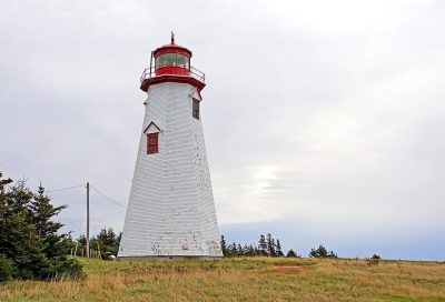
Designated heritage place · 1864Seacow Head LightPhoto: Dennis G. Jarvis · CC BY-SA 2.0 · Commons file
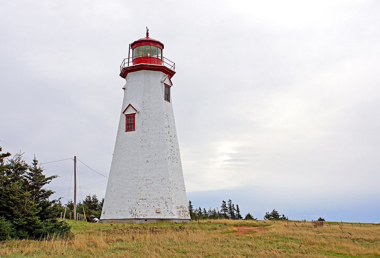 Seacow Head Light · Photo: Dennis G. Jarvis · CC BY-SA 2.0
1historic place on the registers
History of Kinkora · Canada’s heritage registers
Kinkora has 1 historic place on the registers
Older housing stands out in Kinkora: 35% of homes predate 1961, where the typical town has 18%. The one entry is Seacow Head Light (1864), a designated heritage place. Just beyond the boundary, the registers place one more. Local registers add 4 more places, counted here but not paged: Wikidata holds their numbers and little else.
Historic places
1
Highest designations
0
National Historic Sites and Classified Federal Heritage Buildings
Provincial and local listings
1
provincial and municipal listings with an encyclopedia article
Oldest building
1864
the first construction date on its record
Homes built before 1961
35%
typical town: 18%
The map
Where Kinkora’s history is
Every place on the registers inside the town, by its designation.
Provincial and local listings
Hover a dot for its name; tap one to open its page.
The 1, by tier
1 Provincial and local listings
Parks Canada’s Directory of Federal Heritage Designations lists the places the Government of Canada has recognized; outside Québec, provincial and municipal listings come only through Wikidata, and only those with an encyclopedia article get a page.
Points from Wikidata (Parks Canada’s files carry none) and from Québec’s register, as mapped there.
Provincial and local listings
On a provincial or local list in Kinkora: one place
Provincial and municipal listings that Wikidata records and an encyclopedia describes. Each one opens its own page.
Around the town
Kinkora’s surroundings: 10 historic places within 25 km
Green Gables House, 25 km off, is the oldest: 1831. The first one out is Kensington Railway Station (Prince Edward Island), 10 km away in Kensington. Their towns number 7: Summerside, New London and New Glasgow first.
The 10 nearest, within 25 km
| Kensington Railway Station (Prince Edward Island)National Historic Site · 1904–1905 · 10 km away, in Kensington |
| Summerside stationRegistered historic place · 13 km away, in Summerside |
| Former Summerside Post OfficeNational Historic Site · 1883–1888 · 13 km away, in Summerside |
| Tryon United ChurchNational Historic Site · 1881–1882 · 14 km away, in Crapaud, Part 1 |
| St. Mary's Roman Catholic ChurchDesignated heritage place · 15 km away, in Malpeque Bay |
| Back Range Light TowerRecognized Federal Heritage Building · 1876–1877 · 21 km away, in New London |
| Cape Tryon LightRegistered Heritage Place · 1905 · 23 km away, in New London |
| Simpson Farm, Main HouseRecognized Federal Heritage Building · 1921–1922 · 25 km away, in New Glasgow |
| Green Gables HouseRecognized Federal Heritage Building · 1831–1871 · 25 km away, in New Glasgow |
| Cape Jourimain LighthouseHeritage Lighthouse · 1869–1870 · 25 km away, in Botsford |
Just outside Kinkora: 1
| Indian Head LighthouseDesignated heritage place · 100 m outside the town |
Homes by age
New homes stand out in Kinkora: 8.3% from 2016–21, where most towns have 4.1%
Kinkora built little from 1961 to 1980: 15% of its homes, where most towns have 27%. More than half of Kinkora’s housing predates 2001. Homes built from 1981 to 2000 make up 24% of Kinkora’s, about the typical 23%.
35%
Before 1961
15%
1961–80
24%
1981–2000
18%
2001–15
8.3%
2016–21
KinkoraTypical town
2021 Census, private dwellings by period of construction (Statistics Canada); the typical town is the middle Canadian town of 2,500 or more.
Born here
Lives that started in Kinkora, 1820–1901
Canada counts James Colledge Pope among its national historic persons. Fame, by Wikipedia: George Uglow Pope first, in 13 languages. The longest life was George Uglow Pope’s: 88 years, to 1908. 11 people on the record were born here before 1914.
George Uglow Pope
James Colledge Pope
Robert Weatherbe
Benjamin Rogers
Patrick Charles Murphy
James Ewen Matthews
Clarence Jameson
George Henry Ross
Hugh John Montgomery
John George MacKay
Alban Farmer
1800182518501875190019251950
GP
George Uglow Pope1820–1908 · Indian missionary
BR
Benjamin Rogers1837–1923 · Canadian merchant and political figure in Prince Edward Island, died …
JP
James Colledge Pope1826–1885 · National historic person, 1938 · Canadian politician
GR
George Henry Ross1878–1956 · Canadian politician
JM
John George MacKay1893–1974 · Canadian politician
CJ
Clarence Jameson1872–1928 · Canadian politician
RW
Robert Weatherbe1834–1915 · Canadian lawyer and judge
PM
Patrick Charles Murphy1868–1925 · Canadian politician
Everyone born in Kinkora → Born before 1914. Birthplaces from Wikidata, each checked against Wikipedia; national historic persons from Parks Canada’s Directory of Federal Heritage Designations, matched by name and life years.
Neighbours
Kinkora and its neighbours
| Town | People | Places | Highest | Oldest |
|---|---|---|---|---|
| Kinkora | 1,416 | 1 | 0 | 1864 |
| Kensington | 2,016 | 1 | 1 | 1904 |
| Kensington, Part 1 | 3,357 | 0 | 0 | — |
| New London | 1,443 | 2 | 0 | 1876 |
| Summerside | 19,006 | 3 | 1 | 1881 |
| Crapaud, Part 1 | 1,781 | 0 | 0 | — |
| Malpeque Bay | 1,351 | 1 | 0 | — |
In brief
Kinkora in brief
The pre-1961 share of Kinkora’s homes is 35%, against 18% in the typical town. In all there are 1 historic place. Its people of the past include George Uglow Pope (1820), Benjamin Rogers (1837) and James Colledge Pope (1826).
How to read these numbers
What this data can and can’t tell you
- The grade. History isn’t one of Canada’s graded pillars, so this page describes and compares without a letter.
- Provincial and municipal lists. The local and provincial lists outside Québec aren’t published openly, so this page counts what Wikidata records and pages only the places an encyclopedia describes.
- Map points. Pins for federal places come from Wikidata rather than Parks Canada, which gives no points.
- The tiers. National Historic Sites and the most protected buildings form the top tier; recognized federal buildings, stations and lighthouses the second; provincial and municipal listings the third.
- The federal register. Federal places come from Parks Canada’s directory, which counts National Historic Sites, federal heritage buildings, stations and lighthouses; their statements are the register’s own.
- People and events. Persons of national historic significance come with no location; a town gets one only by birthplace (name and both life years agreeing) or by one of its own places that bears the name and whose record tells the story. Events, which can’t be tied, are left out.
- Protection. Federal recognition isn’t a planning control: buildings the federal government owns follow its heritage policy, while others are protected only by a provincial or municipal designation.
Questions about Kinkora’s history
How many historic places does Kinkora have on the registers?
Inside Kinkora: 1 historic place.
How old are the homes in Kinkora?
The 2021 Census dates 35% of its homes before 1961 (18% in the typical town).
What is the oldest building in Kinkora?
By its record, Seacow Head Light, from 1864 (Designated heritage place).
Why might a heritage building in Kinkora be missing here?
Provincial and municipal registers outside Québec aren’t open data. Wikidata knows 4 more listings in Kinkora, but without an open description or an encyclopedia article they get no page.
Contains information licensed under the Open Government Licence – Canada (Parks Canada).
Sources: Parks Canada, Directory of Federal Heritage Designations · Canadian Register of Historic Places (federal extract) · Wikidata (CC0) for map points, other names and articles · Statistics Canada, 2021 Census (homes by period of construction). Under the Statistics Canada Open Licence.
Adapted from Statistics Canada (Census of Population 2021, population estimates 2025, 2021 census boundaries) under the Statistics Canada Open Licence; this does not constitute an endorsement by Statistics Canada. Neighbourhood names in some cities © OpenStreetMap contributors (ODbL).