 Top
National Historic Site · 1831–1835Maplelawn & Gardens529 Richmond RoadPhoto: Deinocheirus · CC BY-SA 3.0 · Commons file
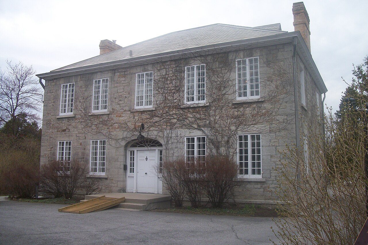 Maplelawn & Gardens · Photo: Deinocheirus · CC BY-SA 3.0
1historic place on the registers
History of Westboro · Canada’s heritage registers
Westboro’s 1 historic place is a top designation
In Westboro that place is Maplelawn & Gardens, a national historic site, from 1831. Measured against its size, Westboro’s 0.8 per 10,000 residents puts it ahead of 77% of Canadian towns.
Historic places
1
0.8 per 10,000 residents
Highest designations
1
National Historic Sites and Classified Federal Heritage Buildings
Oldest building
1831
the first construction date on its record
Homes built before 1961
28%
typical town: 18%
The map
Where Westboro’s history is
Every place on the registers inside the town, by its designation.
Highest designations
Names show on hover, and a tap takes you to the place’s page.
The 1, by tier
1 Highest designations
What the map shows is the open record: the federal directory in full, and from provincial or municipal lists only the places Wikidata ties to an encyclopedia article.
Points from Wikidata (Parks Canada’s files carry none) and from Québec’s register, as mapped there.
Highest designations
One place in Westboro with the highest designation
National Historic Sites and Classified Federal Heritage Buildings, Canada’s highest federal recognition. Each one opens its own page.
Around the town
Within 5 km of Westboro, 9 top designations
Closest of all is 3/Statistics Canada Building (Former Dominion Bureau of Statistics Building), in Island Park-Wellington Village, 2.2 km off. They are 21 municipal citations, 12 Recognized Federal Heritage Buildings and 5 Classified Federal Heritage Buildings. Their towns number 9: Les Golfs, Centre-Ville and Carleton Heights-Courtland Park first.
The 12 nearest, within 5 km
| 3/Statistics Canada Building (Former Dominion Bureau of Statistics Building)Recognized Federal Heritage Building · 1950–1954 · 2.2 km away, in Island Park-Wellington Village |
| K. W. Neatby Building #20Recognized Federal Heritage Building · 1936–1939 · 2.7 km away, in Carleton Heights-Courtland Park |
| Dominion ObservatoryClassified Federal Heritage Building · 1902–1905 · 2.9 km away, in Carleton Heights-Courtland Park |
| Dairy Technology Annex #57Recognized Federal Heritage Building · 1920–1921 · 2.9 km away, in Carleton Heights-Courtland Park |
| Carpenter's Shop #98Recognized Federal Heritage Building · 1889–1991 · 2.9 km away, in Carleton Heights-Courtland Park |
| Stymie CottageMunicipal citation (Québec) · 1906 · 2.9 km away, in Les Golfs |
| Thomas-MacKerall HouseMunicipal citation (Québec) · 1903 · 2.9 km away, in Les Golfs |
| MacKay-Wright HouseMunicipal citation (Québec) · 1857 · 2.9 km away, in Les Golfs |
| Arc Biotech Building (No. 34)Recognized Federal Heritage Building · 1920–1921 · 3 km away, in Carleton Heights-Courtland Park |
| Central Experimental FarmNational Historic Site · 1886–1981 · 3 km away, in Carleton Heights-Courtland Park |
| Service Building (No. 56)Recognized Federal Heritage Building · 1918–1921 · 3.1 km away, in Carleton Heights-Courtland Park |
| Clubhouse of Rivermead Golf ClubMunicipal citation (Québec) · 1914 · 3.2 km away, in Les Golfs |
Homes by age
New homes stand out in Westboro: 11% from 2016–21, where most towns have 4.1%
Westboro has an unusual share of homes built from 2001 to 2015: 23%, where most towns have 15%. At 28%, Westboro’s share of pre-1961 homes is above the typical town’s 18%. Few of Westboro’s homes date from 1981 to 2000: 11%, the norm 23%.
28%
Before 1961
26%
1961–80
11%
1981–2000
23%
2001–15
11%
2016–21
WestboroTypical town
2021 Census, private dwellings by period of construction (Statistics Canada); the typical town is the middle Canadian town of 2,500 or more.
Towns its size
Westboro has the 4th most of 16 towns its size
Towns of 12,800 to 13,000 residents, by places on the registers.
Westboro1
Only Centre-Ville, Downtown and Yonge-Bay Corridor have more. The typical town its size has 0. 9 of them have nothing on the registers.
Neighbours
Westboro and its neighbours
| Town | People | Places | Highest | Oldest |
|---|---|---|---|---|
| Westboro | 12,899 | 1 | 1 | 1831 |
| Island Park-Wellington Village | 5,486 | 1 | 0 | 1950 |
| Laurentian | 11,133 | 0 | 0 | — |
| Carlington | 16,354 | 0 | 0 | — |
| Hintonburg-Mechanicsville | 10,966 | 0 | 0 | — |
| Civic Hospital | 6,091 | 0 | 0 | — |
| Whitehaven - Woodpark - Glabar Park | 11,111 | 0 | 0 | — |
In brief
Westboro in brief
Of the homes standing in Westboro, 28% went up before 1961, against 18% in the typical town. All told, the registers hold 1 historic place, one with the highest designation, Maplelawn & Gardens among them. Of the 16 towns closest in size, just 3 have more historic places. Otherwise the figures are ordinary: Rosina Lawrence (1912) and Ernie Jones (1910) are its people of the past on the record; and its one place was designated in 1989.
How to read these numbers
What this data can and can’t tell you
- The grade. History is described, not graded, for every Canadian town.
- Map points. Where a federal place sits on the map is Wikidata’s placing; the directory itself has no coordinates.
- The tiers. Three tiers: the top for National Historic Sites, classified federal buildings and Québec’s classements, a second for the other federal designations, a third for provincial and municipal listings.
- Provincial and municipal lists. Outside Québec, provinces’ and municipalities’ heritage registers aren’t open data; their places are known only through Wikidata items with a register number, and only those with an encyclopedia article get a page.
- The federal register. Federal places come from Parks Canada’s directory, which counts National Historic Sites, federal heritage buildings, stations and lighthouses; their statements are the register’s own.
- People and events. Persons of national historic significance come with no location; a town gets one only by birthplace (name and both life years agreeing) or by one of its own places that bears the name and whose record tells the story. Events, which can’t be tied, are left out.
- Protection. Being on these registers doesn’t mean a building can’t change. Federal designation commemorates; protection is provincial or municipal, and those lists aren’t open here.
Questions about Westboro’s history
Which places in Westboro have the highest designation?
Maplelawn & Gardens.
What is the oldest building in Westboro?
By its record, Maplelawn & Gardens, from 1831 (National Historic Site).
How old are the homes in Westboro?
28% of its homes were built before 1961, against 18% in the typical Canadian town.
Contains information licensed under the Open Government Licence – Canada (Parks Canada).
Sources: Parks Canada, Directory of Federal Heritage Designations · Canadian Register of Historic Places (federal extract) · Wikidata (CC0) for map points, other names and articles · Statistics Canada, 2021 Census (homes by period of construction). Under the Statistics Canada Open Licence.
Adapted from Statistics Canada (Census of Population 2021, population estimates 2025, 2021 census boundaries) under the Statistics Canada Open Licence; this does not constitute an endorsement by Statistics Canada. Neighbourhood names in some cities © OpenStreetMap contributors (ODbL).