 Top
National Historic Site · 1959–1962Diefenbunker / Central Emergency Government Headquarters3929 Carp RoadPhoto: P199 · CC BY-SA 3.0 · Commons file
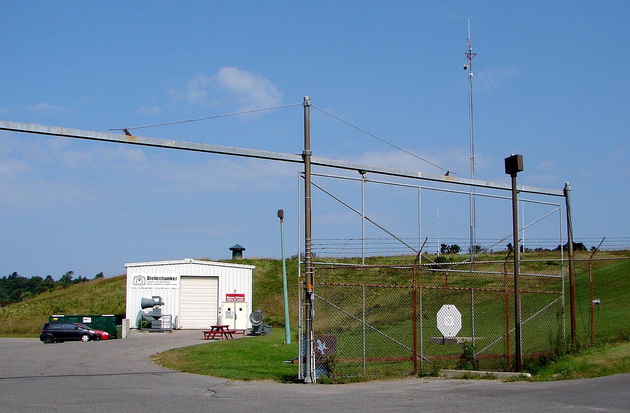 Diefenbunker / Central Emergency Government Headquarters · Photo: P199 · CC BY-SA 3.0
1historic place on the registers
History of Carp · Canada’s heritage registers
One place in Carp, at the top of the registers
Diefenbunker / Central Emergency Government Headquarters, from 1959, is Carp’s national historic site. Per resident Carp has more than 85% of Canadian towns: 1.8 for every 10,000 people. Only 8.4% of its homes were built before 1961, against 18% in the typical Canadian town.
Historic places
1
1.8 per 10,000 residents
Highest designations
1
National Historic Sites and Classified Federal Heritage Buildings
Oldest building
1959
the first construction date on its record
Homes built before 1961
8.4%
typical town: 18%
The map
Where Carp’s history is
Every place on the registers inside the town, by its designation.
Highest designations
Tap any dot to open that place’s own page; hovering shows its name.
The 1, by tier
1 Highest designations
Federal designations come from Parks Canada’s directory; a province’s or a council’s own listing shows here only when Wikidata holds it and an encyclopedia covers it.
Points from Wikidata (Parks Canada’s files carry none) and from Québec’s register, as mapped there.
Highest designations
One place in Carp with the highest designation
National Historic Sites and Classified Federal Heritage Buildings, Canada’s highest federal recognition. Each one opens its own page.
Around the town
Within 25 km of Carp, 12 top designations
Closest of all is Cimetière Edey, in Des Explorateurs, 14 km off. They are 55 municipal citations, 22 Recognized Federal Heritage Buildings and 6 National Historic Sites. Des Explorateurs, Les Golfs and Du Plateau hold most of them, among 14 towns.
The 12 nearest, within 25 km
| Cimetière EdeyMunicipal citation (Québec) · 14 km away, in Des Explorateurs |
| Maison Delormey-EdeyMunicipal citation (Québec) · 1890 · 14 km away, in Des Explorateurs |
| Ancienne station de pompage d'AylmerMunicipal citation (Québec) · 1895 · 14 km away, in Des Explorateurs |
| Maison James-Finlayson-TaylorMunicipal citation (Québec) · 1842–1843 · 14 km away, in Des Explorateurs |
| 4, rue Raoul-RoyMunicipal citation (Québec) · 1890 · 14 km away, in Des Explorateurs |
| Symmes HotelNational Historic Site · 1831–1832 · 15 km away, in Des Explorateurs |
| Maison TakerMunicipal citation (Québec) · 1896 · 15 km away, in Des Explorateurs |
| Maison William-McLeanMunicipal citation (Québec) · 1865 · 15 km away, in Des Explorateurs |
| 67, rue FrontMunicipal citation (Québec) · 1993 · 15 km away, in Des Explorateurs |
| Maison Harvey-Parker-FilsMunicipal citation (Québec) · 1840 · 15 km away, in Des Explorateurs |
| Maison James-McArthurMunicipal citation (Québec) · 1850 · 15 km away, in Des Explorateurs |
| 19, rue ThomasMunicipal citation (Québec) · 1880 · 15 km away, in Des Explorateurs |
Homes by age
A growing town: 10% of Carp’s homes went up from 2016 to 2021, against 4.1%
Homes built from 2001 to 2015 make up 32% of Carp’s, against 15% in the typical town. Only 21% of Carp’s homes were built from 1961 to 1980, less than the typical town’s 27%. More than half of Carp’s housing predates 2001.
8.4%
Before 1961
21%
1961–80
28%
1981–2000
32%
2001–15
10%
2016–21
CarpTypical town
2021 Census, private dwellings by period of construction (Statistics Canada); the typical town is the middle Canadian town of 2,500 or more.
Towns its size
Carp has the 3rd most of 16 towns its size
Towns of 5,600 to 5,700 residents, by places on the registers.
Carp1
Only Memramcook and Wolfville have more. The typical town its size has 0. 10 of them have none.
Neighbours
Carp and its neighbours
| Town | People | Places | Highest | Oldest |
|---|---|---|---|---|
| Carp | 5,621 | 1 | 1 | 1959 |
| Brookside - Briarbrook - Morgans Grant | 15,509 | 0 | 0 | — |
| Kanata Lakes | 19,861 | 0 | 0 | — |
| Dunrobin | 5,724 | 0 | 0 | — |
| Corkery | 3,822 | 0 | 0 | — |
| Beaverbrook | 6,762 | 0 | 0 | — |
| Stittsville North | 13,331 | 0 | 0 | — |
In brief
Carp in brief
Carp holds 1 historic place on Canada’s registers, one with the highest designation, including Diefenbunker / Central Emergency Government Headquarters. Just 2 towns of its size, out of 16, have more historic places. Before 1961: just 8.4% of its homes, against 18% in the typical town. The rest is about typical: people of its past such as George Nelson Kidd (1864) and William Erskine Johnston (1905); and its designation dates from 1994.
How to read these numbers
What this data can and can’t tell you
- Protection. National historic designation honours a place but binds only federal owners; a private building’s protection depends on its province or municipality.
- People and events. National historic persons carry no place in the open file. They appear on a town’s page when born there (same name, same birth and death years) or when a historic place inside it carries their name and its record names them with their dates; national historic events don’t appear.
- The grade. History isn’t one of Canada’s graded pillars, so this page describes and compares without a letter.
- The federal register. The federal list is complete and open: Parks Canada’s directory for the designations, the Canadian Register of Historic Places for what each one is and why it matters.
- Provincial and municipal lists. Outside Québec, provinces’ and municipalities’ heritage registers aren’t open data; their places are known only through Wikidata items with a register number, and only those with an encyclopedia article get a page.
- Map points. Parks Canada publishes no coordinates, so federal places are pinned where Wikidata puts them.
- The tiers. National Historic Sites and the most protected buildings form the top tier; recognized federal buildings, stations and lighthouses the second; provincial and municipal listings the third.
Questions about Carp’s history
Which places in Carp have the highest designation?
Just one: Diefenbunker / Central Emergency Government Headquarters.
What is the oldest building in Carp?
By its record, Diefenbunker / Central Emergency Government Headquarters, from 1959 (National Historic Site).
How old are the homes in Carp?
8.4% of its homes were built before 1961, against 18% in the typical Canadian town.
Contains information licensed under the Open Government Licence – Canada (Parks Canada).
Sources: Parks Canada, Directory of Federal Heritage Designations · Canadian Register of Historic Places (federal extract) · Wikidata (CC0) for map points, other names and articles · Statistics Canada, 2021 Census (homes by period of construction). Under the Statistics Canada Open Licence.
Adapted from Statistics Canada (Census of Population 2021, population estimates 2025, 2021 census boundaries) under the Statistics Canada Open Licence; this does not constitute an endorsement by Statistics Canada. Neighbourhood names in some cities © OpenStreetMap contributors (ODbL).