Ruthven Park
243 Highway 54, Caledonia
About Ruthven Park
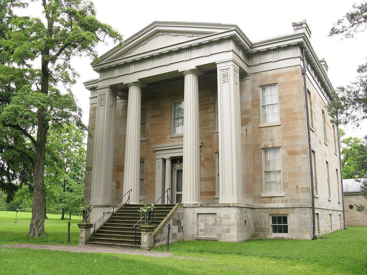
National Historic Site status goes to 2 places in Caledonia, Ruthven Park among them. Ruthven Park dates from 1845–1847. John Latshaw designed it.
Ruthven Park National Historic Site of Canada is a preserved mid-19th-century, picturesque country estate with a Greek Revival villa, associated outbuildings, and the archaeological remains of an early-19th-century village. The estate and the remains of the village are located on the east bank of the Grand River, just north of the village of Cayuga, Ontario. The focus of the estate is the temple-fronted, Greek Revival villa built of ashlar limestone from 1845-1846, enlarged in the 1860s. To the rear of the villa, a series of mid-19th century brick and rubble limestone farm buildings, built between 1845 and 1867, are arranged around an enclosed rectangular farmyard that now functions as a walled garden. The villa and its outbuildings are set on a high point of land overlooking the Grand River, accessed by a long winding driveway.
From the Canadian Register of Historic Places, Ruthven Park National Historic Site of Canada · Open Government Licence – Canada · quoted as the register has it
National Historic Sites are places the Minister of Environment designates, on the advice of the Historic Sites and Monuments Board, for their national significance.
Finding Ruthven Park
Caledonia


To reach another historic place from here you will need more than a short walk.
Questions about Ruthven Park
When was Ruthven Park built?
Its register puts the building of Ruthven Park at 1845–1847.
Can you visit Ruthven Park?
Its exterior is visible from public ground; access inside is up to the owner.
What is Ruthven Park?
Ruthven Park became a National Historic Site in 1995.
Is Ruthven Park protected?
The designation recognizes its national significance; it doesn’t by itself protect a building the federal government doesn’t own. Provincial or municipal designation may.
Contains information licensed under the Open Government Licence – Canada (Parks Canada).
Sources: Parks Canada, Directory of Federal Heritage Designations · Canadian Register of Historic Places (federal extract) · Photos: Wikimedia Commons, each credited with its licence and copied to our own server · Wikidata (CC0) for map points, other names and articles.
Adapted from Statistics Canada (Census of Population 2021, population estimates 2025, 2021 census boundaries) under the Statistics Canada Open Licence; this does not constitute an endorsement by Statistics Canada. Neighbourhood names in some cities © OpenStreetMap contributors (ODbL).