
Bradfordin Bradford West Gwillimbury, Ontario
A town of 51,346 in Ontario. It belongs to the Toronto metropolitan area.
Is Bradford a good place to live?
A good place to live, if you can afford it. Bradford grades B+ overall and ranks #249 of 858 in Ontario. It comes out better than 68% of Canadian towns. Recorded crime is low (A). What counts against it is cost of living (D). Incomes are on the low side (C+).
Rents here are the metro area's average, shared by every town and neighbourhood in it. Safety is the regional police service's figure, shared with its other towns. Health is graded on the health region's survey figures and life expectancy, with the distance to hospital giving the town its own spread.
What makes Bradford stand out
The 3 things Bradford does most differently from other towns.
How Bradford grades
Each subject compares Bradford with Canadian towns of 2,500 or more, ordered by how far it is from the middle. Towns in other countries are graded separately.
How TownRatings grades Canadian towns →
The data
Data highlights are ordered by what stands out in Bradford.
Few places are as safe from hazards as Bradford: it beats 94% of Canadian towns
Radon topped the guideline in 0.9% of tested homes, lower than both Ontario’s towns (4%) and Canadian towns (6.6%). NRCan expects $0.019 of shaking damage a year per $1,000 of buildings in Bradford, near the typical $0.030. No one has filed a flood map for Bradford on the national inventory.
Radon tests above the guideline · share of tested homes, 200 Bq/m³
| Hazards | Bradford | Ontario | Canada |
|---|---|---|---|
| Radon tests above the guideline | 0.9% | 4% | 6.6% |
| Earthquake loss per $1,000 of buildings a year | $0.019 | $0.043 | $0.030 |
NRCan seismic risk model and burned areas, Health Canada radon survey, the Flood Hazard Map Inventory
The police who cover Bradford record less serious crime than Ontario’s towns or Canadian towns: a Crime Severity Index of 33
The force’s area logs 14.9 thefts, break-ins and acts of damage per 1,000 residents a year. The violent index for its police area came to 42, below Ontario’s towns (76) and Canadian towns (86) alike. Violence across its police area runs at 6.7 per 1,000 residents a year. Bradford shares its Crime Severity Index, Violent Crime Severity Index, violent crime and property crime per 1,000 numbers with the rest of the South Simcoe (Innisfil) service area.
Year by year · Crime Severity Index for each year
| 2023–2025 | Bradford | Ontario | Canada |
|---|---|---|---|
| Property crime per 1,000 | 14.9 | 30.5 | 31.2 |
| Crime Severity Index | 33 | 56 | 67 |
| Violent Crime Severity Index | 42 | 76 | 86 |
| Violent crime | 6.7 | 10.5 | 12 |
Statistics Canada, Uniform Crime Reporting Survey, 2023–2025 average
Measured against local pay, Bradford costs more to live in than nine in ten Canadian towns
Shelter took 30% or more of income for 27% of households, above both Ontario’s towns (22%) and Canadian towns (18%). 84% of households are owner-occupiers. Figures for rent as a share of income and monthly rent for a two-bedroom are published for the Toronto metro area as a whole, not for Bradford alone.
What homes were worth · The median owner’s estimate at the 2021 census
| Census 2021 | Bradford | Ontario | Canada |
|---|---|---|---|
| Households spending 30%+ on shelter | 27% | 22% | 18% |
| Households owning their home | 84% | 76% | 74% |
Statistics Canada, Census 2021; CMHC Rental Market Survey via Statistics Canada · The 2021 census asked owners what their home was worth; those values, and 2020 incomes, are what this compares.
Very good or excellent health for 54% of adults in Bradford’s health region
Measured across the Simcoe Muskoka District Health Unit: health survey and life expectancy
Lives in the region last 81.5 years on average (2022/2024): 83.5 for women, 79.5 for men. Measured from where Bradford’s residents live, the nearest hospital is 8.5 km away, beyond the typical 3.7 km. A pharmacy is nearer: 1.5 km on average, with 7.9 within 3 km of the typical home.
Very good or excellent health · adults, age-standardised
| Health | Bradford | Ontario | Canada |
|---|---|---|---|
| Very good or excellent health | 54% | 51% | 52% |
| Life expectancy at birth | 81.5 | 82.8 | 81.5 |
| Smokers | 12% | 10% | 12% |
Statistics Canada, Canadian Community Health Survey 2023/2024 and life expectancy 2022/2024; Open Database of Healthcare Facilities
The schools around Bradford answer to 4 boards
Taken together, Bradford and its 3 km edge hold 16 elementary schools and 2 secondary schools for 9,525 students. Bradford District High School is the biggest, at 1,345 students. The 17 with results split, 3 in the upper two fifths in Ontario and 6 in the lower. None of them teaches in French, though 10% of schools in Ontario do.
| School | Level | Students | System |
|---|---|---|---|
| Fieldcrest Elementary School Middle fifth in OntarioLargest elementary schoolElementary · Grades JK–8 | Elementary · Grades JK–8 | 785 | English public |
| Bradford District High School Second fifth in OntarioLargest secondary schoolSecondary · Grades 9–12 | Secondary · Grades 9–12 | 1,345 | English public |
Schools by system · Schools within 3 km
| Schools within 3 km | Bradford | Ontario | Canada |
|---|---|---|---|
| School boards | 4 | 4 | 3 |
Provincial school lists and results, 2024-25
Commuters in Bradford travel further than in Ontario’s towns or Canadian towns, 36 min on average
94% of commuters drove, above both Ontario’s towns (88%) and Canadian towns (89%).
How working residents got to work · census 2021
| Census 2021 | Bradford | Ontario | Canada |
|---|---|---|---|
| Average trip | 36 min | 29 min | 26 min |
| Car or van | 94% | 88% | 89% |
Statistics Canada, Census 2021 (labour and commuting) · The 2021 census was taken in May 2021, during COVID-19 restrictions: more people than usual worked from home or were off work.
Children make up 21% of Bradford, above Ontario’s towns and Canadian towns
Over-65s are 13% of the population. 31% of residents belong to a visible minority, above both Ontario’s towns (26%) and Canadian towns (15%).
Ages · Share of residents in each age group, Census 2021
Schooling · Highest qualification, residents 15 and over
Women and men · all residents
50.6% of Bradford’s residents are women
By the 2021 count the town had 21,690 women and 21,190 men, while Canada has 50.9% women.
| Bradford | Ontario | Canada | |
|---|---|---|---|
| Under 15 | 21% | 15% | 16% |
| 15 to 64 | 66% | 65% | 64% |
| 65+ | 13% | 19% | 19% |
| No certificate, diploma or degree | 19% | 15% | 16% |
| Postsecondary qualification | 51% | 56% | 56% |
Statistics Canada, Census 2021; Ontario and Canada: medians of towns of 2,500+
January nights in Bradford drop to −11.3°C (Ontario towns −9.1°C, Canadian towns −13.5°C)
July afternoons reach 26.0°C on average, between Ontario’s towns (26.7°C) and Canadian towns (25.5°C). Gardeners get 141 frost-free days, from 16 May to 5 October. Snow peaks in December: 42 cm in a normal year. Rain and snow peak in June, at 83 mm.
Average high by season · ECCC normals, 1991–2020
| Normals, 1991–2020 | Bradford | Ontario | Canada |
|---|---|---|---|
| Snowfall a year | 174 cm | 146 cm | 141 cm |
| January night low | −11.3°C | −9.1°C | −13.5°C |
| Precipitation a year | 793 mm | 902 mm | 883 mm |
| July afternoon high | 26.0°C | 26.7°C | 25.5°C |
Environment and Climate Change Canada, Canadian Climate Normals 1991–2020 (Egbert)
Expect November days around 6°C in Bradford, nights around −1°C
ECCC’s forecast for Newmarket is on the Weather page, hour by hour. The month after, December, normally sees freezing afternoons and −7°C nights. Snowfall in a normal November: 22 cm. Expect about 72 mm of rain and snow over November.
Normal highs, the months ahead · ECCC normals, 1991–2020
| Season | High | Low | Rain and snow |
|---|---|---|---|
| Winter | −2°C | −10°C | 157 mm |
| Spring | 11°C | 0°C | 183 mm |
| Summer | 25°C | 13°C | 244 mm |
| Autumn | 14°C | 4°C | 210 mm |
ECCC normals, 1991–2020 (Egbert); the forecast is on the Weather page
Scot Davidson (Conservative Party of Canada) holds New Tecumseth—Gwillimbury, the riding that includes Bradford
Bradford has no council of its own: it belongs to Bradford West Gwillimbury, a town.
| Turnout | Bradford | Ontario | Canada |
|---|---|---|---|
| Municipal election, 2022 | 34% | 31% | 31% |
Wikidata, MAMH, MMAH, Statistics Canada
Bradford West Gwillimbury Town public library draws 5.9 visits per person served, ahead of 89% of Ontario’s town libraries
Bradford West Gwillimbury Town public library has 2 branches for the 44,125 people it serves.
Provincial library statistics, OpenStreetMap, the CRA and Statistics Canada
Rouge National Urban Park is 28 km from Bradford
Named trails close by number 5, the Kingfisher Loop Trail and Chickadee Loop Trail among them. A provincial park, Holland Landing Prairie Provincial Park, lies 4.0 km away. Within 10 km of the town, 1.1% of the land is protected, against 2.3% around a typical Canadian town. Biggest among them: Northwest Quadrant Woodlot, 60 ha, 4.3 km off.
Protected land · of the land within 10 km
| Outdoors | Bradford | Ontario | Canada |
|---|---|---|---|
| Protected land within 10 km | 1.1% | 2.3% | 2.3% |
| Public protected areas within 10 km | 2 | 4 | 4 |
Canadian Protected and Conserved Areas Database (CPCAD), OpenStreetMap routes and beaches
Canada's Wonderland and 11 more within 40 km
Nothing to visit is mapped within 5 km of Bradford; these are the best known within 40 km.
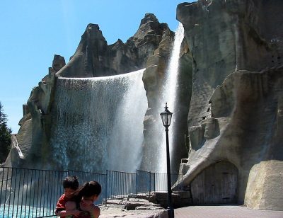 Big drawTheme parkCanada's Wonderland30 km south · 3.2M visitors a year (2025)
 AttractionLeviathan30 km south
 MuseumMcMichael Canadian Art Collection30 km south
 MuseumBase Borden Military Museum33 km northwest
 MuseumBlack Creek Pioneer Village38 km south
 AttractionYukon Striker31 km south
Photos: each place’s Wikidata image, from Wikimedia Commons under the licence below (our copy, resized).
Photo credits (6)
- Canada's Wonderland: Mathew Ingram, CC BY 2.0, Wikimedia Commons
- Leviathan: Chris!!!!!, CC BY 2.0, Wikimedia Commons
- McMichael Canadian Art Collection: Stephanie Spencer, CC BY-SA 2.5, Wikimedia Commons
- Base Borden Military Museum: Balcer, CC BY 2.5, Wikimedia Commons
- Black Creek Pioneer Village: John Griffiths from London, United Kingdom, CC BY-SA 2.0, Wikimedia Commons
- Yukon Striker: Jason Zhang, CC BY-SA 3.0, Wikimedia Commons
Everything we know about Bradford
Famous people from Bradford
12 notable people were born in Bradford.


Photo credits
Bob Pulford: Ralston-Purina Company, maker of Chex cereals, Public domain · William Mulock: Unknown, irrelevant due to age, Public domain · Brandon Mashinter: TheAHL, CC BY 2.0 · Colm Vance: John Jacques, CC BY-SA 4.0 · Britton Bath Osler: Adam, G. Mercer (Graeme Mercer), 1839-1912, Public domain · Mike Kilkenny: Unknown author, Public domain
Bradford’s neighbours
The nearest places of 1,000 or more. Statistics Canada
Questions about Bradford
Is Bradford growing?
It grew from 35,325 people in 2016 to 42,880 in 2021, up 21.4%; the median of Canadian towns grew 4.1%. StatCan’s 2025 estimate is 51,346.
What kind of homes are in Bradford?
Single-detached houses make up 75% of the homes here, where Canadian towns sit at 64%; 2% are in high-rise apartments. 14% of households are one person, and the average is 3.2.
Is Bradford a young town or an old one?
The median resident is 37.6 years old, against 45.2 for the median of Canadian towns. 21% are under 15 and 13% are 65 or over.
About Bradford
Town in Ontario
TownRatings follows Statistics Canada’s map: Bradford is one municipality in Ontario, figures and all.
Statistics Canada: population estimates 2025 (17-10-0155), Census of Population 2021, 2021 census boundaries.
- Population
- 51,346 (people, 2025 estimate)
- Province or territory
- Ontario
- Census division
- Simcoe
- Metro area
- Toronto
- Census subdivision
- 3543014
Sources: Statistics Canada, Census of Population 2021 · population estimates 2025 (17-10-0155) and 2021 census boundaries · Uniform Crime Reporting Survey 2023–25 (35-10-0026, 35-10-0183 to 35-10-0190) · CMHC rents as published by Statistics Canada (34-10-0133) · grades by TownRatings. Under the Statistics Canada Open Licence.
Adapted from Statistics Canada (Census of Population 2021, population estimates 2025, 2021 census boundaries) under the Statistics Canada Open Licence; this does not constitute an endorsement by Statistics Canada. Neighbourhood names in some cities © OpenStreetMap contributors (ODbL).