 Local
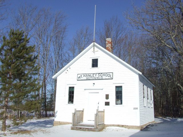
Provincially Registered Property · 1850Mount Hanley Schoolhouse MuseumPhoto: Letterofmarque · Public domain · Commons file
 Photo: Earth Science and Remote Sensing Unit , Lyndon B. Johnson Space Center · Public domain
1historic place on the registers
History of Annapolis County, Subdivision C · Canada’s heritage registers
Canada’s registers list 1 historic place in Annapolis County, Subdivision C
Annapolis County, Subdivision C’s entry is Mount Hanley Schoolhouse Museum (1850), a provincially registered property. Per resident Annapolis County, Subdivision C has more than 84% of Canadian towns: 1.8 for every 10,000 people. One more stands just outside, within 5 km of the town’s edge.
Historic places
1
1.8 per 10,000 residents
Highest designations
0
National Historic Sites and Classified Federal Heritage Buildings
Provincial and local listings
1
provincial and municipal listings with an encyclopedia article
Oldest building
1850
the first construction date on its record
Homes built before 1961
29%
typical town: 18%
In pictures
A look at historic Annapolis County, Subdivision C
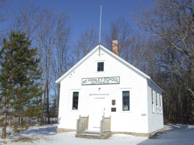
Annapolis County, Subdivision C’s one designated place, Mount Hanley Schoolhouse Museum, is pictured here.
Photos from Wikimedia Commons, each credited to its photographer with its licence; names open the place’s page. Tap a photo to step through them full screen.
The map
Where Annapolis County, Subdivision C’s history is
Every place on the registers inside the town, by its designation.
Provincial and local listings
Dots open their places’ pages; hover first to read the name.
The 1, by tier
1 Provincial and local listings
The federal directory kept by Parks Canada supplies most of these places; provincial and municipal lists outside Québec aren’t open data, so only the ones Wikidata documents with an article appear.
Points from Wikidata (Parks Canada’s files carry none) and from Québec’s register, as mapped there.
Provincial and local listings
On a provincial or local list in Annapolis County, Subdivision C: one place
Provincial and municipal listings that Wikidata records and an encyclopedia describes. Each one opens its own page.
Around the town
Within 25 km of Annapolis County, Subdivision C: 3 places on the registers
They are spread over 2 towns, including Kingston and Middleton. Closest of all is Armoury, in Middleton, 4.4 km off.
The 3 nearest, within 25 km
| ArmouryRecognized Federal Heritage Building · 1902–1903 · 4.4 km away, in Middleton |
| Hangar 9Recognized Federal Heritage Building · 1952–1953 · 8.5 km away, in Kingston |
| Hangar 10Recognized Federal Heritage Building · 1953–1954 · 8.5 km away, in Kingston |
Just outside Annapolis County, Subdivision C: 1
| Margaretsville LighthouseHeritage Lighthouse · 100 m outside the town |
Homes by age
A town of older homes: 29% of Annapolis County, Subdivision C’s were built before 1961 (18% is typical)
More than half of Annapolis County, Subdivision C’s housing predates 1981. Homes built from 2016 to 2021 make up just 2.2% of Annapolis County, Subdivision C’s, below the typical 4.1%. The largest single period is from 1981 to 2000, with 30% of Annapolis County, Subdivision C’s homes.
29%
Before 1961
26%
1961–80
30%
1981–2000
13%
2001–15
2.2%
2016–21
Annapolis County, Subdivision CTypical town
2021 Census, private dwellings by period of construction (Statistics Canada); the typical town is the middle Canadian town of 2,500 or more.
Born here
Born in Annapolis County, Subdivision C before the First World War: 4 lives
In 1844 came the earliest, Joshua Slocum. Fame, by Wikipedia: Joshua Slocum first, in 26 languages. The latest, Guilford Bevil Reed, was born in 1887. Frank Andrews reached 70, the longest life here, ending in 1924.
Joshua Slocum
Frank Andrews
Beniah Longley Whitman
Guilford Bevil Reed
1800182518501875190019251950

Joshua Slocum1844–1909 · American navigator and maritime writer
FA
Frank Andrews1854–1924 · Canadian politician

Beniah Longley Whitman1862–1911 · Canadian-American academic
GR
Guilford Bevil Reed1887–1955 · Canadian biologist
Everyone born in Annapolis County, Subdivision C → Born before 1914 (the page’s periods: Confederation to the First World War). Birthplaces from Wikidata, each checked against the person’s Wikipedia article.
Towns its size
Annapolis County, Subdivision C has the 3rd most of 16 towns its size
Towns of 5,700 to 5,700 residents, by places on the registers.
Annapolis County, Subdivision C1
Ahead of it: Saint-Roch-de-l'Achigan and Waterloo. Their median is 0. For 12, the registers list nothing.
Neighbours
Annapolis County, Subdivision C and its neighbours
In brief
Annapolis County, Subdivision C in brief
Counted by age, 29% of Annapolis County, Subdivision C’s homes predate 1961, against 18% in the typical town. All told, the registers hold 1 historic place. Of the 16 towns closest in size, just 2 have more historic places. Of its people of the past, the best known are Joshua Slocum (1844), Frank Andrews (1854) and Beniah Longley Whitman (1862).
How to read these numbers
What this data can and can’t tell you
- The tiers. National Historic Sites and the most protected buildings form the top tier; recognized federal buildings, stations and lighthouses the second; provincial and municipal listings the third.
- Protection. National historic designation honours a place but binds only federal owners; a private building’s protection depends on its province or municipality.
- Provincial and municipal lists. Outside Québec, provinces’ and municipalities’ heritage registers aren’t open data; their places are known only through Wikidata items with a register number, and only those with an encyclopedia article get a page.
- The grade. History isn’t one of Canada’s graded pillars, so this page describes and compares without a letter.
- Map points. Parks Canada publishes no coordinates, so federal places are pinned where Wikidata puts them.
- People and events. National historic persons carry no place in the open file. They appear on a town’s page when born there (same name, same birth and death years) or when a historic place inside it carries their name and its record names them with their dates; national historic events don’t appear.
- The federal register. The federal list is complete and open: Parks Canada’s directory for the designations, the Canadian Register of Historic Places for what each one is and why it matters.
Questions about Annapolis County, Subdivision C’s history
How many historic places does Annapolis County, Subdivision C have on the registers?
1 historic place inside Annapolis County, Subdivision C, by the federal, Québec and Wikidata-known registers.
What is the oldest building in Annapolis County, Subdivision C?
By its record, Mount Hanley Schoolhouse Museum, from 1850 (Provincially Registered Property).
How old are the homes in Annapolis County, Subdivision C?
The 2021 Census dates 29% of its homes before 1961 (18% in the typical town).
Contains information licensed under the Open Government Licence – Canada (Parks Canada).
Sources: Parks Canada, Directory of Federal Heritage Designations · Canadian Register of Historic Places (federal extract) · Wikidata (CC0) for map points, other names and articles · Statistics Canada, 2021 Census (homes by period of construction). Under the Statistics Canada Open Licence.
Adapted from Statistics Canada (Census of Population 2021, population estimates 2025, 2021 census boundaries) under the Statistics Canada Open Licence; this does not constitute an endorsement by Statistics Canada. Neighbourhood names in some cities © OpenStreetMap contributors (ODbL).