First pick
Oak Lake Sand Hills
Wood or forest · 50 m outside town
526 ha2.9 km of path
40 minto walk all 2.9 km of path
18 km westfrom the centre
Snoman Trail
Directionsto a point inside
Each edition grades its towns against each other only.
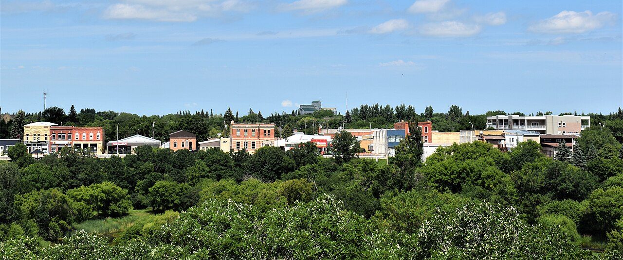 Photo: Words in the Wind · CC BY-SA 4.0
The largest named area nearby is Brandon Hills Wildlife Management Area, 762 ha, 9.9 km away. Within 10 km of the town, 0.5% of the land is protected, against 2.3% around a typical Canadian town. The nearest national park is Riding Mountain National Park, 92 km away.
Each figure against the 2,611 Canadian towns and neighbourhoods of 2,500+ (not city hubs or reserves), with the town marked and the typical one’s line. There is no Outdoors grade for Canadian towns; the figures stand beside the country’s towns of 2,500+ without a letter.
CPCAD 2.9.0 (ECCC, 2026), OpenStreetMap (November 2026). Distances from the town’s outline.
The 40 Canadian towns nearest in population (2,703 to 2,770 residents), by the share of the land within 10 km that is protected. Hover for each one’s figures; click for its page.
For protected land nearby, Souris lags towns its size: 30 of 39 are ahead.
| Town | Protected within 10 km | In town | Areas | Routes | Beaches | |
|---|---|---|---|---|---|---|
| 1 | Victoria County, Subdivision A NS | 33% | 54% | 152 | 3 | 59 |
| 2 | Highlands BC | 24% | 41% | 40 | 0 | 18 |
| 3 | Waskaganish QC | 24% | 0% | 6 | 0 | 0 |
| 4 | Electoral Area E, Peace River BC | 19% | 24% | 25 | 2 | 103 |
| 5 | Holyrood NL | 19% | 3.2% | 4 | 1 | 3 |
| 6 | Sainte-Anne-de-Sorel QC | 18% | 23% | 83 | 0 | 4 |
| 7 | Musquodoboit Harbour NS | 16% | 28% | 50 | 1 | 17 |
| 8 | Meadow Lake No. 588 SK | 13% | 15% | 25 | 3 | 4 |
| 9 | Little Current ON | 13% | 10% | 36 | 0 | 5 |
| 10 | Eastman QC | 11% | 7.4% | 49 | 5 | 7 |
| 11 | Waterridge Village ON | 11% | 9.2% | 39 | 0 | 2 |
| 12 | Maria QC | 9.5% | 1% | 24 | 0 | 1 |
| 13 | Marritt ON | 7.2% | 0% | 14 | 0 | 0 |
| 14 | Freelton ON | 5.6% | 1.6% | 30 | 0 | 0 |
| 15 | Cochrane, Unorganized, North Part ON | 5.1% | 4.9% | 81 | 0 | 28 |
| 16 | Russell MB | 4.9% | 0% | 16 | 0 | 0 |
| 17 | Vars ON | 3.8% | 1.4% | 10 | 0 | 1 |
| 18 | Bonaventure QC | 3.7% | 1.5% | 7 | 0 | 11 |
| 19 | Saint-Charles-de-Bellechasse QC | 3.6% | 0% | 32 | 0 | 0 |
| 20 | Trinity ON | 2.6% | 2.8% | 27 | 3 | 0 |
| 21 | Wakefield NB | 2.2% | 0.8% | 22 | 0 | 13 |
| 22 | Sussex NB | 2.1% | 0% | 13 | 0 | 3 |
| 23 | Division No. 8, Subdivision L NL | 1.9% | 0.2% | 3 | 1 | 1 |
| 24 | Woodcroft AB | 1.9% | 0% | 1 | 0 | 0 |
| 25 | Gore QC | 1.6% | 2.3% | 18 | 0 | 3 |
| 26 | Eastdale ON | 1.6% | 0% | 15 | 3 | 8 |
| 27 | Central River Heights MB | 1.5% | 0% | 23 | 0 | 1 |
| 28 | Tuxedo Industrial MB | 1.4% | 0% | 25 | 0 | 36 |
| 29 | Electoral Area H, Cowichan Valley BC | 1.1% | 3.5% | 28 | 3 | 6 |
| 30 | Upper Mount Royal AB | 0.8% | 0% | 3 | 1 | 1 |
| 31 | Souris MB | 0.5% | 0% | 13 | 0 | 0 |
| 32 | Talbot-Grey MB | 0.5% | 0% | 13 | 0 | 0 |
| 33 | Electoral Area I, Central Kootenay BC | 0.2% | 0.1% | 6 | 1 | 6 |
| 34 | Rivergrove MB | 0.2% | 4.7% | 7 | 0 | 0 |
| 35 | Wickham QC | 0.1% | 0% | 1 | 0 | 1 |
| 36 | Kameyosek AB | 0.1% | 0% | 2 | 0 | 4 |
| 37 | Lee Ridge AB | 0.1% | 0% | 2 | 0 | 3 |
| 38 | Plessisville QC | 0% | 0% | 6 | 0 | 2 |
| 39 | Kuujjuaq QC | 0% | 0% | 0 | 0 | 1 |
| 40 | Country Hills Village AB | 0% | 0% | 0 | 0 | 0 |
The town’s parks, woods, protected land and paths, with its named places numbered.
Oak Lake Sand Hills is the largest, at 526 ha; the rest follow by size, numbered as on the map.
Source: OpenStreetMap parks, gardens, commons and woods with a name, in the town or within 400 m, © OpenStreetMap contributors, ODbL. Sizes are the mapped outline’s.
Residents of each 2021 dissemination area, at a point inside it, within 400 m (about a 5-minute walk) of a park or playing field mapped on OpenStreetMap.
The typical Canadian town reaches 83%. About 2,000 residents live further than 400 m from one.
Every protected and conserved area in CPCAD within 10 km of the town’s edge: parks, reserves, wildlife areas and conservation land.
Of the 13, 2 are public land; the others are privately held. The largest named one is Brandon Hills Wildlife Management Area, at 762 ha. Another 11 are privately owned conservation land; they count in the figures but aren’t named, as private land isn’t a place to visit.
Source: Canadian Protected and Conserved Areas Database (CPCAD) 2.9.0, Environment and Climate Change Canada. Contains information licensed under the Open Government Licence – Canada.
National parks (Parks Canada) and provincial or territorial parks by direction and distance from the town’s edge: every one within 10 km, and the nearest of each within 100 km.
Closer to home, Criddle/Vane Homestead Provincial Park is 32 km away.
Source: CPCAD 2.9.0 (ECCC): areas and outlines, distances outline to outline; directions from the town’s centre point.
OpenStreetMap footpaths, paths, bridleways and steps, and tracks open on foot, in the town and 1 km around it; woods as mapped (landuse=forest, natural=wood).
For woods, 59% of Canadian towns have more. For path density, 93% of Canadian towns do better.
Source: OpenStreetMap, © OpenStreetMap contributors, ODbL. Mapping varies by place: a dense figure can mean keen local mappers as much as many paths.
Named walking and hiking routes on OpenStreetMap with at least 300 m within 2 km of the town, longest first; national routes lead.
OpenStreetMap has no named walking route within 2 km of the town. Trails may exist without being mapped as routes.
Source: OpenStreetMap (route relations hiking, foot and walking), © OpenStreetMap contributors, ODbL. Trans Canada Trail sections as OSM maps them.
Environment and Climate Change Canada’s 1991–2020 normals from Brandon (39 km), and daylight at the town’s latitude. Good months: 12½+ hours of daylight, highs of 15–30 °C, little rain.
| Jan | Feb | Mar | Apr | May | Jun | Jul | Aug | Sep | Oct | Nov | Dec | |
|---|---|---|---|---|---|---|---|---|---|---|---|---|
| Daylight (h) | 8.6 | 10.0 | 11.7 | 13.7 | 15.3 | 16.3 | 15.9 | 14.4 | 12.5 | 10.6 | 9.0 | 8.2 |
| High (°C) | -11 | -9 | -2 | 10 | 17 | 23 | 25 | 25 | 20 | 10 | 0 | -9 |
| Rain & snow (mm) | 18 | 14 | 24 | 27 | 65 | 98 | 72 | 56 | 43 | 32 | 20 | 22 |
The yearly snowfall is near 128 cm. June is the wettest month (98 mm) and February the driest (14 mm). From -11 °C in January to 25 °C in August: that is the range of daytime highs. The climate in Souris →
Viewpoints, peaks, waterfalls, picnic sites, nature reserves, playgrounds, dog parks, campsites and boat launches mapped within 2 km of the town.
There are 3 hills and peaks, more than of anything else.
Plus 2 picnic sites without a name on the map.
Plus 1 slipway without a name on the map.
Source: OpenStreetMap (tourism, natural, waterway and leisure tags), © OpenStreetMap contributors, ODbL.
The nearest places, coloured by the share of the land within 10 km that is protected; tap one for its outdoors page. The nearest places to Souris with figures are 21–30 km away.
| Town | Protected within 10 km | Areas | Routes | Beaches |
|---|---|---|---|---|
| Souris | 0.5% | 13 | 0 | 0 |
| Whitehead 21 km | 0.7% | 22 | 0 | 3 |
| Grassland 25 km | 1.2% | 24 | 0 | 0 |
| Sioux Valley Dakota Nation 30 km | 1.3% | 14 | 0 | 1 |
For protected land, Grassland and Sioux Valley Dakota Nation have twice as much or more.
Riding Mountain National Park, 92 km from the edge of town.
Protected areas cover 0.5% of the land within 10 km.
It is Brandon Hills Wildlife Management Area, a wildlife area covering 762 ha.
May, August and September: long days, mild highs and little rain.
Criddle/Vane Homestead Provincial Park, 32 km away.
Protected areas: Canadian Protected and Conserved Areas Database (CPCAD) 2.9.0, Environment and Climate Change Canada, 2026: every area within 10 km and the nearest national and provincial parks, measured outline to outline.
Walking routes and beaches: OpenStreetMap, November 2026: named hiking, foot and walking route relations within 2 km and beaches within 5 km.
Towns: Statistics Canada 2021 Census boundaries and populations; the comparison is the Canadian towns and neighbourhoods of 2,500+, not city hubs or reserves.
When to go: Environment and Climate Change Canada, Canadian Climate Normals 1991–2020, from the nearest station that publishes them.
Green space, paths, woods, things to do: OpenStreetMap (Geofabrik’s Canada extract), November 2026: parks, gardens, playing fields, woods, footpaths, the coastline and things to do in and around each town.
Residents: Statistics Canada 2021 Census dissemination areas (population, boundaries), each at a point inside it.
Walking routes and beaches © OpenStreetMap contributors, available under the Open Database Licence (ODbL).
Not on this page: trailheads and trail grades, and beach water quality. No open Canadian dataset gives these for every town yet.
Adapted from Statistics Canada (Census of Population 2021, population estimates 2025, 2021 census boundaries) under the Statistics Canada Open Licence; this does not constitute an endorsement by Statistics Canada. Neighbourhood names in some cities © OpenStreetMap contributors (ODbL).