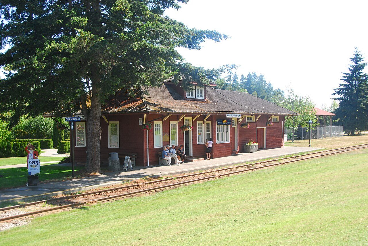
Former Canadian Pacific Railway (VIA Rail) Station, Qualicum Beach, British Columbia · Photo: Alasdair McLellan · CC BY-SA 3.0
2historic places on the registers
History of Qualicum Beach · Canada’s heritage registers
2 historic places on the heritage registers in Qualicum Beach
The list takes in a heritage railway station and a Recognized Federal Heritage Building. Go back to 1882 and you reach Kinkade Farmstead, the oldest of them. Only 6.3% of its homes were built before 1961, against 18% in the typical Canadian town. Per resident Qualicum Beach has more than 86% of Canadian towns: 2.1 for every 10,000 people.
Every place on the registers inside the town, by its designation.
Other federal designations
Dots open their places’ pages; hover first to read the name.
The 2, by tier
2 Other federal designations
What the map shows is the open record: the federal directory in full, and from provincial or municipal lists only the places Wikidata ties to an encyclopedia article.
Points from Wikidata (Parks Canada’s files carry none) and from Québec’s register, as mapped there. One place, placed by its register’s municipality, has no point and isn’t on the map.
Other federal designations
2 other places Canada recognizes in Qualicum Beach
They date from 1882 (Kinkade Farmstead) to 1914. By designation: a Recognized Federal Heritage Building and a heritage railway station. Recognized Federal Heritage Buildings, heritage railway stations and lighthouses. Each one opens its own page.
Recognized Federal Heritage Building · 1882–1885Kinkade Farmstead3567 Island Highway West
Around the town
The heritage closest to Qualicum Beach: McLean Mill, at 29 km
They belong to 3 towns, chiefly Nanaimo, Electoral Area E, Alberni-Clayoquot and Welcome Beach. The registers hold 5 within 50 km. Oldest of them is Bastion (1855), 41 km off.
The 5 nearest, within 50 km
McLean MillNational Historic Site · 1925–1966 · 29 km away, in Electoral Area E, Alberni-Clayoquot
BastionHeritage designation · 1855 · 41 km away, in Nanaimo
Homes by age
Qualicum Beach’s building boom came from 1981 to 2000: 54% of its homes
Homes built from 2016 to 2021 are 3.9% of Qualicum Beach’s, about the typical 4.1%. Few of Qualicum Beach’s homes date from 1961 to 1980: 21%, the norm 27%. More than half of Qualicum Beach’s housing predates 2001.
6.3%
Before 1961
21%
1961–80
54%
1981–2000
15%
2001–15
3.9%
2016–21
Qualicum BeachTypical town
2021 Census, private dwellings by period of construction (Statistics Canada); the typical town is the middle Canadian town of 2,500 or more.
Towns its size
Qualicum Beach has the 2nd most of 16 towns its size
Towns of 9,600 to 9,700 residents, by places on the registers.
Canada’s heritage lists give Qualicum Beach 2 historic places. Just one town of its size, out of 16, has more historic places. Counted by age, only 6.3% of its homes come from before 1961, against 18% in the typical town. Beyond that, the designations ran from 1994 to 1999.
How to read these numbers
What this data can and can’t tell you
•
Protection. Being on these registers doesn’t mean a building can’t change. Federal designation commemorates; protection is provincial or municipal, and those lists aren’t open here.
•
Provincial and municipal lists. Outside Québec, provinces’ and municipalities’ heritage registers aren’t open data; their places are known only through Wikidata items with a register number, and only those with an encyclopedia article get a page.
•
The federal register. Federal places come from Parks Canada’s directory, which counts National Historic Sites, federal heritage buildings, stations and lighthouses; their statements are the register’s own.
•
The grade. History isn’t one of Canada’s graded pillars, so this page describes and compares without a letter.
•
Map points. Parks Canada publishes no coordinates, so federal places are pinned where Wikidata puts them.
•
The tiers. National Historic Sites and the most protected buildings form the top tier; recognized federal buildings, stations and lighthouses the second; provincial and municipal listings the third.
•
People and events. Persons of national historic significance come with no location; a town gets one only by birthplace (name and both life years agreeing) or by one of its own places that bears the name and whose record tells the story. Events, which can’t be tied, are left out.
Questions about Qualicum Beach’s history
How many historic places does Qualicum Beach have on the registers?
Inside Qualicum Beach: 2 historic places.
What is the oldest building in Qualicum Beach?
By its record, Kinkade Farmstead, from 1882 (Recognized Federal Heritage Building).
How old are the homes in Qualicum Beach?
6.3% of its homes were built before 1961, against 18% in the typical Canadian town.
Contains information licensed under the Open Government Licence – Canada (Parks Canada).
Sources: Parks Canada, Directory of Federal Heritage Designations · Canadian Register of Historic Places (federal extract) · Wikidata (CC0) for map points, other names and articles · Statistics Canada, 2021 Census (homes by period of construction). Under the Statistics Canada Open Licence.
 Fed