History of Penticton · Canada’s heritage registers
Canada’s registers list 2 historic places in Penticton
Scaled to its population, Penticton’s 0.5 per 10,000 residents beats 75% of Canadian towns. There are also 8 listings on provincial or municipal registers with no open description, so no pages. Designations here include 2 provincial or municipal listings.
Historic places
2
0.5 per 10,000 residents
Highest designations
0
National Historic Sites and Classified Federal Heritage Buildings
Provincial and local listings
2
provincial and municipal listings with an encyclopedia article
Homes built before 1961
15%
typical town: 18%
In pictures
A walk through Penticton in 2 photos
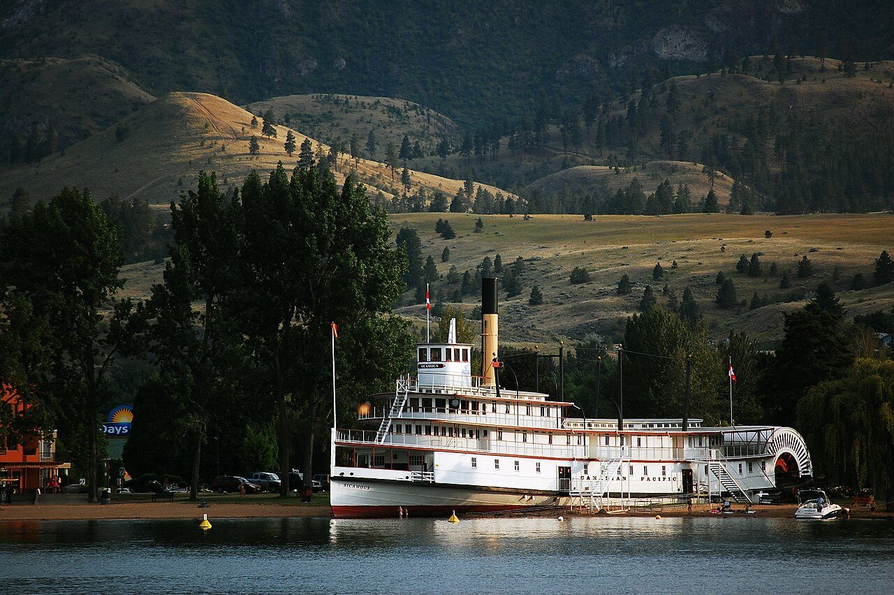
Photos show both of the places Penticton’s registers name. The first two: Naramata and Sicamous.
Photos from Wikimedia Commons, each credited to its photographer with its licence; names open the place’s page. Tap a photo to step through them full screen.
How it began
Penticton’s first recorded year: 1908
Its charter made Penticton a city in 1948. The date Wikidata keeps for Penticton is 1908; whether it was a founding or a legal act, the entry leaves open.
Every place on the registers inside the town, by its designation.
Provincial and local listings
Each dot is a place: point at it for the name, tap it for its page.
The 2, by tier
2 Provincial and local listings
Most entries are federal, from Parks Canada’s Directory of Federal Heritage Designations; local listings outside Québec are known only through Wikidata items with an article.
Points from Wikidata (Parks Canada’s files carry none) and from Québec’s register, as mapped there.
Provincial and local listings
2 local listings in Penticton
Provincial and municipal listings that Wikidata records and an encyclopedia describes. Among them: Naramata and Sicamous. Each one opens its own page.
2 places of the highest rank within 50 km of Penticton
The first one out is Myra Canyon Section of the Kettle Valley Railway, 41 km away in Central Okanagan. They belong to 3 towns, chiefly Central Okanagan, Kelowna and Electoral Area H, Okanagan-Similkameen. 3 places lie within 50 km.
Similkameen Spirit TrailNational Historic Site · 50 km away, in Electoral Area H, Okanagan-Similkameen
Homes by age
Penticton is still building: 9% of homes date from 2016 to 2021, against 4.1%
The busiest building years in Penticton were from 1981 to 2000, which account for 31% of today’s homes. 15% of Penticton’s homes predate 1961, close to the typical town’s 18%. Half of the homes standing in Penticton today were built before 2001.
15%
Before 1961
30%
1961–80
31%
1981–2000
15%
2001–15
9%
2016–21
PentictonTypical town
2021 Census, private dwellings by period of construction (Statistics Canada); the typical town is the middle Canadian town of 2,500 or more.
Towns its size
Penticton has the most of 16 towns its size
Towns of 37,900 to 40,300 residents, by places on the registers.
The registers count 2 historic places in Penticton. Of the 16 towns closest in size, it has the most historic places. Little of its housing was standing by 1961: 15%, against 18% in the typical town.
How to read these numbers
What this data can and can’t tell you
•
The tiers. The highest designations are National Historic Sites, Classified Federal Heritage Buildings and Québec’s classements; then come the other federal designations; then provincial and local listings.
•
The grade. This page gives no grade; history doesn’t count toward a Canadian town’s letter.
•
Map points. Where a federal place sits on the map is Wikidata’s placing; the directory itself has no coordinates.
•
Protection. Being on these registers doesn’t mean a building can’t change. Federal designation commemorates; protection is provincial or municipal, and those lists aren’t open here.
•
People and events. National historic persons carry no place in the open file. They appear on a town’s page when born there (same name, same birth and death years) or when a historic place inside it carries their name and its record names them with their dates; national historic events don’t appear.
•
The federal register. The federal list is complete and open: Parks Canada’s directory for the designations, the Canadian Register of Historic Places for what each one is and why it matters.
•
Provincial and municipal lists. Outside Québec, provinces’ and municipalities’ heritage registers aren’t open data; their places are known only through Wikidata items with a register number, and only those with an encyclopedia article get a page.
Questions about Penticton’s history
How many historic places does Penticton have on the registers?
2 historic places inside Penticton, by the federal, Québec and Wikidata-known registers.
Why might a heritage building in Penticton be missing here?
Only federal designations are fully open outside Québec. 8 more listings in Penticton are known through Wikidata alone, so they are counted, not paged.
How old are the homes in Penticton?
15% of its homes were built before 1961, against 18% in the typical Canadian town.
Contains information licensed under the Open Government Licence – Canada (Parks Canada).
Sources: Parks Canada, Directory of Federal Heritage Designations · Canadian Register of Historic Places (federal extract) · Wikidata (CC0) for map points, other names and articles · Statistics Canada, 2021 Census (homes by period of construction). Under the Statistics Canada Open Licence.

 Local
 Local