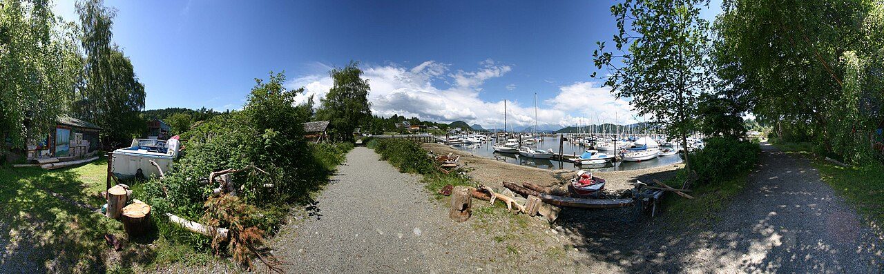
 Photo: Visit-World. com Author: www.visit-world.com · CC BY-SA 3.0
Gibsons sits near the bottom of Canadian towns for frosts
In July the day’s top temperature is typically 23.0°C. It is a wet place: more rain and snow fall here than on 97% of Canadian towns. A year here swings 20°C from midwinter lows to midsummer highs. Picnics, hikes and garden evenings come into their own from May to September, with highs of 18–23°C.
The nearest ECCC normals location to Gibsons is Vancouver (Harbour), 31 km east, and every figure on this page is its.
A year in Gibsons at a glance
Each month’s typical high and low, in °C.
What stands out about Gibsons’s climate
Compared with Canadian towns, with its place among towns of 2,500+ in British Columbia beside it.
What a year in Gibsons feels like
Seasons and months as ECCC’s 1991–2020 normals give them: a typical day’s high and low.
Frost on 17 days, 20°C on 87
Frosts fall from November to March; January has the most, about 6.
Frost days by month
Average days at 0°C or below
Days above 20°C by month
Average days
About 1,537 mm of rain and snow a year
November brings the most rain and snow; July, the least. On about 142 days a year, 1 mm or more falls.
Rain and snow by month
Millimetres
About 37 cm of snow a year
Snow falls from November to March, most of all in December (about 14 cm).
Snowfall by month
Centimetres
Snowfall: Vancouver International (Airport), 34 km away (Vancouver (Harbour) records no complete year of it).
Heating a home in Gibsons
89% of a year’s heating need falls between October and April. Months averaging under 10°C: November to March.
Degree days add up how far each day’s mean temperature falls below 18°C over a year. A house here needs less heating than almost every Canadian town.
Living with Gibsons’s climate
Gardening, time outside, winter cold and summer heat, from the 1991–2020 normals.
Mild days and mild nights together (17–27°C by day, 8°C or more at night) belong to May, Jun, Jul, Aug and Sep.
Parks & trails →A typical year is calm by definition; Gibsons’s hazards page covers the exceptions.
Flood & hazards →ECCC’s normals location: Vancouver (Harbour)
The page’s figures are ECCC’s 1991–2020 normals for Vancouver (Harbour), one of its 450 normals locations.
| Distance from the town | 31 km east |
| Station altitude | 3 m |
| Completeness | meets the WMO “3 and 5” rule |
| WMO standard normals | No |
| Snowfall from | Vancouver International (Airport), 34 km |
| Coldest reading, 1991–2020 | −9.0°C |
| Hottest reading, 1991–2020 | 34.9°C |
| Next-nearest location | Vancouver International (Airport), 34 km |
How Gibsons compares
Placed among 2,611 Canadian towns and neighbourhoods of 2,500+, each on its nearest normals location; each dot is another location used in British Columbia.
Nearby towns’ climate
Nearby places read from a different ECCC location (places on Gibsons’s own would show the same figures). No closer place has figures: this one lies 25 km from Gibsons.
| Town | July high | January low | Rain & snow |
|---|---|---|---|
| Gibsons Vancouver (Harbour) | 23.0°C | 3.3°C | 1,537 mm |
| Electoral Area A, Metro Vancouver 25 km · Vancouver International (Airport) | 22.4°C 0.6°C cooler | 1.4°C 1.9°C colder | 1,160 mm |
Gibsons weather by month
Month by month, 1991–2020: the usual high, low and mean, the rain and snow, and the snowfall.
| Month | High | Low | Mean | Rain & snow | Snow |
|---|---|---|---|---|---|
| January | 7.4°C | 3.3°C | 5.3°C | 237 mm | 12 cm |
| February | 8.4°C | 3.3°C | 5.9°C | 117 mm | 5 cm |
| March | 10.5°C | 4.6°C | 7.6°C | 163 mm | 3 cm |
| April | 13.9°C | 6.9°C | 10.4°C | 118 mm | under 1 cm |
| May | 17.8°C | 10.2°C | 14.0°C | 73 mm | 0 cm |
| June | 20.2°C | 12.8°C | 16.5°C | 66 mm | 0 cm |
| July | 23.0°C | 14.9°C | 19.0°C | 44 mm | 0 cm |
| August | 23.0°C | 14.8°C | 18.9°C | 49 mm | 0 cm |
| September | 19.4°C | 12.1°C | 15.8°C | 71 mm | 0 cm |
| October | 13.9°C | 8.6°C | 11.2°C | 157 mm | under 1 cm |
| November | 9.7°C | 5.3°C | 7.5°C | 245 mm | 3 cm |
| December | 7.1°C | 3.2°C | 5.2°C | 200 mm | 14 cm |
| Year | 14.5°C | 8.3°C | 11.4°C | 1,537 mm | 37 cm |
January varies most from one year to the next (1.5°C), July least
The thirty-year records stretch furthest in June: a low of −2.8°C in 2007 and a high of 30.6°C in 2015.
Where Gibsons’s numbers come from
Averages over 30 years, not a forecast.
- Normals: 1991–2020 normals for Vancouver (Harbour) from ECCC’s climate data site, the nearest location with every month of temperature.
- Other locations: ECCC blanks a month that fails its completeness rule, so the precipitation or snowfall here comes from the next location with all twelve months.
- Comparisons: every Canadian town and neighbourhood of 2,500 or more, each read from its own nearest location; city totals and reserves are left out.
- Not on this page: sunshine, not in ECCC’s 1991–2020 normals, and the effect of the town’s height, for which there is no figure.
Canadian Climate Normals 1991–2020 · ECCC Data Services End-use Licence. Data Source: Environment and Climate Change Canada
Questions about Gibsons’s climate
How warm does Gibsons get in summer?
Afternoons average 23.0°C in July, the warmest time of year.
How cold does Gibsons get in winter?
December nights average 3.2°C, the coldest of the year.
How much rain and snow does Gibsons get?
The yearly total is about 1,537 mm. November gets 245 mm, the most of any month; July gets 44 mm, the least.
Are these figures for Gibsons itself?
No. ECCC measures normals at Vancouver (Harbour), not in Gibsons; the page uses the nearest it has.
Data Source: Environment and Climate Change Canada · ECCC Data Services End-use Licence Today’s forecast for Gibsons →
Adapted from Statistics Canada (Census of Population 2021, population estimates 2025, 2021 census boundaries) under the Statistics Canada Open Licence; this does not constitute an endorsement by Statistics Canada. Neighbourhood names in some cities © OpenStreetMap contributors (ODbL).