
Start with Burnaby Village Museum: the sights of Burnaby
Of the 48 places to visit in and around Burnaby, 33 are museums or galleries. The city limits itself has 12 places on our list; 36 others are within 5 km of its edge. On foot, 5 are within 1 km of the centre. Day-trippers head 13 km out to Stanley Park.
Where to start in Burnaby
 Theme parkBurnaby Village Museumin town
 GardenCentral Parkin town
 Art galleryBurnaby Art Galleryin townMuseumMuseumMarianne and Edward Gibson Art Museumin town
 Art galleryFairacres Mansionin townTheme parkTheme parkBurnaby Central Railwayin town
Each has a page of its own: what it is, who runs it, the weather month by month and what else is near it.
Where to find them
The farthest of them, Inuit Gallery Of Vancouver, is 10 km out.
The dashed line is Burnaby’s city limits; orange marks its middle (where most people live). Numbers match the list below. © OpenStreetMap contributors · Statistics Canada 2021 outline
The list by type
Green: inside Burnaby. Grey: within 5 km of its edge.
All the places to visit
Marianne and Edward Gibson Art Museum
Art museum located at Simon Fraser University.
Nikkei National Museum and Cultural Centre
Museum and cultural centre about Japanese Canadian history, arts and culture in Burnaby, BC, Canada.
 13
 15
Holy Trinity Cathedral
Cathedral in New Westminster, British Columbia.
 16
 17
 18
 19
Park and Tilford Gardens
Botanical garden in North Vancouver, British Columbia, Canada.
Massey Theatre
Proscenium performing arts theatre in New Westminster, British Columbia, Canada.
New Westminster Museum and Archives
Small contemporary exhibition of local historical artifacts, records, photos & vehicles..
The 12 inside Burnaby come first, best known first; then the places within 5 km, close and well known first. Provincial and city parks are on the Outdoors page instead.
Historic places in Burnaby → · Parks, footpaths and green space in Burnaby →
Trips out
 GardenStanley Park13 km northwestArt galleryArt galleryVancouver Art Gallery11 km northwest
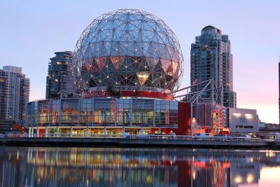 Big drawMuseumScience World9.6 km northwest · 650K visitors a year
 MuseumMuseum of Vancouver12 km northwest · 78K visitors a year
 MuseumMuseum of Anthropology at UBC21 km northwest · 200K visitors a year (2024)
 GardenQueen Elizabeth Park9.9 km northwest
 CathedralCathedral of Our Lady of the Rosary, Vancouver11 km northwestSki hillSki hillCypress Mountain Ski Area23 km north
 AquariumVancouver Aquarium13 km northwestMuseumMuseumVancouver Maritime Museum13 km northwest
 Ski hillGrouse Mountain17 km north
 GardenVanDusen Botanical Garden11 km northwest
Places well known beyond Burnaby (Wikipedia articles in several languages, published visitor counts, or a Parks Canada property), close and famous first. Distances are straight lines from the middle of the town.
Good to know in Burnaby
What are the main attractions in Burnaby?
Inside Burnaby’s city limits, start with Central Park, Burnaby Art Gallery and Marianne and Edward Gibson Art Museum.
Does Burnaby have a museum?
Yes, Fairacres Mansion, Deer Lake Art Gallery and Museum of Archaeology & Ethnology, all in Burnaby or within 5 km.
Is there a Parks Canada property near Burnaby?
Not within 5 km: our list has none near Burnaby.
What are the best-known days out near Burnaby?
For a day out within 40 km: Vancouver Art Gallery (11 km), Science World (9.6 km), Museum of Vancouver (12 km), Museum of Anthropology at UBC (21 km).
How is this list made?
Museums, galleries, national historic sites, forts, lighthouses, gardens, national parks, waterfalls, ski hills, zoos and theme parks from OpenStreetMap, Wikidata, ODCAF and the heritage registers are merged into one list. A historic building needs a sign it welcomes visitors (opening hours, a fee, a website, a heritage operator or a Wikipedia article); hotels, restaurants and tour operators are left out. Each place is put in the town’s 2021 outline or within 5 km of its edge.
Places to visit: Canada publishes no open tourism list, so this one is assembled from OpenStreetMap (© OpenStreetMap contributors, ODbL), Wikidata (CC0), Statistics Canada’s ODCAF museums and galleries (2020, Open Government Licence – Canada), the federal and Québec heritage registers and CPCAD’s national parks, and it reflects what mappers and editors have recorded. Forts, houses, lighthouses and churches count only with a sign that visitors are welcome. Places sit in each town’s 2021 census outline; visitor counts are Wikidata’s latest, with their year.
Photos: each place’s Wikidata image, from Wikimedia Commons under the licence below (our copy, resized).
Photo credits (19)
- Burnaby Village Museum: Xiao23, CC BY-SA 3.0, Wikimedia Commons
- Central Park: Jeff Hitchcock from Seattle, WA, USA, CC BY 2.0, Wikimedia Commons
- Burnaby Art Gallery: Xiao23, CC BY-SA 3.0, Wikimedia Commons
- Fairacres Mansion: Xiao23, CC BY-SA 3.0, Wikimedia Commons
- Playland: ThePointblank, CC BY-SA 3.0, Wikimedia Commons
- Holy Trinity Cathedral: sageb1, CC BY-SA 3.0, Wikimedia Commons
- The Polygon Gallery: Shaundd, CC BY-SA 4.0, Wikimedia Commons
- Wooden Roller Coaster: Ruth Hartnup, CC BY 2.0, Wikimedia Commons
- PoMo Museum: waferboard, CC BY 2.0, Wikimedia Commons
- Park and Tilford Gardens: Shaundd, CC BY-SA 4.0, Wikimedia Commons
- Stanley Park: squeakymarmot, CC BY 2.0, Wikimedia Commons
- Science World: Differense, CC BY-SA 3.0, Wikimedia Commons
- Museum of Vancouver: Bobanny, Public domain, Wikimedia Commons
- Museum of Anthropology at UBC: Rr parker, CC BY-SA 3.0, Wikimedia Commons
- Queen Elizabeth Park: Craig Nagy from Vancouver, Canada, CC BY-SA 2.0, Wikimedia Commons
- Cathedral of Our Lady of the Rosary, Vancouver: Bobanny, Public domain, Wikimedia Commons
- Vancouver Aquarium: Emancipator at en.wikipedia, CC BY-SA 3.0, Wikimedia Commons
- Grouse Mountain: Orlandkurtenbach, Public domain, Wikimedia Commons
- VanDusen Botanical Garden: Stan Shebs, CC BY-SA 3.0, Wikimedia Commons
Adapted from Statistics Canada (Census of Population 2021, population estimates 2025, 2021 census boundaries) under the Statistics Canada Open Licence; this does not constitute an endorsement by Statistics Canada. Neighbourhood names in some cities © OpenStreetMap contributors (ODbL).