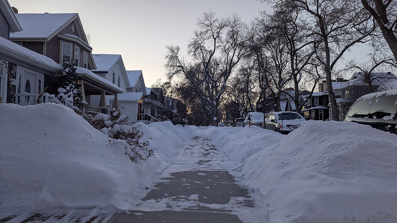
StrathconaEdmonton
8,283 residents make their home in this neighbourhood in Edmonton. Edmonton is split into 195 neighbourhoods, and this is one.
Is Strathcona a good place to live?
Strathcona’s lowest grade is for cost of living (D−). The neighbourhood grades B− overall, better than 46% of Canadian towns, and ranks #283 of 473 in Alberta. Police record more crime here than in most towns (C−). Getting around on foot or by bus is easy (A+).
Rents here are the metro area's average, shared by every town and neighbourhood in it. Safety less sure: this is the whole city's figure, because the city doesn't publish open neighbourhood crime rates. Health is graded on the health region's survey figures and life expectancy, with the distance to hospital giving the town its own spread.
How Strathcona grades
Each subject compares Strathcona with Canadian towns of 2,500 or more, ordered by how far it is from the middle. Towns in other countries are graded separately.
How TownRatings grades Canadian towns →
What makes Strathcona stand out
The 3 things Strathcona does most differently from other towns.
The data
Data highlights are ordered by what stands out in Strathcona.
Hazard risk in Strathcona is lower than in 98% of Canadian towns
Measured across the city of Edmonton: earthquake risk
Radon is lower than usual: 1.4% of tested homes in the survey area topped the guideline, against 6.6% for the typical town. Flood mapping exists: a study by Government of Alberta. Shaking is less of a worry than in most places, at $0.013 a year per $1,000 of building value ($0.030 typical). Strathcona shares its radon tests numbers with the rest of the Capital Health.
Radon tests above the guideline · share of tested homes, 200 Bq/m³
| Hazards | Strathcona | Alberta | Canada |
|---|---|---|---|
| Radon tests above the guideline | 1.4% | 7.5% | 6.6% |
| Earthquake loss per $1,000 of buildings a year | $0.013 | $0.013 | $0.030 |
NRCan seismic risk model and burned areas, Health Canada radon survey, the Flood Hazard Map Inventory
Rent takes more of local pay in Strathcona than in Alberta’s towns or Canadian towns: 30% of household income
The median home value was $456,000, higher than both Alberta’s towns ($400,000) and Canadian towns ($406,000). Figures for rent as a share of income and monthly rent for a two-bedroom are published for the Edmonton metro area as a whole, not for Strathcona alone.
What homes were worth · The median owner’s estimate at the 2021 census
| Census 2021 | Strathcona | Alberta | Canada |
|---|---|---|---|
| Households spending 30%+ on shelter | 33% | 21% | 18% |
| Rent as a share of income | 30% | 20% | 20% |
| Median home value, 2021 | $456,000 | $400,000 | $406,000 |
Statistics Canada, Census 2021; CMHC Rental Market Survey via Statistics Canada · Home values are owners’ own estimates at the May 2021 census, and incomes are for 2020.
Schools in Strathcona: 6 boards, side by side
The 3 km around Strathcona counts 30 elementary schools, 22 secondary schools and 10 schools for every grade, 27,171 students between them. Centre High is the biggest, at 2,501 students. Results are mixed: 21 of 40 schools above the middle in Alberta, 13 below it. Also worth knowing: 7 of the 62 teach in French, against 2% of schools in Alberta.
| School | Level | Students | System |
|---|---|---|---|
| John A. McDougall School Bottom fifth in AlbertaLargest elementary schoolElementary · Grades K–6 | Elementary · Grades K–6 | 426 | English public |
| Centre HighLargest secondary schoolSecondary · Grades 12–12 | Secondary · Grades 12–12 | 2,501 | English public |
| École Maurice-Lavallée FrenchTeaches in FrenchSecondary · Grades 10–12 | Secondary · Grades 10–12 | 248 | French public |
| Clara Tyner School Top fifth in AlbertaResults in the top fifth in AlbertaElementary · Grades K–6 | Elementary · Grades K–6 | 154 | English public |
Schools by system · Schools within 3 km
| Schools within 3 km | Strathcona | Alberta | Canada |
|---|---|---|---|
| School boards | 4 | 3 | 3 |
Provincial school lists and results, 2025/26
The force covering Strathcona records more serious violence than Alberta’s towns or Canadian towns, at 128
The index for the force that serves it came to 110, near Alberta’s towns (110) and higher than Canadian towns (67). For every 1,000 residents of its police area, 45 property crimes are reported each year. For Crime Severity Index, Violent Crime Severity Index, violent crime and property crime per 1,000, the only official count covers all of the Edmonton service area, Strathcona included.
Year by year · Crime Severity Index for each year
| 2023–2025 | Strathcona | Alberta | Canada |
|---|---|---|---|
| Violent Crime Severity Index | 128 | 109 | 86 |
| Crime Severity Index | 110 | 110 | 67 |
| Property crime per 1,000 | 45 | 45 | 31.2 |
Statistics Canada, Uniform Crime Reporting Survey, 2023–2025 average
51% of adults around Strathcona rate their health very good or excellent
Area-wide: health survey and life expectancy, counted over the Edmonton Zone
Women in the region live to 83.6 and men to 78.8, 81.2 years taken together (2022/2024). The town’s own part is the trip to care, and Strathcona is well placed: 2.0 km to a hospital on average, against 3.7 km typical. For everyday care, the nearest pharmacy is 0.6 km away on average (23 within 3 km).
Very good or excellent health · adults, age-standardised
| Health | Strathcona | Alberta | Canada |
|---|---|---|---|
| Chronic conditions (average share) | 18% | 18% | 17% |
| Very good or excellent health | 51% | 51% | 52% |
Statistics Canada, Canadian Community Health Survey 2023/2024 and life expectancy 2022/2024; Open Database of Healthcare Facilities
Dry weather: only 423 mm of rain and snow a year falls on Strathcona, less than on 90% of Canadian towns
Most of the snow comes in January, about 26 cm. A normal July brings 83 mm of precipitation, more than any other month. Summer highs average 23.5°C in July, close to Alberta’s towns (23.5°C) and below Canadian towns (25.5°C). The frost-free season runs from 7 May to 25 September, 141 days.
Average high by season · ECCC normals, 1991–2020
| Normals, 1991–2020 | Strathcona | Alberta | Canada |
|---|---|---|---|
| Precipitation a year | 423 mm | 431 mm | 883 mm |
| July afternoon high | 23.5°C | 23.5°C | 25.5°C |
| Days with frost a year | 179 | 193 | 159 |
| Snowfall a year | 124 cm | 127 cm | 141 cm |
Environment and Climate Change Canada, Canadian Climate Normals 1991–2020 (Edmonton (City))
Households in Strathcona earn less than those in 78% of Canadian towns
The average trip to work took 24 min, lower than both Alberta’s towns (26 min) and Canadian towns (26 min).
How working residents got to work · census 2021
| Census 2021 | Strathcona | Alberta | Canada |
|---|---|---|---|
| Average trip | 24 min | 26 min | 26 min |
Statistics Canada, Census 2021 (labour and commuting) · Census day was in May 2021, mid-pandemic, so commuting and work figures carry the lockdowns’ mark.
Children make up only 8.2% of Strathcona, fewer than in Alberta’s towns and across Canadian towns
14% of residents are 65 or over, lower than both Alberta’s towns (15%) and Canadian towns (19%). Visible minorities make up 24% of the population, below Alberta’s towns (29%) but above Canadian towns (15%).
Ages · Share of residents in each age group, Census 2021
Schooling · Highest qualification, residents 15 and over
Women and men · all residents
Women make up 49.0% of Strathcona
4,065 women and 4,225 men at the 2021 census; across Canada, women are 50.9%.
| Strathcona | Alberta | Canada | |
|---|---|---|---|
| Under 15 | 8.2% | 18% | 16% |
| 15 to 64 | 78% | 67% | 64% |
| 65+ | 14% | 15% | 19% |
| No certificate, diploma or degree | 6.7% | 15% | 16% |
| Postsecondary qualification | 71% | 54% | 56% |
Statistics Canada, Census 2021; Alberta and Canada: medians of towns of 2,500+
What November brings in Strathcona: −8°C at night, 1°C by day
A normal December brings highs of −5°C, lows of −13°C. November usually brings some 20 cm of snow. Expect about 18 mm of rain and snow over November. At the extremes, July afternoons reach 24°C and January nights −15°C.
Normal highs, the months ahead · ECCC normals, 1991–2020
| Season | High | Low | Rain and snow |
|---|---|---|---|
| Winter | −5°C | −14°C | 43 mm |
| Spring | 10°C | −1°C | 90 mm |
| Summer | 22°C | 11°C | 213 mm |
| Autumn | 9°C | 0°C | 77 mm |
ECCC normals, 1991–2020 (Edmonton (City)); the forecast is on the Weather page
Edmonton Public Library Strathcona Branch is Strathcona’s public library
The library figures on this page are Edmonton’s: Edmonton Public Library serves all 972,223 people of the city, Strathcona among them.
Provincial library statistics, OpenStreetMap, the CRA and Statistics Canada
Elk Island National Park lies 34 km beyond Strathcona’s edge
Named trails close by number 2, the Amisk Wacîw Mêskanaw and Edmonton Pedway Network among them. For a provincial park, Big Island Provincial Park lies 12 km off. Of the country within 10 km, 0.1% lies in protected areas; the median Canadian town has 2.3%. Accidental Beach is the one beach within 5 km.
Protected land · of the land within 10 km
| Outdoors | Strathcona | Alberta | Canada |
|---|---|---|---|
| Protected land within 10 km | 0.1% | 0.4% | 2.3% |
| Public protected areas within 10 km | 1 | 2 | 4 |
Canadian Protected and Conserved Areas Database (CPCAD), OpenStreetMap routes and beaches
The registers record 6 historic places in Strathcona
The earliest construction date, 1908, belongs to Old Scona Academic High School. Older housing, built before 1961, accounts for 24% of homes, higher than both Alberta’s towns (4.5%) and Canadian towns (18%).
Historic places by designation · inside the town
| Heritage | Strathcona | Alberta | Canada |
|---|---|---|---|
| Homes built before 1961 | 24% | 4.5% | 18% |
Canadian Register of Historic Places, Directory of Federal Heritage Designations, Québec’s Répertoire du patrimoine culturel, Wikidata; Census 2021 homes by period
Everything we know about Strathcona
Calgary and Edmonton Railway Museum and 51 more in and around Strathcona
From museums to parks and historic sites: Strathcona’s places to visit and those just beyond its edge, most famous first.
 MuseumArt Gallery of Alberta800 m outside town, to the northeast
 MuseumMuttart Conservatory400 m outside town, to the northeast
 ChurchSt. Joseph's Basilica, Edmonton1.2 km outside town, to the north
 Big drawMuseumTelus World of Science4.9 km outside town, to the northwest · 530K visitors a year
 CathedralSt. Josaphat Cathedral1.9 km outside town, to the northeast
Photos: each place’s Wikidata image, from Wikimedia Commons under the licence below (our copy, resized).
Photo credits (5)
- Art Gallery of Alberta: Stella Blu, CC BY 2.0, Wikimedia Commons
- Muttart Conservatory: WinterE229 WinterforceMedia, Public domain, Wikimedia Commons
- St. Joseph's Basilica, Edmonton: http://en.wikipedia.org/wiki/Johntwrl, Public domain, Wikimedia Commons
- Telus World of Science: WinterforceMedia( WinterE229 ), Public domain, Wikimedia Commons
- St. Josaphat Cathedral: Odysseus1479, CC BY-SA 3.0, Wikimedia Commons
Famous people from around Strathcona
One notable person was born in Strathcona; with them, the best known born in the towns around it.


Photo credits
James McKay: Archives of Manitoba, Public domain · Johnny Francis Grant: Unknown author, Public domain
About Strathcona
Neighbourhood in Edmonton
No official boundary marks Strathcona off from the rest of Edmonton: TownRatings draws it from the census’s dissemination areas and takes its name from the city’s map or OpenStreetMap.
Statistics Canada: population estimates 2025 (17-10-0155), Census of Population 2021, 2021 census boundaries.
- Population
- 8,283 (people, 2021 estimate)
- Province or territory
- Alberta
- City
- Edmonton
- Census subdivision
- 4811061
Strathcona’s neighbours
The nearest places of 1,000 or more. Statistics Canada
| Town | People | km | Overall | Cost | Safety | Health |
|---|---|---|---|---|---|---|
| Strathcona | 8,283 | — | B− | D− | C− | B+ |
| Ritchie | 5,215 | 1.4 | B+ | C− | C− | B |
| Queen Alexandra | 5,106 | 1.5 | C+ | D− | C− | B+ |
| Garneau | 8,492 | 1.7 | C+ | D− | C− | B+ |
| Downtown | 12,880 | 1.8 | C+ | D | C− | B+ |
| Bonnie Doon | 6,697 | 1.8 | C+ | D | C− | B |
| Riverdale | 5,490 | 2.1 | B− | D | C− | B+ |
People: Statistics Canada, Census 2021. Distances: centre to centre.
Questions about Strathcona
Is Strathcona a young town or an old one?
Children make up 8% of the population and seniors 14%.
Sources: Statistics Canada, Census of Population 2021 · population estimates 2025 (17-10-0155) and 2021 census boundaries · Uniform Crime Reporting Survey 2023–25 (35-10-0026, 35-10-0183 to 35-10-0190) · CMHC rents as published by Statistics Canada (34-10-0133) · grades by TownRatings. Under the Statistics Canada Open Licence.
Adapted from Statistics Canada (Census of Population 2021, population estimates 2025, 2021 census boundaries) under the Statistics Canada Open Licence; this does not constitute an endorsement by Statistics Canada. Neighbourhood names in some cities © OpenStreetMap contributors (ODbL).