 Top
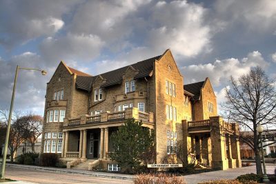
National Historic Site · 1911–1912Government House12845, 102 AvenuePhoto: WinterforceMedia WinterE229 · Public domain · Commons file
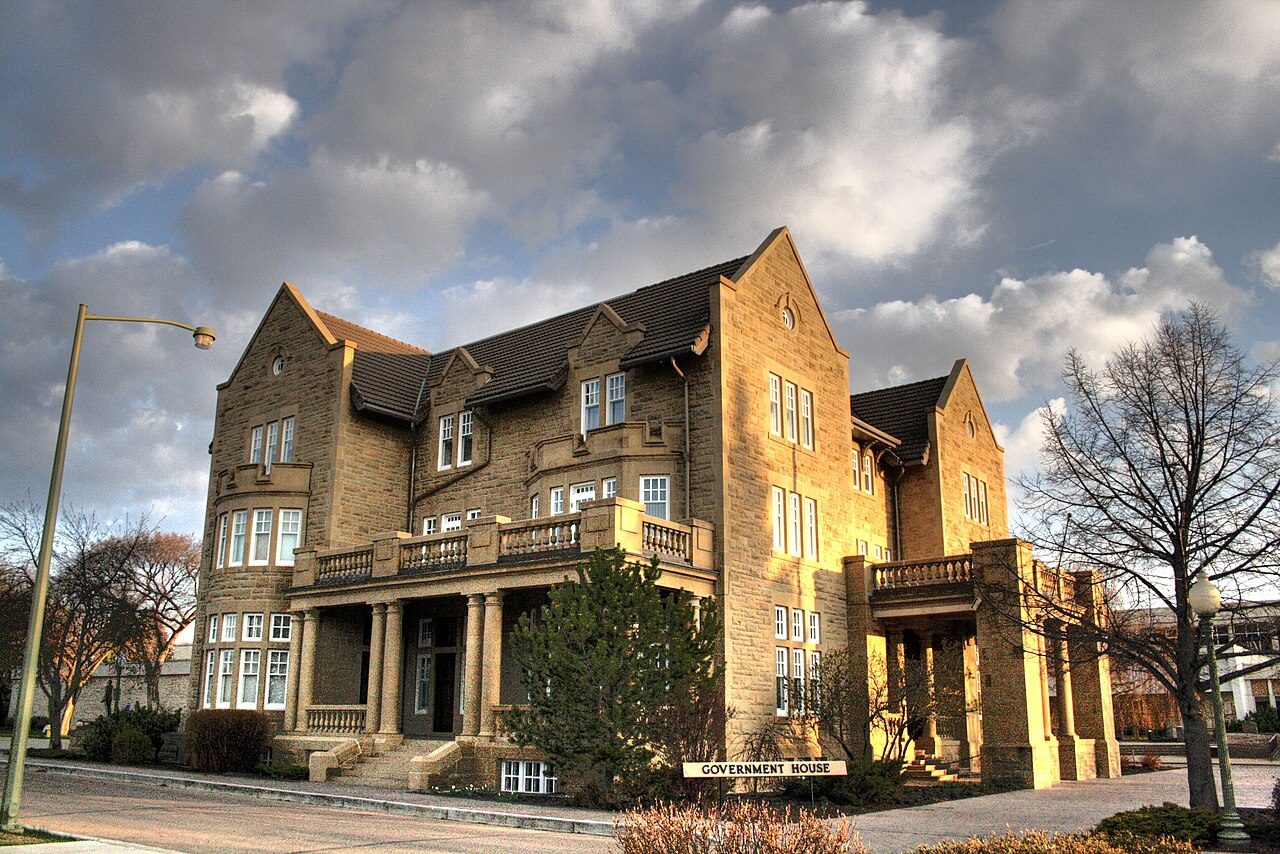 Government House · Photo: WinterforceMedia WinterE229 · Public domain
1historic place on the registers
History of Glenora · Canada’s heritage registers
47% of Glenora’s homes were built before 1961
Glenora has 2.7 times what the typical town has (18%). Its 1 historic place is of the highest rank. Measured against its size, 1.6 per 10,000 residents puts it ahead of 84% of Canadian towns. It is Government House, a national historic site begun in 1911.
Historic places
1
1.6 per 10,000 residents
Highest designations
1
National Historic Sites and Classified Federal Heritage Buildings
Oldest building
1911
the first construction date on its record
Homes built before 1961
47%
typical town: 18%
The map
Where Glenora’s history is
Every place on the registers inside the town, by its designation.
Highest designations
Tap any dot to open that place’s own page; hovering shows its name.
The 1, by tier
1 Highest designations
What the map shows is the open record: the federal directory in full, and from provincial or municipal lists only the places Wikidata ties to an encyclopedia article.
Points from Wikidata (Parks Canada’s files carry none) and from Québec’s register, as mapped there.
Highest designations
The highest rank in Glenora: one place
National Historic Sites and Classified Federal Heritage Buildings, Canada’s highest federal recognition. Each one opens its own page.
Around the town
The registers find 14 places within 5 km of Glenora
The nearest is Robertson-Wesley United Church, 1.9 km away in Wîhkwêntôwin. By age, Old Scona Academic High School leads, from 1908, at 4.8 km. Between them, 6 towns share them, mainly Downtown, Wîhkwêntôwin and Strathcona.
The 12 nearest, within 5 km
| Robertson-Wesley United ChurchMunicipal historic resource · 1971 · 1.9 km away, in Wîhkwêntôwin |
| Rutherford HouseProvincial historic resource · 1911 · 3.3 km away, in Garneau |
| High Level BridgeMunicipal historic resource · 3.7 km away, in Wîhkwêntôwin |
| Alberta Aviation MuseumMunicipal historic resource · 1942 · 3.9 km away, in Sherbrooke |
| Victoria ArmouryProvincial historic resource · 4 km away, in Downtown |
| First Presbyterian ChurchMunicipal historic resource · 1912 · 4.1 km away, in Downtown |
| McKay Avenue SchoolMunicipal historic resource · 4.2 km away, in Downtown |
| Hudson's Bay Company StablesMunicipal historic resource · 1914 · 4.5 km away, in Downtown |
| Rossdale Power PlantProvincial historic resource · 4.5 km away, in Downtown |
| J. J. Duggan ResidenceMunicipal historic resource · 4.7 km away, in Strathcona |
| McLeod BuildingMunicipal historic resource · 1915 · 4.8 km away, in Downtown |
| Old Scona Academic High SchoolProvincial historic resource · 1908 · 4.8 km away, in Strathcona |
Homes by age
12% of Glenora’s homes are from 2016 to 2021 (4.1% is typical)
Homes built from 2001 to 2015 make up just 12% of Glenora’s, against 15% in the typical town. Glenora built little from 1981 to 2000: 7.4% of its homes, where most towns have 23%. Few of Glenora’s homes date from 1961 to 1980: 20%, the norm 27%.
47%
Before 1961
20%
1961–80
7.4%
1981–2000
12%
2001–15
12%
2016–21
GlenoraTypical town
2021 Census, private dwellings by period of construction (Statistics Canada); the typical town is the middle Canadian town of 2,500 or more.
Towns its size
Glenora has the 2nd most of 16 towns its size
Towns of 6,200 to 6,200 residents, by places on the registers.
Glenora1
Only Grosvenor Park has more. The typical town its size has 0. For 10, the registers list nothing.
Neighbours
Glenora and its neighbours
| Town | People | Places | Highest | Oldest |
|---|---|---|---|---|
| Glenora | 6,197 | 1 | 1 | 1911 |
| North Glenora | 3,693 | 0 | 0 | — |
| West Jasper Place | 3,427 | 0 | 0 | — |
| Westmount | 4,961 | 0 | 0 | — |
| Canora | 4,799 | 0 | 0 | — |
| Parkview | 5,729 | 0 | 0 | — |
| Jasper Park | 3,219 | 0 | 0 | — |
In brief
Glenora in brief
In Glenora, 47% of homes were built before 1961, against 18% in the typical town. The lists come to 1 historic place, one with the highest designation, including Government House. Just one town of its size, out of 16, has more historic places. For the rest, its designation dates from 2012.
How to read these numbers
What this data can and can’t tell you
- The grade. There is no history grade: the page sets out the record and compares it with other towns.
- People and events. Parks Canada’s open file gives its national historic persons no place. A town’s page names one only when the person was born there (matched by name and both life years) or one of its own historic places carries the name and its record speaks of them; national historic events stay off.
- Protection. National historic designation honours a place but binds only federal owners; a private building’s protection depends on its province or municipality.
- Provincial and municipal lists. Provincial and municipal listings here come from Wikidata alone, since the provinces’ own registers can’t be reused; a listing needs an encyclopedia article to get a page.
- The tiers. Tiers follow the designation: national recognition and classement first, other federal designations next, provincial and local listings last.
- The federal register. Every federal designation is in Parks Canada’s directory, and the Canadian Register of Historic Places gives most of them a bilingual statement of significance.
- Map points. Where a federal place sits on the map is Wikidata’s placing; the directory itself has no coordinates.
Questions about Glenora’s history
How old are the homes in Glenora?
47% predate 1961, where the typical town has 18%.
Which places in Glenora have the highest designation?
Just one: Government House.
What is the oldest building in Glenora?
Government House, a National Historic Site, begun in 1911.
Why might a heritage building in Glenora be missing here?
Only federal designations are fully open outside Québec. 2 more listings in Glenora are known through Wikidata alone, so they are counted, not paged.
Contains information licensed under the Open Government Licence – Canada (Parks Canada).
Sources: Parks Canada, Directory of Federal Heritage Designations · Canadian Register of Historic Places (federal extract) · Wikidata (CC0) for map points, other names and articles · Statistics Canada, 2021 Census (homes by period of construction). Under the Statistics Canada Open Licence.
Adapted from Statistics Canada (Census of Population 2021, population estimates 2025, 2021 census boundaries) under the Statistics Canada Open Licence; this does not constitute an endorsement by Statistics Canada. Neighbourhood names in some cities © OpenStreetMap contributors (ODbL).