Guest, Sign inJoin

Post to Yuba City

We’ll email a one-tap link to publish your post. No password, and nothing is public until you click it.
Already a member? Sign in
C+History
History · Yuba City

Yuba City dates to 1849

More historic than 41% of U.S. towns · #213 of 847 in California. What drives it

Most of Yuba City was built recently: 5% of its homes predate 1940 and the median home dates from 1984. Below: 12 old photos and papers, maps from 1890 on, and the census since 1890.

1849founded
0on the National Register
5%homes built before 1940
12old photos & papers
25famous people
From Yuba City’s archive · credits on each photo
Quick answers

How Yuba City began

When was Yuba City founded?

1849

Yuba City dates its founding to 1849 (Wikidata). The census first counted it in 1890.

First census: 562 in 18902020 census: 70,117177 years

How historic is Yuba City?

C+

More historic than 41% of U.S. towns, on its age, its old homes and the National Register.

What drives the grade ↓
Founding year: Wikidata. First post office: 1851.The full story ↓
History grade

What drives Yuba City’s History grade

On its age, its old homes and the National Register, Yuba City is more historic than 41% of U.S. towns, #213 of 847 in California. Its age holds the grade up; its National Register listings pull it down.

C+
HistoryA character grade: shown, never part of Yuba City’s overall grade.
All U.S. towns we grade (21,289)Ahead of 41%
NewerOlder
California towns of 2,500+ (847)Ahead of 75%

Few California towns list much on the Register (a typical California town has 0.0 per 10,000 residents, the U.S. 2.4), so Yuba City’s 0.0 sits below most of its state (31% of California towns have fewer) while its 0 listings outnumber those of 23% of U.S. towns.

How sure. Graded on any two of the three inputs instead, the letter would range from C− to B−. The pre-1940 share (±1.2 points) is firm at this size. Two sources give 1849.

Founding year: Wikidata (other dates in Quick answers). Homes: Census ACS 2020–24. National Register: National Park Service, May 2026 list; each listing counted once (boundary changes and added documentation belong to their listing), and a historic district counts its contributing buildings. How TownRatings grades history →

What stands out about Yuba City’s past

Read from the archive, the National Register and the record. The page puts what stands out first.

★ What stands out · Places that used to be

Lost post offices, old corners and burying grounds

Yuba City’s post office has been open since 1851. Two other post offices opened and closed inside today’s town.

Yuba
1851–1851
Yuba City
1851–today
Terra Buena
1913–1918
18501940today
Hamlets and corners on the map
AlemandraBogueTierra BuenaYupu
1cemetery inside Yuba City
Yuba City

US Post Offices dataset (Blevins & Helbock, CC0). Places and cemeteries from the USGS Geographic Names Information System (2021).

By decade

Yuba City, decade by decade

4 decades in the archive, from the 1910s to the 1960s. Scroll each row; tap a photo for its story.

On the map

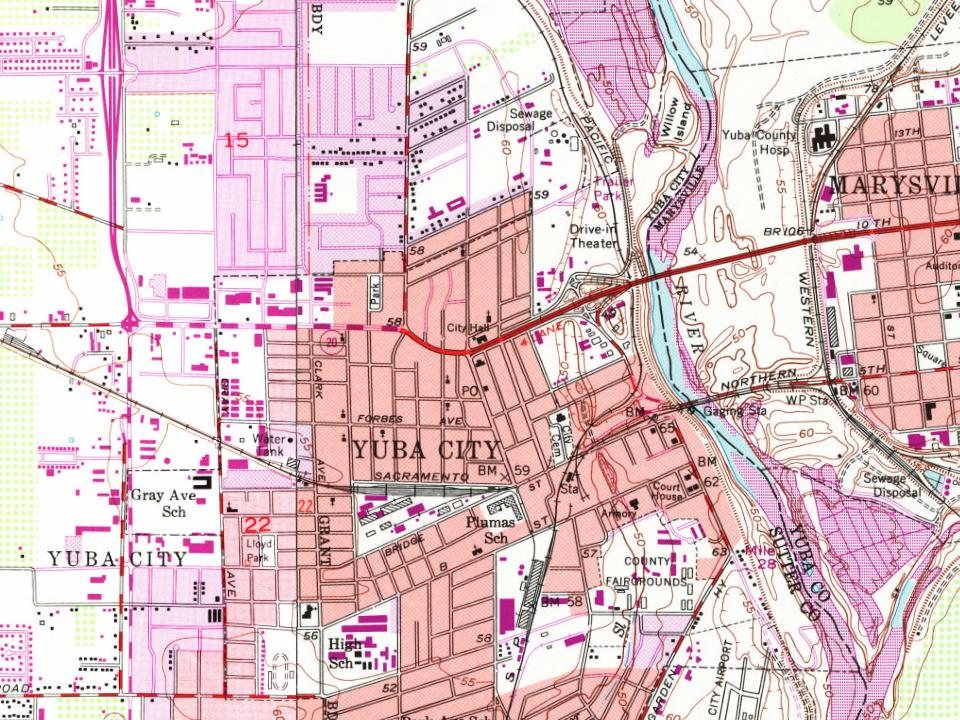
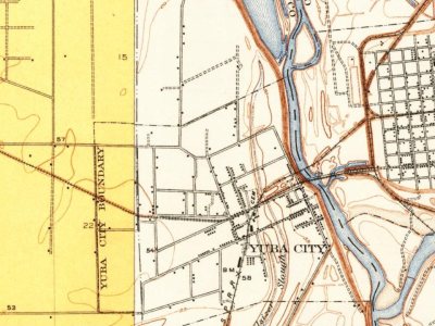
Yuba City on the map, 1911 to 1973

Every edition of the U.S. Geological Survey’s map of Yuba City. Tap a year, or press play to watch the town change.

Yuba City on the 1911 USGS mapYuba City on the 1952 USGS mapYuba City on the 1973 USGS map1911Yuba City sheet · 1:31,680

U.S. Geological Survey historical topographic maps (public domain), via Esri’s collection of the scans. The red ring marks the center of Yuba City.

The story

How Yuba City came to be

From Wikipedia’s history of Yuba City.

Read it all →

The Maidu people were settled in the region when they were first encountered by Spanish and Mexican scouting expeditions in the early 18th century. One version of the origin of the name "Yuba" is that during one of these expeditions, wild grapes were seen growing by a river, and so it was named "Uba", a variant spelling of the Spanish word uva (grape). On the map of the area made by Jean Jacques Vioget in 1841, a Maidu rancheria called Buba, noted in Stephen Powers' 1877 book The Tribes of California as the village of Yú-ba, was located at the present site of Yuba City.

Text from Wikipedia, licensed CC BY-SA 4.0.

Timeline

Yuba City, 1849 to 1986

Woven from the archive, old maps, post office records, the National Register and the people born here.

  1. 19th century
  2. 1849
    FoundingYuba City is established
  3. 1851Post officeThe Yuba post office opens
  4. 1851Post officeThe Yuba post office closes
  5. 1851Post officeThe Yuba City post office opens
  6. 1858Born hereJohn Joseph Montgomery is born here
  7. 20th century
  8. 1911On the mapFirst mapped by the U.S. Geological Survey
  9. 1913Post officeThe Terra Buena post office opens
  10. 1917In the archiveSinghYubaCity
  11. 1918Post officeThe Terra Buena post office closes
  12. 1935In the archiveYuba City, California. Aerial view of the Farm Security Administration camp for migratory…
  13. 1940In the archiveNear Yuba City, California. Children of migrant workers in Yuba City Agricultural Farm Wo…
  14. 1941Born hereCharlotte Stewart is born here
  15. 1960In the archive654 on Bridge st - Flickr - drewj1946
  16. 1985Born hereAdrian Molina is born here
  17. 1986Born hereKevin Bigley is born here
Every building

Yuba City, building by building, 1890–1909

Fire insurance maps drew every building, what it was made of and what it was used for, so insurers could price the risk of fire. Pick a year, then a sheet.

Yuba City fire insurance map, 1890, sheet 11890Sheet 1 of 3
Edition
BrickWoodStone

Sanborn Map Company, via the Library of Congress. Editions published in 1930 or earlier, which are in the public domain.

Then & now

Stand where they stood

No then-and-now pairs yet. Take a photo from the same spot as an old one and they appear here side by side.

SinghYubaCity
Retake this viewSinghYubaCity, 1917

Find the spot, match the angle, and add your photo. It becomes the first then-and-now pair on Yuba City’s page.

Retake this view · +15
People over time

Yuba City, census by census

05,00010,00015,00020,00025,00030,00035,00040,00045,00050,00055,00060,00065,00070,00075,000190019201940196019802000202070,117

Grew from 562 people in 1890 to 70,117 in 2020, more than tenfold.

13 censuses, 1890–2020.

U.S. Census Bureau decennial counts, from the census table on Yuba City’s Wikipedia page.

Famous people

25 famous people were born in Yuba City

Writers, athletes, leaders and more, ranked by how widely they’re known.

See all →
Help out

Finish Yuba City’s story

Most archives stop around 1920. The photos from after that are in family albums, not libraries.

Decades since 1900 with photos
00s10s20s30s40s50s60s70s80s90s
4 of 10 decades. The empty ones are waiting for someone’s album.

Questions about Yuba City’s history

What year was Yuba City founded?

In 1849, according to Wikidata. Yuba City’s post office opened in 1851, and the census of 1890 counted 562 people here.

How does Yuba City rank for history?

Yuba City is more historic than 41% of U.S. towns, #213 of 847 in California. The History grade combines the town’s founding era, the share of homes built before 1940 and its National Register listings. It’s a character grade, so it isn’t part of the overall grade. How it works.

How old are the homes in Yuba City?

5% of Yuba City’s homes were built before 1940 (Census estimate, ±1.2 points), against a typical 3.4% for a California town; the median home was built in 1984.

Memory lane

What the archives can’t tell you, neighbors can.

Town Square →
Start a conversation
Sources

Where this page comes from

Founding dates: Wikidata, Wikipedia, the U.S. post office records of Blevins & Helbock (CC0) and the Census. Homes by year built: Census ACS 2020–24. National Register of Historic Places: National Park Service (list of May 22, 2026). Old photos, postcards and papers: Wikimedia Commons, the Library of Congress and other public archives, credited on each item’s page. Maps: U.S. Geological Survey historical topographic maps (via Esri) and Sanborn fire-insurance maps (Library of Congress). History text and census tables: Wikipedia (CC BY-SA 4.0). Places that used to be: USGS Geographic Names Information System (2021).

From Wikimedia Commons (6), the Library of Congress (6), Wikipedia, Wikidata and Wikipedia for famous people, U.S. Geological Survey historical maps, U.S. Census counts (via Wikipedia), the US Post Offices dataset (Blevins & Helbock), the USGS Geographic Names Information System and Sanborn fire insurance maps (Library of Congress). Archive images are copied here with their credits and licenses, shown on each photo’s page. Refreshed monthly.