
San-Gorgonio-pass-wind-farm IMG 6704 060421 143600, 2006
Whitewater’s story
100 years in pictures
The archive holds 12 old photos and papers going back to 2006 and 5 maps from 1940 on.
- 1926Whitewater is settled
Each edition grades its towns against each other only.
A town of 1,181, settled in 1926.
The best of Whitewater’s subject grades is a B for the outdoors; the weakest is a D− for hazard risk. Whitewater’s July high is 101°F, where California’s towns sit at 89°F and U.S. towns at 85°F. Only 12 of California’s 1,063 towns score lower on walkability. Residents are less healthy than 91% of U.S. towns on CDC estimates. Whitewater’s trail density is 2.4 miles per square mile, against 1.0 in California’s towns and 0.4 across U.S. towns. Sand to Snow National Monument, at 1,044 acres with 7.4 miles of trail, is the biggest park or preserve. Whitewater has fewer than 2,500 residents, so it gets subject grades but no overall grade.
In a town this size, neighbors are the best guide. Ask them anything.
Each subject compared with towns across the country (schools within California), ordered by how far Whitewater is from typical.
How TownRatings grades towns →
The archive holds 12 old photos and papers going back to 2006 and 5 maps from 1940 on.
Museums, parks, gardens and other places to visit around Whitewater. Close and well known come first.
 Big draw14 mi National ParkJoshua Tree National Park2.9M visitors a year
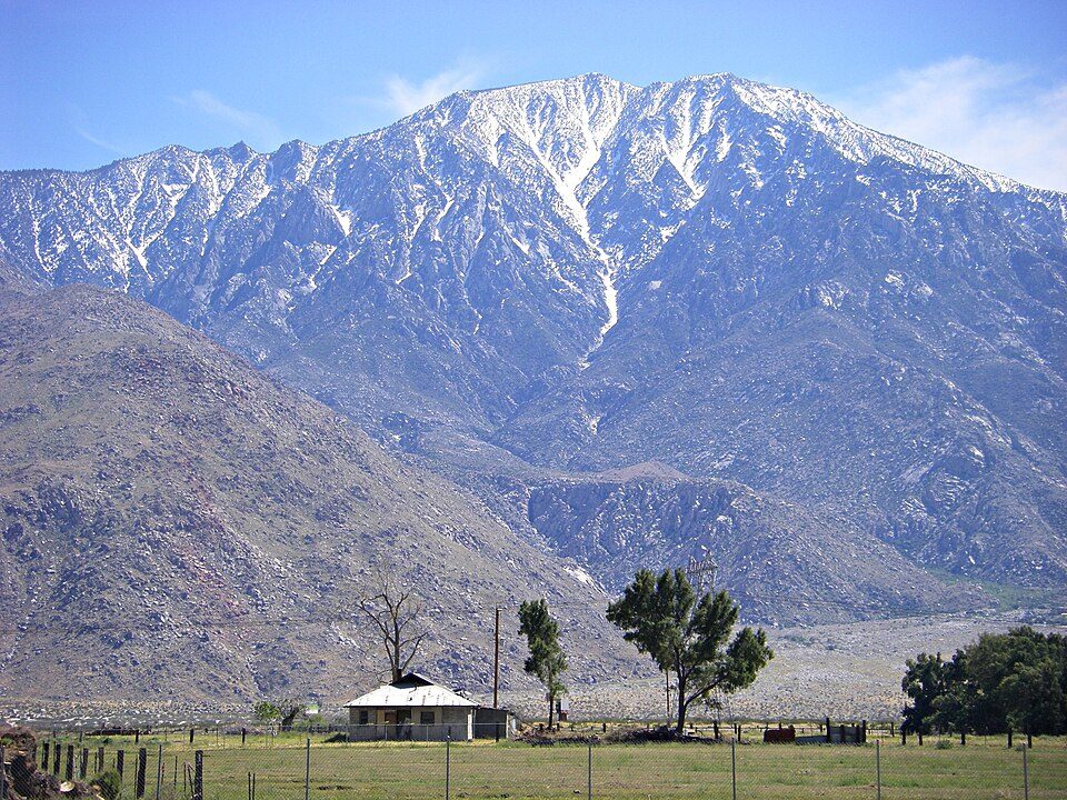 8 mi MountainSan Jacinto Peak
 14 mi MountainSan Gorgonio Mountain
 23 mi Stadium & arenaAcrisure Arena
 27 mi LakeBig Bear Lake16 mi LandmarkForest Lawn Cemetery
Joshua Tree National Park: Sergiy Galyonkin, CC BY-SA 4.0 · San Jacinto Peak: Wattewyl, CC BY 3.0 · San Gorgonio Mountain: Doc Searls, CC BY-SA 2.0 · Acrisure Arena: TheAHL, CC BY 2.0 · Big Bear Lake: H.G. Judd, CC BY-SA 3.0
Whitewater is unincorporated, so Riverside County and regional agencies provide most services.
EPA SDWIS (Oct 9, 2026) · HIFLD + EIA-861 2025 · Census 2020 ZCTAs · NCES 2024–25 · registration: vote.gov, updated Nov 18, 2024.
Ordered by what stands out in Whitewater.
The FEMA risk score in Whitewater is 100 of 100.
FEMA National Risk Index · OpenFEMA
43% of adults have obesity in Whitewater. Whitewater beats the California average on 0 of 32 CDC measures and trails it on 23. 15% of adults have diabetes in Whitewater.
| Whitewater | California towns | U.S. towns | |
|---|---|---|---|
| Fair or poor health (CDC PLACES) | 31% | 22% | 19% |
| Food insecurity (CDC PLACES) | 29% | 16% | 14% |
| Obesity (CDC PLACES) | 43% | 29% | 35% |
| Frequent physical distress (CDC PLACES) | 18% | 14% | 14% |
| What stands out | Whitewater | CA |
|---|---|---|
| More adults facing a utility shut-off | 12.8% | 7.3% |
| More older adults who have lost all their teeth | 18.2% | 10.6% |
| More adults facing food insecurity | 28.5% | 17.9% |
CDC PLACES 2025 · modeled estimates for adults · CMS · HRSA
Most working residents leave Whitewater for work: only 3% work in town. 23% of Whitewater residents live below the poverty line. The top destinations are Palm Springs (9%), Cathedral City (6%) and Beaumont (5%).
| Whitewater | California towns | U.S. towns | |
|---|---|---|---|
| Below the poverty line | 23% | 10% | 9.6% |
| Average trip to work | 34 minutes | 28 minutes | 25 minutes |
| Working residents who work in town | 3.1% | 6.6% | 8% |
| Median household income | $78,000 | $95,000 | $80,000 |
Census LEHD 2023 · ACS
| Biggest places to walk | Trails | Acres |
|---|---|---|
| 1. Sand to Snow National Monument | 7.4 mi | 1,044 |
Trails & parks © OpenStreetMap contributors · Conserved land: USGS PAD-US
Whitewater has warm winters and scorching summers, with very little rain. Whitewater’s January low is 41°F.
NOAA U.S. Climate Normals, 1991–2020
Zillow Home Value Index · Redfin Data Center
None within 15 miles of Whitewater; the nearest are
About 1 of every 100 Whitewater residents are enrolled in college, against 8 across California.
Where Whitewater’s working residents go each day. Line width shows the share.
Census LEHD 2023
Census-designated place in California, United States
Whitewater (formerly White Water) is a census-designated place in Riverside County, California. It is directly off Interstate 10 halfway between North Palm Springs and Cabazon on the way from Palm Springs to Los Angeles. It is known as the site of the San Gorgonio Pass Wind Farm. The ZIP Code is 92282, and the community is inside area code 760. The population was 984 at the 2020 census. The elevation is 1,575 feet (480 m). Whitewater is famous for its recently renovated trout farm in the canyon of the Whitewater River.
From Wikipedia, licensed CC BY-SA 4.0 · facts via Wikidata (CC0)
Short answers, built from the data on this page.
The typical home is worth about $299,000, 61% below the California typical home. Cost of living, which also weighs rents, property taxes and how many households pay 30% or more of their income for housing, grades B−.


