176 years in pictures
Census counts: 777 in 1860, 3,667 in 2020. The archive holds 18 old photos and papers going back to 1973 and 3 maps from 1950 on.
1 place on the National Register of Historic Places.
- 1850Weaverville is settled
Each edition grades its towns against each other only.

A town of 4,018, settled in 1850.
FEMA rates its natural-hazard risk higher than 97% of U.S. communities, with wildfire at the top. Overall it grades C, 430th among California's 841 graded towns. It is more walkable than 88% of U.S. towns and it has 36 miles of trail and 27% conserved land. Its weakest subject is incomes: the median household income is $66K, and 18% of residents live below the poverty line. 50% of working residents work locally in Weaverville, above both California’s towns (6.6%) and U.S. towns (8%). On history, just 51 of California’s 1,063 towns do better. The biggest park or preserve is Lowden Park, at 24 acres.
Where Weaverville beats most towns, and one thing worth knowing.
Each subject compared with towns across the country (schools within California), ordered by how far Weaverville is from typical.
Its grades run from A for walkability (better than 88% of comparable towns) to D− for hazard risk (better than 2%), so the C overall blends very different results.
How TownRatings grades towns →
Census counts: 777 in 1860, 3,667 in 2020. The archive holds 18 old photos and papers going back to 1973 and 3 maps from 1950 on.
1 place on the National Register of Historic Places.
Weaverville is unincorporated, so Trinity County and regional agencies provide most services.
EPA SDWIS (Oct 9, 2026) · HIFLD + EIA-861 2025 · Census 2020 ZCTAs · NCES 2024–25 · registration: vote.gov, updated Nov 18, 2024.
Ordered by what stands out in Weaverville.
Weaverville is healthier than towns with similar incomes, has hotter summers than nearly all U.S. towns and has home values still below their peak.
37 miles of trail in 3 parks and preserves. The trail density in Weaverville is 2.9 miles per square mile.
| Biggest places to walk | Trails | Acres |
|---|---|---|
| 1. Lowden Park | — | 24 |
| 2. Lee Fong Park Disc Golf Course | 0.2 mi | 9 |
| 3. Weaverville Joss House State Historic Park | — | 3 |
Trails & parks © OpenStreetMap contributors · Conserved land: USGS PAD-US
Its public schools are run by the Trinity Alps Unified school district. Two of its 7 schools are below, each with why it’s listed.
| School | Level | Students | Letter |
|---|---|---|---|
| Weaverville ElementaryLargest public elementary schoolGrades K–8 | Grades K–8 | 331 | B |
| Trinity HighLargest public high schoolGrades 9–12 | Grades 9–12 | 289 | B |
NCES · EDFacts · graded within CA on state tests and graduation
The typical value, about $284K, is 10% below its June 2022 peak. At about $284K, home values are down 7% in five years, against a rise of 13% across California.
The typical Weaverville home is worth about $284,000, up 1.3% in a year, 63% below the California typical home. Weaverville’s median rent is $1,056 a month.
| Weaverville | California towns | U.S. towns | |
|---|---|---|---|
| Median rent | $1,056 a month | $1,898 a month | $1,185 a month |
| Households that own their home | 75% | 64% | 73% |
Census ACS, 2020–24 · Zillow Home Value Index · Redfin Data Center
FEMA National Risk Index · OpenFEMA
July afternoons average 94.5°, hotter than in 95% of U.S. towns; January nights average 33°.
Weaverville has mild winters and hot summers. About 9 inches of snow falls in a winter.
| Weaverville | California towns | U.S. towns | |
|---|---|---|---|
| July high | 95°F | 89°F | 85°F |
| January low | 33°F | 41°F | 22°F |
NOAA U.S. Climate Normals, 1991–2020
The average commute for its 997 working residents takes 15.8 minutes, against 28.7 across California.
Since 2013, Weaverville has lost 103 jobs, to 1,479 in 2023. The top destinations are Redding (6%), Sacramento (2%) and Lewiston (2%). Half commute less than 3 miles.
| Weaverville | California towns | U.S. towns | |
|---|---|---|---|
| Average trip to work | 16 minutes | 28 minutes | 25 minutes |
| Median household income | $66,000 | $95,000 | $80,000 |
Census LEHD 2023 · ACS
Against the 10,065 U.S. towns with household incomes like Weaverville’s, it is healthier than 72%, so its B− isn’t only a matter of income.
Weaverville beats the California average on 8 of 32 CDC measures and trails it on 9. 26% of adults have been diagnosed with depression in Weaverville.
| Weaverville | California towns | U.S. towns | |
|---|---|---|---|
| Depression (CDC PLACES) | 26% | 22% | 23% |
| Yearly checkup (CDC PLACES) | 74% | 72% | 79% |
| Frequent physical distress (CDC PLACES) | 15% | 14% | 14% |
| High blood pressure (CDC PLACES) | 36% | 31% | 35% |
| What stands out | Weaverville | CA |
|---|---|---|
| Fewer uninsured adults | 5.7% | 10.6% |
| Fewer adults facing food insecurity | 12.6% | 17.9% |
| More adults who have had cancer | 10.1% | 6.4% |
CDC PLACES 2025 · modeled estimates for adults · CMS · HRSA
Museums, parks, gardens and other places to visit around Weaverville. Close and well known come first.
in town National forestShasta–Trinity National Forest
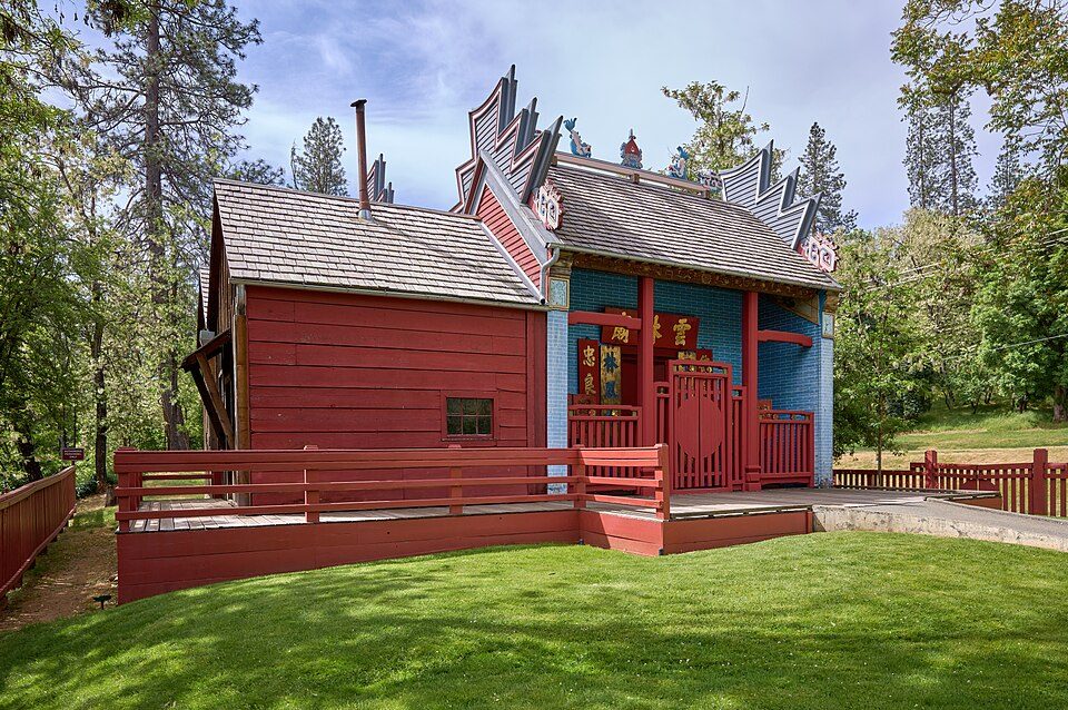
in town MuseumWeaverville Joss House State Historic Park
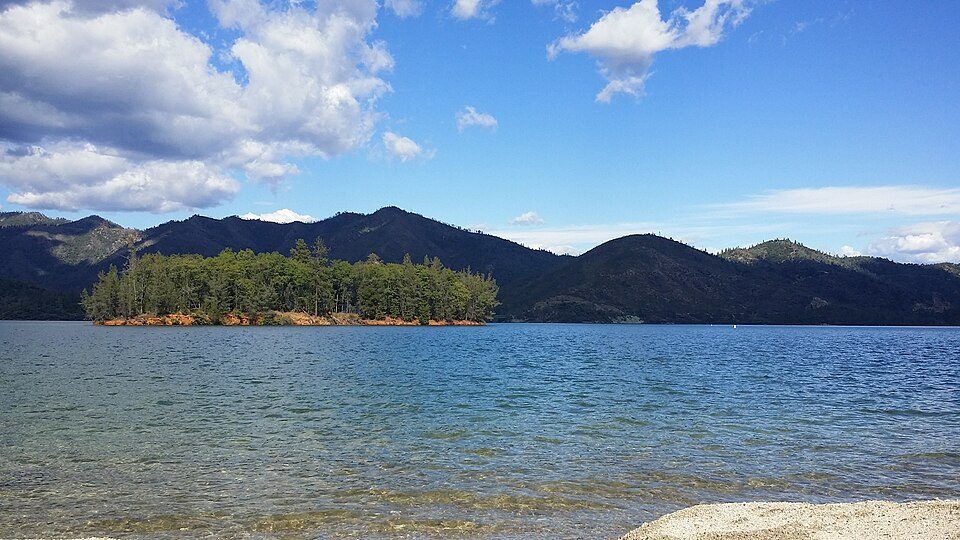
14 mi National Recreation AreaWhiskeytown-Shasta-Trinity National Recreation Area764K visitors a year
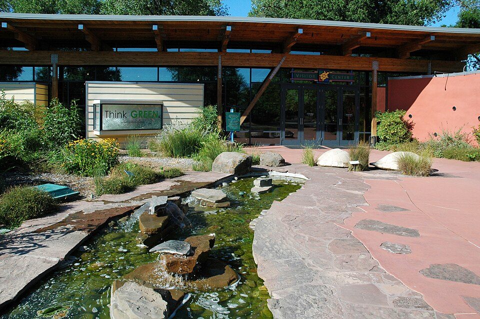
31 mi MuseumTurtle Bay Exploration Park
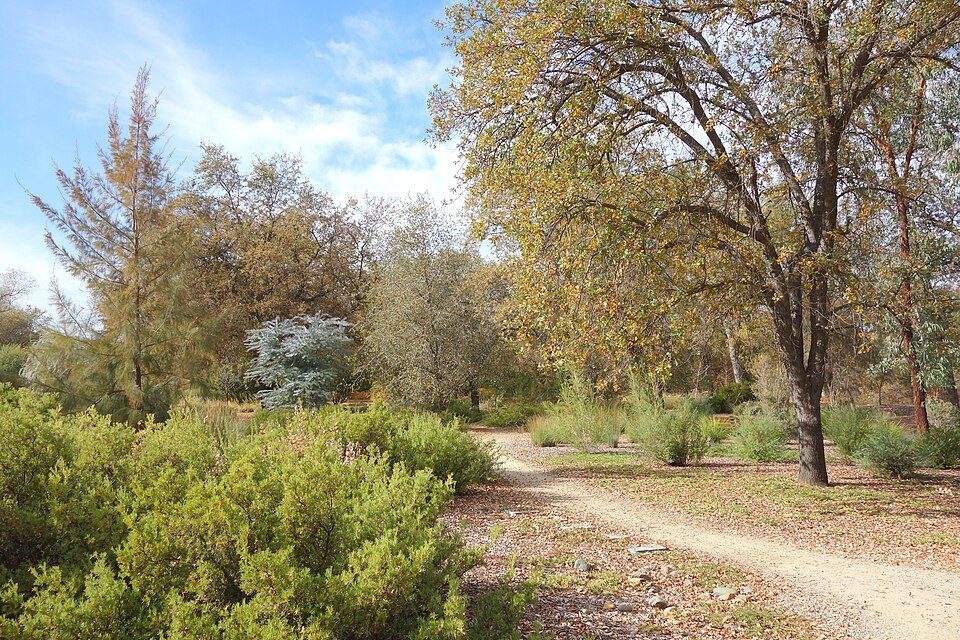
30 mi TheatreCascade Theatre
30 mi GardenMcConnell Arboretum & Botanical GardensShasta–Trinity National Forest: Unknown, CC BY-SA 3.0 · Weaverville Joss House State Historic Park: Frank Schulenburg, CC BY-SA 4.0 · Whiskeytown-Shasta-Trinity National Recreation Area: RoyalMayfair, CC BY-SA 4.0 · Turtle Bay Exploration Park: DimiTalen, CC BY-SA 3.0 · Cascade Theatre: Publichall, CC BY-SA 3.0 · McConnell Arboretum & Botanical Gardens: Daderot, CC0
None within 15 miles of Weaverville; the nearest are
About 3 of every 100 Weaverville residents are enrolled in college, against 8 across California.
Census-designated place in California, United States
Weaverville (Chimariko: Ho'raqtu) is a census-designated place in and the county seat of Trinity County, California, United States. Its population is 3,667 as of the 2020 census, up from 3,600 from the 2010 census.
From Wikipedia, licensed CC BY-SA 4.0 · facts via Wikidata (CC0)
One town shares a border with Weaverville.
| Town | CA rank | Overall | Cost | Safety | Schools | Health |
|---|---|---|---|---|---|---|
| Weaverville | #430 | C | C− | — | B+ | B− |
| Douglas City | — | — | C− | — | A+ | D |
Douglas City has fewer than 2,500 residents, so it gets subject grades but no overall grade. Weaverville and Douglas City report no FBI crime data of their own. Compare Weaverville with a neighbor →
Short answers, built from the data on this page.
Weaverville grades C overall, better than 26% of U.S. towns and #430 of 841 in California. It grades B− for health and B+ for schools. Hazard risk is its weak spot, with a D−.
Yes. That is 5.4 years of the area's median household income ($53,002 across the county). Cost of living, which also weighs rents, property taxes and how many households pay 30% or more of their income for housing, grades C−.