Half of Vandenberg AFB’s homes were built after 2001
More historic than 9% of U.S. towns · #718 of 847 in California. What drives it
Most of Vandenberg AFB was built recently: 0.5% of its homes predate 1940 and the median home dates from 2001. Below: 11 old photos and papers, maps from 1947 on, and the census since 1970.
On its age, its old homes and the National Register, Vandenberg AFB is more historic than 9% of U.S. towns, #718 of 847 in California. Its National Register listings hold the grade up; its share of homes from before 1940 pulls it down.
D
HistoryA character grade: shown, never part of Vandenberg AFB’s overall grade.
Few California towns list much on the Register (a typical California town has 0.0 per 10,000 residents, the U.S. 2.4), so Vandenberg AFB’s 0.0 sits below most of its state (31% of California towns have fewer) while its 0 listings outnumber those of 23% of U.S. towns.
How sure. Graded on two of the three inputs, so a change in either one moves the letter more than it would with three. The pre-1940 share (±0.8 points) is firm at this size.
Founding year: our sources. Homes: Census ACS 2020–24. National Register: National Park Service, May 2026 list; each listing counted once (boundary changes and added documentation belong to their listing), and a historic district counts its contributing buildings. How TownRatings grades history →
In 1941, just before the United States entered World War II, the United States Army embarked on an initiative to acquire lands in the United States to be used to train infantry and armored forces. These areas needed to be of a varied nature to ensure relevant training. In March 1941, the Army identified approximately 86,000 acres (35,000 ha) of open ranch lands along the Central Coast of California between Lompoc and Santa Maria. With its flat plateau, surrounding hills, numerous canyons, and relative remoteness from populated areas, the Army was convinced this portion of the Gaviota Coast was an ideal training location. The government purchased most of the land, however, some smaller parcels were obtained either by lease, license, or as easements. The land was previously part of six ranchos: Casmalia, Guadalupe, Mission de la Purisima, Rancho Lompoc and Rancho Todos Santos y San Antoni…
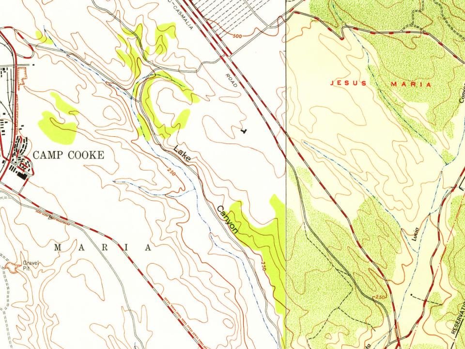
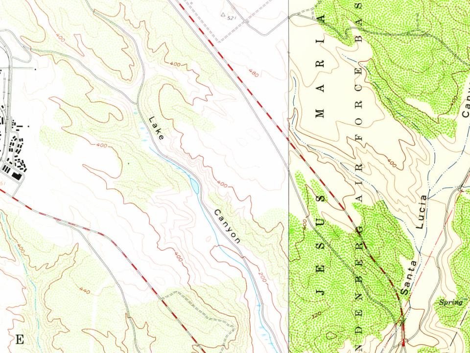
Every edition of the U.S. Geological Survey’s map of Vandenberg AFB. Tap a year, or press play to watch the town change.
1947Surf sheet · 1:24,000
U.S. Geological Survey historical topographic maps (public domain), via Esri’s collection of the scans. The red ring marks the center of Vandenberg AFB.
Then & now
Stand where they stood
No then-and-now pairs yet. Take a photo from the same spot as an old one and they appear here side by side.
Retake this viewPhilip St. George Cooke, c. 1860
Find the spot, match the angle, and add your photo. It becomes the first then-and-now pair on Vandenberg AFB’s page.
Vandenberg AFB is more historic than 9% of U.S. towns, #718 of 847 in California. The History grade combines the town’s founding era, the share of homes built before 1940 and its National Register listings. It’s a character grade, so it isn’t part of the overall grade. How it works.
How old are the homes in Vandenberg AFB?
0.5% of Vandenberg AFB’s homes were built before 1940 (Census estimate), against a typical 3.4% for a California town; the median home was built in 2001.
Founding dates: Wikidata, Wikipedia, the U.S. post office records of Blevins & Helbock (CC0) and the Census. Homes by year built: Census ACS 2020–24. National Register of Historic Places: National Park Service (list of May 22, 2026). Old photos, postcards and papers: Wikimedia Commons, the Library of Congress and other public archives, credited on each item’s page. Maps: U.S. Geological Survey historical topographic maps (via Esri) and Sanborn fire-insurance maps (Library of Congress). History text and census tables: Wikipedia (CC BY-SA 4.0). Places that used to be: USGS Geographic Names Information System (2021).
From Wikimedia Commons (19), Wikipedia, U.S. Geological Survey historical maps and U.S. Census counts (via Wikipedia). Archive images are copied here with their credits and licenses, shown on each photo’s page. Refreshed monthly.




 c. 1980
 1981
 1986
 1996
 1998
 2012
 2012
 2012
 2012
 2012
 2011
 2011
 2004