Shafter’s post office opened in 1898, and 3 of its places are on the National Register
More historic than 54% of U.S. towns · #135 of 847 in California. What drives it
Most of Shafter was built recently: 8% of its homes predate 1940 and the median home dates from 1993. 3 places in town are on the National Register, among them a historic district with 5 buildings. Below: 17 old photos and papers, maps from 1926 on, and the census since 1940.
Founding year: the first Shafter post office (Blevins & Helbock, CC0). Wikidata: 1938.The full story ↓
History grade
What drives Shafter’s History grade
On its age, its old homes and the National Register, Shafter is more historic than 54% of U.S. towns, #135 of 847 in California. Its National Register listings hold the grade up; its age pulls it down.
B−
HistoryA character grade: shown, never part of Shafter’s overall grade.
Few California towns list much on the Register (a typical California town has 0.0 per 10,000 residents, the U.S. 2.4), so Shafter’s 3.3 sits above most of its state (85% of California towns have fewer) while its 7 historic buildings outnumber those of 73% of U.S. towns.
How sure. Graded on any two of the three inputs instead, the letter would range from C to B+. The pre-1940 share is a Census survey estimate (±3.7 points). The founding year is the first post office, not a stated founding date; Wikidata gives 1938.
Founding year: the first post office (other dates in Quick answers). Homes: Census ACS 2020–24. National Register: National Park Service, May 2026 list; each listing counted once (boundary changes and added documentation belong to their listing), and a historic district counts its contributing buildings. How TownRatings grades history →
What stands out about Shafter’s past
Read from the archive, the National Register and the record. The page puts what stands out first.
Nothing in the archives for these yearsWeddings on Main Street, storms, parades, school pictures, the old store. If it’s in your family album, it belongs here.
Nothing in the archives for these yearsWeddings on Main Street, storms, parades, school pictures, the old store. If it’s in your family album, it belongs here.
The city of Shafter began as a loading dock along the Santa Fe Railroad (former San Francisco and San Joaquin Valley Railroad) right-of-way. The community was named for General William Rufus Shafter who commanded US Forces in Cuba during the Spanish–American War. Property was sold beginning in 1914 and the city incorporated on January 11, 1938.
The first post office opened in 1898, moved in 1902, closed in 1905. A new postal service started in 1914.
Passages that mention Shafter, cut from the printed page as they were published.
History of Kern County California1914 · page 185Read the page →
Read the text
Other centers of farming development in the valley hardly ranking as towns are Rio Bravo, which is only a neighborhood of pioneer pump irrigators about fifteen miles west of Bakersfield; Button Willow, which is a shipping point and headquarters for the Miller & Lux ranches; Shafter, where the Kern County Land Company is just opening a townsite in connection with a subdivision of 7000 acres now being placed on the market ; Rosedale, which was founded as the community center of Rosedale colony in 1889 and which is now holding its own with a country store, a school
Text read by machine from the scan; it may contain errors.
History of Kern County, California, with biographical sketches of the leading men and women of the county who have been identified with its growth and development from the early days to the present1914 · page 150Read the page →
Read the text
great belt of mesa land that stretches south and southeast from Edison, around Delano and all along the high sloping lands to the east and southeast of that place. At Rio Bravo the same progress is being made, and the new colonies of Shafter and Lerdo are laying good foundations for a similar success. Pumping Plant Extension in 1912 The Lerdo colony was founded in 1912 by a corporation controlled by the same men who are the dominant factors in the San Joaquin Light & ' Power Corporation, and one of the purposes in mind was to furnish a market
Text read by machine from the scan; it may contain errors.
Scans and text from the Internet Archive. Books published in 1930 or earlier, which are in the public domain.
Timeline
Shafter, 1898 to 1963
Woven from the archive, old maps, post office records, the National Register and the people born here.
The Shafter post office opened in 1898, the earliest record of the town by name (U.S. post office records). Wikidata gives 1938.
How does Shafter rank for history?
Shafter is more historic than 54% of U.S. towns, #135 of 847 in California. The History grade combines the town’s founding era, the share of homes built before 1940 and its National Register listings. It’s a character grade, so it isn’t part of the overall grade. How it works.
What is on the National Register in Shafter?
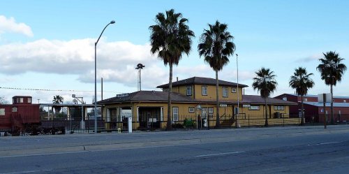
Three places: the Santa Fe Passenger and Freight Depot (listed 1982), the Green Hotel (1989) and the Shafter Research Station (1997).
How old are the homes in Shafter?
8% of Shafter’s homes were built before 1940 (Census estimate, ±3.7 points), against a typical 3.4% for a California town; the median home was built in 1993.
Founding dates: Wikidata, Wikipedia, the U.S. post office records of Blevins & Helbock (CC0) and the Census. Homes by year built: Census ACS 2020–24. National Register of Historic Places: National Park Service (list of May 22, 2026). Old photos, postcards and papers: Wikimedia Commons, the Library of Congress and other public archives, credited on each item’s page. Maps: U.S. Geological Survey historical topographic maps (via Esri) and Sanborn fire-insurance maps (Library of Congress). History text and census tables: Wikipedia (CC BY-SA 4.0). Places that used to be: USGS Geographic Names Information System (2021).
From Wikimedia Commons (3), the Library of Congress (14), the National Register of Historic Places (3), Wikipedia, Wikidata and Wikipedia for famous people, U.S. Geological Survey historical maps, U.S. Census counts (via Wikipedia), the US Post Offices dataset (Blevins & Helbock), the USGS Geographic Names Information System, Sanborn fire insurance maps (Library of Congress) and old county and town histories (Internet Archive). Archive images are copied here with their credits and licenses, shown on each photo’s page. Refreshed monthly.

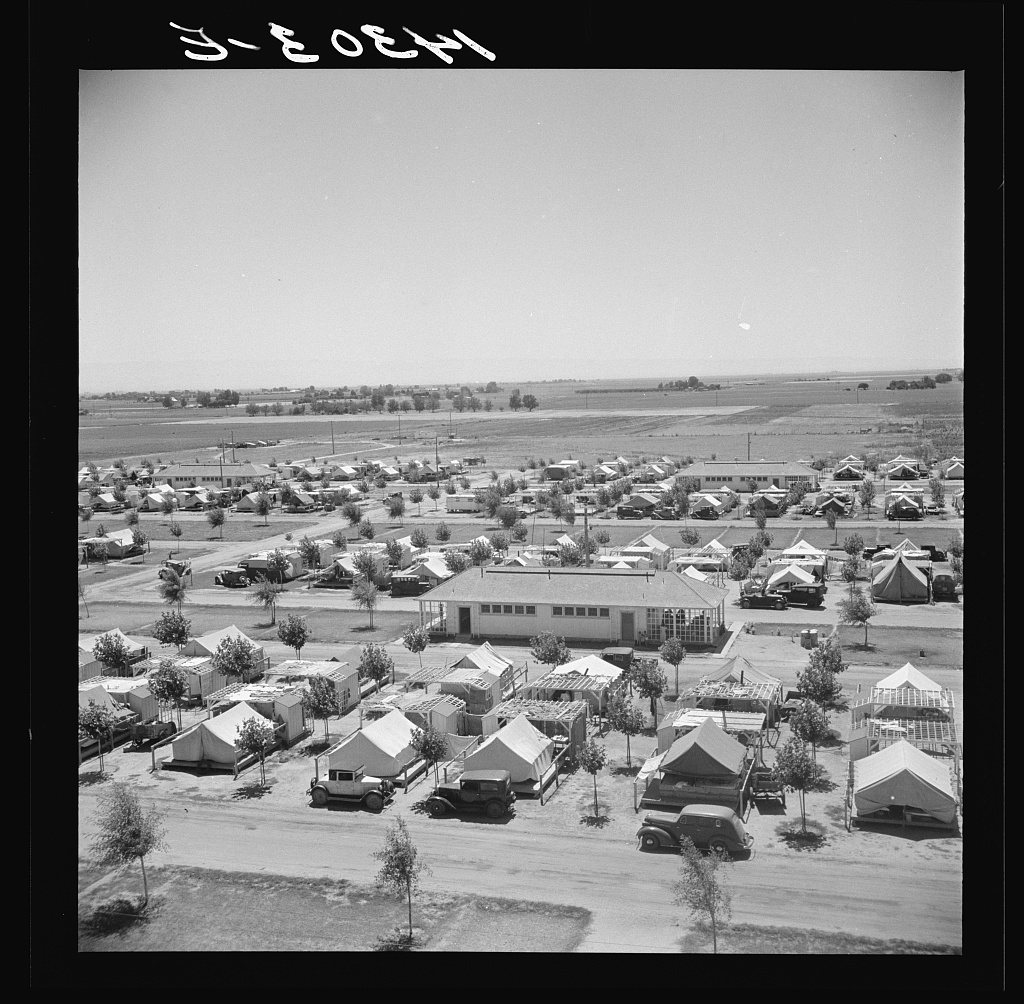


 1899
 1937
 1937
 1938
 1938
 1938
 1938
 1938
 1938
 1938
 1938
 1938
 1938
 1939
 1940
 1940
 1940