Santa Rosa ValleyCA
In California, this town has 2,780 residents.
What should you know before moving to Santa Rosa Valley?
The picture is mixed. Its weakest subject is cost of living (D−) — the typical home is worth about $1.7 million, 15.5 years of the Oxnard metro’s $110K median household income. Taken together, its subjects give Santa Rosa Valley a C+ overall, better than 44% of U.S. towns. In the ranking it comes 250th of 841 in California. Where it does best is health (A): CDC estimates put its residents' health ahead of 94% of the country. Add incomes to its strengths: the median household earns $214K. The town’s rent at the middle of the market is $2,846 a month, against $1,895 a month in California’s towns and $1,185 a month across U.S. towns. Only 89 of California’s 1,063 towns score lower on walkability.
Figures: health, CDC PLACES · incomes, Census ACS, 2020–24 · home values, Zillow.
What makes Santa Rosa Valley stand out
Where Santa Rosa Valley beats most towns, and one thing worth knowing.
97% of working residents leave Santa Rosa Valley for work
Where Santa Rosa Valley’s working residents go each day. Line width shows the share.
Census LEHD 2023
How Santa Rosa Valley grades
Each subject compared with towns across the country (schools within California), ordered by how far Santa Rosa Valley is from typical.
How TownRatings grades towns →
Hollywood Walk of Fame and 146 more within 40 miles
Museums, parks, gardens and other places to visit around Santa Rosa Valley. Close and well known come first.
 Big draw33 mi LandmarkHollywood Walk of Fame10.0M visitors a year
 Big draw38 mi Stadium & arenaSoFi Stadium
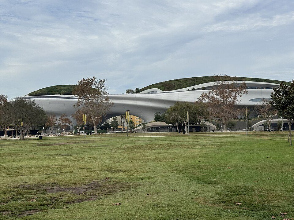 Big draw38 mi MuseumLucas Museum of Narrative Art
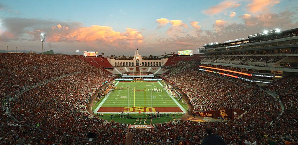 Big draw39 mi Stadium & arenaLos Angeles Memorial Coliseum
 Big draw34 mi LandmarkHollywood Sign
 Big draw34 mi MuseumLa Brea Tar Pits
Photo credits
Hollywood Walk of Fame: BenSherman, Public domain · SoFi Stadium: Thank You (21 Millions+) views, CC BY 2.0 · Lucas Museum of Narrative Art: Kriddl, CC0 · Los Angeles Memorial Coliseum: CanonStarGal, CC BY-SA 4.0 · Hollywood Sign: Thomas Wolf, www.foto-tw.de, CC BY-SA 3.0 · La Brea Tar Pits: Daniel Schwen, CC BY-SA 2.5


Moving to Santa Rosa Valley: who provides what
Santa Rosa Valley is unincorporated, so Ventura County and regional agencies provide most services.
EPA SDWIS (Oct 9, 2026) · HIFLD + EIA-861 2025 · Census 2020 ZCTAs · NCES 2024–25 · registration: vote.gov, updated Nov 18, 2024.
The data
Ordered by what stands out in Santa Rosa Valley.
Santa Rosa Valley has milder winter nights than nearly all U.S. towns and sends most of its workers to Los Angeles and beyond, but it has homes that cost more against local pay than most of California.
0.5% of the land in Santa Rosa Valley is protected from building
In 3 parks and preserves, walkers have 18 miles of trail. The concentration of trails in Santa Rosa Valley is 2.5 miles per square mile. Parks and preserves here: 3, covering 22 acres.
| Santa Rosa Valley | California towns | U.S. towns | |
|---|---|---|---|
| Miles of trail per square mile | 2.5 miles per square mile | 1.0 | 0.4 |
| Conserved land | 0.5% | 4.3% | 4.3% |
| Biggest places to walk | Trails | Acres |
|---|---|---|
| 1. Mount Clef Ridge Open Space | 0.4 mi | 18 |
| 2. Wildwood Park | 0.1 mi | 3 |
| 3. McCrea Open Space | 0.1 mi | 1 |
Trails & parks © OpenStreetMap contributors · Conserved land: USGS PAD-US
On state tests, Santa Rosa Valley’s schools beat 68% of California districts
Public schools: the Pleasant Valley school district. Its one school is below. 450 students attend Santa Rosa Valley’s public school.
| School | Level | Students | Letter |
|---|---|---|---|
| Santa Rosa Technology MagnetLargest public elementary schoolGrades K–8 | Grades K–8 | 450 | A |
NCES · EDFacts · graded within CA on state tests and graduation
A smaller share of adults in Santa Rosa Valley feel lonely than in the typical California or U.S. town
Against the 803 U.S. towns with household incomes like Santa Rosa Valley’s, it is less healthy than 74%: its national edge comes with its incomes.
In Santa Rosa Valley, 15% of adults say their health is fair or poor. This California town does better than the California average on 19 of 32 CDC measures and worse on 3.
| Santa Rosa Valley | California towns | U.S. towns | |
|---|---|---|---|
| Obesity (CDC PLACES) | 22% | 29% | 35% |
| Feel lonely (CDC PLACES) | 29% | 36% | 33% |
| Sleep under 7 hours (CDC PLACES) | 29% | 35% | 36% |
| Frequent mental distress (CDC PLACES) | 14% | 17% | 17% |
| What stands out | Santa Rosa Valley | CA |
|---|---|---|
| Fewer uninsured adults | 3.9% | 10.6% |
| Fewer adults facing food insecurity | 6.7% | 17.9% |
| More adults who have had cancer | 10.9% | 6.4% |
CDC PLACES 2025 · modeled estimates for adults · CMS · HRSA
Top of a very high hazard risk in Santa Rosa Valley: inland flooding
Federal aid has come to Santa Rosa Valley households in 3 declared disasters; the latest was in 2022. Storm and flood damage is expected to run higher than in 93% of U.S. communities. FEMA puts 61% of the town’s expected hazard losses down to inland flooding, and 28% to earthquakes.
FEMA disaster declarations and aid · FEMA National Risk Index · OpenFEMA
Santa Rosa Valley stands out in California and nationally: a smaller share of its residents live below the poverty line
Santa Rosa Valley has 322 jobs for its 1,402 working residents: even if every job went to a resident, most would still commute out. 37.4% of workers work from home, against 17.2% across California.
The top destinations are Los Angeles (15%), Camarillo (12%) and Thousand Oaks (12%). Santa Rosa Valley’s typical journey to work stands at 32 minutes. Commuting out is the norm here: 3% of working residents work locally.
| Santa Rosa Valley | California towns | U.S. towns | |
|---|---|---|---|
| Median household income | $214,000 | $95,000 | $80,000 |
| Below the poverty line | 2.9% | 10% | 9.6% |
| Average trip to work | 32 minutes | 28 minutes | 25 minutes |
| Working residents who work in town | 3.5% | 6.6% | 8% |
Where working residents work
Census LEHD 2023 · ACS
Santa Rosa Valley has mild winters and pleasant summers
January nights average 43.9°, milder than in 96% of U.S. towns; July afternoons average 85°.
Snow is almost unheard of. In Santa Rosa Valley, the January low is 44°F.
| Santa Rosa Valley | California towns | U.S. towns | |
|---|---|---|---|
| January low | 44°F | 40°F | 22°F |
| July high | 85°F | 89°F | 85°F |
Typical low → high °F
NOAA U.S. Climate Normals, 1991–2020
A home in Santa Rosa Valley sells for about $1.87M at the median
At 15.5 years of the Oxnard metro’s $110K median household income, the typical home costs more against local pay than in 93% of California towns; that ratio is one input to its D− for cost of living.
97% of Santa Rosa Valley households own their home.
| Santa Rosa Valley | California towns | U.S. towns | |
|---|---|---|---|
| Median rent | $2,846 a month | $1,895 a month | $1,185 a month |
| Households that own their home | 97% | 64% | 73% |
Census ACS, 2020–24 · Zillow Home Value Index · Redfin Data Center
Everything we know about Santa Rosa Valley
Colleges nearby
3 within 15 miles of the center of Santa Rosa Valley
About 9 of every 100 Santa Rosa Valley residents are enrolled in college, about the same as California.
About Santa Rosa Valley
Place in California, United States
Santa Rosa Valley is a rural unincorporated community, named after the eponymous valley in which it lies, located in Ventura County, California, United States. For statistical purposes, the United States Census Bureau has defined Santa Rosa Valley as a census-designated place (CDP). The census definition of the area may not precisely correspond to local understanding of the area with the same name. The 2020 United States census reported Santa Rosa Valley's population was 3,312. Santa Rosa Valley sits at an elevation of 433 feet (132 m). It lies within Ventura County north of Newbury Park, between Thousand Oaks and Camarillo. Norwegian Grade, which was constructed by the Norwegian Colony, co…
From Wikipedia, licensed CC BY-SA 4.0 · facts via Wikidata (CC0)
- Area
- 6.9 sq mi
- Elevation
- 433 ft
Santa Rosa Valley’s neighbors
2 towns share a border with Santa Rosa Valley.
| Town | CA rank | Overall | Cost | Safety | Schools | Health |
|---|---|---|---|---|---|---|
| Santa Rosa Valley | #250 | C+ | D− | — | B+ | A |
| Thousand Oaks | #102 | B+ | D− | B | A | A |
| Moorpark | #79 | B+ | D− | B+ | A− | A |
Santa Rosa Valley reports no FBI crime data of its own. Compare Santa Rosa Valley with a neighbor →
Questions about Santa Rosa Valley
Short answers, built from the data on this page.
Is Santa Rosa Valley, CA a good place to live?
Santa Rosa Valley grades C+ overall, better than 44% of U.S. towns and #250 of 841 in California. It grades A for health and B+ for schools. Cost of living is its weak spot, with a D−.
Is Santa Rosa Valley, CA expensive?
Yes. The typical home is worth about $1,706,000, 124% above the California typical home. Cost of living, which also weighs rents, property taxes and how many households pay 30% or more of their income for housing, grades D−.