Santa Barbara dates to 1847, and 20% of its homes were built before 1940
More historic than 88% of U.S. towns · #9 of 847 in California. What drives it
19 places in town are on the National Register, among them 3 National Historic Landmarks and a historic district. Below: 22 old photos and papers, maps from 1886 on, and the census since 1880.
Founding year: Wikidata. First post office: 1850.The full story ↓
History grade
What drives Santa Barbara’s History grade
On its age, its old homes and the National Register, Santa Barbara is more historic than 88% of U.S. towns, #9 of 847 in California. All 3 inputs are above most U.S. towns; its National Register listings ranks highest and its share of homes from before 1940 lowest.
A
HistoryA character grade: shown, never part of Santa Barbara’s overall grade.
Few California towns list much on the Register (a typical California town has 0.0 per 10,000 residents, the U.S. 2.4), so Santa Barbara’s 3.0 sits above most of its state (84% of California towns have fewer) while its 26 historic buildings outnumber those of 81% of U.S. towns.
How sure. Graded on any two of the three inputs instead, the letter would range from A− to A. The pre-1940 share (±1.6 points) is firm at this size. Two sources give 1847.
Founding year: Wikidata (other dates in Quick answers). Homes: Census ACS 2020–24. National Register: National Park Service, May 2026 list; each listing counted once (boundary changes and added documentation belong to their listing), and a historic district counts its contributing buildings. How TownRatings grades history →
What stands out about Santa Barbara’s past
Read from the archive, the National Register and the record. The page puts what stands out first.
Nothing in the archives for these yearsWeddings on Main Street, storms, parades, school pictures, the old store. If it’s in your family album, it belongs here.
Fire insurance maps drew every building, what it was made of and what it was used for, so insurers could price the risk of fire. Pick a year, then a sheet.
Evidence of human habitation of the area begins at least 13,000 years ago. Evidence for a Paleoindian presence includes a fluted Clovis-like point found in the 1980s along the western Santa Barbara County coast, as well as the remains of Arlington Springs Man, found on Santa Rosa Island in the 1960s. At least 25,000 Chumash natives lived in the region prior to Spanish contact. Five Chumash villages flourished in the area. The present-day area of Santa Barbara City College was the village of Mispu; the site of the Los Baños pool (along west beach) was the village of Syukhtun, chief Yanonalit's large village located between Bath and Chapala streets; Amolomol was at the mouth of Mission Creek; and Swetete, above the bird refuge.
Passages that mention Santa Barbara, cut from the printed page as they were published.
History of Santa Barbara, San Luis Obispo and Ventura counties, California1917 · page 577Read the page →
Read the text
Santa Barbara Unit Brick and Tile Company. Founded in 1912, the Santa Barbara Unit Brick and Tile Company is the only business of its kind in Santa Barbara County devoted exclusively to the manufacture of artificial granite, limestone, sandstone, roof tile, plain and ornamental brick, and interior and lawn decorations. It is a company that has supplied an insistent local demand for the highest class of building material, and these materials have been constantly utilized since the opening of the plant in the construction of many of the notable private, business and
Text read by machine from the scan; it may contain errors.
History of Santa Barbara, San Luis Obispo and Ventura counties, California1917 · page 648Read the page →
Read the text
In 1872 there was made on the part of the Atlantic & Pacific Railroad Company an attempt to obtain from San Francisco and the southern counties of California a subsidy, efforts being specially made to obtain a donation from the County and Town of Santa Barbara. Mr. Richards maintained that it would be disastrous thus to saddle a burden of debt upon the community under conditions that gave no positive assurance that the proposed railroad line would be constructed, and his opposition to the cause was later fully justified by results. To oppose the project the
Text read by machine from the scan; it may contain errors.
Scans and text from the Internet Archive. Books published in 1930 or earlier, which are in the public domain.
Timeline
Santa Barbara, 1722 to 1984
Woven from the archive, old maps, post office records, the National Register and the people born here.
Every edition of the U.S. Geological Survey’s map of Santa Barbara. Tap a year, or press play to watch the town change.
1944Santa Barbara sheet · 1:31,680
U.S. Geological Survey historical topographic maps (public domain), via Esri’s collection of the scans. The red ring marks the center of Santa Barbara.
Then & now
Stand where they stood
No then-and-now pairs yet. Take a photo from the same spot as an old one and they appear here side by side.
Retake this viewDrawing of the presidio of early Santa Barbara, as seen in Alfred Robinson's "Life in California", ca.1839 (CHS-5760), c. 1839
Find the spot, match the angle, and add your photo. It becomes the first then-and-now pair on Santa Barbara’s page.
Santa Barbara’s post office has been open since 1850.
Hamlets and corners on the map
Mission
Gone or out of use
First Presbyterian ChurchchurchGuadalupe HallbuildingHoff General HospitalhospitalMarine Corps Air Station Santa BarbaramilitaryMesa Oil FieldoilfieldNeighborhood ChurchchurchPunta Del CastillobuildingSan Miguel ChurchchurchSanta Barbara PresidiolocaleSanta Barbara SanitariumhospitalTrinity Evangelical Lutheran ChurchchurchVega Marbuilding
1cemetery inside Santa Barbara
Calvary
US Post Offices dataset (Blevins & Helbock, CC0). Places and cemeteries from the USGS Geographic Names Information System (2021).
Help out
Finish Santa Barbara’s story
Most archives stop around 1920. The photos from after that are in family albums, not libraries.
Decades since 1900 with photos
00s10s20s30s40s50s60s70s80s90s
2 of 10 decades. The empty ones are waiting for someone’s album.
In 1847, according to Wikidata. Santa Barbara’s post office opened in 1850, and the census of 1880 counted 3,460 people here.
How does Santa Barbara rank for history?
Santa Barbara is more historic than 88% of U.S. towns, #9 of 847 in California. The History grade combines the town’s founding era, the share of homes built before 1940 and its National Register listings. It’s a character grade, so it isn’t part of the overall grade. How it works.
What is on the National Register in Santa Barbara?
19 listings, 3 of them National Historic Landmarks: 16 buildings, among them the Santa Barbara Mission (a National Historic Landmark since 1960), 1 historic district, the Santa Barbara Presidio,, and 2 structures. 26 historic buildings in all.
How old are the homes in Santa Barbara?
20% of Santa Barbara’s homes were built before 1940 (Census estimate, ±1.6 points), against a typical 3.4% for a California town; the median home was built in 1965.
Founding dates: Wikidata, Wikipedia, the U.S. post office records of Blevins & Helbock (CC0) and the Census. Homes by year built: Census ACS 2020–24. National Register of Historic Places: National Park Service (list of May 22, 2026). Old photos, postcards and papers: Wikimedia Commons, the Library of Congress and other public archives, credited on each item’s page. Maps: U.S. Geological Survey historical topographic maps (via Esri) and Sanborn fire-insurance maps (Library of Congress). History text and census tables: Wikipedia (CC BY-SA 4.0). Places that used to be: USGS Geographic Names Information System (2021).
From Wikimedia Commons (22), Wikidata (2), the National Register of Historic Places (19), Wikipedia, Wikidata and Wikipedia for famous people, U.S. Geological Survey historical maps, U.S. Census counts (via Wikipedia), the US Post Offices dataset (Blevins & Helbock), the USGS Geographic Names Information System, Sanborn fire insurance maps (Library of Congress) and old county and town histories (Internet Archive). Archive images are copied here with their credits and licenses, shown on each photo’s page. Refreshed monthly.


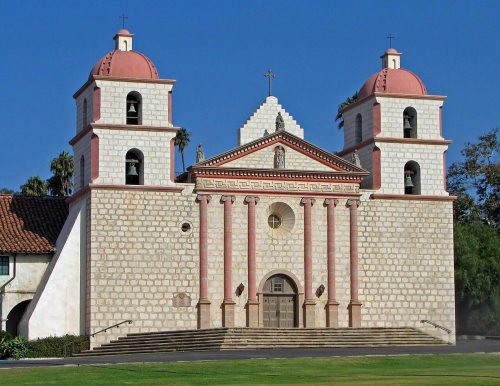 ★ Landmark
 ★ Landmark
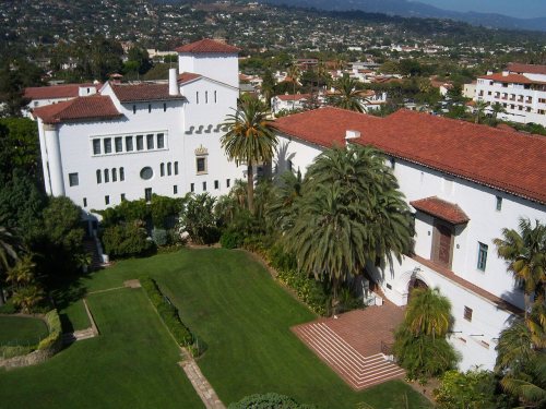 ★ Landmark

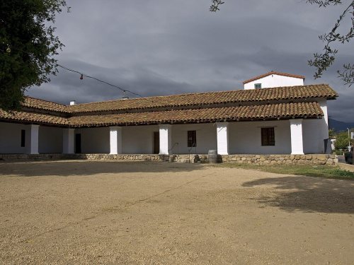

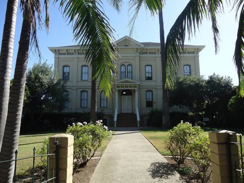

 c. 1839
 1855
 1856
 1880
 c. 1880
 1898
 1898
 c. 1898
 1900
 1900
 c. 1900
 c. 1900
 c. 1905
 1907
 1908
 c. 1908
 1910
 c. 1910
 1911
 1914
 1915
 1917


