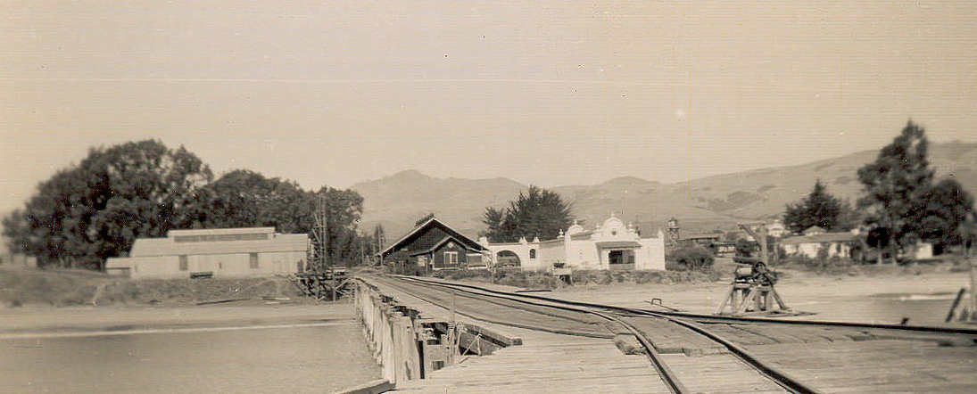
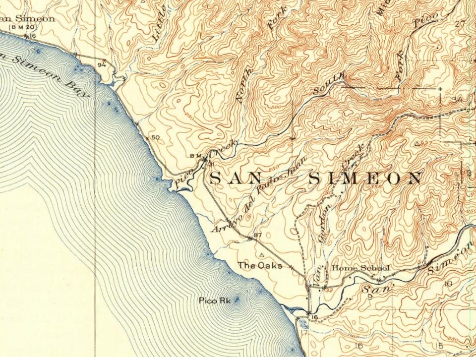
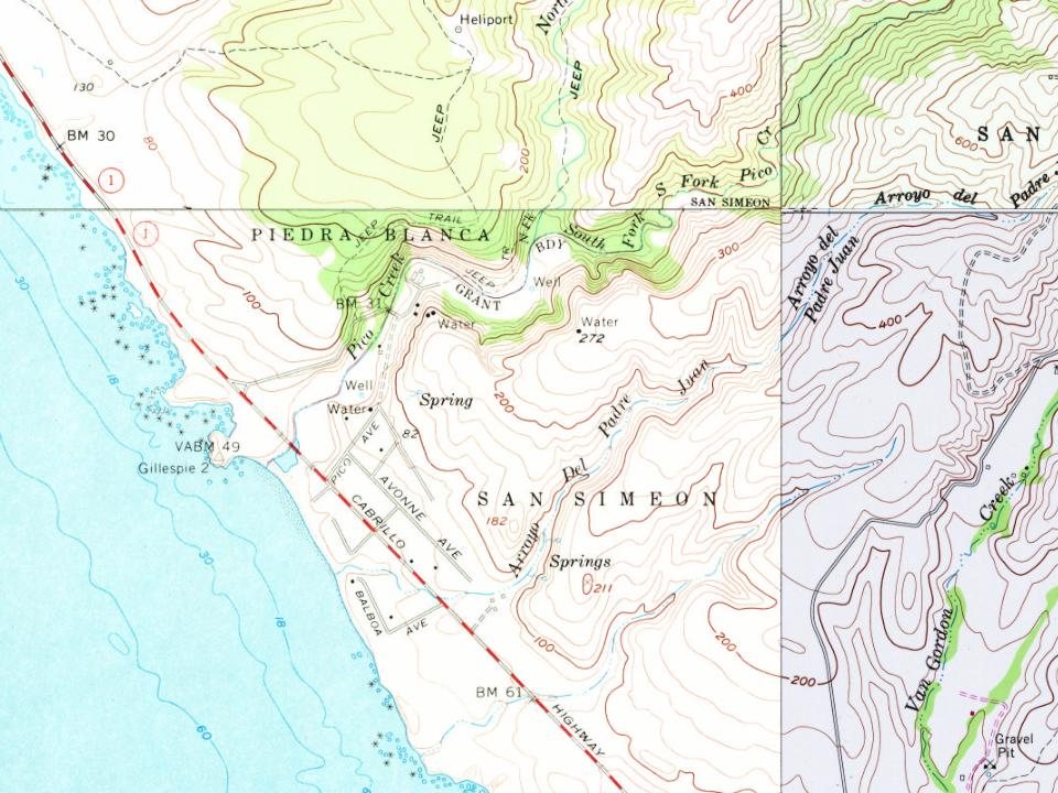
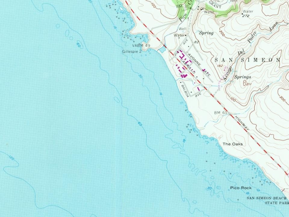
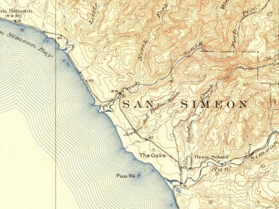
Most of San Simeon was built recently: 0.0% of its homes predate 1940 and the median home dates from 1982. Below: 9 old photos and papers, maps from 1919 on, and old-book passages.
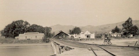
Humans first settled the local area at least 11,000 years ago. Prehistorically, the local area was inhabited by the Chumash people, including a large village south of San Simeon at Morro Creek.
In 1542 the coastal exploration of Juan Cabrillo discovered the bay and named it the Bay of Sardines.
The first European land exploration of Alta California, the Spanish Portolà expedition, traveled northwest along the coast in September 1769. On September 11–12, the party passed the future location of San Simeon. At Ragged Point, which is about 15 mi (24 km) past San Simeon, the party turned inland across the Santa Lucia Range.
Passages that mention San Simeon, cut from the printed page as they were published.
History of San Luis Obispo County and environs, California, with biographical sketches of the leading men and women of the county and environs who have been identified with the growth and development of the section from the early days to the present1917 · page 431Read the page →
Read the text
a comparatively desolate country, and ])urchased land at the mouth of San Simeon creek, where he lived through the winter. The next spring he helped organize the firm of Grant, Lull and Co. and built a store at the mouth of San Simeon creek, .\fter carrying on a general merchandise business for six months, he moved to Cambria and erected the first store building in that town, and put in a stock valued at $8,000. From that beginning, tiie town has grown until it has become a jjrosperous trading center.
Text read by machine from the scan; it may contain errors.
History of San Luis Obispo County and environs, California, with biographical sketches of the leading men and women of the county and environs who have been identified with the growth and development of the section from the early days to the present1917 · page 777Read the page →
Read the text
Coming to San Simeon, he engaged, for about six years, in the whaling trade, while that industry was at its height. Seeking employment on land again, he worked for a dairy concern for a short time, and then rented land near San Simeon, the present site of the Hearst ranch, and there he followed general farming and stock-raising with good success until 1883. He next moved to Rocky Butte and purchased seven hundred acres adapted to grazing; and there also he followed stock-raising. Disposing of this jiroperty in 1891, he went to the San Jropo section above San Simeon, and con-
Text read by machine from the scan; it may contain errors.
History of San Luis Obispo County, California1883 · page 332Read the page →
Read the text
The name of San Simeon is also applied to the township which embraces the northwestern portion of the county. The township line begins on the south side of the Arroyo de la Laguna, where it empties into the ocean, just below the port of San Simeon. It extends northwardly to the Monterey County line. The township embraces the whole of the princely estate of the Piedras Blancas. This ranch, now and for some years past,
Text read by machine from the scan; it may contain errors.
History of San Luis Obispo County, California1883 · page 341Read the page →
Read the text
lASSIXG down the coast from San Simeon Bay, the traveler comes to Leffingivell's Wharf, a landing place some six mUes south of San Simeon. Here is a short wharf used mainly for unloading lumber, and for schooner trade generally. Small vessels find no difficulty in discharging at this point in good weather, and no impediments exist in its approach. The neighborhood is furnished with lumber from this wharf and ships from it at
Text read by machine from the scan; it may contain errors.
Scans and text from the Internet Archive. Books published in 1930 or earlier, which are in the public domain.
Timeline
San Simeon, 1890 to 1980
Woven from the archive, old maps, post office records, the National Register and the people born here.
Nothing in the archives for these yearsWeddings on Main Street, storms, parades, school pictures, the old store. If it’s in your family album, it belongs here.
Nothing in the archives for these yearsWeddings on Main Street, storms, parades, school pictures, the old store. If it’s in your family album, it belongs here.
Founding dates: Wikidata, Wikipedia, the U.S. post office records of Blevins & Helbock (CC0) and the Census. Homes by year built: Census ACS 2020–24. National Register of Historic Places: National Park Service (list of May 22, 2026). Old photos, postcards and papers: Wikimedia Commons, the Library of Congress and other public archives, credited on each item’s page. Maps: U.S. Geological Survey historical topographic maps (via Esri) and Sanborn fire-insurance maps (Library of Congress). History text and census tables: Wikipedia (CC BY-SA 4.0). Places that used to be: USGS Geographic Names Information System (2021). How TownRatings grades history →
From Wikimedia Commons (11), the Library of Congress (12), Wikidata (1), Wikipedia, U.S. Geological Survey historical maps and old county and town histories (Internet Archive). Archive images are copied here with their credits and licenses, shown on each photo’s page. Refreshed monthly.


![a comparatively desolate country, and ])urchased land at the mouth of San Simeon creek, where he lived through the winter. The next spring he helped organize the firm of Grant, Lull and Co. and built a store at the mouth of San Simeon creek, .\fter carrying on a general merchandise business for six…](https://images.townratings.com/story/36713/bk-ab1d986279e926e3-l.jpg)




 1924
 1980
 1980
 1980
 1980
 1980
 2013
 2013
 2013
 2013
 2012
 2011
 2011
 2011
 2011
 2010
 2009
 2009
 2008
 2002