Guest, Sign inJoin

Post to Sacramento

We’ll email a one-tap link to publish your post. No password, and nothing is public until you click it.
Already a member? Sign in
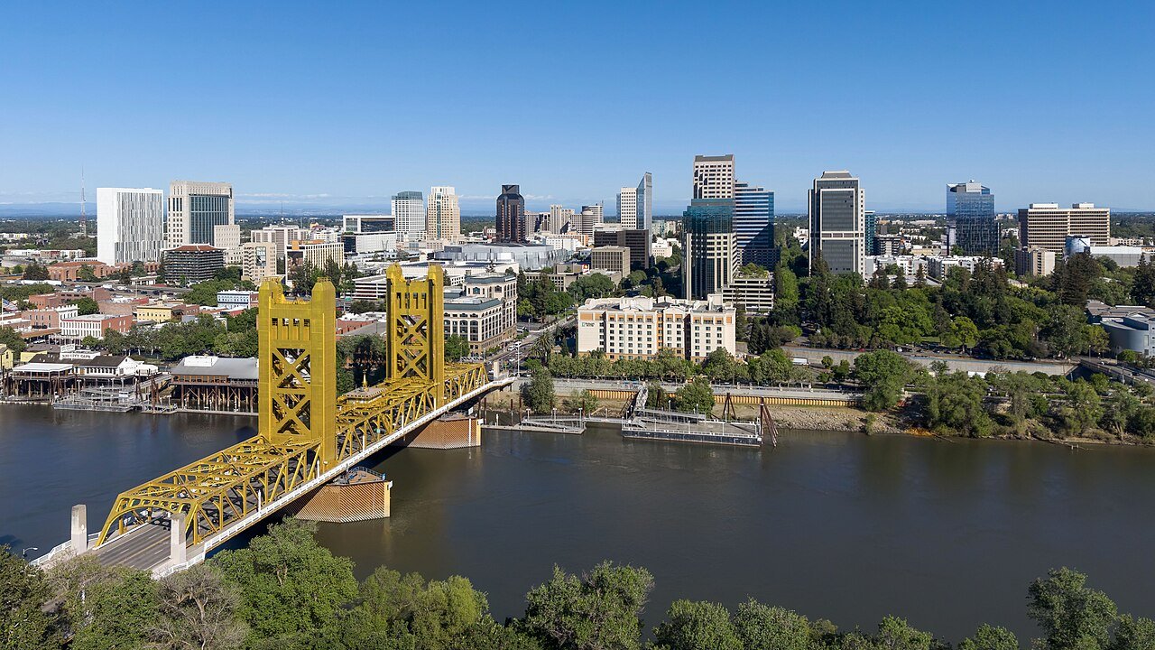
Sacramento, CA skyline (cropped)Photo: Quintin Soloviev · CC BY 4.0
A−Outdoors
Outdoors in Sacramento

9% of Sacramento’s land is conserved, and 97% of residents live within a half mile of a park

102 miles of mapped trail cross Sacramento, 1.0 per square mile of land. 9% of Sacramento’s land is conserved, about 5,899 acres. The biggest trail networks: American River Parkway (20.6 mi), William Land Park (3.2 mi), Capitol Park (2.6 mi).

Ahead of 83% of U.S. towns · #264 of 847 in California. What drives it

Conserved land
9%
5,899 acres · of 98.7 sq mi of land
Trails
102 mi
1.0 per sq mi of land
Park land
5,092 ac
9.6 acres per 1,000 residents
Near a park
97%
of residents within ½ mile
Bike routes
454 mi
320 mi lanes · 117 mi paths
Highest peak
33 ft
Whisky Hill
Lakes & rivers
15
5 beaches · 6 boat launches

What kind of outdoors town is Sacramento?

Read from the map. The page puts what stands out first.

Outdoors grade

How much outdoors does Sacramento have?

On conserved land, trails, park land and how close residents live to a park, Sacramento is ahead of 83% of U.S. towns, #264 of 847 in California. The share of residents near a park holds the grade up; park acres per resident pull it down.

A−
OutdoorsA character grade: shown, never part of Sacramento’s overall grade.
All U.S. towns we grade (21,298)Ahead of 83%
LessMore
California towns of 2,500+ (847)Ahead of 69%

Among the 400 U.S. cities of 100,000 or more, Sacramento ranks #162 on Outdoors.

How sure. Graded on any three of the four inputs instead, the letter would range from B+ to A. Trails and many small parks come from OpenStreetMap, mapped by volunteers, so coverage varies from town to town; the half mile is a straight line from each census block, so a river or highway in the way isn’t counted against it.

PAD-US, OpenStreetMap (© OpenStreetMap contributors), Census 2025 Gazetteer and 2020 blocks; details in Sources below. How TownRatings grades the outdoors →

The map

Conserved land, trails & bike routes

Tap a number to zoom to a park. Tap a layer to hide it.

12345678
Easements protect land from building but are usually private.© OpenStreetMap contributors · USGS PAD-US
Places to walk

Pick a walk

The longest trail network is American River Parkway, with 20.6 miles. Directions go to the nearest trailhead or public parking.

American River Parkway

Managed by Sacramento County Parks
2,129 acres20.6 mi of trail
Levee PathAmerican River Levee Path
Dog rules not recorded
Directionsto the parking lot

William Land Park

Park
234 acres3.2 mi of trail
Dog rules not recorded
Directionsto the parking lot

Capitol Park

Park
38 acres2.6 mi of trail
Dog rules not recorded
Directionsto Capitol Garage

Sutter's Landing Regional Park

Park
220 acres2 mi of trail
Levee Path
Dog rules not recorded
Directionsto the parking lotWebsite ↗

North Natomas Regional Park

Park
232 acres1.7 mi of trail
Unpaved
Dog rules not recorded
Directionsto the parking lot

North Natomas Community Park

Park
37 acres1.2 mi of trail
large rock path
Dog rules not recorded
Directionsto the parking lot

San Juan Reservoir Park

Park
31 acres1.1 mi of trail
Fisherman’s Lake Trail
Dog rules not recorded
No trailhead mapped yet

Hansen Ranch Park

Park
263 acres0.9 mi of trail
Dog rules not recorded
No trailhead mapped yet
All 168 parks & preserves
American River Parkway2,129 acres · 20.6 mi of trail · Sacramento County Parks
Directions
William Land Park234 acres · 3.2 mi of trail
Directions
Capitol Park38 acres · 2.6 mi of trail
Directions
Sutter's Landing Regional Park220 acres · 2 mi of trail
Directions
North Natomas Regional Park232 acres · 1.7 mi of trail
Directions
North Natomas Community Park37 acres · 1.2 mi of trail
Directions
San Juan Reservoir Park31 acres · 1.1 mi of trail
Hansen Ranch Park263 acres · 0.9 mi of trail
Sutter's Fort State Historic Park7 acres · 0.9 mi of trail
Directions
McKinley Park28 acres · 0.8 mi of trail
Directions
Curtis Park21 acres · 0.8 mi of trail
Directions
McClatchy Park16 acres · 0.8 mi of trail
Directions
Hagginwood Park13 acres · 0.8 mi of trail
Directions
Parkway Oaks Park11 acres · 0.8 mi of trail
Granite Park67 acres · 0.7 mi of trail
Directions
Natomas Oaks Park12 acres · 0.7 mi of trail
Directions
Frederick Miller Regional Park33 acres · 0.6 mi of trail · City of Sacramento
Directions
Southside Park20 acres · 0.6 mi of trail
Directions
Glenbrook Park18 acres · 0.6 mi of trail
Directions
McClatchy School Park15 acres · 0.5 mi of trail
Directions
Burberry Community Park13 acres · 0.5 mi of trail
Jefferson Park7 acres · 0.5 mi of trail
Directions
Old Sacramento State Historic Park56 acres · 0.4 mi of trail · California Department of Parks and Recreation
Directions
Tahoe Park17 acres · 0.4 mi of trail
Directions
Manuel J Barandes Park11 acres · 0.4 mi of trail
Orchard Park11 acres · 0.4 mi of trail
Directions
Airfield Park9 acres · 0.4 mi of trail
Egret Park9 acres · 0.4 mi of trail
Peregrine Park7 acres · 0.4 mi of trail
Woodlake Park6 acres · 0.4 mi of trail
Directions
Swainson's Hawk Park6 acres · 0.4 mi of trail
Gateway Park5 acres · 0.4 mi of trail
Blackbird Park10 acres · 0.3 mi of trail
Directions
North Natomas Aquatic Complex10 acres · 0.3 mi of trail
Directions
Franklin Boyce Community Park8 acres · 0.3 mi of trail
Directions
Robert Brookins Park8 acres · 0.3 mi of trail
Directions
Kokomo Park7 acres · 0.3 mi of trail
Oakbrook Park5 acres · 0.3 mi of trail
Directions
Muir Park5 acres · 0.3 mi of trail
Directions
Fremont Park3 acres · 0.3 mi of trail
Directions
Regency Community Park42 acres · 0.2 mi of trail
Directions
Shasta Community Park18 acres · 0.2 mi of trail
Directions
Westlake Community Park12 acres · 0.2 mi of trail
Directions
Renfree Park9 acres · 0.2 mi of trail
Tahoe Tallac Park7 acres · 0.2 mi of trail · City of Sacramento
Directions
Autumn Meadow Park6 acres · 0.2 mi of trail
Lawrence Park6 acres · 0.2 mi of trail · City of Sacramento
Hite Park5 acres · 0.2 mi of trail
Westshore Park5 acres · 0.2 mi of trail
Linden Park5 acres · 0.2 mi of trail
Directions
Westhamptton Park5 acres · 0.2 mi of trail
Township 9 Park4 acres · 0.2 mi of trail
Directions
Cove Park4 acres · 0.2 mi of trail
Marshall Park3 acres · 0.2 mi of trail
Directions
Strauch Park3 acres · 0.2 mi of trail · City of Sacramento
Directions
Willow Park3 acres · 0.2 mi of trail
Emiliano Zapata Park1 acres · 0.2 mi of trail · City of Sacramento
Directions
Reichmuth Regional Park41 acres · 0.1 mi of trail
Directions
Johnston Park30 acres · 0.1 mi of trail
Directions
South Natomas Community Park28 acres · 0.1 mi of trail
Directions
Danny Nunn Park13 acres · 0.1 mi of trail · City of Sacramento
Directions
Meadowview Park10 acres · 0.1 mi of trail
Directions
Wild Rose Park9 acres · 0.1 mi of trail
Mae Fong Park9 acres · 0.1 mi of trail
Oki Park8 acres · 0.1 mi of trail · City of Sacramento Department of Youth, Parks and Community Enrichment
Glenn Hall Park8 acres · 0.1 mi of trail
Directions
Gardenland Park6 acres · 0.1 mi of trail
Directions
Quail Park5 acres · 0.1 mi of trail
Directions
Hummingbird Park4 acres · 0.1 mi of trail
Lilac Park3 acres · 0.1 mi of trail
Robert Matsui Waterfront Park3 acres · 0.1 mi of trail
Directions
Lewis Park2 acres · 0.1 mi of trail
Bertha Henschel Park2 acres · 0.1 mi of trail
Directions
Camellia Park2 acres · 0.1 mi of trail · City of Sacramento
Winner's Circle Park2 acres · 0.1 mi of trail
Directions
Sundance Park1 acres · 0.1 mi of trail
Directions
Washington Park1 acres · 0.1 mi of trail
Directions
Pioneer Landing Park1 acres · 0.1 mi of trail · City of Sacramento
Directions
Brooks Truitt Park1 acres · 0.1 mi of trail · City of Sacramento
Directions
Neely Johnson Park1 acres · 0.1 mi of trail · City of Sacramento
Directions
Del Paso Park72 acres
Niños Parkway57 acres · City of Sacramento
Directions
Tanzanite Community Park34 acres
Directions
Laguna Verde Park20 acres
Robla Community Park16 acres
Directions
Northgate Park16 acres
Directions
Valley High Park15 acres
Meadows Park14 acres · City of Sacramento
Directions
John Mackey Memorial Park13 acres
Northlake Community Park13 acres
Chuckwagon Park13 acres
George Sim Park11 acres · City of Sacramento
Mangan Park11 acres
Directions
Jacinto Creek Park10 acres
Directions
East Portal Park10 acres
Directions
Bannon Creek Park and Parkway10 acres
Directions
Regency Park10 acres
Directions
Cooledge Park9 acres
Directions
Seymour Park9 acres
Valley Oak Park8 acres
Directions
Witter Ranch Park8 acres
Directions
Richardson Village Park7 acres
Tiscornia Park7 acres
Directions
Southgate Park7 acres
Directions
Natomas Park7 acres
Directions
Steve Jones Park7 acres
Directions
Bahnfieth Park7 acres
Garden Valley Park7 acres
Directions
Sojourner Truth Park6 acres
Magnolia Park6 acres
Mesa Grande Park6 acres
California School Park6 acres
Directions
Babcock Park6 acres
Belle Cooledge Park6 acres
Directions
Cottonwood Park6 acres
Directions
Argonaut Park5 acres
Directions
O'Neil Park5 acres
Directions
American Lakes School Park5 acres
Directions
River View Park5 acres
Earl Warren Park5 acres
Sand Cove Park5 acres
Directions
Charter Point Park5 acres
Sam and Bonnie Pannell Community Center Park5 acres · City of Sacramento
Directions
Baer Park5 acres
Niños Park5 acres · City of Sacramento
Didion School Park5 acres
Hampton Park5 acres
Heron Park5 acres
Directions
Sycamore Park4 acres
Directions
Northborough Park4 acres
24th Street Bypass Park4 acres
Directions
Mama Marks Park4 acres
Directions
Birney School Park4 acres
Directions
Sacramento School Park3 acres
Directions
Prairie School Park3 acres
Dos Rios School Park3 acres
Directions
Z'Berg Park3 acres
Stanford Park3 acres
Directions
Winn Park3 acres
Directions
Coloma Park3 acres
Directions
Sierra School Park3 acres
Directions
Dogwood Park3 acres
Directions
Shorebird Park3 acres
Elderberry Park3 acres
Crocker Park2 acres
Directions
University Park2 acres
Cesar E. Chavez Plaza2 acres
Directions
Grant Park2 acres
Directions
Colonial Park2 acres · City of Sacramento
Eventide Park2 acres
Roosevelt Park2 acres
Directions
Alder Park2 acres
Potuguese Community Park2 acres
Ciavarella Field2 acres
Directions
Sparrow Park2 acres
Martin Luther King Jr. Park2 acres
Golden Poppy Park1 acres
Kemble Park1 acres
Strawberry Manor Park1 acres
Oak Park1 acres
Directions
Mirasol Village Park1 acres
Directions
Tony Court Park1 acres
Lubin School Park1 acres
Blue Oak Park1 acres
Temple Avenue Park1 acres
Leland Stanford Mansion State Historic Park1 acres
Directions
P Z Cervantes Park1 acres
Directions
Governor's Mansion State Historic Park1 acres
Directions
Who protects it

5,899 conserved acres

9% of Sacramento’s land. Who manages Sacramento’s conserved land, from the USGS Protected Areas Database. Approximate, because parcels can overlap.

Town or city4,020 ac
County1,080 ac
Other state land420 ac
Regional agency357 ac
Land trusts & nonprofits258 ac
State parks29 ac
State Department of Land12 ac
Local Park · 2,783 acLocal Recreation Area · 2,032 acLocal Other or Unknown · 453 acState Other or Unknown · 418 acUnknown Easement · 249 ac
Good to know

Conserved doesn’t always mean open to visitors. 5 acres are conservation easements, usually private land. The walks above are places people visit.

The biggest protected parcels
Parcel (PAD-US)Managed byAcresPublic access
American River Parkway
Local Recreation Area
County1,135Open
Ueda Parkway
Local Recreation Area
Town or city478Open
Haggin Oaks Golf Course
Local Recreation Area
Town or city404Restricted
Sacramento Regional County Sanitation District
Local Other or Unknown
Regional agency328Restricted
American River Parkway - Discovery Park
Local Park
County273Open
Hansen Ranch Park Site
Local Park
Town or city247Open
North Natomas Regional Park
Local Park
Town or city209Open
Del Paso Regional Park
Local Park
Town or city187Open
Bing Maloney Golf Course
Local Recreation Area
Town or city170Open
William Land Park
Local Park
Town or city159Open

5 smaller protected places aren’t shown.

Things to do

272 places to go in Sacramento

Beaches, playgrounds, peaks, falls and more. Pick a kind.

Dog parks in Sacramento
Bark Park
Directions
Regency Community Park Off Leash Dog ParkIn Regency Community Park
Directions
Sky's Dog ParkIn Bannon Creek Park and Parkway
Directions
Tanzanite Dog ParkIn Tanzanite Community Park
Directions
University Dog Park
Directions
Valley Oak Large Dog ParkIn Valley Oak Park
Directions
Valley Oak Small Dog ParkIn Valley Oak Park
Directions
large dog parkIn Blackbird Park
Directions
1 more dog park
small dog parkIn Blackbird Park
Directions

Plus 6 dog parks without a name on the map.

Trails & water

9 named trails and 15 lakes & rivers

Named trails
Open to bikes · 4.4 miUnpaved · 24.0 mi
Levee Path7.3 mi
American River Levee Path1.7 mi
large rock path0.6 mi
natomas walking path0.6 mi
Laguna Trail0.5 mi
Fisherman’s Lake Trail0.4 mi
terracina walking path0.3 mi
Unpaved0.3 mi
City College Pedestrian and Bicycle Bridge0.2 mi
Lakes & rivers tap for directions
Biking & sports

454 miles of bike routes

Bike lanes are often missing from the map in smaller towns, so that number is likely low.

320 mi
painted or protected bike lanes
117 mi
off-road bike paths
16 mi
shoulders & shared lanes
Courts & fields
200Tennis
190Basketball
96Baseball
68Soccer
32Pickleball
13Skate park
11Football
8Tracks

Includes school and college facilities, which aren’t always open to the public.

History along the way

79 places on the National Register, 5 of them National Historic Landmarks

The country’s official list of places worth saving (National Park Service). The map also marks 23 historic points from OpenStreetMap: plaques, memorials and old buildings.

History →
★
"Big Four" HouseNational Historic Landmark · Building · listed 1966
About it
★
Old Sacramento Historic DistrictNational Historic Landmark · District · listed 1966
About it
★
Pony Express TerminalNational Historic Landmark · Building · listed 1966
About it
★
Sutter's FortNational Historic Landmark · Site · listed 1966
About it
★
Stanford-Lathrop HouseNational Historic Landmark · Building · listed 1971
About it
California Governor's MansionBuilding · listed 1970
About it
Crocker, E. B., Art GalleryBuilding · listed 1971
About it
California State CapitolBuilding · listed 1973
About it
Southern Pacific Railroad Company's Sacramento DepotBuilding · listed 1975
About it
J. Neely Johnson HouseBuilding · listed 1976
About it
Heilbron HouseBuilding · listed 1976
About it
Van Voorhies HouseBuilding · listed 1977
About it

67 more on the History page.

When to get out

The best walking months in Sacramento: April and May

NOAA’s 1991–2020 normals for the town and the daylight at its latitude. Outlined months have long days, highs of 59 to 86 °F and little rain for the place.

JanFebMarAprMayJunJulAugSepOctNovDec
Daylight (h)9.710.711.813.214.314.814.613.712.411.110.09.5
High (°F)566267738189949389796657
Rain (in)3.83.62.71.40.90.20.00.00.10.91.83.3

July is the driest month (under 0.1 in) and the warmest (highs of 94 °F). 3.8 inches fall in January, the wettest month. Summer highs reach 94 °F, too hot for the outline. The climate in Sacramento →

Next door

Sacramento and its neighbors

Sacramento has the most mapped trails of the 8 towns around it. Tap a town to see its outdoors.

TownConserved
of land
Trail mi
per sq mi
Park acres
per 1,000
Near a park
½ mile
Outdoors
Sacramento9%1.01097%A−
Arden-Arcade3%1.1494%B+
West Sacramento2%1.5798%B+
Lemon Hill3%0.2199%+B−
Florin2%0.3390%C+
McClellan Park1%0.11498%B−
North Highlands1%under 0.1290%C−
Fruitridge Pocketunder 1%under 0.1under 199%+C−

The four inputs of the Outdoors grade, from the engine; shares are of land, not water.

Questions about parks and trails in Sacramento

Where can I hike in Sacramento?

The longest trail networks: American River Parkway, 20.6 miles; William Land Park, 3.2 miles; Capitol Park, 2.6 miles; Sutter's Landing Regional Park, 2 miles. Each one is on the map above, with directions to the nearest trailhead or parking.

How much of Sacramento is conserved land?

9% of its land, against a typical 4% for a California town and 4% nationally (PAD-US). Conserved doesn’t always mean open to visitors: easements are usually private land.

Are dogs allowed on Sacramento’s trails?

American River Parkway and William Land Park don’t have dog rules recorded on the map; check the signs at the trailhead.

Where can I bike in Sacramento?

454 miles of bike routes are on the map: 320 of painted or protected lanes, 117 of off-road paths and 16 of shoulders and shared lanes.

Is there public land near Sacramento?

41,200 acres of parks and open public land lie inside Sacramento or within 10 miles of it (PAD-US), 5,523 of them inside the city line.

How much outdoors does Sacramento have?

Ahead of 83% of U.S. towns on the Outdoors grade, #264 of 847 in California. The grade combines the share of land that is conserved, miles of mapped trail per square mile of land, park acres per 1,000 residents and the share of residents within a half mile of a park. It’s a character grade, so it isn’t part of the overall grade. How it works.

Trail talk

Conditions, parking and favorite walks from Sacramento neighbors.

Town Square →
Share a tip
Sources

Where this page comes from

Conserved and public land: USGS Protected Areas Database of the United States (PAD-US), service updated July 2026. Parks, trails, playgrounds, beaches and other places: OpenStreetMap (© OpenStreetMap contributors, ODbL), map data as of 2026-10-28. Land and water area: Census 2025 Gazetteer. Residents near a park: 2020 Census blocks. National Register: National Park Service. How TownRatings grades the outdoors →