Manchester’s post office opened in 1871, and 1 of its places is on the National Register
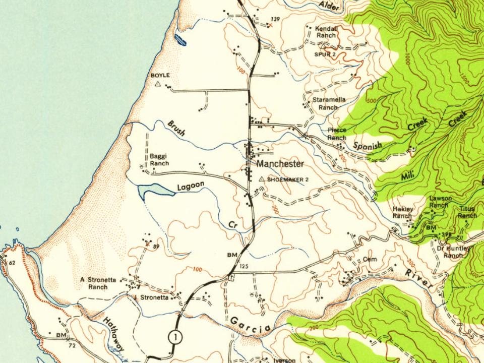
Most of Manchester was built recently: 4% of its homes predate 1940 and the median home dates from 2003. Its Register listing is the Manchester Schoolhouse. Below: 4 old photos and papers, maps from 1943 on, and old-book passages.
The Manchester post office opened in 1871, closed in 1876, and reopened in 1877. The place was named after Manchester, England, an early settler's former home.
1 and 2 George IV., cap. 126. Act to improve Market Street, in the town of Manchester, and approaches thereto, and to amend an Act passed in the 57th year of His late Majesty's reign, for building a bridge across the river Irwell from Water Street, in the township of Salford, to St. Mary's Gate, in the township of Manchester. July 2.
Text read by machine from the scan; it may contain errors.
The following placard was posted in the town of Manchester : " The bellman of Manchester and Salford.— iVo< ice is hereby f/ivcn, that William Sherman, post-office keeper, of New Windsor, Salford, and of No. 3, Old Slillgate, Market Place, Manchester, is duly appointed to the office of bellman of the towns of Manchester and Salford; the appointment of which exclusively belongs to Arabella Penelope Eliza Hoare, wife of Peter Richard lloare, of Kelsey Park, in the county of Kent, esquire, as one of the descendants of the Chetham family, formerly of Clayton Hall and Turton Tower, in this
Text read by machine from the scan; it may contain errors.
Scans and text from the Internet Archive. Books published in 1930 or earlier, which are in the public domain.
Timeline
Manchester, 1871 to 1943
Woven from the archive, old maps, post office records, the National Register and the people born here.
Nothing in the archives for these yearsWeddings on Main Street, storms, parades, school pictures, the old store. If it’s in your family album, it belongs here.
Founding dates: Wikidata, Wikipedia, the U.S. post office records of Blevins & Helbock (CC0) and the Census. Homes by year built: Census ACS 2020–24. National Register of Historic Places: National Park Service (list of May 22, 2026). Old photos, postcards and papers: Wikimedia Commons, the Library of Congress and other public archives, credited on each item’s page. Maps: U.S. Geological Survey historical topographic maps (via Esri) and Sanborn fire-insurance maps (Library of Congress). History text and census tables: Wikipedia (CC BY-SA 4.0). Places that used to be: USGS Geographic Names Information System (2021). How TownRatings grades history →
From Wikimedia Commons (6), the National Register of Historic Places (1), Wikipedia, U.S. Geological Survey historical maps, the US Post Offices dataset (Blevins & Helbock), the USGS Geographic Names Information System and old county and town histories (Internet Archive). Archive images are copied here with their credits and licenses, shown on each photo’s page. Refreshed monthly.


 1906
 1906
 1906
 2011
 2004