Long Beach’s post office opened in 1885, and 19% of its homes were built before 1940
More historic than 68% of U.S. towns · #62 of 847 in California. What drives it
19 places in town are on the National Register, among them the Los Cerritos Ranch House, a National Historic Landmark. Below: 23 old photos and papers, maps from 1888 on, and the census since 1890.
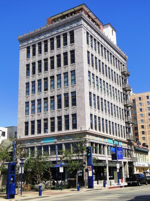
Founding year: the first Long Beach post office (Blevins & Helbock, CC0). Wikidata: 1888.The full story ↓
History grade
What drives Long Beach’s History grade
On its age, its old homes and the National Register, Long Beach is more historic than 68% of U.S. towns, #62 of 847 in California. Its National Register listings hold the grade up; its age pulls it down.
B+
HistoryA character grade: shown, never part of Long Beach’s overall grade.
Among the 400 U.S. cities of 100,000 or more, Long Beach ranks #180 on History.
Few California towns list much on the Register (a typical California town has 0.0 per 10,000 residents, the U.S. 2.4), so Long Beach’s 0.6 sits above most of its state (73% of California towns have fewer) while its 28 historic buildings outnumber those of 81% of U.S. towns.
How sure. Graded on any two of the three inputs instead, the letter would range from B− to A−. The pre-1940 share (±0.8 points) is firm at this size. The founding year is the first post office, not a stated founding date; Wikidata’s 1888 falls in the same era, so the grade doesn’t depend on which one is used.
Founding year: the first post office (other dates in Quick answers). Homes: Census ACS 2020–24. National Register: National Park Service, May 2026 list; each listing counted once (boundary changes and added documentation belong to their listing), and a historic district counts its contributing buildings. How TownRatings grades history →
What stands out about Long Beach’s past
Read from the archive, the National Register and the record. The page puts what stands out first.
National Park Service, National Register of Historic Places. Photos from Wikimedia Commons, credited on each place’s page.
Places that used to be
Old corners, places now gone and burying grounds
Long Beach’s post office has been open since 1885.
Hamlets and corners on the map
Belmont HeightsBelmont ShoreBixby KnollsBluff HeightsBluff ParkCalifornia HeightsCambodia TownCotaDouglas JunctionGaspurLos AltosNaplesNorth Long BeachRose ParkVista del MarWillowvilleWrigley
Gone or out of use
Arlington CollegeschoolBixby SchoolschoolFire Station Number 11buildingFire Station Number 2buildingFriendship Baptist ChurchchurchLlewellyn SchoolschoolLong Beach Army Air FieldmilitaryLong Beach Naval ShipyardmilitaryLong Beach Plaza Shopping CenterlocaleNaval Hospital Long BeachhospitalNaval Hospital-Long Beach HeliportairportNike Site LA-40CmilitaryNike Site LA-40LmilitaryPine Avenue PierlocaleZion Evangelical Churchchurch
4cemeteries and burying grounds inside Long Beach
All SoulsForest Lawn Memorial ParkLong Beach MunicipalSunnyside
US Post Offices dataset (Blevins & Helbock, CC0). Places and cemeteries from the USGS Geographic Names Information System (2021).
By decade
Long Beach, decade by decade
3 decades in the archive, from the 1880s to the 1900s. Scroll each row; tap a photo for its story.
Nothing in the archives for these yearsWeddings on Main Street, storms, parades, school pictures, the old store. If it’s in your family album, it belongs here.
Indigenous people have lived in coastal Southern California for over 10,000 years, and several successive cultures have inhabited the present-day area of Long Beach. By the 16th-century arrival of Spanish explorers, the dominant group was the Tongva, who had established at least three major settlements within the present-day city. Tevaaxa'anga was an inland settlement near the Los Angeles River, while Ahwaanga and Povuu'nga were coastal villages. Povuu'nga was particularly important to the Tongva, not only as a regional trading center and hub for fishermen, but for its deep ceremonial significance, being understood as their place of emergence as a people from which their lives began.
Passages that mention Long Beach, cut from the printed page as they were published.
An illustrated history of Los Angeles County, California. Containing a history of Los Angeles County from the earliest period of its occupancy to the present time, together with glimpses of its prospective future ... and biographical mention of many of it1889Read the page →
Read the text
La Fetra engaged in real-estate transactions, and wasoneof the original incorporators and directors of the Long Beach Land and Water Company. He took up his residence at Long Beach, and was the superintendent of that company, having charge of and directing the improvements projected at that place, building railroads, hotel, and improving and extending their water works. In
Text read by machine from the scan; it may contain errors.
An illustrated history of Los Angeles County, California. Containing a history of Los Angeles County from the earliest period of its occupancy to the present time, together with glimpses of its prospective future ... and biographical mention of many of it1889Read the page →
Read the text
Long Beach has an intelligent and refined class of citizens, excellent public schools, four church societies, no saloons, enterprising business men, and a live newspaper, the Long Beach Journal.
Text read by machine from the scan; it may contain errors.
Scans and text from the Internet Archive. Books published in 1930 or earlier, which are in the public domain.
Timeline
Long Beach, 1834 to 1988
Woven from the archive, old maps, post office records, the National Register and the people born here.
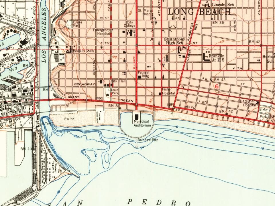
Every edition of the U.S. Geological Survey’s map of Long Beach. Tap a year, or press play to watch the town change.
1896Downey sheet · 1:62,500
U.S. Geological Survey historical topographic maps (public domain), via Esri’s collection of the scans. The red ring marks the center of Long Beach.
Every building
Long Beach, building by building, 1888–1928
Fire insurance maps drew every building, what it was made of and what it was used for, so insurers could price the risk of fire. Pick a year, then a sheet.
1888Sheet 1 of 1
Edition
Sheets
BrickWoodStone
Sanborn Map Company, via the Library of Congress. Editions published in 1930 or earlier, which are in the public domain.
Then & now
Stand where they stood
No then-and-now pairs yet. Take a photo from the same spot as an old one and they appear here side by side.
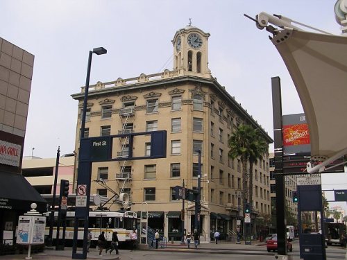
Retake this viewExterior view of the Willmore Hotel circa 1887, 1887
Find the spot, match the angle, and add your photo. It becomes the first then-and-now pair on Long Beach’s page.
The Long Beach post office opened in 1885, the earliest record of the town by name (U.S. post office records). Wikidata gives 1888.
How does Long Beach rank for history?
Long Beach is more historic than 68% of U.S. towns, #62 of 847 in California. The History grade combines the town’s founding era, the share of homes built before 1940 and its National Register listings. It’s a character grade, so it isn’t part of the overall grade. How it works.
What is on the National Register in Long Beach?
19 listings: 18 buildings, among them the Los Cerritos Ranch House (a National Historic Landmark since 1970), and 1 structure. 28 historic buildings in all.
How old are the homes in Long Beach?
19% of Long Beach’s homes were built before 1940 (Census estimate), against a typical 3.4% for a California town; the median home was built in 1959.
Founding dates: Wikidata, Wikipedia, the U.S. post office records of Blevins & Helbock (CC0) and the Census. Homes by year built: Census ACS 2020–24. National Register of Historic Places: National Park Service (list of May 22, 2026). Old photos, postcards and papers: Wikimedia Commons, the Library of Congress and other public archives, credited on each item’s page. Maps: U.S. Geological Survey historical topographic maps (via Esri) and Sanborn fire-insurance maps (Library of Congress). History text and census tables: Wikipedia (CC BY-SA 4.0). Places that used to be: USGS Geographic Names Information System (2021).
From Wikimedia Commons (12), the Library of Congress (11), Wikidata (1), the National Register of Historic Places (19), Wikipedia, Wikidata and Wikipedia for famous people, U.S. Geological Survey historical maps, U.S. Census counts (via Wikipedia), the US Post Offices dataset (Blevins & Helbock), the USGS Geographic Names Information System, Sanborn fire insurance maps (Library of Congress) and old county and town histories (Internet Archive). Archive images are copied here with their credits and licenses, shown on each photo’s page. Refreshed monthly.


 ★ Landmark




 1887
 c. 1895
 1900
 c. 1900
 c. 1902
 1902
 1905
 c. 1905
 1905
 1905
 1905
 c. 1906
 c. 1906
 1906
 1906
 c. 1907
 1907
 1907
 1908
 1908
 1908
 1908
 1908