Guest, Sign inJoin

Post to Lincoln

We’ll email a one-tap link to publish your post. No password, and nothing is public until you click it.
Already a member? Sign in
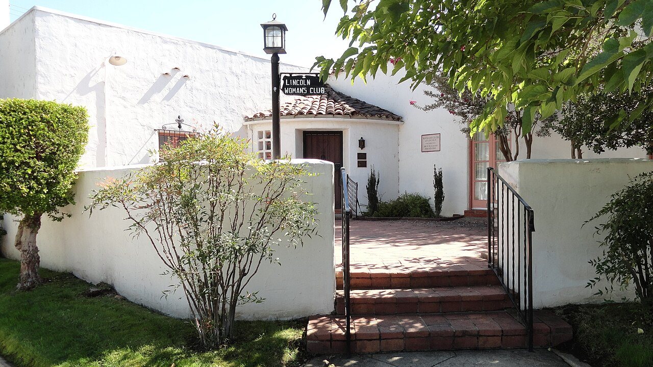
Woman's Club of LincolnWoman's Club of Lincoln · Photo: T71024 · CC BY-SA 3.0
B+Outdoors
Outdoors in Lincoln

Lincoln has 21 miles of mapped trails, 0.8 for every square mile of land

90% of residents live within a half mile of a park. 7% of Lincoln’s land is conserved, about 1,165 acres. 483 acres are parks and preserves, 9.1 per 1,000 residents.

Ahead of 74% of U.S. towns · #320 of 847 in California. What drives it

Conserved land
7%
1,165 acres · of 24.5 sq mi of land
Trails
21 mi
0.8 per sq mi of land
Park land
483 ac
9.1 acres per 1,000 residents
Near a park
90%
of residents within ½ mile
Bike routes
101 mi
66 mi lanes · 27 mi paths
Lakes & rivers
11
1 beach

What kind of outdoors town is Lincoln?

Read from the map. The page puts what stands out first.

Outdoors grade

How much outdoors does Lincoln have?

On conserved land, trails, park land and how close residents live to a park, Lincoln is ahead of 74% of U.S. towns, #320 of 847 in California. Trail miles hold the grade up; park acres per resident pull it down.

B+
OutdoorsA character grade: shown, never part of Lincoln’s overall grade.
All U.S. towns we grade (21,298)Ahead of 74%
LessMore
California towns of 2,500+ (847)Ahead of 62%
How sure. Graded on any three of the four inputs instead, the letter would range from B+ to A−. Trails and many small parks come from OpenStreetMap, mapped by volunteers, so coverage varies from town to town; the half mile is a straight line from each census block, so a river or highway in the way isn’t counted against it.

PAD-US, OpenStreetMap (© OpenStreetMap contributors), Census 2025 Gazetteer and 2020 blocks; details in Sources below. How TownRatings grades the outdoors →

The map

Conserved land, trails & bike routes

Tap a number to zoom to a park. Tap a layer to hide it.

1234
Easements protect land from building but are usually private.© OpenStreetMap contributors · USGS PAD-US
Places to walk

Pick a walk

The longest trail network is Coyote Pond Park, with 0.1 miles. Directions go to the nearest trailhead or public parking.

Coyote Pond Park

Managed by City of Lincoln
184 acres0.1 mi of trail
Dog rules not recorded
Directionsto the parking lotWebsite ↗

Auburn Ravine Nature Preserve

Nature preserve
62 acres
Dog rules not recorded
Directionsto the parking lot
All 29 parks & preserves
Coyote Pond Park184 acres · 0.1 mi of trail · City of Lincoln
Directions
Bella Breeze Park16 acres · 0.1 mi of trail
Markham Park14 acres · 0.1 mi of trail
Directions
Joiner Park12 acres · 0.1 mi of trail
Directions
Dr. Nathan Dubin Park6 acres · 0.1 mi of trail
Busey Park5 acres · 0.1 mi of trail
Directions
Leavell Park1 acres · 0.1 mi of trail
Brown Park1 acres · 0.1 mi of trail · City of Lincoln
Auburn Ravine Nature Preserve62 acres
Directions
Foskett Regional Park44 acres
Directions
McBean Park23 acres
Directions
Wilson Park14 acres
Directions
Aitken Ranch Park7 acres
Directions
Peter Singer Park7 acres
Aldo Pineschi Jr. Park5 acres
Twelve Bridges Park4 acres
Palo Verde Park3 acres · City of Lincoln Public Works
Machado Park3 acres
Directions
Sandstad Park3 acres
Scheiber Park3 acres
Jimenez Park3 acres
Directions
Stone House Park3 acres
Eadie Park3 acres
Pasillas Park2 acres
Vasion Park2 acres
Meadowlands Park1 acres
Directions
Sheffield Park1 acres
Atkinson Park1 acres
Pete Demas Park1 acres
Who protects it

1,165 conserved acres

7% of Lincoln’s land. Who manages Lincoln’s conserved land, from the USGS Protected Areas Database. Approximate, because parcels can overlap.

Land trusts & nonprofits671 ac
Town or city491 ac
Private owners3 ac
Other Easement · 463 acLocal Recreation Area · 239 acConservation Easement · 202 acLocal Park · 175 acLocal Other or Unknown · 77 ac
Good to know

Conserved doesn’t always mean open to visitors. 664 acres are conservation easements, usually private land. The walks above are places people visit.

The biggest protected parcels
Parcel (PAD-US)Managed byAcresPublic access
City of Lincoln Golf Courses
Local Recreation Area
Town or city238Restricted
Auburn Ravine
Local Other or Unknown
Town or city75Open
Foskett Regional Park
Local Park
Town or city45Open
Coyote Pond Park
Local Park
Town or city35Open
McBean Park
Local Park
Town or city24Open
Robert "Chief" Jimenez Park
Local Park
Town or city14Open
Joiner Park
Local Park
Town or city12Open
Aitken Park
Local Park
Town or city7Open
Nathan Dubin Park
Local Park
Town or city6Open
Swainson’s Grassland Preserve
Private Conservation
Land trusts & nonprofits6Closed

5 smaller protected places aren’t shown.

Things to do

42 places to go in Lincoln

Beaches, playgrounds, peaks, falls and more. Pick a kind.

Dog parks in Lincoln
Auburn Ravine Dog ParkHours: Open 24 hours · In Auburn Ravine Nature Preserve
Directions
Foskett Dog ParkIn Foskett Regional Park
Directions
McBean Dog Park aka "The Bark Park"In McBean Park
Directions
Trails & water

2 named trails and 11 lakes & rivers

Named trails
Open to bikes · 0.8 miUnpaved · 4.7 mi
Canyon Oaks Trail0.9 mi
Elderberry Trail0.6 mi
Lakes & rivers tap for directions
Biking & sports

101 miles of bike routes

Bike lanes are often missing from the map in smaller towns, so that number is likely low.

66 mi
painted or protected bike lanes
27 mi
off-road bike paths
7.2 mi
shoulders & shared lanes
Courts & fields
23Pickleball
20Baseball
19Basketball
18Tennis
16Soccer
5Softball
3Football
1Skate park

Includes school and college facilities, which aren’t always open to the public.

History along the way

2 places on the National Register

The country’s official list of places worth saving (National Park Service). The map also marks 9 historic points from OpenStreetMap: plaques, memorials and old buildings.

History →
Lincoln Public LibraryBuilding · listed 1990
About it
Woman's Club of LincolnBuilding · listed 2001
About it
When to get out

The best walking months in Lincoln: April and May

NOAA’s 1991–2020 normals for the town and the daylight at its latitude. Outlined months have long days, highs of 59 to 86 °F and little rain for the place.

JanFebMarAprMayJunJulAugSepOctNovDec
Daylight (h)9.710.711.813.214.314.914.613.712.411.110.09.5
High (°F)566267738291969590796556
Rain (in)4.54.43.41.81.00.30.00.00.11.02.54.0

July is the driest month (under 0.1 in) and the warmest (highs of 96 °F). 4.5 inches fall in January, the wettest month. Summer highs reach 96 °F, too hot for the outline. The climate in Lincoln →

Next door

Lincoln and its neighbors

Lincoln has the second most mapped trails of the 3 towns around it. Tap a town to see its outdoors.

TownConserved
of land
Trail mi
per sq mi
Park acres
per 1,000
Near a park
½ mile
Outdoors
Lincoln7%0.8990%B+
Rocklin7%1.61097%A−
Sheridan6%0.3522%C+

The four inputs of the Outdoors grade, from the engine; shares are of land, not water.

Questions about parks and trails in Lincoln

Where can I hike in Lincoln?

The longest trail networks: Coyote Pond Park, 0.1 miles. Each one is on the map above, with directions to the nearest trailhead or parking.

How much of Lincoln is conserved land?

7% of its land, against a typical 4% for a California town and 4% nationally (PAD-US). Conserved doesn’t always mean open to visitors: easements are usually private land.

Are dogs allowed on Lincoln’s trails?

OpenStreetMap records dogs as welcome at Foskett Regional Park and McBean Park. For the rest, check the signs at the trailhead.

Where can I bike in Lincoln?

101 miles of bike routes are on the map: 66 of painted or protected lanes, 27 of off-road paths and 7.2 of shoulders and shared lanes.

Is there public land near Lincoln?

21,905 acres of parks and open public land lie inside Lincoln or within 10 miles of it (PAD-US), 483 of them inside the city line.

How much outdoors does Lincoln have?

Ahead of 74% of U.S. towns on the Outdoors grade, #320 of 847 in California. The grade combines the share of land that is conserved, miles of mapped trail per square mile of land, park acres per 1,000 residents and the share of residents within a half mile of a park. It’s a character grade, so it isn’t part of the overall grade. How it works.

Trail talk

Conditions, parking and favorite walks from Lincoln neighbors.
Town Square →
Share a tip
Sources

Where this page comes from

Conserved and public land: USGS Protected Areas Database of the United States (PAD-US), service updated July 2026. Parks, trails, playgrounds, beaches and other places: OpenStreetMap (© OpenStreetMap contributors, ODbL), map data as of 2026-10-28. Land and water area: Census 2025 Gazetteer. Residents near a park: 2020 Census blocks. National Register: National Park Service. How TownRatings grades the outdoors →