Grass Valley’s post office opened in 1852, and 14% of its homes were built before 1940
More historic than 67% of U.S. towns · #68 of 847 in California. What drives it
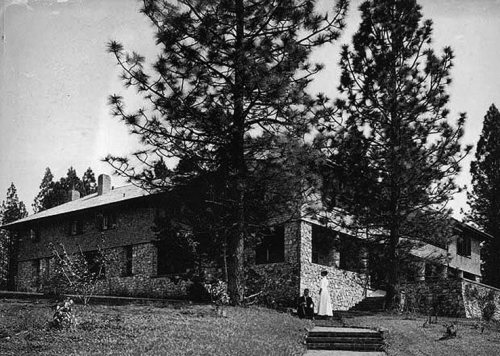
4 places in town are on the National Register, among them a historic district with 15 buildings. Below: 8 old photos and papers, maps from 1891 on, and the census since 1900.
From Grass Valley’s archive · credits on each photo
Quick answers
How Grass Valley began
When was Grass Valley founded?
1852
The Grass Valley post office opened in 1852, the earliest record of the town by name. Two smaller post offices, Centreville (1851) and Boston Ravine (1889), opened inside today’s city and later closed.
First census: 4,719 in 19002020 census: 14,016174 years
How historic is Grass Valley?
B+
More historic than 67% of U.S. towns, on its age, its old homes and the National Register.
Founding year: the first Grass Valley post office (Blevins & Helbock, CC0).The full story ↓
History grade
What drives Grass Valley’s History grade
On its age, its old homes and the National Register, Grass Valley is more historic than 67% of U.S. towns, #68 of 847 in California. Its National Register listings hold the grade up; its age pulls it down.
B+
HistoryA character grade: shown, never part of Grass Valley’s overall grade.
Few California towns list much on the Register (a typical California town has 0.0 per 10,000 residents, the U.S. 2.4), so Grass Valley’s 12.8 sits above most of its state (93% of California towns have fewer) while its 18 historic buildings outnumber those of 79% of U.S. towns.
How sure. Graded on any two of the three inputs instead, the letter would range from C+ to A−. The pre-1940 share is a Census survey estimate (±3.5 points). The founding year is the first post office, not a stated founding date.
Founding year: the first post office (other dates in Quick answers). Homes: Census ACS 2020–24. National Register: National Park Service, May 2026 list; each listing counted once (boundary changes and added documentation belong to their listing), and a historic district counts its contributing buildings. How TownRatings grades history →
What stands out about Grass Valley’s past
Read from the archive, the National Register and the record. The page puts what stands out first.
Lost post offices, old corners, places now gone and burying grounds
Grass Valley’s post office has been open since 1852. Two other post offices opened and closed inside today’s town.
Centreville
1851–1852
Grass Valley
1852–today
Boston Ravine
1889–1890
18501940today
Hamlets and corners on the map
Boston RavineCypress HillGlenbrookHills FlatOlympia GladeSpring Hill
Gone or out of use
Alpha MinemineCoe MinemineCrown Point MinemineGold Hill MinemineGranite Hill MinemineGrant Public SchoolschoolIdaho-Maryland MinemineLarimer MinemineMaslin ShaftmineNew Eureka MineminePeabody MineminePennsylvania MinemineSaint John MinemineScotia MinemineSpring Hill MinemineW G Jones Memorial HospitalhospitalWashington Public SchoolschoolWyoming Minemine
3cemeteries and burying grounds inside Grass Valley
Elm RidgeOld Grass Valley CityOld Saint Patrick's Catholic
US Post Offices dataset (Blevins & Helbock, CC0). Places and cemeteries from the USGS Geographic Names Information System (2021).
Every building
Grass Valley, building by building, 1891–1912
Fire insurance maps drew every building, what it was made of and what it was used for, so insurers could price the risk of fire. Pick a year, then a sheet.
Grass Valley, which was originally known as Boston Ravine and later named Centerville, dates from the California Gold Rush, as does nearby Nevada City. Gold was discovered at Gold Hill in October 1850 and population grew around the mine. When a post office was established in 1851, it was renamed Grass Valley the next year for unknown reasons. The town was incorporated in 1860.
By an Act of the Legi lature, approved April 15, 1861, the Town of Grass Valley was incorporated. The area wa twelve hundred yards square, lying north and south, of which th northwest corner of the Congregational church was the cent r.
Text read by machine from the scan; it may contain errors.
Bean's history and directory of Nevada County, California. Containing a complete history of the county, with sketches of the various towns and mining camps ... also, full statistics of mining and all other industrial resources1867 · page 189Read the page →
Read the text
The township of Grass Valley embraces Grass Valley proper, Boston Ravine, Allison Ranch, Massachusetts Hill, New York Hill, Forest Springs, Union Hill, Ophir Hill, Hucston Hill, Eureka Hill, Buena Vista, Sebastopol Hill, Osborne and countless other hills, as well as a host of prefixed ravines, at all of which localities quartz mining is conducted, and, in most instances, vrith highly satisfactory results.
Text read by machine from the scan; it may contain errors.
History of Nevada County, California1880 · page 218Read the page →
Read the text
1864, when he came to Graas Valley. He kept the Empire Stables from 1864 to 18C6 and the Fashion Stables until 1869. He then spent two years in the East, and returned to Grass Valley, Tie kept the Half Way House, between Nevada City and Grass Valley until 1875. He lived then a year in Nevada City and a short time in Grass Valley, when he purchased the old Wheeler
Text read by machine from the scan; it may contain errors.
Bean's history and directory of Nevada County, California. Containing a complete history of the county, with sketches of the various towns and mining camps ... also, full statistics of mining and all other industrial resources1867 · page 245Read the page →
Read the text
This mine, the situation of which, on the west side of Wolf Creek, about three miles below the town of Grass Valley, has already been alluded to, has obtained probably a more wide-spread fame than any other gold mine in California. The vein was discovered in 1851, by one of the present owners, in the bed of the creek, while washing for gold. The quartz was so rich in gold near the surface that it furnished all the means required to fully explore the mine and erect the mill.
Text read by machine from the scan; it may contain errors.
Scans and text from the Internet Archive. Books published in 1930 or earlier, which are in the public domain.
Timeline
Grass Valley, 1851 to 1982
Woven from the archive, old maps, post office records, the National Register and the people born here.
The Grass Valley post office opened in 1852, the earliest record of the town by name (U.S. post office records).
How does Grass Valley rank for history?
Grass Valley is more historic than 67% of U.S. towns, #68 of 847 in California. The History grade combines the town’s founding era, the share of homes built before 1940 and its National Register listings. It’s a character grade, so it isn’t part of the overall grade. How it works.
What is on the National Register in Grass Valley?
4 listings: 3 buildings, among them the Mount St. Mary's Academy and Convent (listed 1974, the first), and 1 historic district, the Empire Mine, with 15 contributing buildings. 18 historic buildings in all.
How old are the homes in Grass Valley?
14% of Grass Valley’s homes were built before 1940 (Census estimate, ±3.5 points), against a typical 3.4% for a California town; the median home was built in 1978.
Founding dates: Wikidata, Wikipedia, the U.S. post office records of Blevins & Helbock (CC0) and the Census. Homes by year built: Census ACS 2020–24. National Register of Historic Places: National Park Service (list of May 22, 2026). Old photos, postcards and papers: Wikimedia Commons, the Library of Congress and other public archives, credited on each item’s page. Maps: U.S. Geological Survey historical topographic maps (via Esri) and Sanborn fire-insurance maps (Library of Congress). History text and census tables: Wikipedia (CC BY-SA 4.0). Places that used to be: USGS Geographic Names Information System (2021).
From Wikimedia Commons (9), the Library of Congress (13), Wikidata (2), the National Register of Historic Places (4), Wikipedia, Wikidata and Wikipedia for famous people, U.S. Geological Survey historical maps, U.S. Census counts (via Wikipedia), the US Post Offices dataset (Blevins & Helbock), the USGS Geographic Names Information System, Sanborn fire insurance maps (Library of Congress) and old county and town histories (Internet Archive). Archive images are copied here with their credits and licenses, shown on each photo’s page. Refreshed monthly.


 Date?
 Date?
 Date?
 Date?
 Date?
 Date?
 Date?
 Date?
 2026
 2026
 2026
 2026
 2026
 2026
 2026
 2026
 2026
 2012
 2012
 2012
 2012
 2012