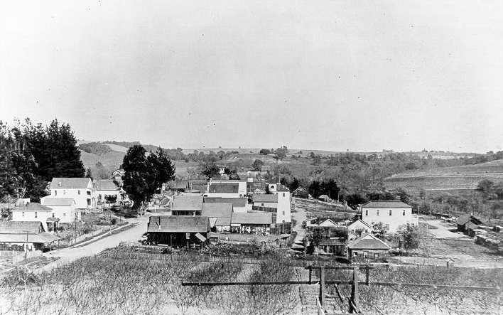
Forestville, California (1909), 1909
Forestville’s story
154 years in pictures
Census counts: 84 in 1880, 3,264 in 2020. The archive holds 5 old photos and papers going back to 1909 and 4 maps from 1942 on.
- 1872Forestville is settled
Each edition grades its towns against each other only.
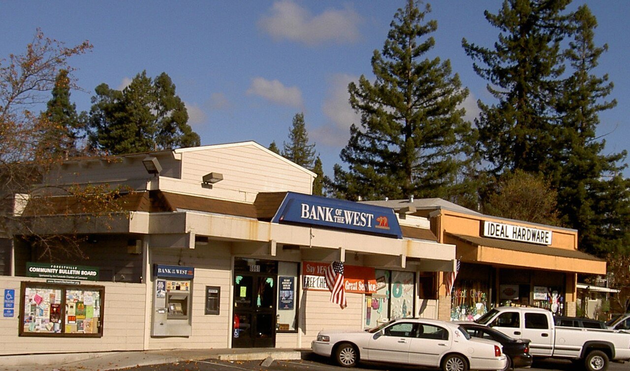
A town of 3,717, settled in 1872.
FEMA rates its natural-hazard risk higher than 98% of U.S. communities, with inland flooding at the top. Overall it grades C+, 268th of 841 graded towns in California. CDC estimates put its residents' health ahead of 90% of the country. Its weakest subject is cost of living: homes are expensive, about $618K for a typical one and 5.9 times the Santa Rosa metro’s $105K median household income. Forestville’s midsummer high is 80°F, below both California’s towns (89°F) and U.S. towns (85°F). The biggest park or preserve is Steelhead Beach Regional Park, at 45 acres.
Where Forestville beats most towns, and one thing worth knowing.
Where Forestville’s working residents go each day. Line width shows the share.
Census LEHD 2023
Each subject compared with towns across the country (schools within California), ordered by how far Forestville is from typical.
How TownRatings grades towns →
Census counts: 84 in 1880, 3,264 in 2020. The archive holds 5 old photos and papers going back to 1909 and 4 maps from 1942 on.
Museums, parks, gardens and other places to visit around Forestville. Close and well known come first.
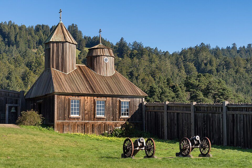 19 mi Ancient siteFort Ross
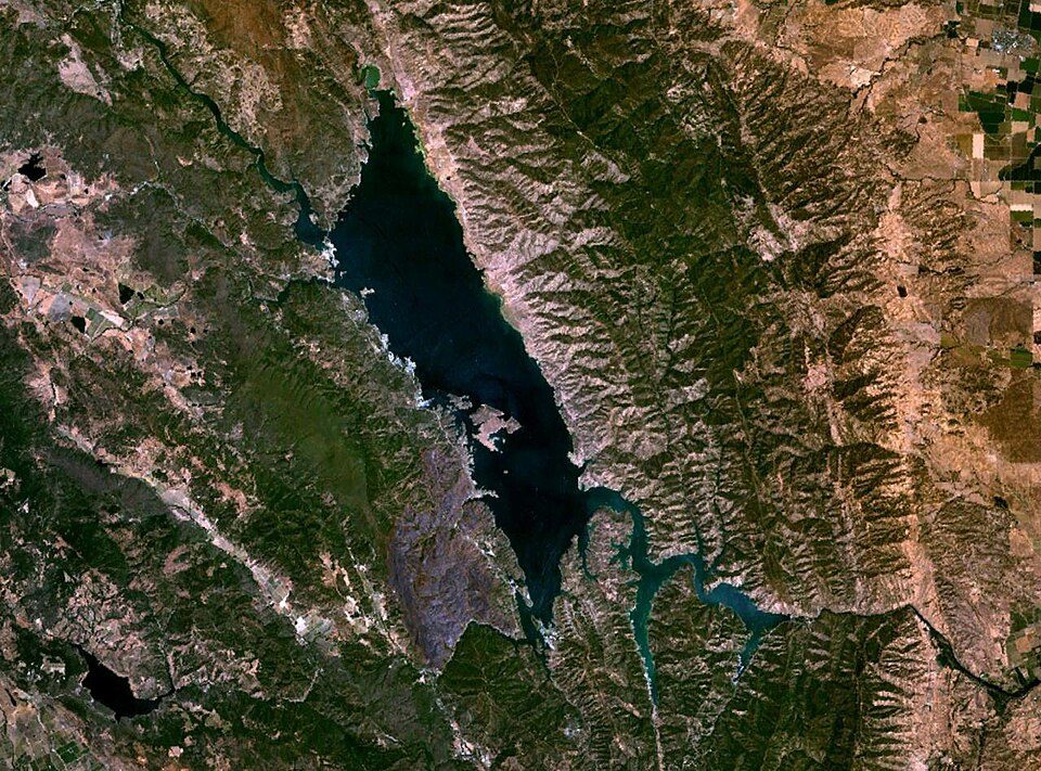 36 mi LakeLake Berryessa
 17 mi National SeashorePoint Reyes National Seashore2.4M visitors a year
 9 mi MuseumCharles M. Schulz Museum and Research Center
 16 mi Ancient siteBodega Bay
 18 mi National Recreation AreaGolden Gate National Recreation Area15.7M visitors a year
Fort Ross: Frank Schulenburg, CC BY-SA 4.0 · Lake Berryessa: Unknown, Public domain · Point Reyes National Seashore: King of Hearts, CC BY-SA 4.0 · Charles M. Schulz Museum and Research Center: BrokenSphere, CC BY-SA 3.0 · Bodega Bay: Pixistik1687, Public domain · Golden Gate National Recreation Area: Unknown, CC BY-SA 3.0
Forestville is unincorporated, so Sonoma County and regional agencies provide most services.
EPA SDWIS (Oct 9, 2026) · HIFLD + EIA-861 2025 · Census 2020 ZCTAs · NCES 2024–25 · registration: vote.gov, updated Nov 18, 2024.
Ordered by what stands out in Forestville.
Forestville has home values still below their peak, has commutes shorter than most of California and has a longer frost-free season than most of the country, though not than most of California.
Federal aid has come to Forestville households in 3 declared disasters; the latest was in 2020. FEMA puts just over three fifths of the town’s expected hazard losses down to inland flooding, and 26% to earthquakes.
FEMA disaster declarations and aid · FEMA National Risk Index · OpenFEMA
The Forestville Union Elementary school district runs its public schools. Two of its 5 schools are shown below, with the reason for each. The 4 public schools in Forestville teach 306 students between them.
| School | Level | Students | Letter |
|---|---|---|---|
| Forestville AcademyLargest public middle schoolGrades 2–8 | Grades 2–8 | 152 | – |
| Laguna HighLargest public high schoolGrades 9–12 | Grades 9–12 | 57 | C− |
NCES · EDFacts · graded within CA on state tests and graduation
Among adults in Forestville, 10% have diabetes. CDC measures, 32 in all: Forestville beats California on 14 and trails on 2. In Forestville, 25% of adults have obesity, and 17% get no exercise outside work.
| Forestville | California towns | U.S. towns | |
|---|---|---|---|
| Feel lonely (CDC PLACES) | 29% | 36% | 33% |
| Obesity (CDC PLACES) | 25% | 29% | 35% |
| Get no exercise (CDC PLACES) | 17% | 24% | 25% |
| Frequent mental distress (CDC PLACES) | 15% | 17% | 17% |
| What stands out | Forestville | CA |
|---|---|---|
| Fewer adults facing food insecurity | 8.2% | 17.9% |
| Fewer uninsured adults | 5.1% | 10.6% |
| More adults who have had cancer | 10.6% | 6.4% |
CDC PLACES 2025 · modeled estimates for adults · CMS · HRSA
The average commute for its 1,317 working residents takes 20.6 minutes, against 28.7 across California.
Between 2013 and 2023, jobs in Forestville dropped by 36, to 475. Just 5% of the town’s working residents have a job in town. The mean commuting time locally is 21 minutes. The top destinations are Santa Rosa (22%), Sebastopol (4%) and San Francisco (4%).
| Forestville | California towns | U.S. towns | |
|---|---|---|---|
| Average trip to work | 21 minutes | 28 minutes | 25 minutes |
| Median household income | $116,000 | $95,000 | $80,000 |
| Below the poverty line | 7.4% | 10% | 9.6% |
| Working residents who work in town | 5.3% | 6.6% | 8% |
Census LEHD 2023 · ACS
For adults 25 and older in Forestville, the share who hold a bachelor’s degree or more is 39%. Adults 18 to 34 are 13% of residents (24% statewide); people 65 and older are 25% of residents (16% statewide). The midpoint age for Forestville comes to 45.2 years.
| Forestville | California towns | U.S. towns | |
|---|---|---|---|
| Aged 65 or older | 25% | 16% | 18% |
| Median age | 45.2 years | 39 years | 40.5 years |
| Bachelor’s degree or more, 25+ | 39% | 29% | 29% |
51% women, 49% men
That’s an even split within the survey’s margin of ±1.5 points. Across California, 50.1% of residents are women.
| Forestville | CA | U.S. | |
|---|---|---|---|
| Under 10 | 11.7% | 11.4% | 11.6% |
| 10 to 17 | 8.7% | 10.5% | 10.3% |
| 18 to 24 | 4% | 9.1% | 9.1% |
| 25 to 34 | 9.4% | 14.8% | 13.7% |
| 35 to 44 | 16% | 13.9% | 13.2% |
| 45 to 54 | 9.2% | 12.5% | 12.2% |
| 55 to 64 | 16% | 12.1% | 12.7% |
| 65 to 74 | 16.6% | 9.2% | 10.2% |
| 75 and older | 8.5% | 6.5% | 7% |
| No diploma | 5.5% | 15.3% | 10.4% |
| High school | 18.1% | 20.5% | 26% |
| Some college | 27.7% | 19.3% | 19.1% |
| Associate’s | 9.5% | 7.9% | 8.8% |
| Bachelor’s | 21.5% | 22.7% | 21.6% |
| Graduate | 17.7% | 14.4% | 14.1% |
U.S. Census Bureau · ACS 2020-2024 5-year estimates · in a town of 3,700, single groups can be off by several points
The Graton weather station records that the frost-free season runs about 240 days: longer than most of the country, but shorter than 78% of California places with climate records.
For Forestville, the January low is 39°F.
NOAA U.S. Climate Normals, 1991–2020
The typical value, about $619K, is 8% below its May 2024 peak.
Forestville’s midpoint rent is $1,833 a month. In Forestville, 72% of households own their home. A home in Forestville typically sold within 33 days of listing.
| Forestville | California towns | U.S. towns | |
|---|---|---|---|
| Median rent | $1,833 a month | $1,898 a month | $1,185 a month |
| Households that own their home | 72% | 64% | 73% |
Census ACS, 2020–24 · Zillow Home Value Index · Redfin Data Center
Walkers can cover 2.4 miles of trail in 3 parks and preserves. In Forestville, the concentration of trails is 0.5 miles per square mile.
| Forestville | California towns | U.S. towns | |
|---|---|---|---|
| Miles of trail per square mile | 0.5 miles per square mile | 1.0 | 0.4 |
| Conserved land | 4.2% | 4.3% | 4.3% |
| Biggest places to walk | Trails | Acres |
|---|---|---|
| 1. Steelhead Beach Regional Park | 0.8 mi | 45 |
| 2. Forestville Youth Park | — | 7 |
| 3. Forestville Downtown Park | — | 1 |
Trails & parks © OpenStreetMap contributors · Conserved land: USGS PAD-US
1 within 15 miles of the center of Forestville
About 7 of every 100 Forestville residents are enrolled in college, about the same as California.
Census-designated place in California, United States
Forestville is a census-designated place (CDP) in Sonoma County, California, United States. It was settled during the late 1860s and was originally spelled Forrestville after one of its founders; the spelling was soon standardized with one "r". The population was 3,264 at the 2020 census, down from 3,293 at the 2010 census. By 1900, the community was known for attracting writers and artists and had a bohemian reputation. The small town has a limited number of businesses.
From Wikipedia, licensed CC BY-SA 4.0 · facts via Wikidata (CC0)
Short answers, built from the data on this page.
Forestville grades C+ overall, better than 42% of U.S. towns and #268 of 841 in California. It grades A for health and B for schools. Hazard risk is its weak spot, with a D−.
Yes. Cost of living, which also weighs rents, property taxes and how many households pay 30% or more of their income for housing, grades D.


