93 years in pictures
Census counts: 10,331 in 1970, 2,135 in 2020. The archive holds 12 old photos and papers going back to 1940 and 4 maps from 1947 on.
- 1933Edwards AFB is settled
Each edition grades its towns against each other only.

A town of 2,500, settled in 1933. A regional job hub with 722 jobs.
Homes are expensive, about for a typical one and times the Bakersfield metro’s $70K median household income. Overall it grades C−, 525th among California's 841 graded towns. Residents are healthier than 84% of U.S. towns on CDC estimates. Edwards AFB’s average trip to work is 11 minutes, against 28 minutes in California’s towns and 25 minutes across U.S. towns. No town in California scores lower than Edwards AFB on cost of living. Edwards AFB has 1 place on the National Register.
Where Edwards AFB beats most towns.
| Widest gap | Edwards AFB | CA |
|---|---|---|
| Fewer adults with heart disease | 1.6% | 5.6% |
Where Edwards AFB’s working residents go each day. Line width shows the share.
Census LEHD 2023
Each subject compared with towns across the country (schools within California), ordered by how far Edwards AFB is from typical.
How TownRatings grades towns →
Census counts: 10,331 in 1970, 2,135 in 2020. The archive holds 12 old photos and papers going back to 1940 and 4 maps from 1947 on.
Edwards AFB is unincorporated, so Kern County and regional agencies provide most services.
EPA SDWIS (Oct 9, 2026) · HIFLD + EIA-861 2025 · Census 2020 ZCTAs · NCES 2024–25 · registration: vote.gov, updated Nov 18, 2024.
Ordered by what stands out in Edwards AFB.
Edwards AFB draws workers from Lancaster and beyond and has more 90° days than nearly all U.S. towns, but it is a long drive from an emergency room.
722 jobs are based in Edwards AFB, 2.1 for every working resident, so most of the people who work here commute in. The average commute takes 11.2 minutes, against 28.7 across California.
Most working residents leave Edwards AFB for work: only 5% work in town. The top destinations are Los Angeles (9%), Bakersfield (8%) and Lancaster (6%). Half commute less than 69 miles.
| Edwards AFB | California towns | U.S. towns | |
|---|---|---|---|
| Median household income | $91,000 | $95,000 | $80,000 |
| Working residents who work in town | 5.5% | 6.6% | 8% |
Census LEHD 2023 · ACS
Its public schools are run by the Muroc Joint Unified school district. Two of its 3 schools are below, each with why it’s listed. The largest public high school is Desert Junior-Senior High, with 497 students.
| School | Level | Students | Letter |
|---|---|---|---|
| Irving L. Branch ElementaryLargest public elementary schoolGrades 3–6 | Grades 3–6 | 388 | B− |
| Desert Junior-Senior HighLargest public high schoolGrades 7–12 | Grades 7–12 | 497 | B |
NCES · EDFacts · graded within CA on state tests and graduation
The nearest emergency room, Antelope Valley Hospital, is 20 miles away in a straight line. Its widest gap with California is heart disease: 1.6% of its 1,304 adults have heart disease, against 5.6% statewide.
3.5% of adults have diabetes in Edwards AFB. Only 7 of the 847 California towns we compare have a higher share of adults who have been diagnosed with depression than Edwards AFB. 16% of adults have high blood pressure in Edwards AFB.
| Edwards AFB | California towns | U.S. towns | |
|---|---|---|---|
| Diabetes (CDC PLACES) | 3.5% | 12% | 12% |
| Frequent mental distress (CDC PLACES) | 23% | 17% | 17% |
| Binge drink (CDC PLACES) | 25% | 16% | 16% |
| High blood pressure (CDC PLACES) | 16% | 31% | 35% |
| What stands out | Edwards AFB | CA |
|---|---|---|
| Fewer adults with heart disease | 1.6% | 5.6% |
| Fewer adults with diabetes | 3.5% | 11.7% |
| More binge drinkers | 25.2% | 15.3% |
CDC PLACES 2025 · modeled estimates for adults · CMS · HRSA
14 miles of trail in 2 parks and preserves. The biggest park or preserve is Onizuka Park, at 29 acres.
| Biggest places to walk | Trails | Acres |
|---|---|---|
| 1. Onizuka Park | — | 29 |
| 2. Corvais Community Park | — | 10 |
Trails & parks © OpenStreetMap contributors · Conserved land: USGS PAD-US
The Mojave weather station, 17 miles away, records that about 110 days a year reach 90°, more than in 97% of U.S. towns. July afternoons average 99.6°, hotter than in 99% of U.S. towns; January nights average 33°.
Edwards AFB has mild winters and hot summers, with very little rain. Edwards AFB’s July high is 100°F. About 1 inches of snow falls in a winter.
| Edwards AFB | California towns | U.S. towns | |
|---|---|---|---|
| July high | 100°F | 89°F | 85°F |
| January low | 33°F | 41°F | 22°F |
NOAA U.S. Climate Normals, 1991–2020
Expected storm and flood damage is higher than in 65% of U.S. communities.
FEMA National Risk Index · OpenFEMA
Museums, parks, gardens and other places to visit around Edwards AFB. Close and well known come first.
7 mi LandmarkBalls 8in town MuseumAir Force Flight Test Museum
37 mi Park & preserveVasquez Rocks
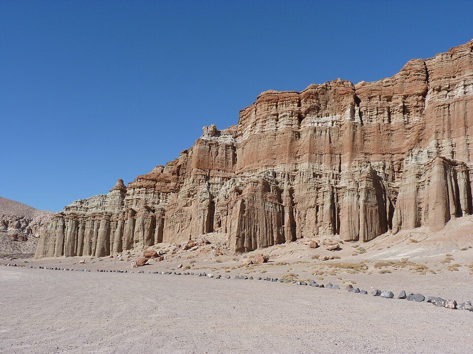
33 mi State parkRed Rock Canyon State Park37 mi Zoo & aquariumShambala Preserve
29 mi State parkAntelope Valley California Poppy ReserveBalls 8: NASA/Tony Landis, Public domain · Vasquez Rocks: Thomas from USA, CC BY 2.0 · Red Rock Canyon State Park: Jean trans h+, CC BY-SA 4.0 · Antelope Valley California Poppy Reserve: Thomas, CC BY 2.0
None within 15 miles of Edwards AFB; the nearest are
About 13 of every 100 Edwards AFB residents are enrolled in college, against 8 across California.
US Air Force base in California
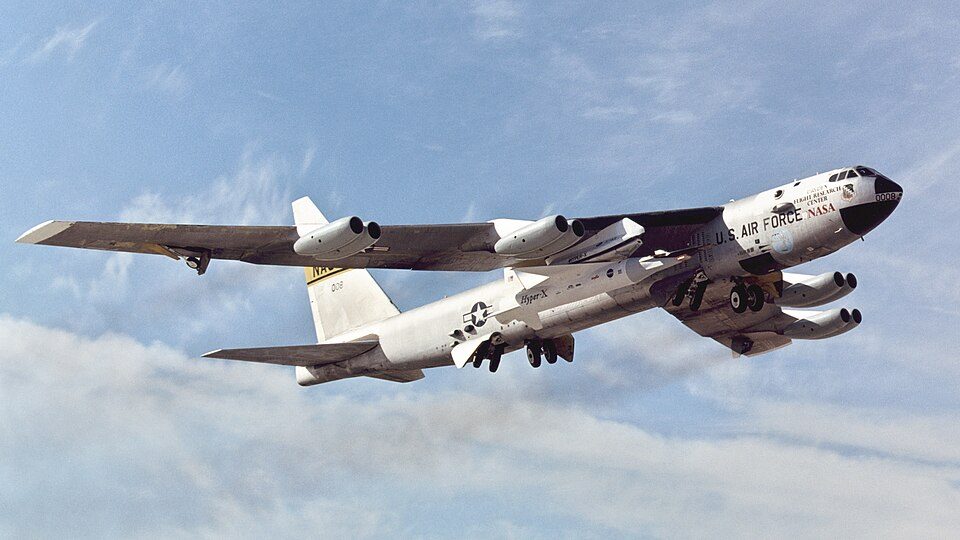
Edwards Air Force Base (AFB) (IATA: EDW, ICAO: KEDW, FAA LID: EDW) is a United States Air Force installation in California. Most of the base sits in Kern County, but its eastern end is in San Bernardino County and a southern arm is in Los Angeles County. The hub of the base is Edwards, California. Established in the 1930s as Muroc Field, the facility was renamed Muroc Army Airfield and then Muroc Air Force Base before its final renaming in 1950 for World War II USAAF veteran and test pilot Capt. Glen Edwards. Edwards is the home of the Air Force Test Center, Air Force Test Pilot School, and NASA's Armstrong Flight Research Center. It is the Air Force Materiel Command center for conducting a…
From Wikipedia, licensed CC BY-SA 4.0 · facts via Wikidata (CC0)
Short answers, built from the data on this page.
Edwards AFB grades C− overall, better than 17% of U.S. towns and #525 of 841 in California. It grades A− for health and B− for schools. Cost of living is its weak spot, with a D−.