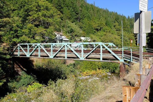
177 years in pictures
The archive holds 18 old photos and papers going back to 1940 and 3 maps from 1951 on.
5 places on the National Register of Historic Places.
- 1849Downieville is founded
Each edition grades its towns against each other only.

17% of working residents work locally in Downieville, where California’s towns sit at 6.6% and U.S. towns at 8%. 79% of the land in Downieville is conserved, above both California’s towns (4.3%) and U.S. towns (4.3%). The biggest place to walk is Tahoe National Forest, 2,028 acres with 5.8 miles of trail. Downieville has fewer than 1,000 residents, too few for fair grades; the figures below are still real.
Where Downieville beats most towns.
The archive holds 18 old photos and papers going back to 1940 and 3 maps from 1951 on.
5 places on the National Register of Historic Places.
Downieville is unincorporated, so Sierra County and regional agencies provide most services.
EPA SDWIS (Oct 9, 2026) · HIFLD + EIA-861 2025 · Census 2020 ZCTAs · NCES 2024–25 · registration: vote.gov, updated Nov 18, 2024.
Ordered by what stands out in Downieville.
In Downieville, the density of trails is 1.8 miles per square mile.
| Biggest places to walk | Trails | Acres |
|---|---|---|
| 1. Tahoe National Forest | 5.8 mi | 2,028 |
Trails & parks © OpenStreetMap contributors · Conserved land: USGS PAD-US
Its two schools are below. The public schools here belong to the Sierra-Plumas Joint Unified school district.
| School | Level | Students | Letter |
|---|---|---|---|
| Downieville ElementaryLargest public elementary schoolGrades K–6 | Grades K–6 | 26 | – |
| Downieville Junior-Senior HighLargest public high schoolGrades 7–12 | Grades 7–12 | 19 | – |
NCES · EDFacts
In Downieville, 58% of households are owner-occupiers.
Census ACS, 2020–24 · Zillow Home Value Index · Redfin Data Center
Jobs based in Downieville grew to 200 in 2023, 104 more than in 2013. For half of commuters, work is under 43 miles away. The top destinations are Truckee (8%), Reno (7%) and Loyalton (5%).
Census LEHD 2023 · ACS
Downieville’s risk rating from FEMA comes in at 99 of 100. Expected losses in Downieville break down as 43% from inland flooding and 41% from wildfires.
FEMA National Risk Index · OpenFEMA
A winter brings about 26 inches of snow, with January nights at 28° and July afternoons at 87°.
NOAA U.S. Climate Normals, 1991–2020
16% of Downieville adults report frequent mental distress. Against the California average, Downieville comes out ahead on 9 CDC measures out of 32, and behind on 12. Among adults here, 19% report frequent physical distress and 12% binge drink.
| Downieville | California towns | U.S. towns | |
|---|---|---|---|
| High blood pressure (CDC PLACES) | 47% | 31% | 35% |
| Frequent physical distress (CDC PLACES) | 19% | 14% | 14% |
| Binge drink (CDC PLACES) | 12% | 16% | 16% |
| Fair or poor health (CDC PLACES) | 27% | 22% | 19% |
| What stands out | Downieville | CA |
|---|---|---|
| Fewer uninsured adults | 7.3% | 10.6% |
| Fewer adults facing housing insecurity | 10.4% | 14.9% |
| More adults with COPD | 11.6% | 5.1% |
CDC PLACES 2025 · modeled estimates for adults · CMS · HRSA
None within 15 miles of Downieville; the nearest are
About 0 of every 100 Downieville residents are enrolled in college, against 8 across California.
In a town this size, neighbors are the best guide. Ask them anything.
5 places in Downieville on the National Register of Historic Places.
Census-designated place in California, United States
Downieville is a census-designated place in and the county seat of Sierra County, California, United States. Downieville is on the North Fork of the Yuba River, at an elevation of 2,966 feet (904 m). The 2020 United States census reported Downieville's population was 290.
From Wikipedia, licensed CC BY-SA 4.0 · facts via Wikidata (CC0)
Short answers, built from the data on this page.
Downieville has fewer than 1,000 residents, too few for fair grades; the figures below are still real.