Guest, Sign inJoin

Post to Davenport

We’ll email a one-tap link to publish your post. No password, and nothing is public until you click it.
Already a member? Sign in
–Not graded
History · Davenport

Davenport’s post office opened in 1874, and 56% of its homes were built before 1940

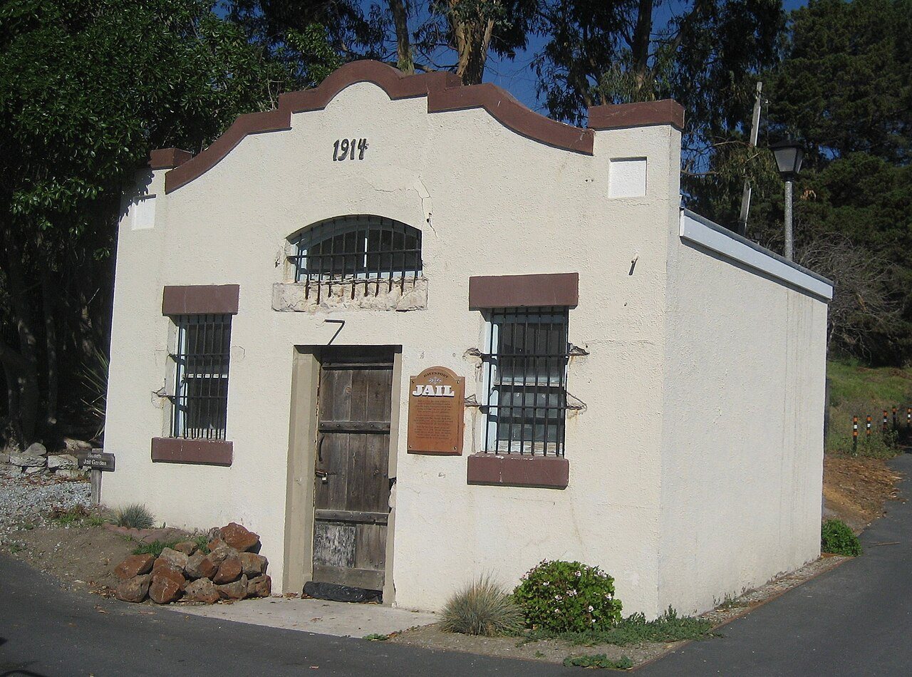
Its Register listing is the Davenport Jail. Below: maps from 1943 on and old-book passages.

1874first post office
1on the National Register
56%homes built before 1940
Quick answers

How Davenport began

When was Davenport founded?

1874

The Davenport post office opened in 1874, the earliest record of the town by name.

2020 census: 388152 years
Founding year: the first Davenport post office (Blevins & Helbock, CC0).The full story ↓

What stands out about Davenport’s past

Read from the archive, the National Register and the record. The page puts what stands out first.

★ What stands out · Help out

Start Davenport’s collection

The first neighbors to add old photos shape how Davenport’s history is told.

Decades since 1900 with photos
00s10s20s30s40s50s60s70s80s90s
0 of 10 decades. The empty ones are waiting for someone’s album.
The story

How Davenport came to be

From Wikipedia’s history of Davenport.

Read it all →

A whaling captain named John Pope Davenport settled at El Jarro Point, about half a mile from today's town, in 1867. Davenport built a 400-foot wharf at the mouth of Agua Puerca Creek ("agua puerca" translates to "muddy water"). This wharf was built to load the lumber brought down from the hills for shipment to Santa Cruz. A small village grew up around the port and was known as Davenport Landing. The local post office began operations in 1874, but was known only as Davenport. Agua Puerca Creek lived up to its name by bringing down so much mud that the port filled up and steamers could not tie up to the wharf to load lumber. A small extension did not solve the problem. Then a competitor built a longer wharf, but it was destroyed in a storm. Captain Davenport went bankrupt and moved to Santa Cruz. The post office in Davenport Landing closed in 1889.

Text from Wikipedia, licensed CC BY-SA 4.0.

From the old history books

What they wrote about Davenport in 1858

Passages that mention Davenport, cut from the printed page as they were published.

This sidewalk estimate includes none above the Eailroad Bridge, none in East Davenport, and none in North Davenport, except Brady street, though they are all within the city limits ; these would certainly eke out the measures to twenty miles of sidewalk in the city of Davenport.
Davenport, past and present1858 · page 134Read the page →
Read the text

This sidewalk estimate includes none above the Eailroad Bridge, none in East Davenport, and none in North Davenport, except Brady street, though they are all within the city limits ; these would certainly eke out the measures to twenty miles of sidewalk in the city of Davenport.

Text read by machine from the scan; it may contain errors.
The town of Davenport was incorporated by this Legislature. The first election for township officers was held April first. Rodolphus Bennett was elected Mayor, Frazer "Wilson :Recorder, and Dr. A. C. Donaldson, D. C. Eldredge, Jobn Forrest, Thomas Dillon, and Capt. John Litch, Trustees.
Davenport, past and present1858 · page 70Read the page →
Read the text

The town of Davenport was incorporated by this Legislature. The first election for township officers was held April first. Rodolphus Bennett was elected Mayor, Frazer "Wilson :Recorder, and Dr. A. C. Donaldson, D. C. Eldredge, Jobn Forrest, Thomas Dillon, and Capt. John Litch, Trustees.

Text read by machine from the scan; it may contain errors.

Scans and text from the Internet Archive. Books published in 1930 or earlier, which are in the public domain.

By decade

Davenport, decade by decade

On the map

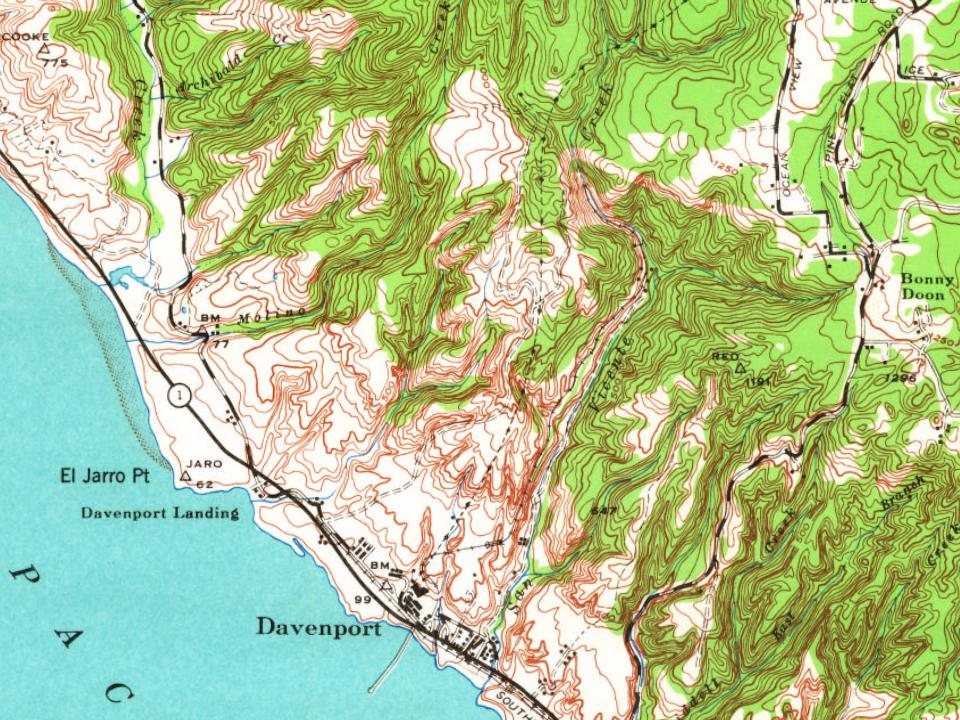
Davenport on the map, 1943 to 1991

Every edition of the U.S. Geological Survey’s map of Davenport. Tap a year, or press play to watch the town change.

Davenport on the 1943 USGS mapDavenport on the 1955 USGS mapDavenport on the 1968 USGS mapDavenport on the 1991 USGS map1943Ben Lomond sheet · 1:62,500

U.S. Geological Survey historical topographic maps (public domain), via Esri’s collection of the scans. The red ring marks the center of Davenport.

On the National Register

1 historic place in Davenport

The country’s official list of buildings and places worth saving.

place listed
1
National Historic Landmarks
0
none yet
historic buildings protected
1
each building in a district counts
first listed
1992
Davenport Jail
Buildings

Architectural styles listings

Late 19th and Early 20th Century Revivals: Mission/Spanish Colonial Revival1

National Park Service, National Register of Historic Places. Photos from Wikimedia Commons, credited on each place’s page.

Famous people

Famous people close to Davenport

Nobody well known was born in Davenport itself, so here are the best known from just nearby.

See all →
Places that used to be

Old corners

Davenport’s post office has been open since 1874.

Hamlets and corners on the map
Davenport Landing

US Post Offices dataset (Blevins & Helbock, CC0). Places and cemeteries from the USGS Geographic Names Information System (2021).

Questions about Davenport’s history

What year was Davenport founded?

The Davenport post office opened in 1874, the earliest record of the town by name (U.S. post office records).

What is on the National Register in Davenport?

One place: the Davenport Jail (listed 1992).

Memory lane

What the archives can’t tell you, neighbors can.

Town Square →
Start a conversation
Sources

Where this page comes from

Founding dates: Wikidata, Wikipedia, the U.S. post office records of Blevins & Helbock (CC0) and the Census. Homes by year built: Census ACS 2020–24. National Register of Historic Places: National Park Service (list of May 22, 2026). Old photos, postcards and papers: Wikimedia Commons, the Library of Congress and other public archives, credited on each item’s page. Maps: U.S. Geological Survey historical topographic maps (via Esri) and Sanborn fire-insurance maps (Library of Congress). History text and census tables: Wikipedia (CC BY-SA 4.0). Places that used to be: USGS Geographic Names Information System (2021). How TownRatings grades history →

From Wikimedia Commons (9), the Library of Congress (3), the National Register of Historic Places (1), Wikipedia, U.S. Geological Survey historical maps, the US Post Offices dataset (Blevins & Helbock), the USGS Geographic Names Information System and old county and town histories (Internet Archive). Archive images are copied here with their credits and licenses, shown on each photo’s page. Refreshed monthly.