174 years in pictures
Census counts: 814 in 1860, 13,776 in 2020. The archive holds 30 old photos and papers going back to 1888 and 4 maps from 1944 on.
14 places on the National Register of Historic Places.
- 1852Auburn is settled
Each edition grades its towns against each other only.

Auburn grades B− overall, 218th of 841 graded towns in California, with clear strengths and some subjects that lag. It is more walkable than 91% of U.S. towns and it has 12 miles of trail. On the other side, homes are expensive, about $627K for a typical one and 6.4 times the Sacramento metro’s $97K median household income. Auburn’s trail density is 1.7 miles per square mile, above both California’s towns (1.0) and U.S. towns (0.4). On hazard risk, just 13 of California’s 1,064 towns do better. Its National Register listings include Old Auburn Historic District and Mountain Quarries Bridge.
Where Auburn beats most towns.
Census counts: 814 in 1860, 13,776 in 2020. The archive holds 30 old photos and papers going back to 1888 and 4 maps from 1944 on.
14 places on the National Register of Historic Places.
Each subject compared with towns across the country (schools within California), ordered by how far Auburn is from typical.
How TownRatings grades towns →
Who provides power, water and the rest in Auburn, and how to reach them.
EPA SDWIS (Oct 9, 2026) · HIFLD + EIA-861 2025 · Census 2020 ZCTAs · NCES 2024–25 · registration: vote.gov, updated Nov 18, 2024.
Ordered by what stands out in Auburn.
Auburn carries less natural-hazard risk than nearly all of California (mostly inland flooding) and has seen reported crime fall by a third or more, but it has lost a quarter or more of its jobs in ten years.
On this, Auburn is above both the California town median (4.2%) and the median of U.S. towns (4.3%). The biggest park or preserve is Auburn Recreation Park, at 23 acres.
| Biggest places to walk | Trails | Acres |
|---|---|---|
| 1. Auburn Recreation Park | 0.4 mi | 23 |
| 2. Railhead Park | — | 10 |
| 3. American River Canyon Overlook Park | 0.2 mi | 6 |
Trails & parks © OpenStreetMap contributors · Conserved land: USGS PAD-US
Two of its 10 schools are below, each with why it’s listed. The largest public high school is Placer High, with 1,265 students.
| School | Level | Students | Letter |
|---|---|---|---|
| Skyridge ElementaryLargest public elementary schoolGrades K–8 | Grades K–8 | 461 | B |
| Placer HighLargest public high schoolGrades 9–12 | Grades 9–12 | 1,265 | B+ |
NCES · EDFacts · graded within CA on state tests and graduation
FEMA rates its natural-hazard risk lower than 100% of California towns, with expected losses of about $94 per resident a year; that rating is what its B+ for hazard risk is built on.
Auburn’s FEMA risk score is 10 of 100. Since 1986, 25 flood insurance claims have been paid out in Auburn.
FEMA flood insurance claims · FEMA National Risk Index · OpenFEMA
People 65 and older are 27% of residents (16% statewide); adults 18 to 34 are 18% of residents (24% statewide). The median age in Auburn is 47.5 years. 41% of adults 25 and older have a bachelor’s degree or more, vs 37% across California.
| Auburn | California towns | U.S. towns | |
|---|---|---|---|
| Aged 65 or older | 27% | 16% | 18% |
| Median age | 47.5 years | 39 years | 40.5 years |
| Under 18 | 17% | 22% | 22% |
| Bachelor’s degree or more, 25+ | 41% | 29% | 29% |
54% women, 46% men
About 87 men for every 100 women (the survey’s margin: ±2.4 points). Across California, 50.1% of residents are women.
| Auburn | CA | U.S. | |
|---|---|---|---|
| Under 10 | 9.4% | 11.4% | 11.6% |
| 10 to 17 | 7.6% | 10.5% | 10.3% |
| 18 to 24 | 7.3% | 9.1% | 9.1% |
| 25 to 34 | 10.6% | 14.8% | 13.7% |
| 35 to 44 | 12.3% | 13.9% | 13.2% |
| 45 to 54 | 9.1% | 12.5% | 12.2% |
| 55 to 64 | 16.6% | 12.1% | 12.7% |
| 65 to 74 | 17.1% | 9.2% | 10.2% |
| 75 and older | 9.9% | 6.5% | 7% |
| No diploma | 6.1% | 15.3% | 10.4% |
| High school | 18.8% | 20.5% | 26% |
| Some college | 23.3% | 19.3% | 19.1% |
| Associate’s | 11.3% | 7.9% | 8.8% |
| Bachelor’s | 23% | 22.7% | 21.6% |
| Graduate | 17.6% | 14.4% | 14.1% |
U.S. Census Bureau · ACS 2020-2024 5-year estimates
Auburn beats the California average on 11 of 32 CDC measures and trails it on 7. 37% of adults have high blood pressure in Auburn.
| Auburn | California towns | U.S. towns | |
|---|---|---|---|
| Sleep under 7 hours (CDC PLACES) | 32% | 35% | 36% |
| Feel lonely (CDC PLACES) | 32% | 36% | 33% |
| High blood pressure (CDC PLACES) | 37% | 31% | 35% |
| Yearly checkup (CDC PLACES) | 76% | 72% | 79% |
| What stands out | Auburn | CA |
|---|---|---|
| Fewer uninsured adults | 6% | 10.6% |
| Fewer adults facing housing insecurity | 9.8% | 14.9% |
| More adults who have had cancer | 10.8% | 6.4% |
CDC PLACES 2025 · modeled estimates for adults · CMS · HRSA
Auburn has mild winters and hot summers. July afternoons reach 94° and January nights drop to 38°.
NOAA U.S. Climate Normals, 1991–2020
The typical Auburn home is worth about $627,000, up 1.2% in a year, 18% below the California typical home. 62% of Auburn households own their home.
| Auburn | California towns | U.S. towns | |
|---|---|---|---|
| Median rent | $1,501 a month | $1,898 a month | $1,185 a month |
| Households that own their home | 62% | 64% | 73% |
Census ACS, 2020–24 · Zillow Home Value Index · Redfin Data Center
Jobs based here fell from 9,384 in 2013 to 7,165. The average commute for its 5,933 working residents takes 21.2 minutes, against 28.7 across California.
Most working residents leave Auburn for work: only 13% work in town. Since 2013, Auburn has lost 2,219 jobs, to 7,165 in 2023. The top destinations are North Auburn (10%), Sacramento (9%) and Roseville (9%).
| Auburn | California towns | U.S. towns | |
|---|---|---|---|
| Average trip to work | 21 minutes | 28 minutes | 25 minutes |
| Work from home | 19% | 14% | 11% |
| Working residents who work in town | 13% | 6.6% | 8% |
| Below the poverty line | 13% | 10% | 9.6% |
Census LEHD 2023 · ACS
Reported crimes fell from 184 to 106 over the last three FBI years, a drop beyond ordinary year-to-year swings.
Within California, it does better than 77% of towns.
| Auburn | California towns | U.S. towns | |
|---|---|---|---|
| Property crimes per 1,000 (2025) | 6 per 1,000 residents | 13.4 | 9.9 |
| Violent crimes per 1,000 (2025) | 1.7 per 1,000 residents | 2.9 | 1.6 |
FBI crime data, 2025 · crimes reported to police
Museums, parks, gardens and other places to visit around Auburn. Close and well known come first.
29 mi Stadium & arenaARCO Arena
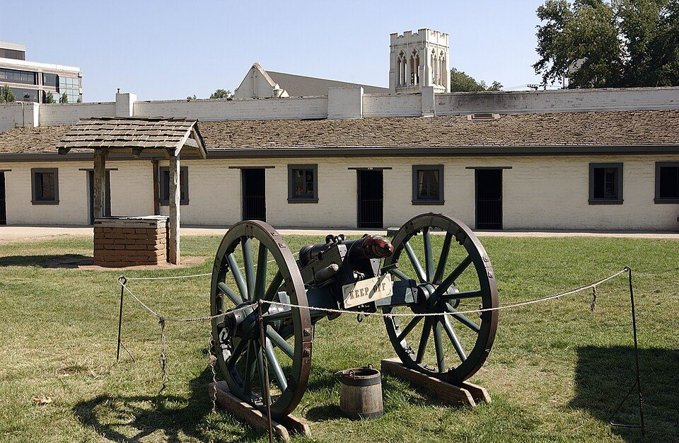
31 mi State parkSutter's Fort
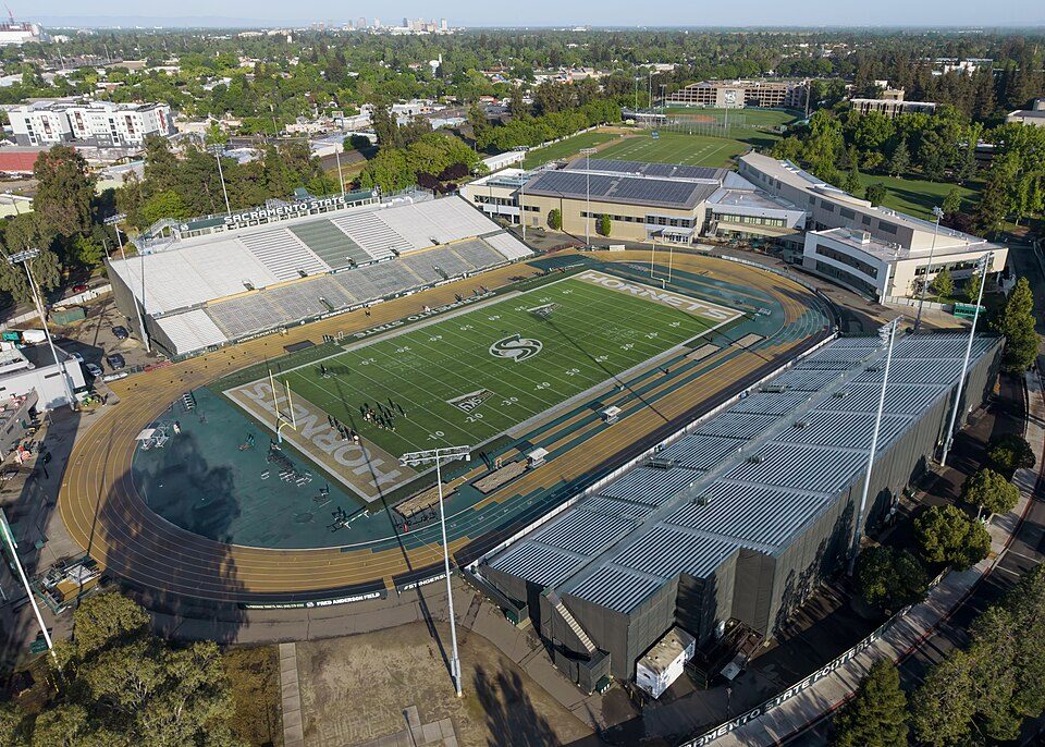
30 mi Stadium & arenaHornet Stadium
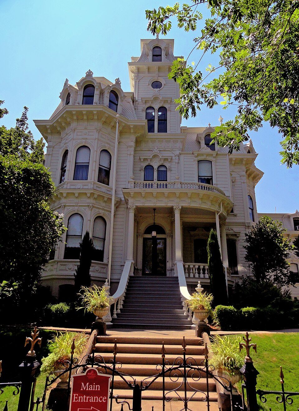
31 mi State parkGovernor's Mansion State Historic Park
21 mi State parkEmpire Mine State Historic Park
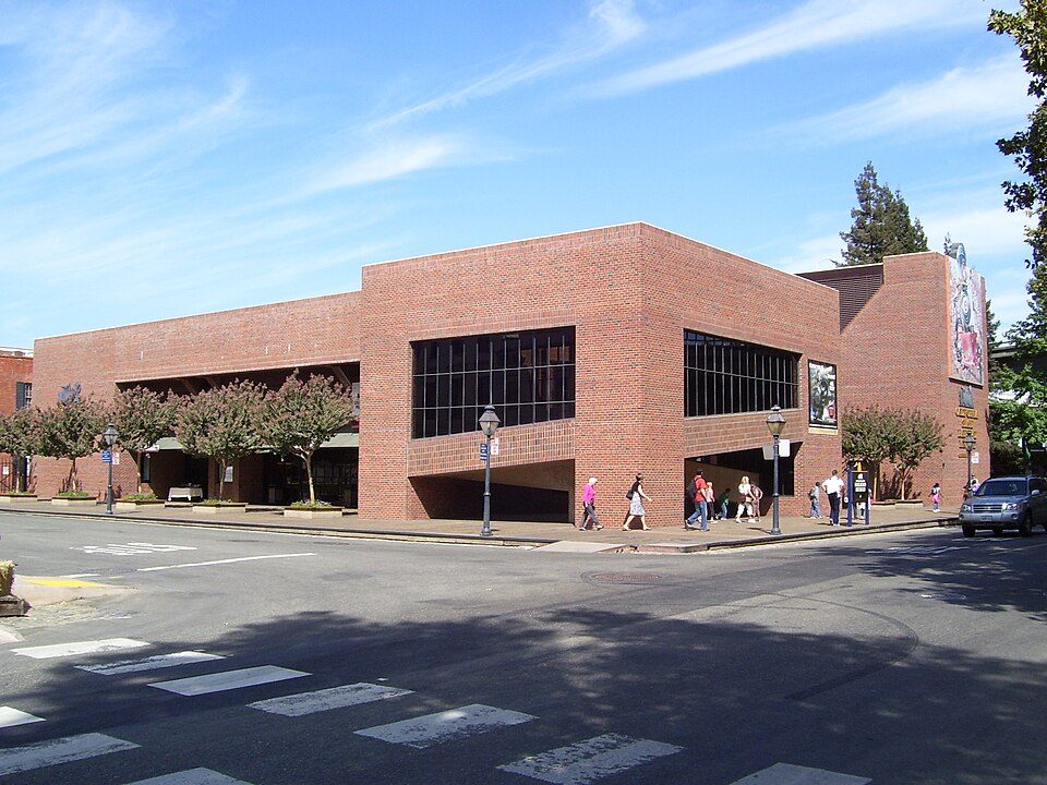
32 mi MuseumCalifornia State Railroad Museum500K visitors a yearARCO Arena: CLopez63, CC BY-SA 3.0 · Sutter's Fort: Ian Howard, CC BY 2.5 · Hornet Stadium: Quintin Soloviev, CC BY 4.0 · Governor's Mansion State Historic Park: Mark James Miller, CC BY 3.0 · Empire Mine State Historic Park: Beej71, CC BY 2.5 · California State Railroad Museum: The original uploader was Swampyank at English Wikipedia., CC BY-SA 3.0
2 within 15 miles of the center of Auburn
About 4 of every 100 Auburn residents are enrolled in college, against 8 across California.
14 places in Auburn on the National Register of Historic Places.
19 notable people were born in Auburn.


City in California, United States
Auburn is a city in and the county seat of Placer County, California, United States. Its population was 13,776 at the 2020 census. Auburn is known for its California Gold Rush history and is registered as a California Historical Landmark. Auburn is part of the Sacramento metropolitan area.
From Wikipedia, licensed CC BY-SA 4.0 · facts via Wikidata (CC0)
One town shares a border with Auburn.
| Town | CA rank | Overall | Cost | Safety | Schools | Health |
|---|---|---|---|---|---|---|
| Auburn | #218 | B− | D | B− | B+ | B+ |
| North Auburn | #212 | B− | D | — | B+ | B |
North Auburn reports no FBI crime data of its own. Compare Auburn with a neighbor →
Short answers, built from the data on this page.
Auburn grades B− overall, better than 48% of U.S. towns and #218 of 841 in California. It grades B+ for health, B− for safety and B+ for schools. Cost of living is its weak spot, with a D.
Within California, it does better than 77% of towns.
Yes. Cost of living, which also weighs rents, property taxes and how many households pay 30% or more of their income for housing, grades D.
19 notable people were born here, including Kane Hodder and Stacy Dragila.