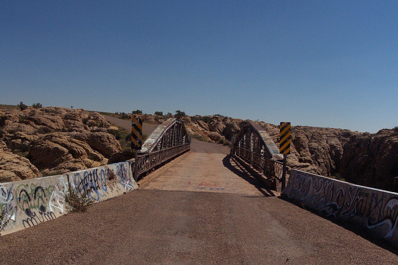
Winslow West in pictures
Census counts: 131 in 2000, 457 in 2020. The archive holds 2 old photos and papers going back to 2004 and a map from 1983 on.
1 place on the National Register of Historic Places.
Explore the history →Each edition grades its towns against each other only.

It is a town of 335 residents in Arizona.
37% of residents live below the poverty line in Winslow West, where Arizona’s towns sit at 12% and U.S. towns at 9.6%. Only 2 of the 141 Arizona towns we compare have a lower share of adults with a bachelor’s degree than Winslow West. 36% of the land in Winslow West is conserved, against 14% in Arizona’s towns and 4.3% across U.S. towns. Chevelon Creek Bridge and Jack's Canyon Bridge is on the National Register of Historic Places. Winslow West has fewer than 1,000 residents, too few for fair grades; the figures below are still real.
Census counts: 131 in 2000, 457 in 2020. The archive holds 2 old photos and papers going back to 2004 and a map from 1983 on.
1 place on the National Register of Historic Places.
Explore the history →In a town this size, neighbors are the best guide. Ask them anything.
Ordered by what stands out in Winslow West.
5.2 miles of trail. The trail density for Winslow West comes to 0.3 miles per square mile.
Trails & parks © OpenStreetMap contributors · Conserved land: USGS PAD-US
Half the trips to work are shorter than 52 miles. The top destinations are Flagstaff (20%), Winslow (19%) and Phoenix (9%).
Census LEHD 2023 · ACS
Winslow West’s typical July afternoon high is 95°F.
NOAA U.S. Climate Normals, 1991–2020
Winslow West: nearly a quarter of adults worry about having enough food. Among 141 Arizona towns, just 8 have a higher share of adults who report frequent mental distress than Winslow West.
| Winslow West | Arizona towns | U.S. towns | |
|---|---|---|---|
| Yearly checkup (CDC PLACES) | 67% | 75% | 79% |
| Frequent mental distress (CDC PLACES) | 21% | 16% | 17% |
| Food insecurity (CDC PLACES) | 24% | 15% | 14% |
| Feel lonely (CDC PLACES) | 35% | 31% | 33% |
| What stands out | Winslow West | AZ |
|---|---|---|
| Fewer adults who have had cancer | 6.1% | 8.8% |
| Fewer adults with high cholesterol | 29.5% | 37.3% |
| More adults facing a utility shut-off | 13.2% | 7.2% |
CDC PLACES 2025 · modeled estimates for adults · CMS · HRSA
FEMA puts nearly three quarters of Winslow West’s expected hazard losses down to inland flooding, and 11% to lightning. Expected storm and flood damage is higher than in 58% of U.S. communities.
FEMA National Risk Index · OpenFEMA
Winslow West is unincorporated, so Coconino County and regional agencies provide most services.
EPA SDWIS (Oct 9, 2026) · HIFLD + EIA-861 2025 · Census 2020 ZCTAs · NCES 2024–25 · registration: vote.gov, updated Sep 12, 2025.
Where Winslow West’s working residents go each day. Line width shows the share.
Census LEHD 2023
None within 15 miles of Winslow West; the nearest are
About 0 of every 100 Winslow West residents are enrolled in college, against 6 across Arizona.
CDP in Coconino County, Arizona
Winslow West is a census-designated place (CDP) in Navajo and Coconino counties in Arizona, United States. The population was 438 at the 2010 census. The entire community is off-reservation trust land belonging to the Hopi Tribe of Arizona. It lies just west of the city of Winslow, and is more than 50 km (31 mi) south of the main Hopi Reservation.
From Wikipedia, licensed CC BY-SA 4.0 · facts via Wikidata (CC0)
Short answers, built from the data on this page.
Winslow West has fewer than 1,000 residents, too few for fair grades; the figures below are still real.
Ask a question, answer one, post a photo or an event. Free, and the parts only a neighbor would know are the parts worth reading.