Wickenburg dates to 1863, and 24 of its places are on the National Register
More historic than 43% of U.S. towns · #28 of 140 in Arizona. What drives it
Most of Wickenburg was built recently: 2% of its homes predate 1940 and the median home dates from 1993. 24 places in town are on the National Register, among them a historic district with 6 buildings. Below: maps from 1915 on and the census since 1870.
Founding year: Wikidata. First post office: 1878.The full story ↓
History grade
What drives Wickenburg’s History grade
On its age, its old homes and the National Register, Wickenburg is more historic than 43% of U.S. towns, #28 of 140 in Arizona. Its National Register listings hold the grade up; its share of homes from before 1940 pulls it down.
C+
HistoryA character grade: shown, never part of Wickenburg’s overall grade.
Few Arizona towns list much on the Register (a typical Arizona town has 0.1 per 10,000 residents, the U.S. 2.4), so Wickenburg’s 37.2 sits above most of its state (86% of Arizona towns have fewer) while its 30 historic buildings outnumber those of 82% of U.S. towns.
How sure. Graded on any two of the three inputs instead, the letter would range from C− to B. The pre-1940 share (±1.9 points) is firm at this size. Two sources give 1863.
Founding year: Wikidata (other dates in Quick answers). Homes: Census ACS 2020–24. National Register: National Park Service, May 2026 list; each listing counted once (boundary changes and added documentation belong to their listing), and a historic district counts its contributing buildings. How TownRatings grades history →
What stands out about Wickenburg’s past
Read from the archive, the National Register and the record. The page puts what stands out first.
The Wickenburg area, along with much of the Southwest, became part of the United States by the 1848 treaty that ended the Mexican–American War. An expedition into the area took place on January 7, 1860, when the Gila Rangers led by Jack Swilling, entered an unexplored part of central Arizona while pursuing Tonto Apache raiders who had stolen stock from miners and the Overland Mail Company.
In 1862, a gold strike on the Colorado River near present-day Yuma brought American prospectors, who searched for minerals throughout central Arizona. Many of the geographic landmarks now bear the names of these pioneers, including the Weaver Mountains, named after mountain man Pauline Weaver, and Peeples Valley, named after a settler.
Lost post offices, old corners, places now gone and burying grounds
Wickenburg’s post office has been open since 1894. Another post office, Wickenburgh, opened and closed inside today’s town.
Wickenburgh
1878–1894
Wickenburg
1894–today
18701950today
Hamlets and corners on the map
Aztec Mobile Home ParkDesert Cypress Trailer RanchPalm Drive Trailer RanchValle Vista Trailer ParkWestpark Mobile Home Park
Gone or out of use
Flying E Guest Ranch Airportairport
5cemeteries and burying grounds inside Wickenburg
GarciaHenry Wickenburg PioneerSaint Alban's Episcopal Church Memorial GardenSaint Anthony de Padua Catholic Church ColumbariumWickenburg
US Post Offices dataset (Blevins & Helbock, CC0). Places and cemeteries from the USGS Geographic Names Information System (2021).
Questions about Wickenburg’s history
What year was Wickenburg founded?
In 1863, according to Wikidata. Wickenburg’s post office opened in 1878, and the census of 1870 counted 174 people here.
How does Wickenburg rank for history?
Wickenburg is more historic than 43% of U.S. towns, #28 of 140 in Arizona. The History grade combines the town’s founding era, the share of homes built before 1940 and its National Register listings. It’s a character grade, so it isn’t part of the overall grade. How it works.
What is on the National Register in Wickenburg?
24 listings: 22 buildings, 1 historic district, the Kay-El-Bar Ranch, with 6 contributing buildings, and 1 site. 30 historic buildings in all.
How old are the homes in Wickenburg?
2% of Wickenburg’s homes were built before 1940 (Census estimate, ±1.9 points), against a typical 0.4% for an Arizona town; the median home was built in 1993.
Founding dates: Wikidata, Wikipedia, the U.S. post office records of Blevins & Helbock (CC0) and the Census. Homes by year built: Census ACS 2020–24. National Register of Historic Places: National Park Service (list of May 22, 2026). Old photos, postcards and papers: Wikimedia Commons, the Library of Congress and other public archives, credited on each item’s page. Maps: U.S. Geological Survey historical topographic maps (via Esri) and Sanborn fire-insurance maps (Library of Congress). History text and census tables: Wikipedia (CC BY-SA 4.0). Places that used to be: USGS Geographic Names Information System (2021).
From Wikimedia Commons (12), the National Register of Historic Places (24), Wikipedia, U.S. Geological Survey historical maps, U.S. Census counts (via Wikipedia), the US Post Offices dataset (Blevins & Helbock), the USGS Geographic Names Information System and Sanborn fire insurance maps (Library of Congress). Archive images are copied here with their credits and licenses, shown on each photo’s page. Refreshed monthly.


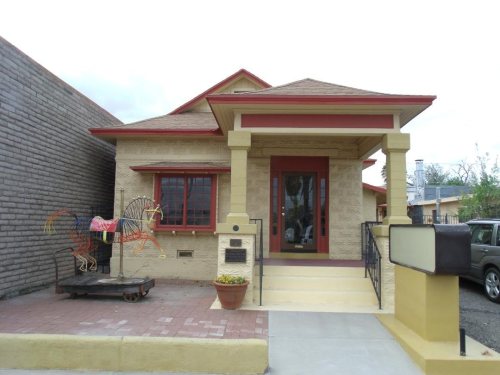


 2017
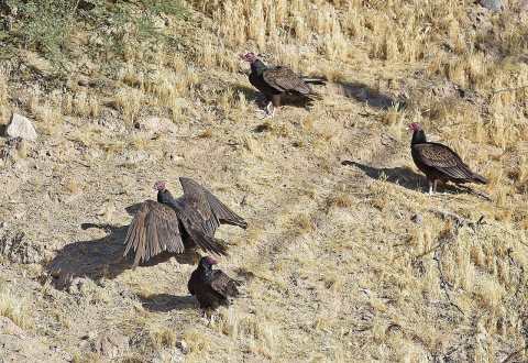 2017
 2017
 2015
 2012
 2012
 2012
 2012
 2012
 2009
 2009
 2006


